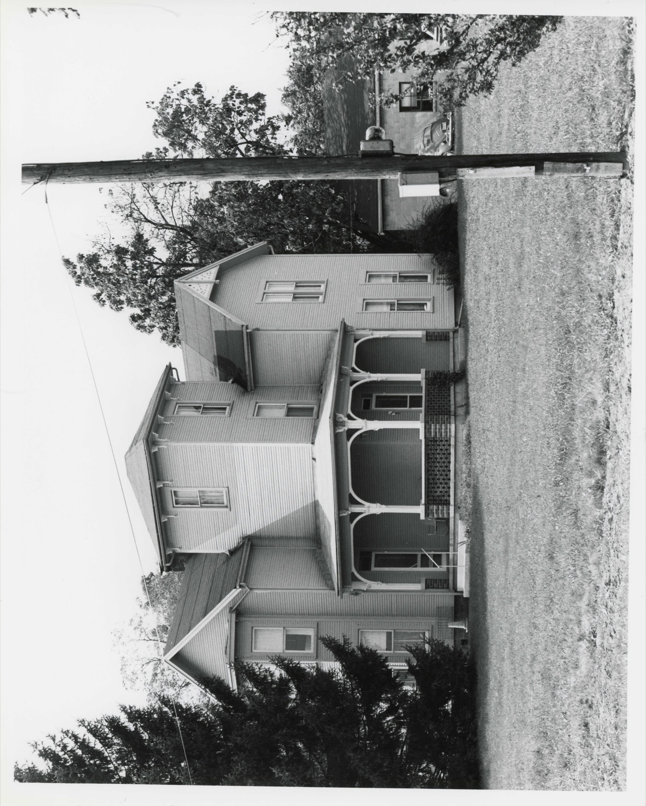
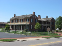
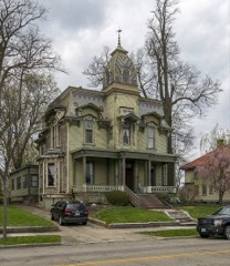
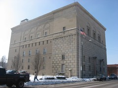
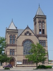
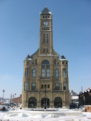
Photographs from the nomination case file, National Park Service records.
Reeser, C. A., House
Listed on the National Register of Historic Places in
1980. A historic map-sheet match is not published yet. The record needs a coordinate-quality review before it can be joined to a sheet boundary.
From the record
“For a few years after the coming of the above-mentioned pioneers, we have little knowledge of settlements made, and of those making them. William Simms and Samuel Brandenburg, the latter from Kentucky, entering land in Section 13, were early settlers of Pike, but the dates of their coming and further knowledge of them we have been unable to obtain.”
20th Century History of Springfield, and Clark County, Ohio, and Representative Citizens (1908). Machine-read text.
one of 32 National Register listings in Clark County · listed in 1980 · category: Building.
National Register reference number.80002957- the number the National Park Service assigned this property when it was listed, and the key its nomination file is catalogued under at the National Archives.
Lhe survey completed, Foose and his party returned to Fraoklington for their fumilies. In their removal with their wagons, they made the first wagon-trucle from that direction into Springfield. The jouruey oveupied four wand uw hal! days, one day being given lo crossing the Big Darby. Virst they packed their goods acrosa upon horses, and then drew their wagons over with ropes, while some Their route through the woods had to be cleared with the axe in many places. After Moos arrived, he made prepirations for the erection of nh house.
One Myers was killed near Urbanw by a party of wandering Indians, and u fumily named Elliott, living on Mad Niver, was visited by an Indian of 'teeumsch's tribe, who demanded a buteher-knife of them, was refused, and told to leave. Mrs. Elliott was soon after out getting firewood in the door-yard, when o rifleshot was heard and o ball whistled through the front of her sun-bonnot and grazed the skiu upon her throat. These acts, coupled with the gathering together of the Indians under the Shawnee brothers, induced a panie among the people of this nnd other counties, Tho bold and warlike organized into companies. The tavern of Foos was made u temporary stronghold, while many fumilies Jeft in haste for their previous homes in Kentueky., The whites demauded the aggressors: (he Indians denied knowledge of their committal, and it was left to 1 council to be held ut Springfield. The commiasioners for the whites wore General Benjamin Whiteman, Major Moore, Captain Ward, and two others. he Indians were led by Tecumseh, Round Head, Black Fish, and other chiefs, The council took place in w maple-grove ncross the atreet from the tavern. The Tniiens bad come in two bodies; the band of Tecumseh from towards Fort Wayne, and one from the north, some seventy in numbor, in charge of McPherson. Each party, unfriendly to the other, charged them with the deeds unlawful. Me- Pherson's party, by request, had loft their arme at a distanos, but Tecumseh and his bravew refused to disarm themselves, the chief suying that in bis tomahawk was his pipo, and it might be needed for a smoke.
Regional context, not property-specific
evidence. The
federal wildfire occurrence database
lists 5 fires within 5 miles of Reeser, C. A., House between
2002 and 2002, burning about 3 acres in total. 1 started naturally. 1 was recorded as arson.
Distance is straight-line from the map coordinates, so a fire counted
here may appear on a neighbouring settlement's page as well.
Reported cause
Fires
Natural
1
Debris and open burning
1
Missing data/not specified/undetermined
1
Recreation and ceremony
1
Arson/incendiarism
1
The most recent of
them, most recent first, with the day each was reported and the service
that recorded it.
Regional context, not property-specific
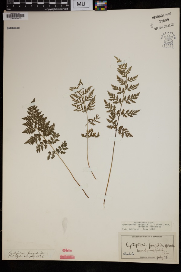
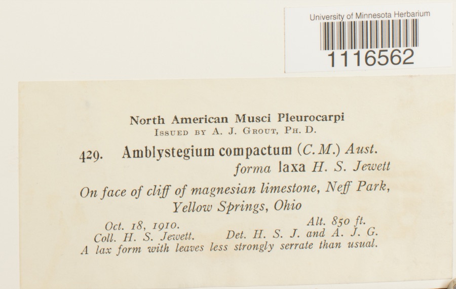
evidence. Museums hold 1,455 specimens
collected within 10 miles of Reeser, C. A., House between 1840 and
1975: 977 Animalia, 337 Plantae, 138 Fungi, 2 Unrecorded, 1 Chromista. 12 distinct Species records are shown.
Collected by 73.7; J.H., ?, A JOHN and others. Each is a
physical object with a catalogue
number, and each entry opens the museum's record. This is what was
collected and kept, not a survey of what lives here - nothing can be
concluded from a species being absent.
Regional context, not property-specific
evidence. The federal mineral resources record lists
9 workings within 5 miles of Reeser, C. A., House: 8 past producers, 1 producer.
1 still produces. What was taken out: Sand and Gravel, Construction, Stone, Crushed/Broken. Distance is straight-line from the
map coordinates, so a quarry counted here may appear on a neighbouring
settlement's page as well.
Regional context, not property-specific
evidence. The National Weather Service names
Springfield, the town this property stands in, in 107 storm reports between 1994 and 2023: 56 thunderstorm wind, 31 hail, 10 flash flood, 4 flood.
The reports record 2 injuries. Each account below is quoted exactly as the forecast office
filed it, from the NOAA Storm Events Database, and each date
opens the federal record of that event.
Several utility poles were down, a barn was blown off of its foundation, and minor damage occurred to a house and an apartment due to damaging thunderstorm winds.
A tornado touched down along Moorefield Road, just to the east of State Route 4. Trees were either uprooted or snapped off towards their tops with additional large limbs down from other trees. Some minor structural damage occured as well along the 250 yard damage path. The tornado was rated EF-0 with top wind speeds of 70 mph.
A barn was blown over on Victory Road. Several trees and power lines were down on Sintz Road. In another location, a roof was peeled back due to damaging thunderstorm winds.
There was scattered damage at a mobile home park affecting four mobile homes. A metal carport was heavily damaged. Three evergreen trees were also downed.
Numerous 12 to 15 inch diameter trees were downed in Snyder Park. A tree fell on a house on Upper Valley Pike. Part of the roof was removed as a result.
Three to four inches of rain fell across southern Clark County as thunderstorms pushed slowly east during the late evening. A car was washed into a flooded ditch near the Springfield Airport along US 68. High water caused several road closures across the southern part of the county, with basements flooded on the south side of Springfield.
2 papers published in this town,
digitised by the Library of Congress and free to read: 0 issues,
0 pages. Every page is searchable, so a name or a street can be
looked for directly in what the town printed about itself at the time.
No historic map-sheet match is published
for this property yet. That does not mean no map exists. This record needs
a coordinate-quality review before it can be joined to a sheet boundary.
Browse the county's mapped places while that work is
pending.
From the nomination file
3,233 words on record
When this property was proposed for the
National Register, someone wrote the case for it: what the building is,
and why it matters. That document is a federal record in the public domain.
It is quoted below word for word, never summarised. The text was read off the scanned case file by machine, so the
occasional stray character is the recogniser's and the 1970s
typewriter's.
Description of the property
The C. A. Reeser House at the site of the Innisfallen Greenhouse house- When considerably magnified, this woodcut shows the house to Street. Immediately to the west there is a small, cement block A standard, vernacular Italianate porch surrounds the first No other structures from the Innisfallen Greenhouses Complex remain. The nearest date is a row of modest priced cottages of relatively modern construction. campanile tower, built on a random ashlar foundation.The north design and center brace.On the east side of this section, Set back of Semi-octagonal shape, having windows on three sides on each floor floor of the tower on two sides, thus connecting with both of the wings.
which the upper half is filled in Eastlake style with a lacy cut-out Several hundred feet to the east is a Semi-modern industrial-type and roof.Apparently the bases of the wooden columns rotted away approximately 10' but attached is a three story campanile tower, with to the west isa cement block garage known locally as"Nelson Garage."Residential Areas of Significance - Check and justify below - prehistoric . archeology-historic _ conservation _ science _ 1500-1599 -agriculture . economics . literature - sculpture - 1600-1699 _ architecture _ education _ social/ _ art - engineering - music - 1800-1899 X commerce _exploration/settlement _ - philosophy - theater - 1900- - communications X industry - politics/government . transportation _ invention - other (specify) Statement of
Statement of significance
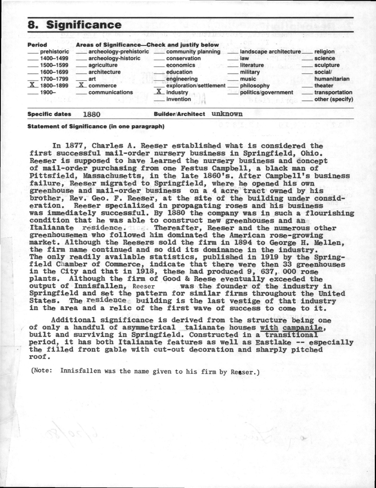
(in one paragraph) In 1877, Charles A. Reeser established what is considered the of mail-order purchasing from one Festus Campbell, a black man of Pittsfield, Massachusetts, in the late 1860's. After Campbell's business failure, Reeser migrated to Springfield, where he opened his own brother, Rev. Geo. F. Reeser, at the site of the building under consid- Thereafter, Reeser and the numerous other market. Although the Reesers sold the firm in 1894 to George H. Mellen, the filled front gable with cut-out decoration and sharply pitched roof. 1400-1499 1700-1799 humanitarian Period military law Additional significance is derived from the structure being one Springfield and set the pattern for similar firms throughout the United built and surviving in Springfield.
Constructed in a transitional greenhousemen who followed him dominated the American rose-growing first successful mail-order nursery business in Springfield, Ohio. condition that he was able to construct new greenhouses and an Italianate residence. the firm name continued and so did its dominance in the industry. in the area and a relic of the first wave of success to come to it. Specific dates /of only a handful of asymmetrical italianate houses with campanile, The only readily available statistics, published in l9l9 by the Spring- was immediately successful.By 188o the company was in such a flourishing 8.
Significance output of Innisfallen, the latter was the founder of the industry in in the City and that in 1918,these had produced 9,637,000 rose - archeology-prehistoric - - community planning . landscape architecture- - religion plants. Although the firm of Good & Reese eventually exceeded the Builder/Architect unknown field Chamber of Commerce, indicate that there were then 33 greenhouses
Quoted from the National Register nomination
for reference 80002957, 24 pages, held by the National Archives in Record
Group 79. See the
catalogue record.
Listed places nearby
6 within 8 miles
Other National Register properties close
enough to walk or drive between, ordered by distance from this one. Both
positions come from the same geocoding pass that matched these properties
to their map sheets.
Listing record. National Park Service National Register of Historic Places, listed-properties dataset, current to 2026-05-22.
Map join. Address geocoded through the United States Census geocoder, then tested against the published boundary of every sheet in the USGS Historical Topographic Map Collection.
How this page is made. Listing fields come from federal records; map-sheet coverage is a labelled coordinate-to-boundary calculation, not a source-field claim.
Wildfire. Short, Karen C. 2022. Spatial wildfire occurrence data for the United States, 1992-2020 [FPA_FOD_20221014]. 6th Edition. Fort Collins, CO: Forest Service Research Data Archive. https://doi.org/10.2737/RDS-2013-0009.6 Collected with United States Government funding and usable without additional permissions or fees.
Specimens. Global Biodiversity Information Facility (GBIF), https://www.gbif.org/. Only records licensed CC0 or CC BY are used. Records licensed CC BY-NC are excluded because this site carries advertising. Images are checked individually and any whose licence is non-commercial, no-derivatives or unreadable is refused.
Mines and quarries. USGS Mineral Resources Data System (MRDS) https://mrdata.usgs.gov/mrds/ A work of the United States government, no copyright under 17 U.S.C. 105.
Storms. NOAA National Centers for Environmental Information, Storm Events Database https://www.ncei.noaa.gov/stormevents/ A work of the United States government, no copyright under 17 U.S.C. 105. Narratives are quoted verbatim from the National Weather Service report and are not edited or summarised.
 Block
Block