BlockBefore
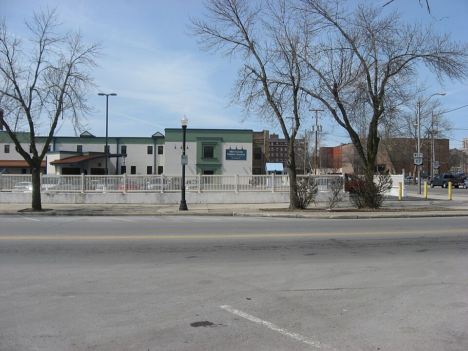
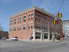
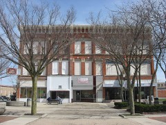
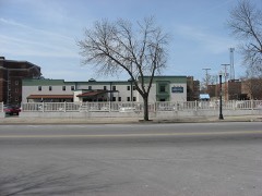
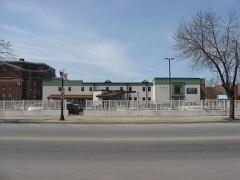
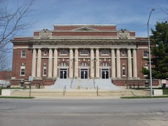
Photograph of Beck and R.C. Cahill Buildings
Photograph by Nyttend, Public domain. Via Wikimedia Commons.

Cahill, Beck and R. C., Buildings

Listed on the National Register of Historic Places in 1982. A historic map-sheet match is not published yet. The record needs a coordinate-quality review before it can be joined to a sheet boundary.

From the record

“Cahill Buildings [sic] was a historic commercial building on the southern side of downtown Lima, Ohio, United States. Built in 1890 in a late version of the Victorian style, the building was located along Main Street south of the city's central square.”

Wikipedia article Beck and R.C. Cahill Buildings, CC BY-SA 4.0.

one of 26 National Register listings in Allen County · listed in 1982 · category: Building.

Sources: the Wikipedia article · the case file at the National Archives · the National Register database, National Park Service

The listing

  • What is counted as historic. The nomination lists 1 building as contributing to the listing.
  • Address. 200-206 S. Main St., Lima, 45801
  • When was it listed? 1982-10-07
  • Category. building
  • Also known as. Lima MRA
  • Township. Lima city
  • National Register reference number. 82001349 - the number the National Park Service assigned this property when it was listed, and the key its nomination file is catalogued under at the National Archives.

The ground it stands on

30,764 words

The chapter on Lima City in History of Allen County, Ohio. Containing a History of the County, Its Townships, Towns, Villages, Schools, Churches, Industries, Etc; Portraits of Early Settlers and Prominent Men; Biographies; History of the Northwest Territory; History of Ohio; Statistical and Miscellaneous Matter, Etc., Etc, published 1885 names Lima. This is what it says, exactly as the scans read.

Lima has passed the first half century of her existence. From the day in 1831, when the pioneers arrived on the spot, now known as the Public Square, progress has been made as remarkable as conciliatory. The locality possessed many advantages - nature made it beautifuL The American pioneers came to draw forth all the resources of the country; the forest began to disappear; mills to spring up along the stream which then flowed swiftly by the settlement ; log-cabins to dot the clearings; roads to lead through the wilderness ; gardens to peep forth from the confusion of fallen and decayed trees; the whole scene to assume an air of busy life, which told at once that the men and. women who toiled there came to stay and to improve and to build up a city. The task which those early settlors of Lima set out to accomplish, has been performed.

Passage source: History of Allen County, Ohio. Containing a History of the County, Its Townships, Towns, Villages, Schools, Churches, Industries, Etc; Portraits of Early Settlers and Prominent Men; Biographies; History of the Northwest Territory; History of Ohio; Statistical and Miscellaneous Matter, Etc., Etc, published 1885.

From what has been already written of Ottawa Township, a knowledge of the location and general physical characteristics of Lima may be obtained. Its altitude (at railroad depot), above Lake Erie level, is 208 feet ; while its depression below Hog Creek marsh is 147 feet, this marsh being 850 feet above the lake level.

Passage source: History of Allen County, Ohio. Containing a History of the County, Its Townships, Towns, Villages, Schools, Churches, Industries, Etc; Portraits of Early Settlers and Prominent Men; Biographies; History of the Northwest Territory; History of Ohio; Statistical and Miscellaneous Matter, Etc., Etc, published 1885.

Machine-read from a century-old scan, so expect the errors a machine makes: misspelled names, dropped words, stray characters.

Read the whole chapter on Lima City - 30,764 words on its settlement, mills, schools and churches.

Specimens collected near this property

12 of 335 shown

Regional context, not property-specific evidence. Museums hold 335 specimens collected within 10 miles of Cahill, Beck and R. C., Buildings between 1893 and 1975: 316 Animalia, 18 Fungi, 1 Plantae. 12 distinct Species records are shown. Collected by Adler, K. K., Amstutz, K., Bezdek, H. and others. Each is a physical object with a catalogue number, and each entry opens the museum's record. This is what was collected and kept, not a survey of what lives here - nothing can be concluded from a species being absent.

Image SpeciesYear Collected by Where, as recorded
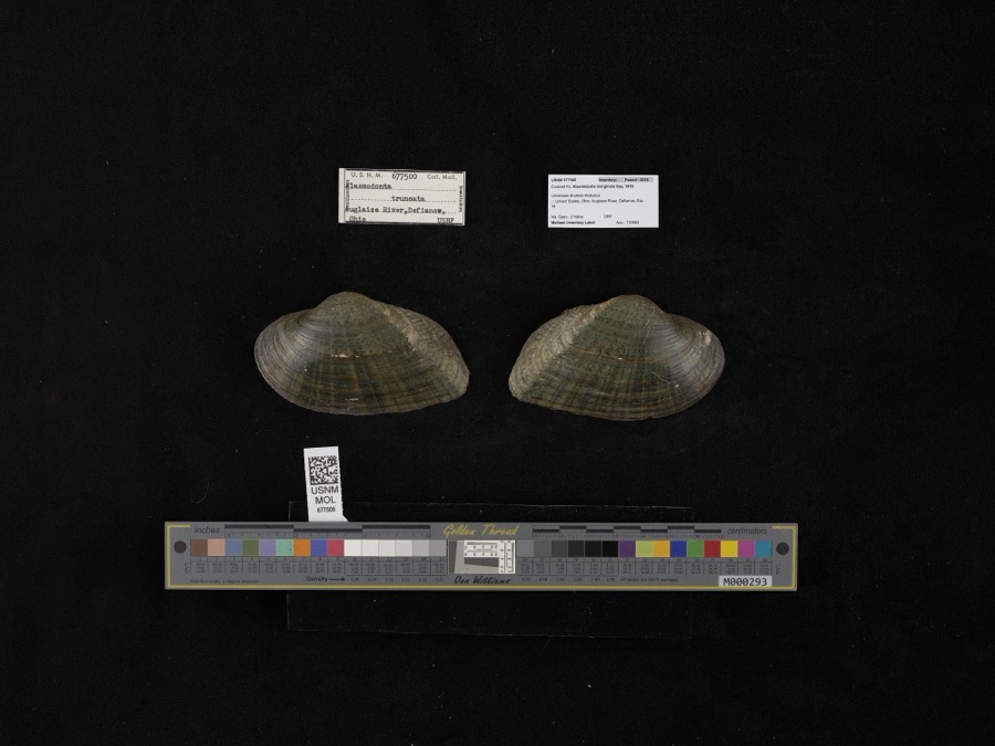
Specimen of Alasmidonta marginata Say, 1818Alasmidonta marginata Say, 18181908not recordedAuglaize River, Defiance
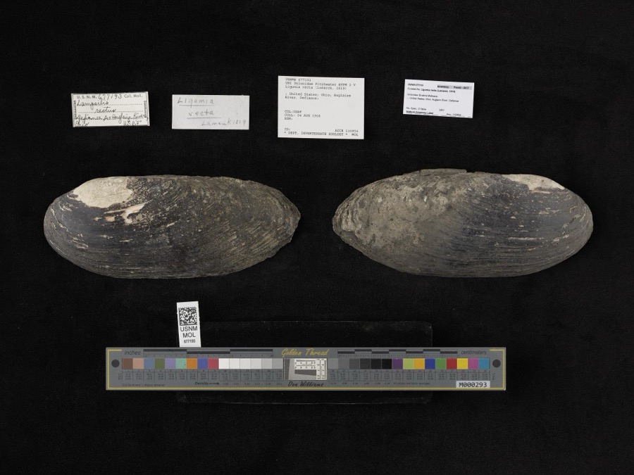
Specimen of Ligumia recta (Lamarck, 1819)Ligumia recta (Lamarck, 1819)1908Bureau of FisheriesAuglaize River, Defiance
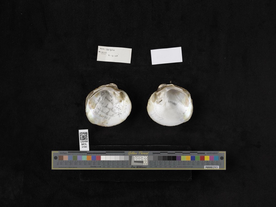
Specimen of Quadrula pustulosa (I.Lea, 1831)Quadrula pustulosa (I.Lea, 1831)1908not recordedAuglaize River, Defiance
A photograph of the species Chrysemys picta, not of this specimenChrysemys picta (Schneider, 1783)1893not recordedCloverdale, Sugar Creek
A photograph of the species Etheostoma spectabile, not of this specimenEtheostoma spectabile (Agassiz, 1854)1893PH KirschSugar Creek, 2 miles north of Lima; Maumee River dr.
A photograph of the species Lepomis cyanellus, not of this specimenLepomis cyanellus Rafinesque, 18191893P. KirschLost Creek, Lima, Ohio
A photograph of the species Lithobates pipiens, not of this specimenLithobates pipiens (Schreber, 1782)1893not recordedLima, Sugar Creek
A photograph of the species Nerodia sipedon, not of this specimenNerodia sipedon (Linnaeus, 1758)1893not recordedLima, Sugar Creek
A photograph of the species Regina septemvittata, not of this specimenRegina septemvittata (Say, 1825)1893not recordedLima, Sugar Creek
A photograph of the species Thamnophis sirtalis, not of this specimenThamnophis sirtalis (Linnaeus, 1758)1893not recordedLima, Sugar Creek
A photograph of the species Amanita frostiana, not of this specimenAmanita frostiana (Peck) Sacc.1902C. W. DawsonLima
A photograph of the species Amanita rubescens, not of this specimenAmanita rubescens Pers.1902C. W. DawsonLima

All 335 specimens within 10 miles, at the Global Biodiversity Information Facility.

Mines and quarries near this property

8 within 5 miles

Regional context, not property-specific evidence. The federal mineral resources record lists 8 workings within 5 miles of Cahill, Beck and R. C., Buildings: 4 past producers, 2 plants, 2 producers. 4 still produce. What was taken out: Limestone, General, Stone, Crushed/Broken, Sand and Gravel, Construction, Sulfur. Distance is straight-line from the map coordinates, so a quarry counted here may appear on a neighbouring settlement's page as well.

Where SiteCommodity StatusRecorded
(Facility) Lima Ohio RefinerySulfurPlant
Fouremans PitSand and Gravel, ConstructionPast ProducerSedimentary
Lima PlantStone, Crushed/BrokenPlant
Lima QuarryLimestone, GeneralPast ProducerSedimentary
Western Ohio Stone Co. Quarry No. 1Limestone, GeneralPast ProducerSedimentary
Western Ohio Stone Co. Quarry No. 1Stone, Crushed/BrokenProducer
Western Ohio Stone Co. Quarry No. 2Limestone, GeneralPast ProducerSedimentary
Western Ohio Stone Co. Quarry No. 2Stone, Crushed/BrokenProducer

Every working recorded in Allen County

Storms near this property

60 of 77 shown

Regional context, not property-specific evidence. The National Weather Service names Lima, the town this property stands in, in 77 storm reports between 1994 and 2025: 57 thunderstorm wind, 15 hail, 3 tornado, 2 flash flood. The reports record 2 injuries. Each account below is quoted exactly as the forecast office filed it, from the NOAA Storm Events Database, and each date opens the federal record of that event.

WhenEvent Place namedHarm What the report says
June 2006Thunderstorm WindLima2 hurt, $200,000Widespread tree and power line damage throughout the city of Lima. Along a strech of Shawnee Rd. from Fort Amanda Rd. to Reed Rd., every power pole and traffic signal was blown over, completely blocking the road. The roof of an automotive shop at Jackson St. and Findlay Rd. collapsed. Numerous homes and businesses sustained roof damage. About two thirds of Allen County was without power. One person was injured by a falling tree, and one person was knocked over by the wind and sustained minor injuries. There were also up to 15 indirect injuries from automobile accidents during the storm.
June 2006Thunderstorm WindLima$1,600,000Three aircraft hangars destroyed. About 17 airplanes and the Allen County Sheriff's Office helicopter were significantly damaged or destroyed.
August 2007Flash FloodLima$500,000Numerous roads closed across the county caused by high, flowing water.
April 2003Thunderstorm WindLima$100,000Law enforcement reported tress and power lines down across the county with much of the damage in and around Lima. A large tree fell on a home and a car. The Lima High school which was under construction had damage to the roof.
June 2006Thunderstorm WindLima$50,000Roof collapsed at the Motel 6 on Harding Highway. The south end of the building sustained considerable damage.
July 1998Thunderstorm WindLima$50,000TELEPHONE POLES DOWN ON CABLE RD.
July 1994Thunderstorm WindLima$50,000Trees and limbs were downed, some on power lines. An enclosed patio on a home was destroyed by a falling tree.
July 1999Thunderstorm WindLima$25,000Many power lines were downed.
April 1995Thunderstorm WindLima$25,000Several roofs were blown off houses, and several windows were also reported blown out.
June 2025Thunderstorm WindLima$20,000Large tree down onto car at the intersection of North Woodlawn Avenue and Latham Avenue.
June 2008Thunderstorm WindLima$20,000Law enforcement officials reported trees and power lines down through the county.
June 2006Thunderstorm WindLima$20,000Roof damage to a shopping center. Widespread trees and power lines down.
July 1999Thunderstorm WindLima$20,000TV tower blown down.
June 1999Thunderstorm WindLima$10,000Several large trees uprooted or downed. Four power poles snapped.
November 1998Thunderstorm WindLima$10,000TWO POWER POLES WERE SNAPPED. ONE LARGE TREE WAS BLOWN DOWN. TWO RAILROAD CROSSING ARMS WERE SNAPPED AS WELL.
May 1997Flash FloodLima$10,000Riley creek in Bluffton rose out of its banks causing 6 residents to be evacuated. Several roads flooded across the county.
July 1999Thunderstorm WindLima$5,000Trees and power lines down throughout county
July 1994Thunderstorm WindLima$5,000Trees and limbs were downed.
July 1999Thunderstorm WindLima$4,000Canopy on a shopping mall was blown down along with a portion of the wall that it was attached to. 4 blocks to the south several large tree limbs were sheared off from only the lowest 20 feet of the trees.
June 1995Thunderstorm WindLima$4,000Large trees downed, some on power lines.
June 1999Thunderstorm WindLima$2,000Trees down in American Township reported by Allen County sheriff.
August 2003Tornado (F0)Lima$1,000Brief touchdown reported near State Route 65 and Interstate 75. 1 barn received damage from the tornado.
July 2023Thunderstorm WindLima-Tree inch tree limbs broken. Reported from mPing. Time estimated from radar.
May 2022Thunderstorm WindLima-Large tree branches were downed.
June 2022Thunderstorm WindLima-Emergency management officials reported trees and power lines down in several locations across the county.
July 2019Thunderstorm WindLima-The public reported large tree limbs down.
March 2017Thunderstorm WindLima-Local media reported structural damage to a modular home, with roof damage and porch collapse noted.
March 2017Thunderstorm WindLima-The public reported a large tree was uprooted onto a privacy fence. In addition, roughly a half dozen other large trees were blown down in the area.
July 2013Thunderstorm WindLima-Emergency management officials reported several trees down throughout the county.
April 2013Thunderstorm WindLima-A trained spotter estimated wind gusts to 60 mph just south of Lima.
November 2013Thunderstorm WindLima-A mesonet station recorded a 63 mph wind gust.
August 2012Thunderstorm WindLima-Law enforcement officials reported a large tree being blown down on Lakewood Street.
June 2012Thunderstorm WindLima-A trained spotter estimated 60 mph wind gusts. Power lines and small tree limbs were blown down throughout the town.
June 2012Thunderstorm WindLima-A trained spotter reported a 80 foot pine tree snapped roughly 20 feet from the ground at the corner of 7th and Main Streets.
June 2012Thunderstorm WindLima-A trained spotter reported multiple trees down along Kemp Road. Shingles were blown off many roofs in the area.
June 2011Thunderstorm WindLima-Law enforcement officials reported trees and power lines down on the east side of Lima.
July 2011Thunderstorm WindLima-Amateur radio operators reported several tree branches down.
June 2010Thunderstorm WindLima-A local newspaper reported a large tree fell onto a house and garage in the 600 block of Nixon Avenue in Lima. No information was provided in terms of damage to the structures.
June 2010Thunderstorm WindLima-A trained spotter reported a light pole was damaged by strong winds at the intersection of Metcalf and Elm.
October 2010Thunderstorm WindLima-A trained spotter reported a 70 mph wind gust near Heritage Elementary school.
June 2010Tornado (EF0)Lima-The broadcast media relayed eyewitness reports of a weak, short-lived circulation that briefly touched down near the intersection of Kenilworth Avenue and Rice Avenue. Despite the touchdown, the only damage observed in the area was the blowing around of a trampoline. The circulation dissipated northwest of the intersection of Rice Avenue and Cole Street.
June 2008Thunderstorm WindLima-Local law enforcement officials reported several trees blown down around Lima.
June 2008Thunderstorm WindLima-Emergency management officials reported that part of a wall from a building fell onto a man walking by, causing minor injuries.
June 2006Thunderstorm WindLima-Three tractor tailers were blown over on Interstate 75.
June 2004Thunderstorm WindLima-Amateur radio reported power lines down in the city of Lima.
August 2003Thunderstorm WindLima-Trees and power lines reported blown down. A tree fell down onto an occupied vehicle. No injuries were reported.
April 2003Thunderstorm WindLima-Emergency management reported 15 downed power lines and about 30 trees down south of Lima.
July 2003Thunderstorm WindLima-Law enforcement reported trees and power lines down in Lima.
July 2003Thunderstorm WindLima-A trained spotter reported trees and power lines down in Lima.
November 2002Thunderstorm WindLima-Sheriff reported trees and power lines down in and around Lima.
July 2001Thunderstorm WindLima-Trees and power lines down.
August 2001Thunderstorm WindLima-Trees down in Shawnee.
April 2000Thunderstorm WindLima-Power lines and tree lines downed. Time estimated.
September 2000Thunderstorm WindLima-Large tree blown down.
August 2000Thunderstorm WindLima-Trees and power lines down.
July 1999Thunderstorm WindLima-Fourteen 4-8 foot diameter trees were uprooted along the Auglaize River.
July 1999Thunderstorm WindLima-Numerous trees blown down.
April 1998HailLima-Three-quarter inch hail was reported by Amateur Radio Operators and Sheriff's Department on Mumaugh Rd. in Lima and along I-75 at Beaverdam.
July 1998Thunderstorm WindLima-AT CABLE RD AND LATHEN AVE AND AT ALLENTOWN RD AND ELIDA RD AND AT CLOCK TOWER PLAZA ON WEST SIDE OF LIMA... TREES DOWN AND POWER LINES DOWN. TREES SNAPPED OFF ABOUT 20 FEET ABOVE GROUND, 4 LARGE POLES BEND OVER, AND SMALL CAMPER-TRAILER FLATTENED.
July 1998Tornado (F0)Lima-TORNADO TOUCHDOWN REPORTED BY SPOTTER 1/10TH OF A MILE NORTH OF FINDLEY RD AT NORTH SUGAR ST. BLEW STEEL WALL DOWN ALONG SCRAP METAL YARD AND POWER POLES SNAPPED OFF. MOVED SE AND TORE OFF RAILROAD CROSSING ARMS BEFORE LIFTING.

Every storm recorded in Allen County

Map coverage status

No historic map-sheet match is published for this property yet. That does not mean no map exists. This record needs a coordinate-quality review before it can be joined to a sheet boundary. Browse the county's mapped places while that work is pending.

From the nomination file

947 words on record

When this property was proposed for the National Register, someone wrote the case for it: what the building is, and why it matters. That document is a federal record in the public domain. It is reproduced in full on its own page, word for word and never summarised. The text was read off the scanned case file by machine, so the occasional stray character is the recogniser's and the 1970s typewriter's.

The whole case file for this property - 947 words, 10 pages, reproduced complete.

Quoted from the National Register nomination for reference 82001349, 10 pages, held by the National Archives in Record Group 79. See the catalogue record.

Listed places nearby

6 within 8 miles

Other National Register properties close enough to walk or drive between, ordered by distance from this one. Both positions come from the same geocoding pass that matched these properties to their map sheets.

Photograph PropertyDistance Listed
Martin Block and Kibby Blockunder 500 feet1982
Union Blockunder 500 feet1982
Dorsey Buildingunder 500 feet1982
Linneman Buildingunder 500 feet1982
First National Bank and Trust Buildingunder 500 feet1982
Lima Memorial Hallunder 500 feet1979

Sources for this property

National Archives recordThe nomination case file for reference 82001349 in Record Group 79.
Wikipedia articleCommunity-written account of this property, licensed CC BY-SA.
Allen CountyAll 26 listed properties in this county.

Provenance

  • Listing record. National Park Service National Register of Historic Places, listed-properties dataset, current to 2026-05-22.
  • Map join. Address geocoded through the United States Census geocoder, then tested against the published boundary of every sheet in the USGS Historical Topographic Map Collection.
  • How this page is made. Listing fields come from federal records; map-sheet coverage is a labelled coordinate-to-boundary calculation, not a source-field claim.
  • Specimens. Global Biodiversity Information Facility (GBIF), https://www.gbif.org/. Only records licensed CC0 or CC BY are used. Records licensed CC BY-NC are excluded because this site carries advertising. Images are checked individually and any whose licence is non-commercial, no-derivatives or unreadable is refused.
  • Mines and quarries. USGS Mineral Resources Data System (MRDS) https://mrdata.usgs.gov/mrds/ A work of the United States government, no copyright under 17 U.S.C. 105.
  • Storms. NOAA National Centers for Environmental Information, Storm Events Database https://www.ncei.noaa.gov/stormevents/ A work of the United States government, no copyright under 17 U.S.C. 105. Narratives are quoted verbatim from the National Weather Service report and are not edited or summarised.