Listed on the National Register of Historic Places in
1982. A historic map-sheet match is not published yet. The record needs a coordinate-quality review before it can be joined to a sheet boundary.
From the record
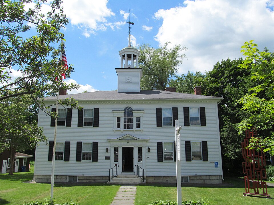
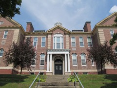
“Lenox Academy is a historic school building at 65 Main Street in Lenox, Massachusetts. Built in 1802-03 as a private academy, it was the first secondary school to open in Berkshire County.”
Wikipedia article Lenox Academy, CC BY-SA 4.0.
one of 94 National Register listings in Berkshire County · listed in 1982 · category: Building · one of 1 National Historic Landmarks in Berkshire County.
National Register reference number.82001895- the number the National Park Service assigned this property when it was listed, and the key its nomination file is catalogued under at the National Archives.
Fires near this property
50 since 2002
Regional context, not property-specific
evidence. The
federal wildfire occurrence database
lists 50 fires within 5 miles of Lenox Academy between
2002 and 2020, burning about 34 acres in total. 3 started naturally. None was recorded as arson.
Distance is straight-line from the map coordinates, so a fire counted
here may appear on a neighbouring settlement's page as well.
Reported cause
Fires
Debris and open burning
20
Recreation and ceremony
11
Equipment and vehicle use
7
Missing data/not specified/undetermined
3
Natural
3
Railroad operations and maintenance
2
Smoking
2
Other causes
1
Power generation/transmission/distribution
1
The most recent of
them, most recent first, with the day each was reported and the service
that recorded it.
Regional context, not property-specific
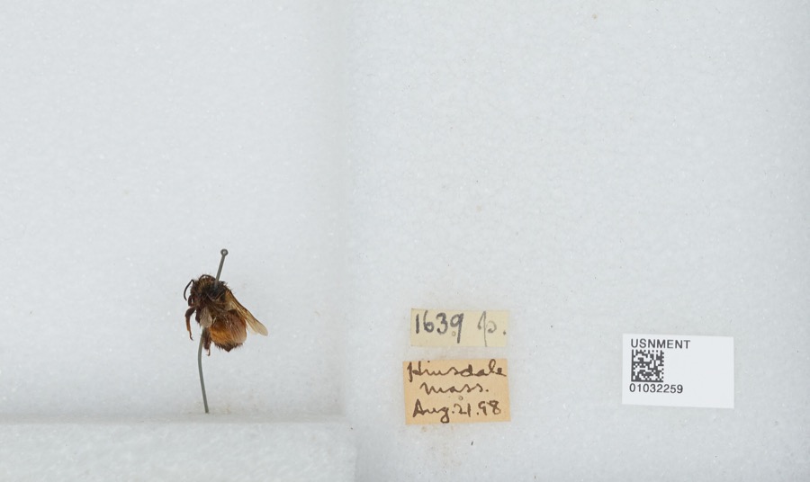
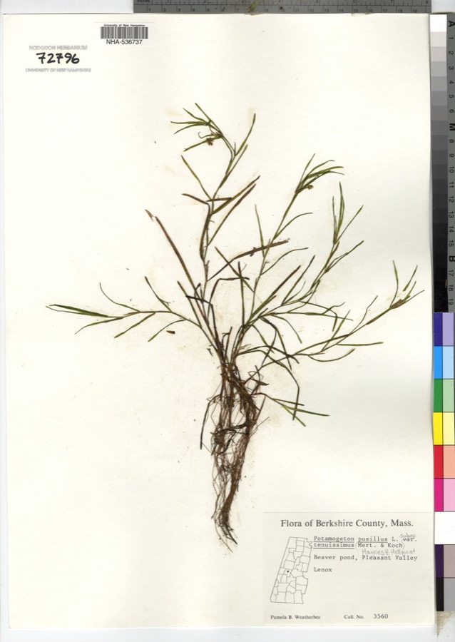
evidence. Museums hold 1,851 specimens
collected within 10 miles of Lenox Academy between 1833 and
1975: 856 Animalia, 657 Plantae, 330 Fungi, 4 Unrecorded, 2 Chromista, 2 Protozoa. 12 distinct Species records are shown.
Collected by A W Evans, A. Brown, A. E. Treat and others. Each is a
physical object with a catalogue
number, and each entry opens the museum's record. This is what was
collected and kept, not a survey of what lives here - nothing can be
concluded from a species being absent.
Regional context, not property-specific
evidence. The federal mineral resources record lists
40 workings within 5 miles of Lenox Academy: 22 past producers, 13 producers, 4 occurrences, 1 unknown.
13 still produce. What was taken out: Iron, Sand and Gravel, Construction, Stone, Crushed/Broken, Limestone, General. Distance is straight-line from the
map coordinates, so a quarry counted here may appear on a neighbouring
settlement's page as well.
Regional context, not property-specific
evidence. The National Weather Service names
Lenox, the town this property stands in, in 51 storm reports between 1994 and 2026: 35 thunderstorm wind, 8 flash flood, 7 hail, 1 lightning.
The reports record 5 injuries. Each account below is quoted exactly as the forecast office
filed it, from the NOAA Storm Events Database, and each date
opens the federal record of that event.
A roof was partially ripped off a horse barn and several trees were reported down due to strong thunderstorm winds at the Aspinwall Equestrian Center off Route 7A, Main Street, in Lenox. ||A large tree and power lines were downed on Route 7 and 20, Pittsfield Road, just north of the entrance to the Aspinwell Shops due to strong thunderstorm winds. A vehicle was hit with debris resulting in minor injuries to a person. ||Along East Dugway Road, 10 trees and 8 utility poles were reported downed due to strong thunderstorm winds. Two cars were struck by downed trees and 2 people were treated for minor injuries. ||Trees were reported down near the Eastover Resort on East Road in Lenox due to strong thunderstorm winds.
In Lenox, numerous trees were reported down due to strong thunderstorm winds|along East Street between New Lenox Road and Housatonic Street, on Kemble Street at the Shakespeare and Company Campus and on Walker Street at the Ventfort Hall Mansion and Gilded Age Museum.
An estimated one thousand or more trees and branches were snapped or uprooted around the Mass Audubon's Pleasant Valley Wildlife Sanctuary, north of of the Town of Lenox. Damage was also observed along the trails as well as a window breaking in the office. Preliminary damage estimates were up to $500,000.
A NWS Storm Survey confirmed straight line wind damage in the Town of Lenox. Damage was sporadic and ranged from broken tree limbs to large diameter trees snapped and uprooted. Damage was most concentrated downwind of large open spaces or lakes. Downed trees blocked many roads and caused numerous power outages. Trees also fell onto homes and cars. Some festival tents were also blown away. The maximum estimated winds were 85 mph with a path length of 1.7 miles and width of 0.8 of a mile.
A National Weather Service storm survey confirmed a severe thunderstorm produced a microburst along Cliffwood Street just northwest of downtown Lenox. Hardwood and softwood trees were snapped and uprooted. Some homes were damaged from the fallen trees. Winds were estimated between 80 and 90 mph with a path length of one-half mile and a path width of 50 yards.
The National Weather Service storm survey confirmed a severe thunderstorm produced a microburst along Housatonic Street before ending at Kimball Farms in the Town of Lenox. Hardwood and softwood trees were snapped and uprooted along its path. One home along Housatonic Street suffered wind damage to its siding. Some homes were damaged by fallen trees. Winds were estimated at 80 to 90 mph with a path length of one-half mile and a path width of 100 yards.
Heavy rain from thunderstorms caused flash flooding in both Lenox and Lenoxdale. The intersection of East and Walker streets was closed due to flooding and repairs were needed to the roadway. In addition, washouts also occurred on Housatonic Street and Crystal Street.
A tall pine tree on Old Stockbridge Road, Route 7, was reported down by strong thunderstorm winds near Lenox Town Hall. A car crashed into the tree and the driver was reported hospitalized with lacerations.
Several tree limbs were reported down approximately 4 miles south of Pittsfield due to strong thunderstorm winds. In addition, penny size hail was also reported during this thunderstorm.
Penny size hail was reported approximately 4 miles south of Pittsfield during a thunderstorm. In addition, several tree limbs were reported down due to strong thunderstorm winds.
Straight line winds from a thunderstorm downed hundreds of trees over a 1.5 mile path length, at a width of around 1 mile, near Lenox. Estimated maximum winds were between 80 and 85 MPH.
Dime-size hail fell in Lenox while urban street flooding occurred in Stockbridge and Lenoxdale. Rainfall of 2.70 inches was observed in one hour and 15 minutes.
No historic map-sheet match is published
for this property yet. That does not mean no map exists. This record needs
a coordinate-quality review before it can be joined to a sheet boundary.
Browse the county's mapped places while that work is
pending.
Named in the fire insurance atlases
Sanborn surveyors printed an index of the
town's establishments at the front of each atlas. This property is named in
one, read straight off the scanned sheet.
When this property was proposed for the
National Register, someone wrote the case for it: what the building is,
and why it matters. That document is a federal record in the public domain.
It is quoted below word for word, never summarised. The text was read off the scanned case file by machine, so the
occasional stray character is the recogniser's and the 1970s
typewriter's.
Description of the property
The Lenox Academy, constructed in 1802-03 in the Federal style, is located on the west side of Main Street (Route 7A) in Lenox, Massachusetts within the Lenox local Historic District. It is an unusually well preserved example of an early nineteenth century institutional building. The original deed from Azariah Egleston of Lenox to The Trustees of Lenox Ac- ademy describes "38 3/4 rods of land", "on the west side of the Turnpike Road, together with the Academy now standing on the premises", and is dated May 21, 1807. The considera- tion given was twenty-two hundred dollars. The present plot measures 9,270 sq. ft., la minor portion of the original six mile square grant). The Academy is a rectangular plan, 2½ storey, wood frame structure with a symmetrical five-bay facade.
It rests on an ashlar foundation and is enclosed by a hipped roof with a central belfry which includes a bell and weather vane. Single, end wall chimneys rise from the side elevations. The exterior is sheathed with clapboard; the window contains 6/6 sashes and have exterior shutters... Decorative elements are focused at the center of the facade below the belfry. The entry is flanked by pairs of pilasters which in turn frame leaded glass side lightsand support a wide entablature and a small pediment.. A palladian window of similar design and proportion is set over the entry. The narrow cornice at the roof line is marked by a band of dentils.
The overall visual effect of the building is one of a solid mass which is firmly anchored and pulled vertically by the central upward progression of entry, palladian window, and belfry. In plan the building is similar on both the first and second floors having a central hall- way with one room on either side.
/Architect Eldad Lewis Statement of Significance (in one paragraph) The Lenox Academy possesses integrity of setting, design, workmanship, materials, and association. Built in 1802-03, it was the first academy for secondary education to be established in Berkshire County. Its location in what was then the County Seat (1787- 1868) helped to make it the most popular school in the region. Both historically and vis- ually, it is an important landmark reflecting the development of Lenox and Berkshire County. Although the building was moved 20' in 1880 it retains it position in the town and is significant as an excellent example of a high style Federal period institu- tional building. The Lenox Academy thus meets criteria A and C of the National Register of Historic Places.
The building design, a block plan with symmetrical facades, sur- mounted by a central belfry, is the typical Federal period academy form, found through- out New England. The Lenox Academy is unusual, however, for its small scale and wood construction, as well as its early date. The more common treatment of the time is illus- trated by West Hall, Williams College, Williamstown (1790) and the Wilbraham Academy building, Wilbraham (1825), both more elaborate, three storey, brick structures. Other surviving examples of 19th century academies in Berkshire County were built much later and show influence of the Greek Revival style. These are located in South Egre- mont (1832-33) and Alford (1848-49). Additional academies, once standing in Sheffield and New Marlborough are now gone.
A petition was presented to the Massachusetts General Court on January 5, 1803 for the incorporation of an Academy "for the instruction of youth in piety, morality and liberal arts "at some" convenient, central place in said County.
Quoted from the National Register nomination
for reference 82001895, 16 pages, held by the National Archives in Record
Group 79. See the
catalogue record.
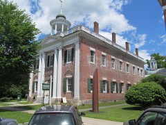
Listed places nearby
6 within 8 miles
Other National Register properties close
enough to walk or drive between, ordered by distance from this one. Both
positions come from the same geocoding pass that matched these properties
to their map sheets.
Listing record. National Park Service National Register of Historic Places, listed-properties dataset, current to 2026-05-22.
Map join. Address geocoded through the United States Census geocoder, then tested against the published boundary of every sheet in the USGS Historical Topographic Map Collection.
How this page is made. Listing fields come from federal records; map-sheet coverage is a labelled coordinate-to-boundary calculation, not a source-field claim.
Wildfire. Short, Karen C. 2022. Spatial wildfire occurrence data for the United States, 1992-2020 [FPA_FOD_20221014]. 6th Edition. Fort Collins, CO: Forest Service Research Data Archive. https://doi.org/10.2737/RDS-2013-0009.6 Collected with United States Government funding and usable without additional permissions or fees.
Specimens. Global Biodiversity Information Facility (GBIF), https://www.gbif.org/. Only records licensed CC0 or CC BY are used. Records licensed CC BY-NC are excluded because this site carries advertising. Images are checked individually and any whose licence is non-commercial, no-derivatives or unreadable is refused.
Mines and quarries. USGS Mineral Resources Data System (MRDS) https://mrdata.usgs.gov/mrds/ A work of the United States government, no copyright under 17 U.S.C. 105.
Storms. NOAA National Centers for Environmental Information, Storm Events Database https://www.ncei.noaa.gov/stormevents/ A work of the United States government, no copyright under 17 U.S.C. 105. Narratives are quoted verbatim from the National Weather Service report and are not edited or summarised.
 Block
Block