Listed on the National Register of Historic Places in
1982. A historic map-sheet match is not published yet. The record needs a coordinate-quality review before it can be joined to a sheet boundary.
From the record
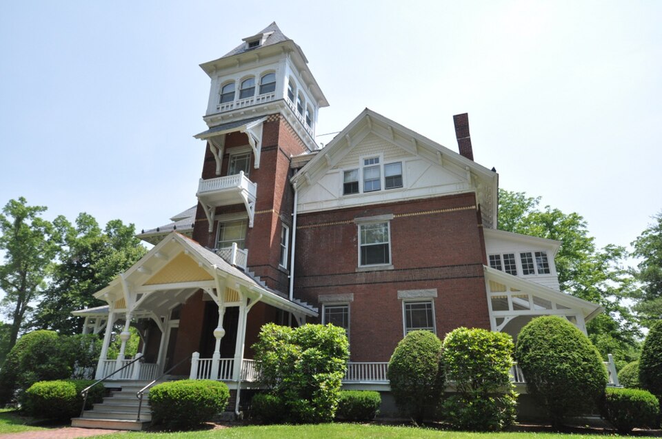
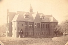
“Grove Hill Mansion is an historic mansion at Florence Street and Front Street in Northampton, Massachusetts. The mansion was built in 1880 and added to the National Register of Historic Places in 1982.”
Wikipedia article Grove Hill Mansion, CC BY-SA 4.0.
one of 32 National Register listings in Hampshire County · listed in 1982 · category: Building.
National Register reference number.82001910- the number the National Park Service assigned this property when it was listed, and the key its nomination file is catalogued under at the National Archives.
The city of Northampton has for several years established its cruslaing works near the north line of the town and at a distance from railroads, and works the Hatfield tonalite or hornblendic granite, which is a partly decomposed rock, more brittle than the trap, and in many ways an inferior rock for road ballast. The city has access beside the road or railroad within its own limits to several better ledges than the one it works now. In 1897 the city of Ware opened a quarry on the Coys Hill dike on the mountain side east of the railroad station. The dike is here 5 rods wide, favorably situated for quanying, and will furnish the best material in inexhaustible quantity.
Regional context, not property-specific
evidence. The
federal wildfire occurrence database
lists 59 fires within 5 miles of Grove Hill Mansion between
2015 and 2020, burning about 40 acres in total. 5 started naturally. 4 were recorded as arson.
Distance is straight-line from the map coordinates, so a fire counted
here may appear on a neighbouring settlement's page as well.
Reported cause
Fires
Missing data/not specified/undetermined
19
Equipment and vehicle use
17
Debris and open burning
10
Natural
5
Arson/incendiarism
4
Recreation and ceremony
4
The most recent of
them, most recent first, with the day each was reported and the service
that recorded it.
Regional context, not property-specific
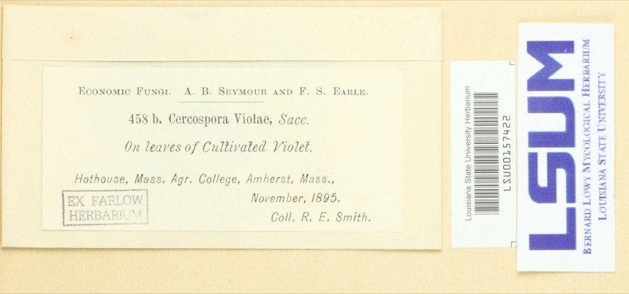
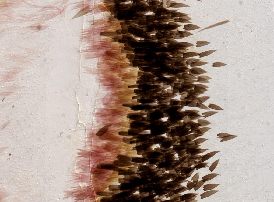
evidence. Museums hold 6,516 specimens
collected within 10 miles of Grove Hill Mansion between 1781 and
1975: 3,130 Plantae, 1,777 Fungi, 1,384 Animalia, 136 Chromista, 78 Protozoa, 10 Unrecorded, 1 Bacteria. 12 distinct Species records are shown.
Collected by A V Osmun, A., A. Albee and others. Each is a
physical object with a catalogue
number, and each entry opens the museum's record. This is what was
collected and kept, not a survey of what lives here - nothing can be
concluded from a species being absent.
Regional context, not property-specific
evidence. The federal mineral resources record lists
27 workings within 5 miles of Grove Hill Mansion: 10 producers, 10 past producers, 5 occurrences, 2 prospects.
10 still produce. What was taken out: Sand and Gravel, Construction, Lead, Brick Clay, Iron. Distance is straight-line from the
map coordinates, so a quarry counted here may appear on a neighbouring
settlement's page as well.
Regional context, not property-specific
evidence. The National Weather Service names
Northampton, the town this property stands in, in 36 storm reports between 1995 and 2025: 18 thunderstorm wind, 6 flood, 4 hail, 4 lightning.
The reports record 1 injury. Each account below is quoted exactly as the forecast office
filed it, from the NOAA Storm Events Database, and each date
opens the federal record of that event.
Record flooding along the Mill River caused extensive flooding in Northampton. The river crested at 15.6 feet on the 16th, which was the highest crest on record, and well above the previous record crest of 13.7 feet which occurred in October, 2005. Many roads near the river were closed and some evacuations took place as flood waters threatened nearby homes and businesses.|Minor flooding also affected the mainstem Connecticut River through Northampton. A crest of 119 feet was recorded at 430 pm on the 17th (flood stage is 112 feet).
After receiving roughly four and a half inches of rain from Tropical Storm Irene, an overtopped dike resulted in the closure of West Street in Northampton. At exit 24 on Route 5, there was five to six feet of water flooding the road, with two cars floating down the road.
In the Florence section of Northampton, a 50 foot by 50 foot wooden permanent pavilion structure was blown crooked at a landmark restaurant/tavern. The footings, which were lifted and bent, were attached by a metal bracket to concrete. The pavilion can accomodate 18 tables with 4 people per table. The building inspector classified the damage as $20,000. Slightly farther to the southeast, a 50 ft by 75 ft. section of roofing, including insulation and rubber membrane, was peeled off of the Smith Vocational and Agricultural High School. There was little in the way of water damage inside the school. The Northampton building inspector rated the roof damage as $30,000. Still farther to the southeast, a tree was down on Washington Avenue, as reported by amateur radio.
Numerous trees were downed in Northampton, including several on Summer Street and one on Massasoit Street which fell on wires. Large trees also were downed in Easthampton, including one that fell on a house and a car on Chestnut Street.
No historic map-sheet match is published
for this property yet. That does not mean no map exists. This record needs
a coordinate-quality review before it can be joined to a sheet boundary.
Browse the county's mapped places while that work is
pending.
From the nomination file
2,511 words on record
When this property was proposed for the
National Register, someone wrote the case for it: what the building is,
and why it matters. That document is a federal record in the public domain.
It is quoted below word for word, never summarised. The text was read off the scanned case file by machine, so the
occasional stray character is the recogniser's and the 1970s
typewriter's.
Description of the property
Grove Hill Mansion, a High Victorian mansion, is set on a hilltop overlooking the Mill River in the village of Leeds in Northampton. The house stands about 75 feet back from Front Street, surrounded by residential structures, a few of which are contemporary and the rest are later infill. The property contains 3z acres of land, and includes at the front a stand of large pine trees which formed a distinctive part of the land- scape when the house was built. Highly eclectic and idiosyncratic in design, the brick mansion (built in 1880) incorporates elements of both Queen Anne and Eastlake styles. The building is generally 23 stories high, with a T-shape floor plan embellished by numerous Eastlakian porches and a 4} story tower at the front.
Intersecting gable and hip roofs of the various building segments are broken by decorative chimneys (one of which enframes a window); all roof surfaces are covered with slate tiles. Decorative brick and stone stringcourses enliven the walls, while the irregularly placed windows are articulated by granite sills and rusticated lintels. Brick relieving arches cap the second story windows. Wooden ornament of particular note includes the first floor porches on each side, featuring bulbous posts and a geo- metrically formed balustrade; stickwork and decorative shingling on the gable ends of the south wing; a covered balcony and open arcade on the tower; and a bracketed entablature with loosely interpreted triglyphs. The exterior remains essentially in its original condition.
On the interior, Grove Hill Mansion retains its grand period woodwork. The entrance vestibule is distinguishedby double doors with etched and bevelled glass, oak panelling and strapwork, and a coffered ceiling. A central stairway opening onto all three floors has panelled wainscoting and unusually carved newels and balustrade in the Eastlake manner.
(in one paragraph) E.C. Gardner Grove Hill Mansion retains integrity of design, materials, setting, and location. The building is significant for its associations (1) with the development of Leeds Village and(2) with alocally prominentmanufacturer and a regionally known architect, and as an excellent and unusual example of its style in the area. The property thus meets criteria A, B, and C of the National Register. Grove Hill Mansion was built in 1879-80 for Lucius Dimock, an incorporator and director of the Nonotuck Silk Company. The companymanufactured silk threads and yarns from 1855 until 1921, when it passed out of local hands. The Nonotuck Silk Mill in Leeds was established in 1879 and is significant for its role in revitalizing the town after a disastrous flooding of the Mill River.
Both the mill and mansion were objects of local pride. A contemporary newspaper account described the mill as a "model" factory, 'massive, solid, neat and attractive," and the nearby owner's residence as "one of the finest houses in the Connecticut Valley." The mansion was designed in 1879 by E.C. Gardner. " A native of Ashfield, Gardner (1836-1915) began to practice architecture in Northampton at the age of 22. Gardner settled in Springfield after the Civil War and maintained a practice there until 1911. Although he designed numerous conmercial buildings in Northampton prior to his move to Springfield, the Dimock house and one, Elm Street residence, also of brick and designed in 1879, are his only residential designs yet identified in Northampton.
The Dimock house remains a unique example of its style in the Northampton area. As originally conceived, the Dimock estate was once considerable: about 20 acres of land including the mansion, greenhouse, barns and stables (the two latter since demolished), and many fine trees which graced the hill.
Quoted from the National Register nomination
for reference 82001910, 12 pages, held by the National Archives in Record
Group 79. See the
catalogue record.
Listed places nearby
6 within 8 miles
Other National Register properties close
enough to walk or drive between, ordered by distance from this one. Both
positions come from the same geocoding pass that matched these properties
to their map sheets.
Listing record. National Park Service National Register of Historic Places, listed-properties dataset, current to 2026-05-22.
Map join. Address geocoded through the United States Census geocoder, then tested against the published boundary of every sheet in the USGS Historical Topographic Map Collection.
How this page is made. Listing fields come from federal records; map-sheet coverage is a labelled coordinate-to-boundary calculation, not a source-field claim.
Wildfire. Short, Karen C. 2022. Spatial wildfire occurrence data for the United States, 1992-2020 [FPA_FOD_20221014]. 6th Edition. Fort Collins, CO: Forest Service Research Data Archive. https://doi.org/10.2737/RDS-2013-0009.6 Collected with United States Government funding and usable without additional permissions or fees.
Specimens. Global Biodiversity Information Facility (GBIF), https://www.gbif.org/. Only records licensed CC0 or CC BY are used. Records licensed CC BY-NC are excluded because this site carries advertising. Images are checked individually and any whose licence is non-commercial, no-derivatives or unreadable is refused.
Mines and quarries. USGS Mineral Resources Data System (MRDS) https://mrdata.usgs.gov/mrds/ A work of the United States government, no copyright under 17 U.S.C. 105.
Storms. NOAA National Centers for Environmental Information, Storm Events Database https://www.ncei.noaa.gov/stormevents/ A work of the United States government, no copyright under 17 U.S.C. 105. Narratives are quoted verbatim from the National Weather Service report and are not edited or summarised.
 Block
Block