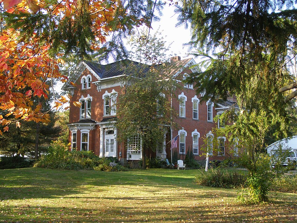
Listed on the National Register of Historic Places in
1982. A historic map-sheet match is not published yet. The record needs a coordinate-quality review before it can be joined to a sheet boundary.
From the record
one of 13 National Register listings in Holmes County · listed in 1982 · category: Building.
National Register reference number.82003599- the number the National Park Service assigned this property when it was listed, and the key its nomination file is catalogued under at the National Archives.
Fires near this property
13 since 2005
Regional context, not property-specific
evidence. The
federal wildfire occurrence database
lists 13 fires within 5 miles of DeYarmon, Joseph L. House between
2005 and 2020, burning about 25 acres in total. None started naturally. 1 was recorded as arson.
Distance is straight-line from the map coordinates, so a fire counted
here may appear on a neighbouring settlement's page as well.
Reported cause
Fires
Debris and open burning
6
Smoking
3
Missing data/not specified/undetermined
2
Arson/incendiarism
1
Equipment and vehicle use
1
The most recent of
them, most recent first, with the day each was reported and the service
that recorded it.
Regional context, not property-specific
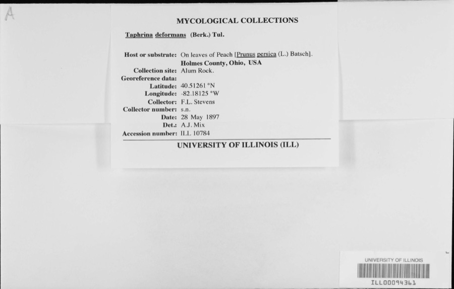
evidence. Museums hold 192 specimens
collected within 10 miles of DeYarmon, Joseph L. House between 1896 and
1975: 178 Animalia, 12 Plantae, 2 Fungi. 12 distinct Species records are shown.
Collected by C F WALKER, Crunkilton, R. (Ron) & Crunkilton, L. (Lila), D.L. Caldwell and others. Each is a
physical object with a catalogue
number, and each entry opens the museum's record. This is what was
collected and kept, not a survey of what lives here - nothing can be
concluded from a species being absent.
Regional context, not property-specific
evidence. The National Weather Service names
Lakeville, the town this property stands in, in 9 storm reports between 1998 and 2014: 5 hail, 3 thunderstorm wind, 1 flood.
No death or injury is recorded in these reports. Each account below is quoted exactly as the forecast office
filed it, from the NOAA Storm Events Database, and each date
opens the federal record of that event.
Heavy rain and rapid snow melt led to widespread flooding across Holmes County. Rainfall totals across the county ranged from one to three inches on February 27th and 28th. Up to ten inches of heavy snow was on the ground at the onset of the rain. This snow rapidly melted as temperatures warmed into the 50s on the 28th. Up to an additional inch of water equivalent rainfall was released from the melted snow. Hundreds of homes in the county sustained damage, mainly from basement flooding. Many roads had to be closed because of the flooding. The Killbuck Creek crested at 18.07 feet, the eight highest height on record. South end of Millersburg and western portions of the Killbuck sustained flood damage.
Straight line winds from a thunderstorm downburst caused considerable damage at a campground along the Ashland/Holmes county line west of Lakeville. Around sixty trees and thirty one power poles were reported down at the campground. A pontoon boat was also flipped over. The downburst continued east from the campground and moved through the Lakeville area where it downed dozens of trees and damaged several buildings. The damage path continued east to Holmesville where four apartment buildings and a business lost large sections of roof. Several hundred trees were downed in northern Holmes County from this downburst which produced winds estimated to be nearly 70 mph. Widespread power outages were reported.
No historic map-sheet match is published
for this property yet. That does not mean no map exists. This record needs
a coordinate-quality review before it can be joined to a sheet boundary.
Browse the county's mapped places while that work is
pending.
From the nomination file
3,043 words on record
When this property was proposed for the
National Register, someone wrote the case for it: what the building is,
and why it matters. That document is a federal record in the public domain.
It is quoted below word for word, never summarised. The text was read off the scanned case file by machine, so the
occasional stray character is the recogniser's and the 1970s
typewriter's.
Description of the property
of a rusticated stone foundation that can be found on the front and sides, while rubble and south side of the building while an Italianate porch is found on the north side. sash offers height and simplicity. Each bay shares a narrow plain lug sill and ornately lighting fixtures, cherry and walnut woodwork, and The barn burned around 1910 so there are no original out buildings. A garage position of the house and the proximity of the large evergreens, the house is part of its own world. date Condition deteriorated unexposed five transoms constructed of ruby red glass. has been added near the main house and reflects the same color scheme. plumbing, Check one ..ruins -altered hip roof allows 4 large gables to project.
Each gable is trimmed with a series of white dentils leading down to the gable end returns. Inside each gable is a double arch bay that crowns the tier treatment of the windows. Two bay windows are featured on the east The red American brick bond facade is boldly but delicately highlighted with the Italianate by paired brackets.
(in one paragraph) tecture which is well preserved. family was quite self-sufficient as 3 oil wells, a spring and cisterns were part of DeYarmon's property. Since the time of its construction, it is obvious the builder 1600-1699 1878 1400-1499 economics commerce conservation invention communications 1500-1599 engineering humanitarian education Builder/Architect theater science music social literature Specific dates transportation law sculpture Period 1900- Significance in the Loudonville-Lakeville area. Mid 19th century documentation reveals that Joseph DeYarmon owned 20 acres.The military The DeYarmon House is the largest nineteenth century residence extant in the small exploration settlement X 1800-1899 ruby red transoms. Even below the bay Joseph Derarmon was the son of Dr.
Joseph DeYarmon, whose family traveled from window one finds 3 large basement windows ready to accept the early morning light. Pennsylvania to Wooster. After his father's death in 1851, the two sons, Joseph and community of Lakeville. Its great size and elaborate ornamentation distinguish the DeYarmon from other nearby buildings.It is an excellent example of Italianate archi- the property.The main facade faces directly east and each morning the sun'srays 10.
Quoted from the National Register nomination
for reference 82003599, 18 pages, held by the National Archives in Record
Group 79. See the
catalogue record.
Listing record. National Park Service National Register of Historic Places, listed-properties dataset, current to 2026-05-22.
Map join. Address geocoded through the United States Census geocoder, then tested against the published boundary of every sheet in the USGS Historical Topographic Map Collection.
How this page is made. Listing fields come from federal records; map-sheet coverage is a labelled coordinate-to-boundary calculation, not a source-field claim.
Wildfire. Short, Karen C. 2022. Spatial wildfire occurrence data for the United States, 1992-2020 [FPA_FOD_20221014]. 6th Edition. Fort Collins, CO: Forest Service Research Data Archive. https://doi.org/10.2737/RDS-2013-0009.6 Collected with United States Government funding and usable without additional permissions or fees.
Specimens. Global Biodiversity Information Facility (GBIF), https://www.gbif.org/. Only records licensed CC0 or CC BY are used. Records licensed CC BY-NC are excluded because this site carries advertising. Images are checked individually and any whose licence is non-commercial, no-derivatives or unreadable is refused.
Storms. NOAA National Centers for Environmental Information, Storm Events Database https://www.ncei.noaa.gov/stormevents/ A work of the United States government, no copyright under 17 U.S.C. 105. Narratives are quoted verbatim from the National Weather Service report and are not edited or summarised.
 Block
Block