BlockBefore
Decorative drawing: a county panorama. Not a photograph of this place.

Holmes County, Ohio

86 topographic sheets and 7 fire insurance atlases across 1 place.

Research this county

This curated hub for Holmes County, Ohio brings together the page's documented record links, visible map or image evidence where published, and routes to related local records.

What is documented here?

Use the page's provenance and linked records to distinguish the source material from the site's navigation and summaries.

How should I cite it?

Open the original record, preserve its repository and identifier, then use the citation tool for this page as a path back to the source.

Where should I go next?

Follow the county or state hub for related places and records, then use the guide for a source-aware research sequence.

From the record

13 National Register listings · 1 businesses named in the fire insurance atlases from 1898 to 1898 · the 1894 county history tells 0 stories and names 0 people.

Sources: the county history on the Internet Archive · the National Register database, National Park Service

Ohio within the United States
Holmes County within Ohio
Explore by year 1861 1898

What the record shows

  • 1 place in this county was surveyed for fire insurance: Millersburg, between 1887 and 1935.
  • 7 fire insurance atlas(es) survive for the county. Topographic coverage is national; fire insurance survey reached only incorporated places with something worth insuring.
  • 540 topographic sheet readings cover the county's settlements.
  • 13 properties here are on the National Register of Historic Places, including 10 houses and farms.
  • 2 of the 13 listings were added during the 1970s.
  • The Geographic Names Information System records 37 populated places in this county; 0 are covered by at least one topographic sheet.
  • 2 public-domain county histories, 1894 and 1905, supply 0 words of narrative reproduced here in full.

Photographs

40 photographs, 2016

Taken for the Office of War Information and the Farm Security Administration, who photographed the country between 1935 and 1944. Works of United States government photographers, with no known restriction on use. Each opens its catalogue record.

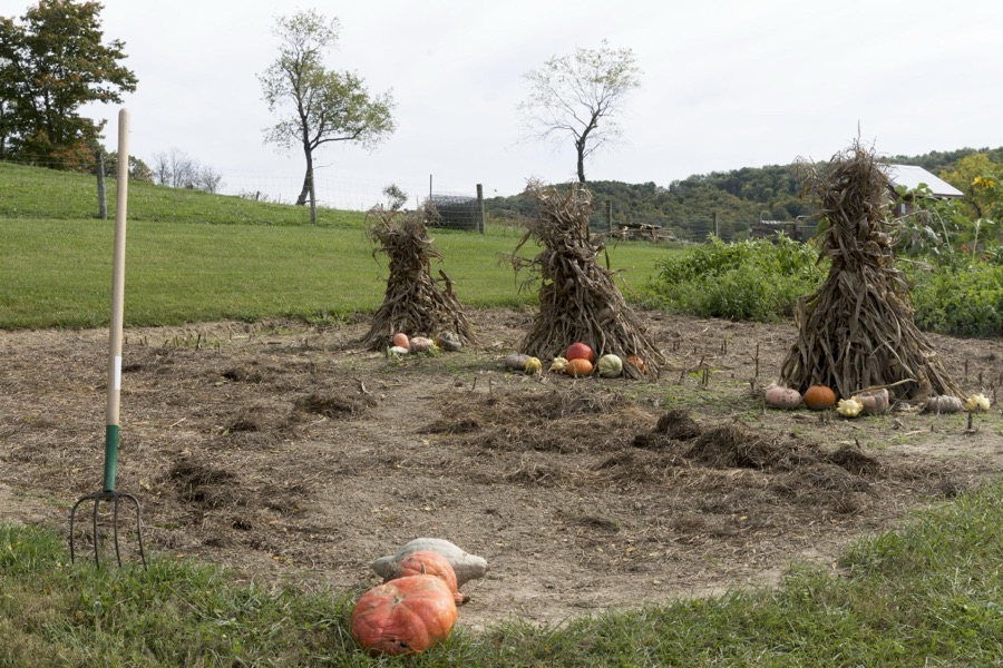
Gourds, pumpkins (which are a form of gourds), and twig stacks at Yoder's Amish Home, an authentic Amish farm that began accepting visitors in 1983 near Walnut Creek in central Ohio, along the "Amish Country Byway"
Highsmith, Carol M, 2016. Library of Congress
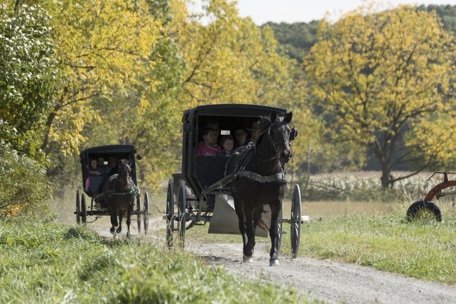
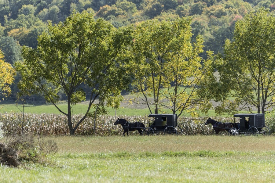
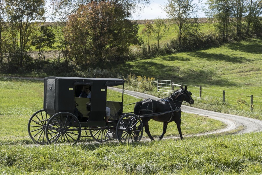
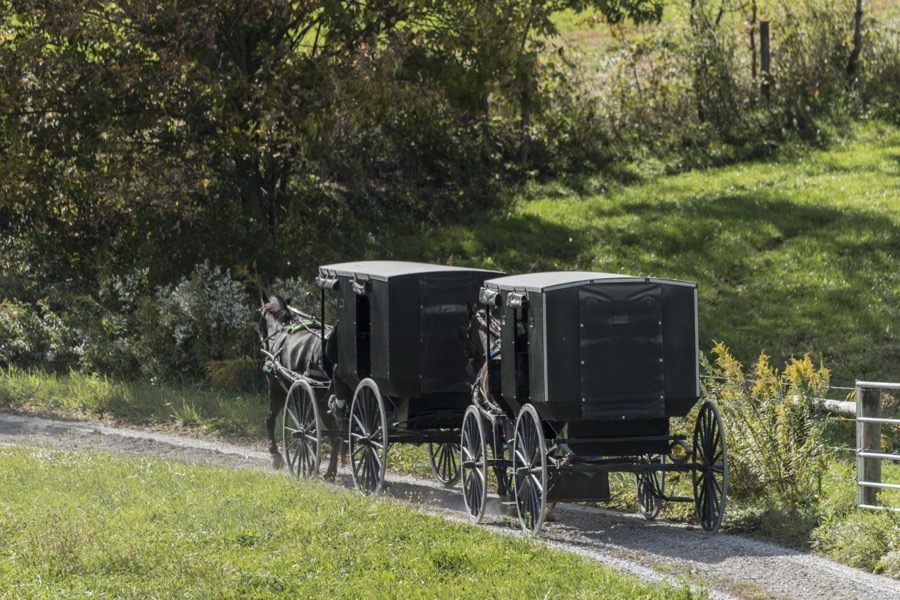
Horse-drawn Amish buggies journey down a country road at Yoder's Amish Home, an authentic Amish farm that began accepting visitors in 1983 near Walnut Creek in central Ohio, along the "Amish Country Byway"
Highsmith, Carol M, 2016. Library of Congress
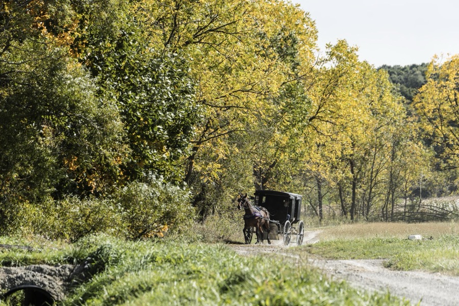
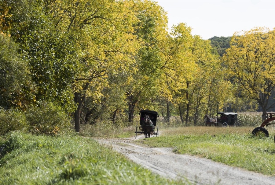
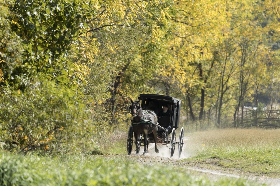
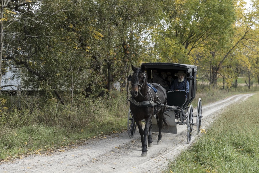
A horse-drawn Amish buggy journeys down a country road at Yoder's Amish Home, an authentic Amish farm that began accepting visitors in 1983 near Walnut Creek in central Ohio, along the "Amish Country Byway"
Highsmith, Carol M, 2016. Library of Congress
Farmhouse kitchen at Yoder's Amish Home, an authentic Amish farm that began accepting visitors in 1983 near Walnut Creek in central Ohio, along the "Amish Country Byway"
Highsmith, Carol M, 2016. Library of Congress
An Amish horse, buggy, and riders roll through Winesburg, Ohio
Highsmith, Carol M, 2016. Library of Congress
An Amish man tends to popcorn, prepared over an open fire at Hershberger's Farm and Bakery, a greatly expanded produce stand near the town of Berlin in central Ohio's "Amish Country"
Highsmith, Carol M, 2016. Library of Congress
Horse-drawn Amish buggies journey down a country road at Yoder's Amish Home, an authentic Amish farm that began accepting visitors in 1983 near Walnut Creek in central Ohio, along the "Amish Country Byway"
Highsmith, Carol M, 2016. Library of Congress
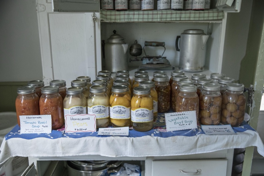
Assortment of jellies, jams, and soups inside the farmhouse at Yoder's Amish Home, an authentic Amish farm that began accepting visitors in 1983 near Walnut Creek in central Ohio, along the "Amish Country Byway"
Highsmith, Carol M, 2016. Library of Congress
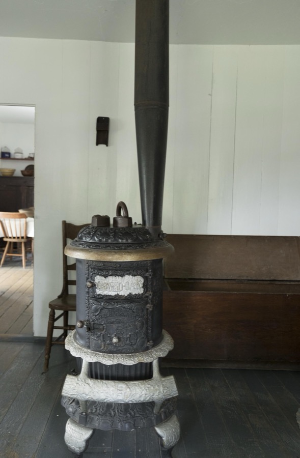
Woodburning fireplace in the farmhouse kitchen at Yoder's Amish Home, an authentic Amish farm that began accepting visitors in 1983 near Walnut Creek in central Ohio, along the "Amish Country Byway"
Highsmith, Carol M, 2016. Library of Congress
Men's straw hats, hanging inside the farmhouse at Yoder's Amish Home, an authentic Amish farm that began accepting visitors in 1983 near Walnut Creek in central Ohio, along the "Amish Country Byway"
Highsmith, Carol M, 2016. Library of Congress
A horse-drawn Amish buggy journeys down a country road at Yoder's Amish Home, an authentic Amish farm that began accepting visitors in 1983 near Walnut Creek in central Ohio, along the "Amish Country Byway"
Highsmith, Carol M, 2016. Library of Congress
Assortment of jellies, jams, and soups inside the farmhouse at Yoder's Amish Home, an authentic Amish farm that began accepting visitors in 1983 near Walnut Creek in central Ohio, along the "Amish Country Byway"
Highsmith, Carol M, 2016. Library of Congress
A horse-drawn Amish buggy journeys down a country road at Yoder's Amish Home, an authentic Amish farm that began accepting visitors in 1983 near Walnut Creek in central Ohio, along the "Amish Country Byway"
Highsmith, Carol M, 2016. Library of Congress
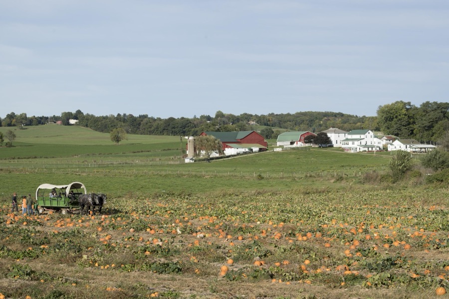
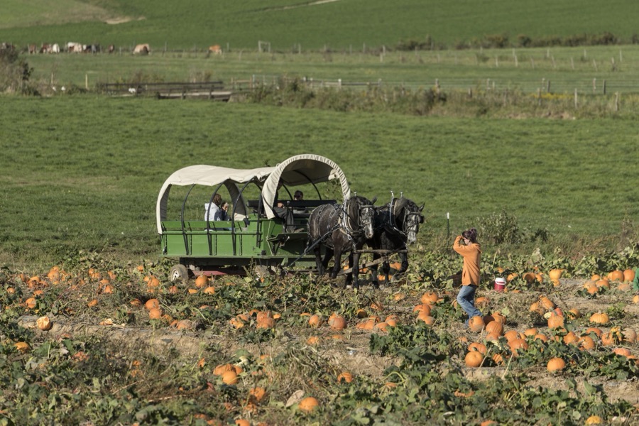
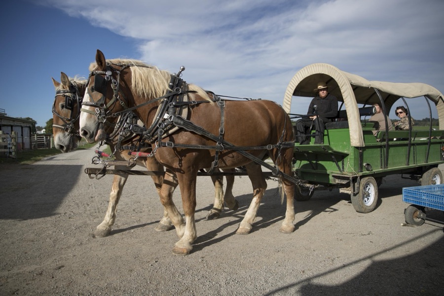
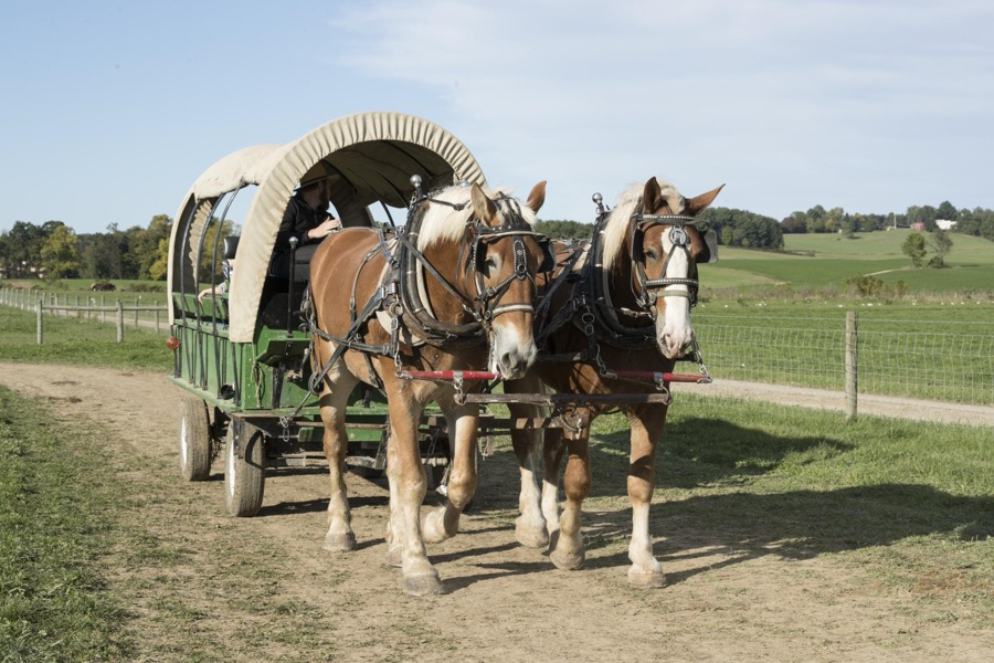
A horse-drawn wagon carries visitors into the pumpkin patch each autumn at Hershberger's Farm and Bakery, a greatly expanded produce stand near the town of Berlin in central Ohio's "Amish Country"
Highsmith, Carol M, 2016. Library of Congress
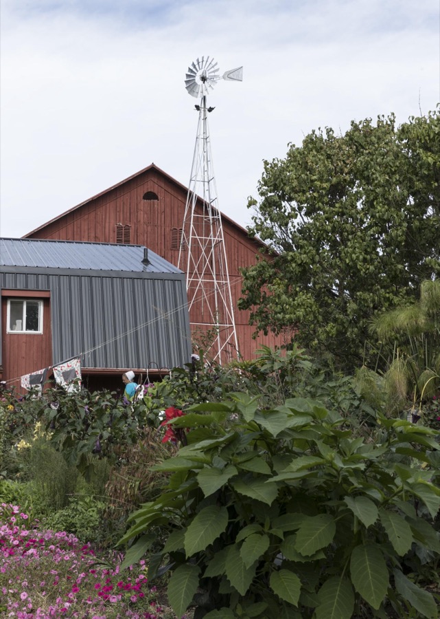
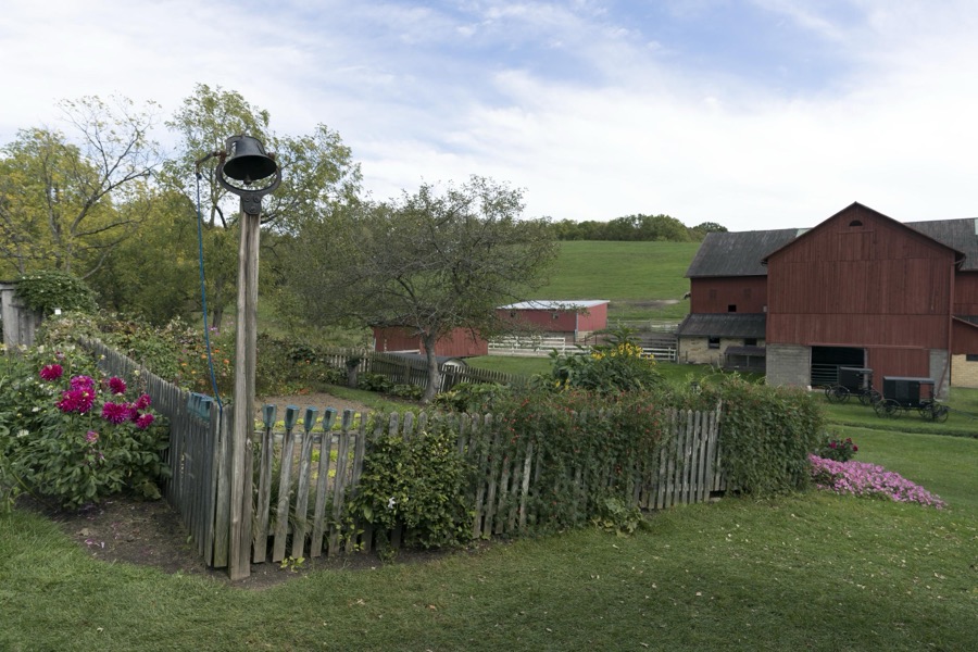
Garden and barn at Yoder's Amish Home, an authentic Amish farm that began accepting visitors in 1983 near Walnut Creek in central Ohio, along the "Amish Country Byway"
Highsmith, Carol M, 2016. Library of Congress
Small pies, before and during frying, inside the farmhouse at Yoder's Amish Home, an authentic Amish farm that began accepting visitors in 1983 near Walnut Creek in central Ohio, along the "Amish Country Byway"
Highsmith, Carol M, 2016. Library of Congress
A horse-drawn Amish buggy journeys down a country road at Yoder's Amish Home, an authentic Amish farm that began accepting visitors in 1983 near Walnut Creek in central Ohio, along the "Amish Country Byway"
Highsmith, Carol M, 2016. Library of Congress
Garden and barn at Yoder's Amish Home, an authentic Amish farm that began accepting visitors in 1983 near Walnut Creek in central Ohio, along the "Amish Country Byway"
Highsmith, Carol M, 2016. Library of Congress
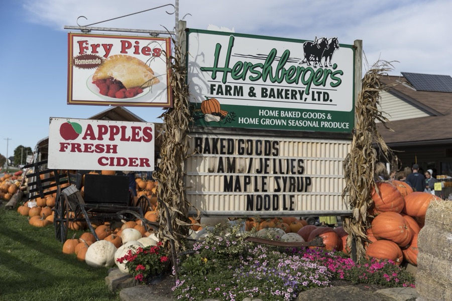
Fall display at Hershberger's Farm and Bakery, a greatly expanded produce stand near the town of Berlin in central Ohio's "Amish Country"
Highsmith, Carol M, 2016. Library of Congress
Garden and barn at Yoder's Amish Home, an authentic Amish farm that began accepting visitors in 1983 near Walnut Creek in central Ohio, along the "Amish Country Byway"
Highsmith, Carol M, 2016. Library of Congress
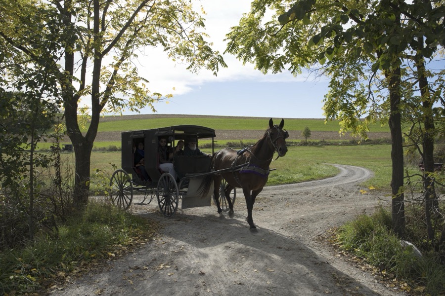
Amish horses, buggies, and their riders clip-clop down a country road in Holmes County, Ohio, near Walnut Creek
Highsmith, Carol M, 2016. Library of Congress
A horse-drawn wagon carries visitors into the pumpkin patch each autumn at Hershberger's Farm and Bakery, a greatly expanded produce stand near the town of Berlin in central Ohio's "Amish Country"
Highsmith, Carol M, 2016. Library of Congress
A horse-drawn wagon carries visitors into the pumpkin patch each autumn at Hershberger's Farm and Bakery, a greatly expanded produce stand near the town of Berlin in central Ohio's "Amish Country"
Highsmith, Carol M, 2016. Library of Congress
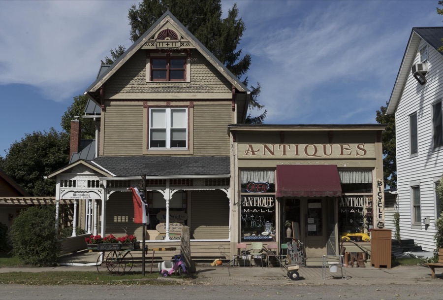
Antique shop and neighboring buildings in Winesburg, Ohio
Highsmith, Carol M, 2016. Library of Congress
Bedroom inside the farmhouse at Yoder's Amish Home, an authentic Amish farm that began accepting visitors in 1983 near Walnut Creek in central Ohio, along the "Amish Country Byway"
Highsmith, Carol M, 2016. Library of Congress
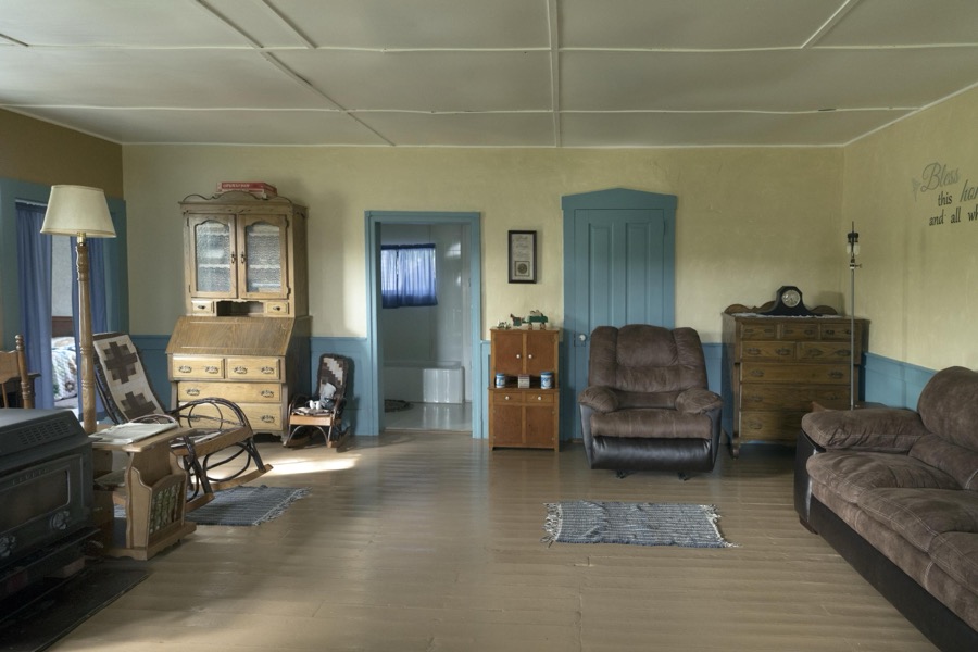
Living room inside the farmhouse at Yoder's Amish Home, an authentic Amish farm that began accepting visitors in 1983 near Walnut Creek in central Ohio, along the "Amish Country Byway"
Highsmith, Carol M, 2016. Library of Congress
Pressing and ironing board for bonnets inside the farmhouse at Yoder's Amish Home, an authentic Amish farm that began accepting visitors in 1983 near Walnut Creek in central Ohio, along the "Amish Country Byway"
Highsmith, Carol M, 2016. Library of Congress
Garden display at Yoder's Amish Home, an authentic Amish farm that began accepting visitors in 1983 near Walnut Creek in central Ohio, along the "Amish Country Byway"
Highsmith, Carol M, 2016. Library of Congress
A contented cat at Yoder's Amish Home, an authentic Amish farm that began accepting visitors in 1983 near Walnut Creek in central Ohio, along the "Amish Country Byway"
Highsmith, Carol M, 2016. Library of Congress
An Amish horse, buggy, and rider or riders clip-clop down a country road in Holmes County, Ohio, near Walnut Creek
Highsmith, Carol M, 2016. Library of Congress
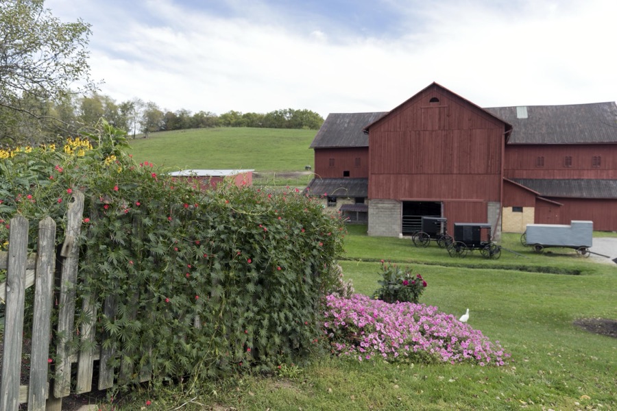
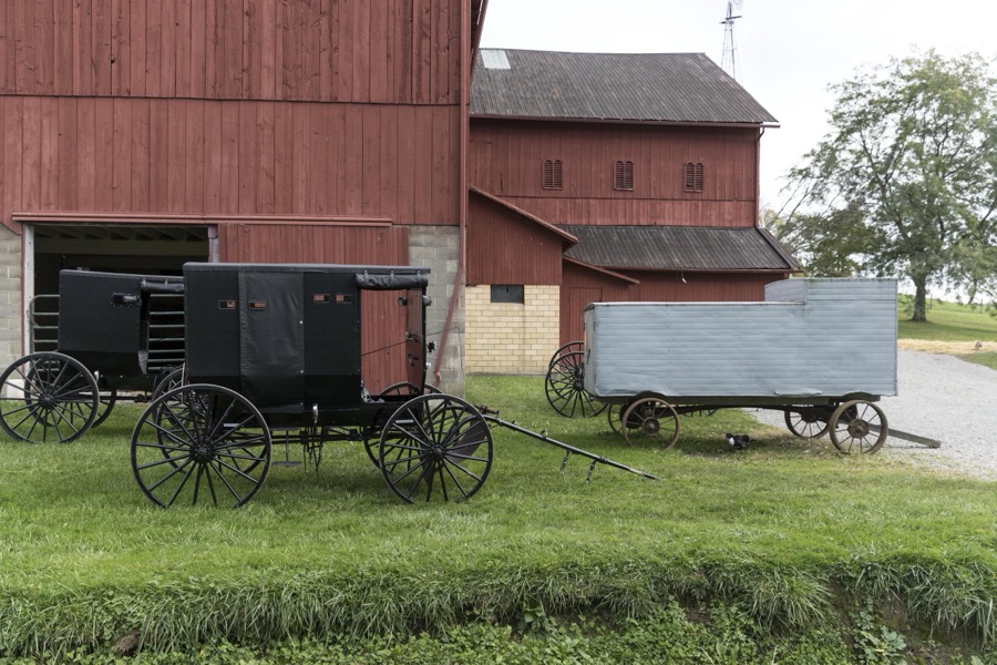
Barns and horse-drawn buggies and farm wagons at Yoder's Amish Home, an authentic Amish farm that began accepting visitors in 1983 near Walnut Creek in central Ohio, along the "Amish Country Byway"
Highsmith, Carol M, 2016. Library of Congress
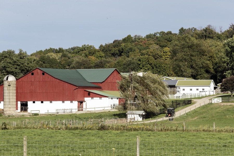
A horse-drawn Amish buggy heads up the hill to the large farmstead at Hershberger's Farm and Bakery, a greatly expanded produce stand near the town of Berlin in central Ohio's "Amish Country"
Highsmith, Carol M, 2016. Library of Congress
Amish horses, buggies, and their riders clip-clop down a country road in Holmes County, Ohio, near Walnut Creek
Highsmith, Carol M, 2016. Library of Congress
Kitchen scene inside the farmhouse at Yoder's Amish Home, an authentic Amish farm that began accepting visitors in 1983 near Walnut Creek in central Ohio, along the "Amish Country Byway"
Highsmith, Carol M, 2016. Library of Congress
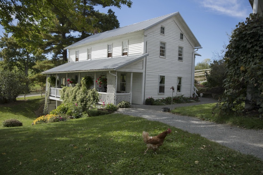
Hangar and hat-block form inside the farmhouse at Yoder's Amish Home, an authentic Amish farm that began accepting visitors in 1983 near Walnut Creek in central Ohio, along the "Amish Country Byway"

Highsmith, Carol M, 2016. Library of Congress
Doll on a rocking chair inside the farmhouse at Yoder's Amish Home, an authentic Amish farm that began accepting visitors in 1983 near Walnut Creek in central Ohio, along the "Amish Country Byway"
Highsmith, Carol M, 2016. Library of Congress
Farmhouse kitchen at Yoder's Amish Home, an authentic Amish farm that began accepting visitors in 1983 near Walnut Creek in central Ohio, along the "Amish Country Byway"
Highsmith, Carol M, 2016. Library of Congress
Kitchen scene inside the farmhouse at Yoder's Amish Home, an authentic Amish farm that began accepting visitors in 1983 near Walnut Creek in central Ohio, along the "Amish Country Byway"
Highsmith, Carol M, 2016. Library of Congress
A horse-drawn wagon carries visitors into the pumpkin patch each autumn at Hershberger's Farm and Bakery, a greatly expanded produce stand near the town of Berlin in central Ohio's "Amish Country"
Highsmith, Carol M, 2016. Library of Congress
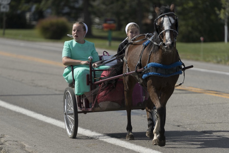
Amish girls ride through Winesburg, Ohio
Highsmith, Carol M, 2016. Library of Congress

Places on the National Register

13

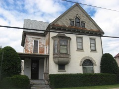
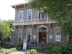
Every property in this county listed on the National Register of Historic Places, with the year it was listed and the federal nomination document.

Photograph PropertyType ListedReference
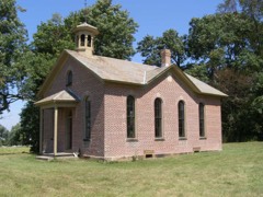
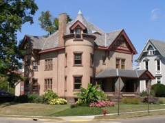
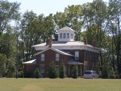
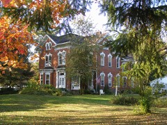
Adams, G., Housebuilding198484003730
Boyd Schoolbuilding198080003103
Brightman Housebuilding197474001528
Cary, G.W., Housebuilding198484003734
Cary, Hiram W., Housebuilding198484003736
Croco Housebuilding198585001343
DeYarmon, Joseph L. Housebuilding198282003599
Disciple-Christian Churchbuilding198484003738
Holmes County Courthouse And Jailbuilding197474001529
Koch, John E., Jr., Housebuilding198484003740
Pomerene Housebuilding198080003102
United Methodist Churchbuilding198484003744
Wise, Peter, Housebuilding198080003104

Covered bridges

0

Holmes County holds 0 covered bridges on the National Register, more than any other property type here. Each is a listed structure with a federal nomination on file.

Bird's-eye views and land ownership maps

2

Drawn when these were printed as single large sheets: the town seen from the air, and the county divided into its farms with every owner named. Each opens the original at the Library of Congress.

Land ownership map, 1875 - Caldwell's atlas of Holmes Co., Ohio
Land ownership map (1875) - Caldwell's atlas of Holmes Co., Ohio. Library of Congress.
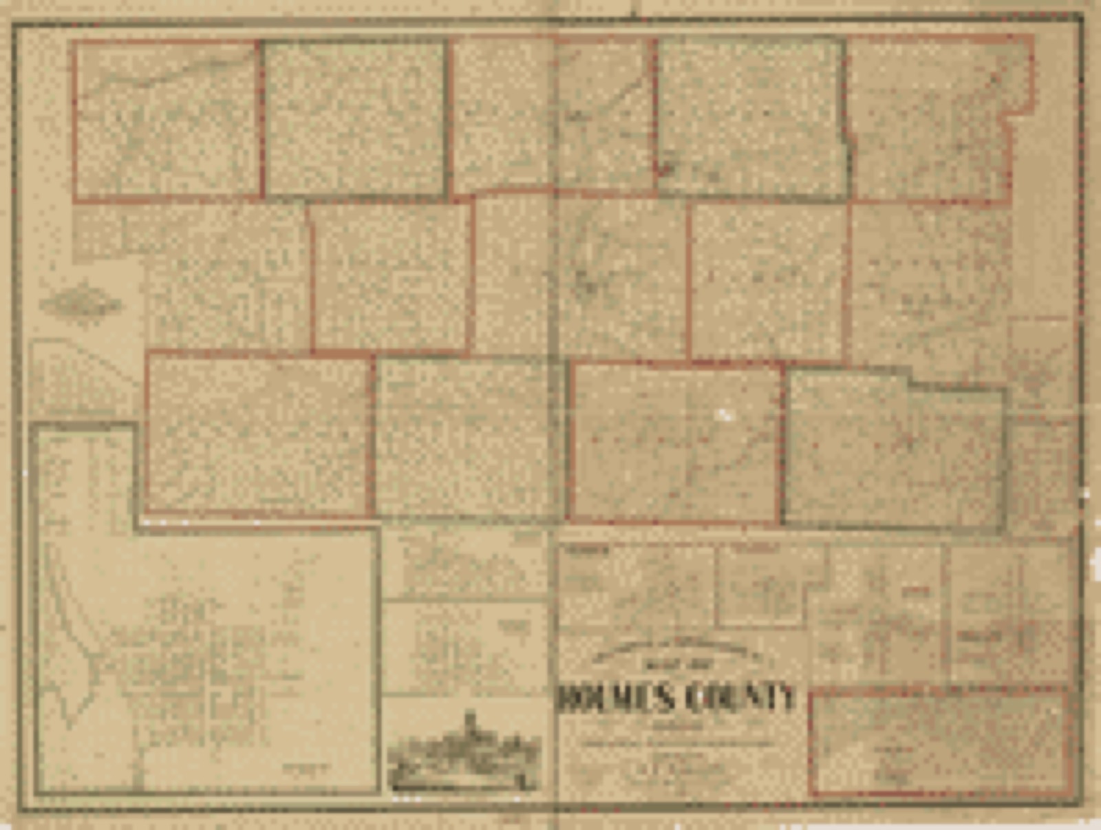
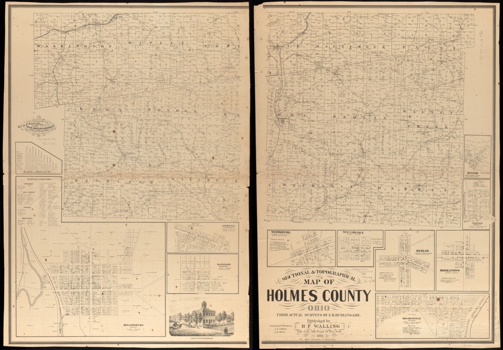
Land ownership map, 1861 - Sectional & topographical map of Holmes County, Ohio
Land ownership map (1861) - Sectional & topographical map of Holmes County, Ohio. Library of Congress.

Photographs from libraries nationwide

1 shown

Selected from the Digital Public Library of America's 1 image records catalogued for this county. Every one shown here carries a public-domain status or a licence that permits reuse on a site that carries advertising; non-commercial, share-alike and restricted images are excluded. The selection is spread across the county's towns (at most eight per town), so no single institution's bulk upload crowds out the rest. Each opens the holding library's record, and the complete set at the Digital Public Library of America is one click away.

Sectional & topographical map of Holmes County, Ohio, Boston Public Library - undated
Sectional & topographical map of Holmes County, Ohio. Burlingame, E. H, Boston Public Library, via the Digital Public Library of America.

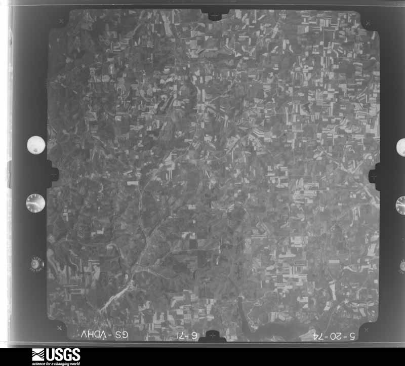
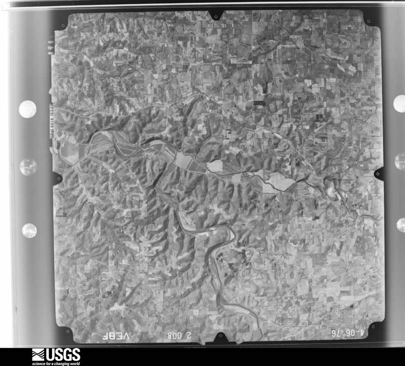
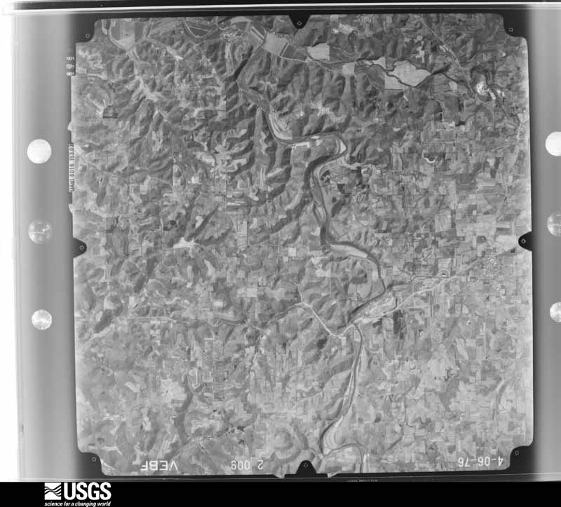
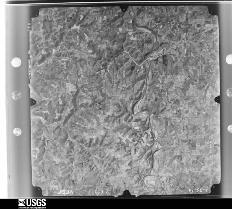
The county from the air

20 of 281 shown

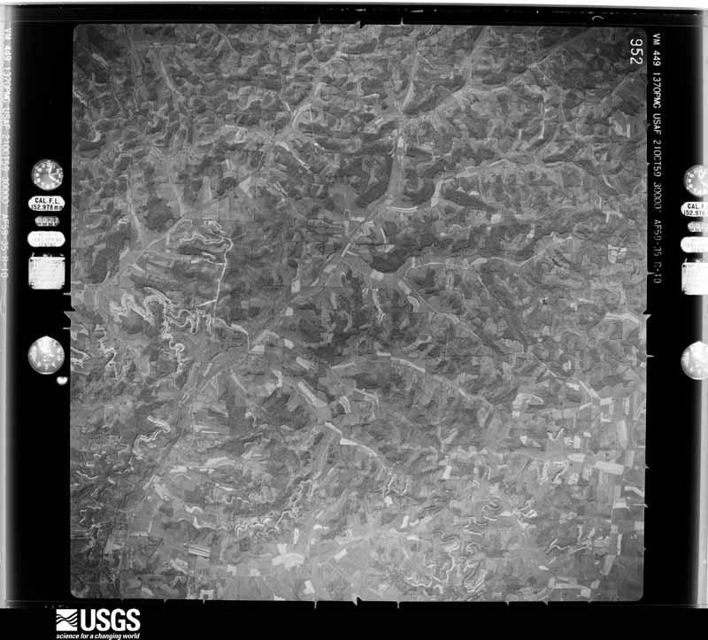
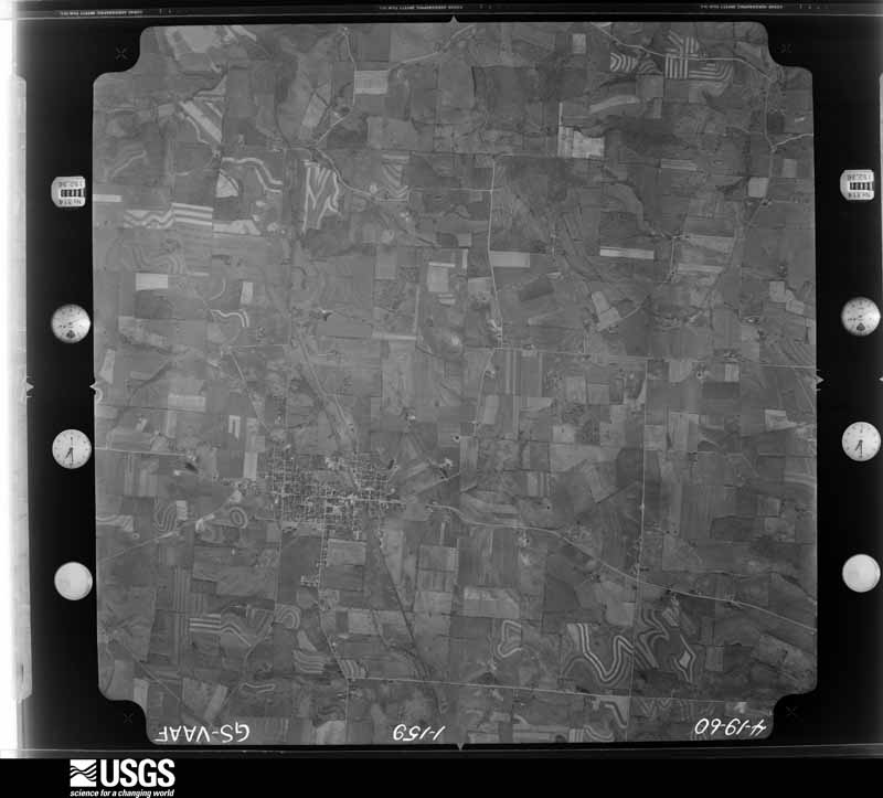
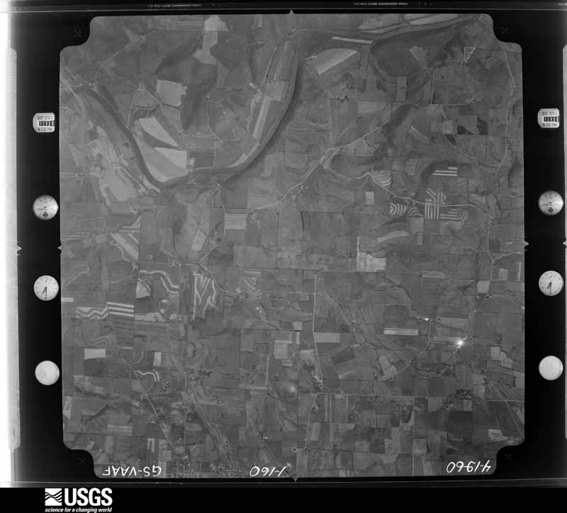
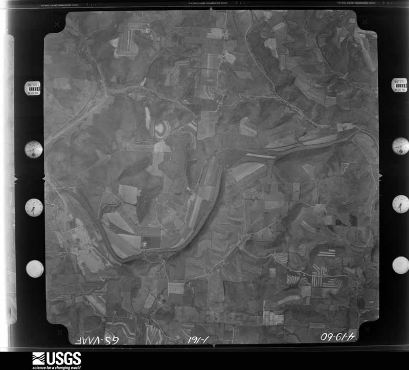
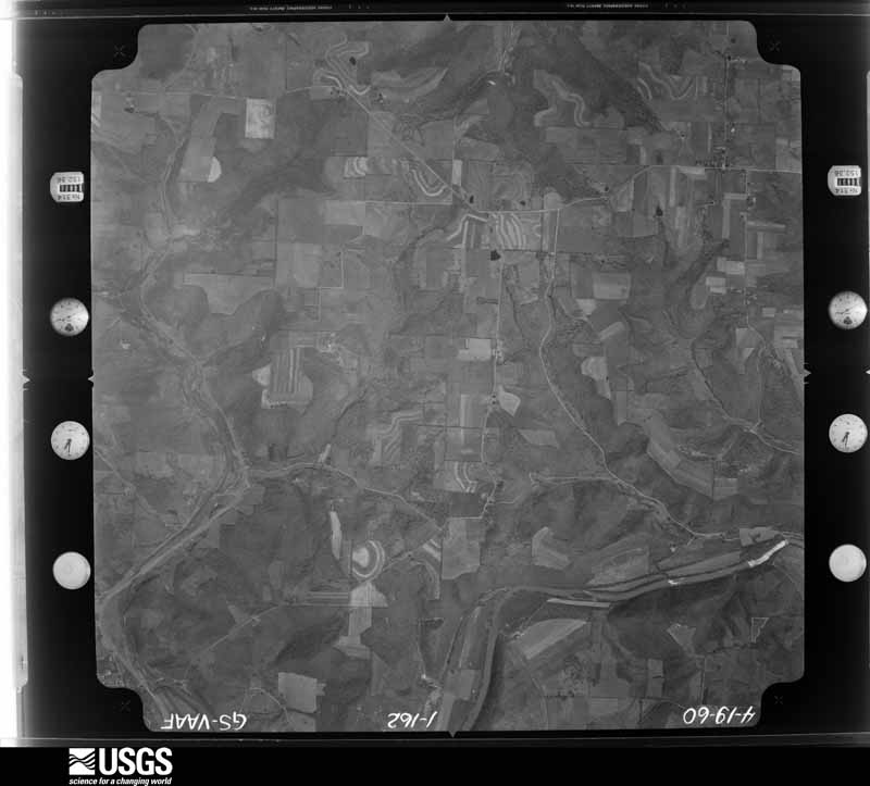
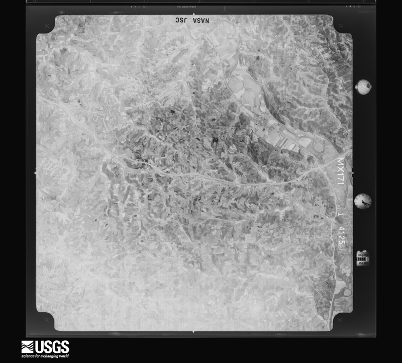
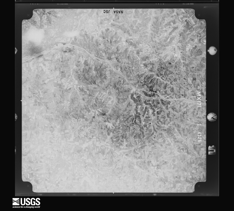
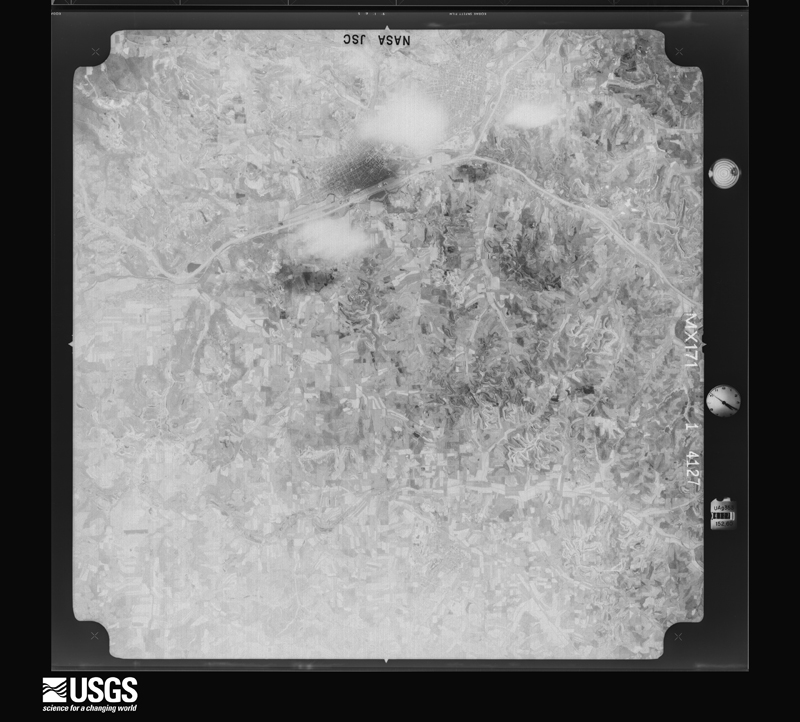
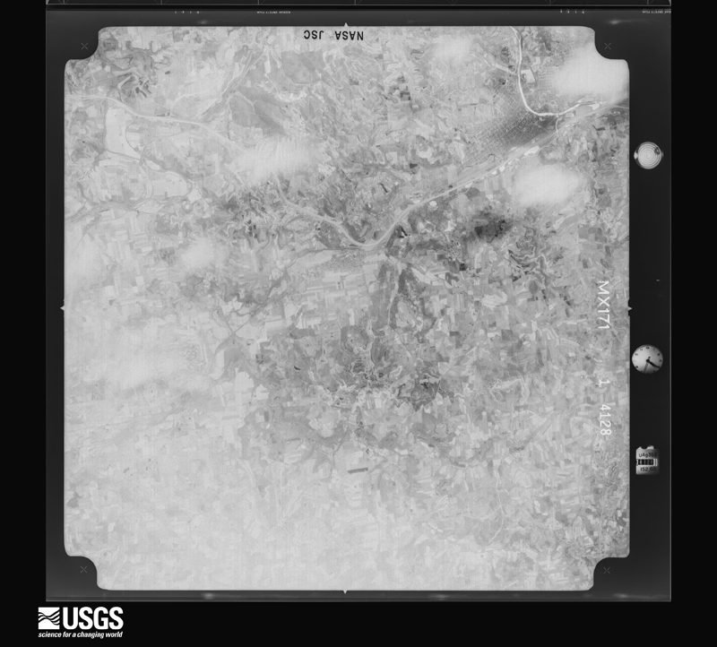
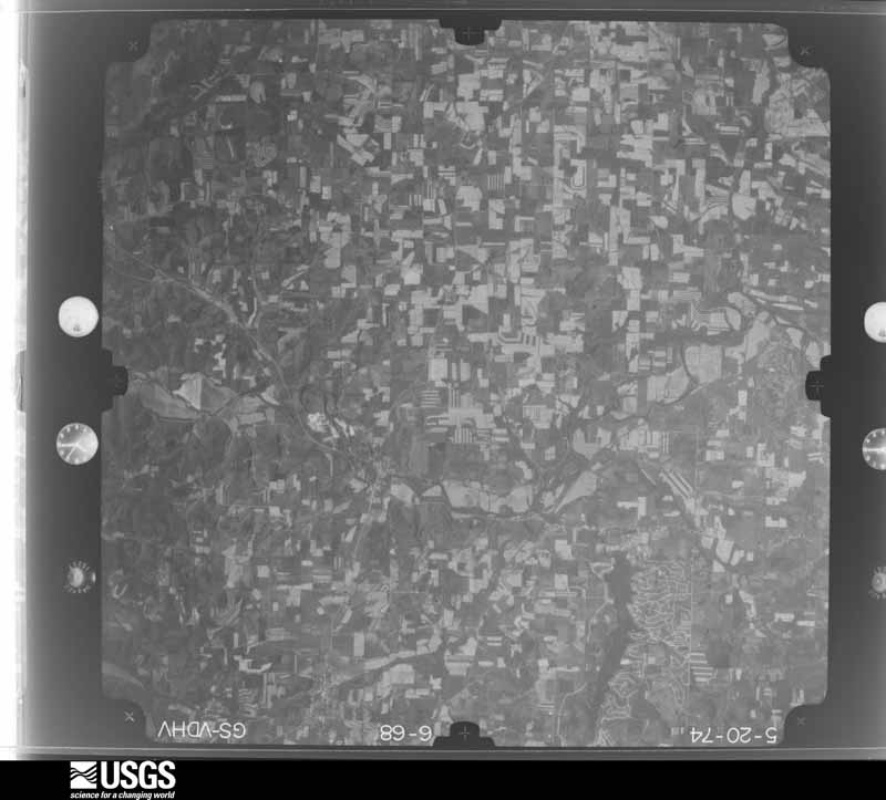
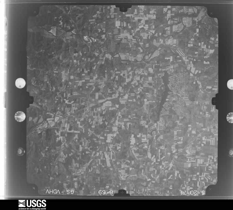
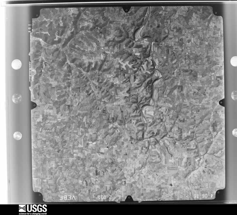
Flown by the U.S. Geological Survey between 1937 and 1989, the Aerial Photo Single Frames collection is the definitive mid-century view of the land: fields, roads and rivers as the camera saw them. 281 frames touch this county; the selection below spreads across the decades of flights (at most four per year), so one flight cannot crowd out the rest. The full set is free to browse and download at EarthExplorer under the dataset Aerial Photo Single Frames.

U.S. Geological Survey aerial photograph, 1959-10-21, scale 1:60000
1959-10-21, scale 1:60000. U.S. Geological Survey aerial photograph.
U.S. Geological Survey aerial photograph, 1959-10-21, scale 1:60000
1959-10-21, scale 1:60000. U.S. Geological Survey aerial photograph.
U.S. Geological Survey aerial photograph, 1959-10-21, scale 1:60000
1959-10-21, scale 1:60000. U.S. Geological Survey aerial photograph.
U.S. Geological Survey aerial photograph, 1959-10-21, scale 1:60000
1959-10-21, scale 1:60000. U.S. Geological Survey aerial photograph.
U.S. Geological Survey aerial photograph, 1960-04-25, scale 1:29000
1960-04-25, scale 1:29000. U.S. Geological Survey aerial photograph.
U.S. Geological Survey aerial photograph, 1960-04-25, scale 1:29000
1960-04-25, scale 1:29000. U.S. Geological Survey aerial photograph.
U.S. Geological Survey aerial photograph, 1960-04-25, scale 1:29000
1960-04-25, scale 1:29000. U.S. Geological Survey aerial photograph.
U.S. Geological Survey aerial photograph, 1960-04-25, scale 1:29000
1960-04-25, scale 1:29000. U.S. Geological Survey aerial photograph.
U.S. Geological Survey aerial photograph, 1971-04-16, scale 1:98058
1971-04-16, scale 1:98058. U.S. Geological Survey aerial photograph.
U.S. Geological Survey aerial photograph, 1971-04-16, scale 1:98058
1971-04-16, scale 1:98058. U.S. Geological Survey aerial photograph.
U.S. Geological Survey aerial photograph, 1971-04-16, scale 1:98058
1971-04-16, scale 1:98058. U.S. Geological Survey aerial photograph.
U.S. Geological Survey aerial photograph, 1971-04-16, scale 1:98058
1971-04-16, scale 1:98058. U.S. Geological Survey aerial photograph.
U.S. Geological Survey aerial photograph, 1974-05-01, scale 1:76000
1974-05-01, scale 1:76000. U.S. Geological Survey aerial photograph.
U.S. Geological Survey aerial photograph, 1974-05-01, scale 1:76000
1974-05-01, scale 1:76000. U.S. Geological Survey aerial photograph.
U.S. Geological Survey aerial photograph, 1974-05-01, scale 1:76000
1974-05-01, scale 1:76000. U.S. Geological Survey aerial photograph.
U.S. Geological Survey aerial photograph, 1974-05-01, scale 1:76000
1974-05-01, scale 1:76000. U.S. Geological Survey aerial photograph.
U.S. Geological Survey aerial photograph, 1976-04-01, scale 1:80000
1976-04-01, scale 1:80000. U.S. Geological Survey aerial photograph.
U.S. Geological Survey aerial photograph, 1976-04-01, scale 1:80000
1976-04-01, scale 1:80000. U.S. Geological Survey aerial photograph.
U.S. Geological Survey aerial photograph, 1976-04-01, scale 1:80000
1976-04-01, scale 1:80000. U.S. Geological Survey aerial photograph.
U.S. Geological Survey aerial photograph, 1976-04-01, scale 1:80000
1976-04-01, scale 1:80000. U.S. Geological Survey aerial photograph.

Weather records

5 stations, 5 gages

The thermometers that kept this county's weather, and the gages that watched its rivers, as the federal records hold them. The extremes below are measured values from those records, not estimates.

  • KILLBUCK 1893 to 1919, hottest 40.6 C, coldest -30.6 C
  • MILLERSBURG 1916 to 2026, hottest 38.3 C, coldest -30.0 C
  • GREER 1946 to 2026
  • CHARM 1948 to 1949
  • MILLERSBURG 1948 to 1953, hottest 36.7 C, coldest -32.8 C

The 1950 census, district by district

26 districts

Who lived here in 1950, one enumeration district at a time, as the Census Bureau described each district. Each row opens its official National Archives result, with Population Schedules and ED Maps available there.

  • 38-1Berlin township: Berlin township - That part north of State Hwy. 39
  • 38-2Berlin township - That part south of State Hwy. 39
  • 38-3Clark township: Clark township - That part east and north of State Hwy. 557 and east of State Hwy. 93
  • 38-4Clark township - That part west and south of State Hwy. 557 and west of State Hwy. 93
  • 38-5Hardy township: Millersburg village: Millersburg village - That part east of State Hwy. 76 and north of State Hwy. 39
  • 38-6Millersburg village - That part west of State Hwy. 76
  • 38-7Millersburg village - That part south of State Hwy. 39 and east of State Hwy. 76
  • 38-8Hardy township - That part outside Millersburg village
  • 38-9Killbuck township: Killbuck village
  • 38-10Killbuck township - That part outside Killbuck village
  • 38-11Nashville village, comprising parts of Knox and Washington townships: Nashville village - That part in Knox township
  • 38-12Nashville village - That part in Washington township
  • 38-13Knox township - That part outside Nashville village (Remainder of Knox township is in Nashville village)
  • 38-14Mechanic township
  • 38-15Monroe township
  • 38-16Paint township
  • 38-17Prairie township: Holmesville village
  • 38-18Prairie township - That part outside Holmesville village
  • 38-19Richland township: Glenmont village
  • 38-20Richland township - That part outside Glenmont village
  • 38-21Ripley township
  • 38-22Salt Creek township: Salt Creek township - That part north and west of State Hwy. 241
  • 38-23Salt Creek township - That part south and east of State Hwy. 241
  • 38-24Walnut Creek township: Walnut Creek township - That part north and east of State Hwy. 39 and east of State Hwy. 515
  • 38-25Walnut Creek township - That part south and west of State Hwy. 39 and west of State Hwy. 515
  • 38-26Washington township - That part outside Nashville village (Remainder of Washington township is in Nashville village)

Businesses named in the atlases

1 businesses

Every Sanborn volume opens with a printed index naming the town's mills, tanneries, hotels and works by proprietor. Those indexes were read off the scanned sheets by machine and then matched to each other, so a business surveyed four times appears here once, with the years it survived. 0 of these 1 were named in more than one atlas. Each carries a crop of the line it was read from: the spelling is the recogniser's and the 1880s lithographer's, and the scan behind it is the proof.

Wildfire, 2004 to 2020

87 fires

Every wildfire the federal occurrence database records inside this county: 87 of them, burning about 177 acres. 0 started naturally and 3 were recorded as arson. Each settlement page carries the fires within five miles of it.

Reported cause Fires
Debris and open burning54
Missing data/not specified/undetermined16
Smoking6
Arson/incendiarism3
Recreation and ceremony3
Equipment and vehicle use3
Power generation/transmission/distribution2

The five largest, by the area the report gives. One of them was set deliberately.

DateCause SizeReported by Name on the report
24 April 2014Missing data/not specified/undetermined20 acresOhio Department of Natural Resourcesnot named
18 April 2015Debris and open burning15 acresOhio Department of Natural Resources2966
7 April 2013Debris and open burning15 acresOhio Department of Natural Resourcesnot named
12 March 2016Arson/incendiarism10 acresOhio Department of Natural Resources3725
14 November 2015Debris and open burning7.0 acresOhio Department of Natural Resources2401
21 March 2015Debris and open burning6.5 acresOhio Department of Natural Resources526
13 March 2004Debris and open burning6.0 acresOhio Department of Natural Resourcesnot named
20 November 2020Debris and open burning6.0 acresOhio Department of Natural Resources16014

Every settlement page carries the fires within five miles of it - see the settlement index below.

Storms, 1962 to 2026

60 of 366 shown

The NOAA Storm Events Database holds 366 reports for this county, causing 0 deaths, 44 injuries and about $16,242,000 in recorded property damage. Each settlement page carries the reports that name it.

Kind of event Reports
Thunderstorm Wind227
Hail92
Flash Flood29
Tornado12
Flood4
Lightning1
Heavy Rain1

The most serious of them, by death, then injury, then recorded damage. The accounts are quoted exactly as the forecast office filed them.

WhenEvent Place namedHarm What the report says
August 1991Thunderstorm Windnot stated31 hurtno account filed
June 1981Tornado (F2)not stated5 hurt, $250,000no account filed
July 1999Tornado (F1)Nashville4 hurt, $75,000A tornado touched down just north of Nashville near a campground and then traveled east along County Roads 316 and 329 to near Holmesville. From the initial touchdown eastward, the damage path was intermittent. Four females, ages 12, 14, 17 and 50 were injured by flying debris while standing inside of an 80 by 100 foot pavilion at the campground. All four victims were transported to a local hospital and the 17 year old required surgery for arm injuries. The roof of the pavilion was partially torn off and a nearby small building was moved approximately 10 feet. A video game inside the small building was flipped over. Six inch by six inch wood posts supporting the pavilion were lifted out of the ground two feet and several trees were also blown down at the campground. Around a dozen trees were snapped just to the west of Holmesville and the roofs of two house suffered damage from fallen trees.
June 1980Tornado (F1)not stated1 hurt, $2,500,000no account filed
June 1994Thunderstorm WindHolmesville and Lakev1 hurt, $500,000Numerous trees were downed, some on power lines, and some on homes which caused significant damage. A man was struck by a large falling limb and injured.
May 1973Tornado (F2)not stated1 hurt, $250,000no account filed
July 2000Thunderstorm WindCountywide1 hurt, $35,000Thunderstorm winds downed many trees in the central and southeast portions of the county. A 43 year old female was injured when her minivan was struck by a large tree. The woman suffered minor injuries and was taken to a local hospital for treatment.
August 2007Flash FloodMillersburg$1,500,000Heavy rain producing thunderstorms affected Holmes County County during the late evening hours of August 20th and early morning hours of August 21st. Rainfall totals from across the county included: 4.30 inches at Nashville; 3.74 inches at Millersburg; 3.08 inches at Holmesville and 2.40 inches at Stillwell. Runoff from this rain combined with ground already saturated from earlier rains led to significant flooding across portions of Holmes County. Widespread lowland flooding occurred across the county and many roads had to be closed because of flooding. Some of the worst flooding occurred in and around Millersburg and also near Glenmont. Killbuck Creek left it's banks in Millersburg flooding homes and business nearby. Several people had to be evacuated from their homes. In Glenmont, Black Creek went into flood and damaged some homes. Hundreds of homes elsewhere in the county suffered damage as well, mainly from basement flooding. Finally, standing water and erosion from the runoff caused damage to agricultural interests in the county.
June 2004Flash FloodCountywide$1,500,000Another round of heavy rain producing thunderstorms moved across Holmes County late on June 16th and early on the 17th. Spotters near Berlin measured two inches of rain between 11 p.m. and midnight with storm totals of four to five inches. This rain combined with ground already saturated from earlier rains led to devastating flooding in portions of Holmes County. The Walnut Creek area was among the hardest hit in the county. Rapid rises in streams and creeks damaged many roads and buildings. Over 14,000 chickens perished at a Walnut Creek Township farm after flood waters surged into a barn. Two motorists were injured when their car was swept off a flooded county road and overturned. Two bridges were washed out in Salt Creek Township. Many roads had to be closed because of washouts or flooding. Hundreds of homes and businesses sustained at least minor flood damage. Damage to roads, bridges and other public property topped $700,000.
July 2006Flash FloodWest Portion$1,100,000Heavy thunderstorm rains fell on the northwestern corner of Holmes County during the late afternoon and early evening hours of July 10th. Rainfall rates with these storms were in excess of three inches per hour. Automated gages measured storm totals of 6.52 inches in Nashville and 3.96 inches at Stillwell. Significant flooding occurred in the northwestern portion of the county along the Mohican River. Flooding occurred as much as 300 feet away from the river, and campgrounds along Wally Road sustained significant damage. Hundreds of campers had to be evacuated, many by boat. The evacuations continued through 10 p.m. and were hampered by mudslides along Wally Road. State Route 520 was flooded near Glenmont by Black Creek. A couple homes in the town had flood waters 1 to 3 feet deep on the ground floor. Several roads were washed out and many others had to be closed because of flooding. State Route 39 and County Road 22 were both impassable west of Nashville. Dozens of campers and mobile homes were damaged by the flooding. Many other homes sustained damages from basement flooding. Crop losses are also expected to significant as standing water damaged many fields.
June 2014Flash FloodBig Prairie$800,000Heavy rain on the evening of June 23rd brought widespread flooding to Holmes County. The torrential rain with rates estimated around 4 inches per hour between 9 and 10 PM caused streams and creeks to rise. At 1 a.m. Tuesday, the Holmes County Sheriff's Office declared a Level 3 state of emergency, restricting travel to emergencies only, because of flooding. The town of Glenmont was evacuated with 3-4 homes inundated to the first floor from the Black Creek. A trailerpark was evacuated in Millersburg due to flooding from the Killbuck Creek. There was significant losses in county infrastructure as three bridges were washed out as well as numerous state and county roads. A fire truck driven into flood waters after the road had been eroded and sustained over $50,000 in damages. There was excessive crop damage primarily to the corn which was flattened by the heavy rain.
June 2006Tornado (F2)Mt Hope$750,000During the late afternoon hours of June 22nd, a severe thunderstorm moved across eastern Holmes County and produced a tornado. This tornado touched down at 5:30 pm just west of Mt Hope and tracked east through Winesburg and then exited the county. The tornado had a damage path in Holmes County roughly six miles in length and 50 to 100 yards in width. The majority of the damage was classified as F1, but there were several areas of F2 damage evident. Along the path, numerous structures were damaged and hundreds of trees toppled or snapped. A barn was heavily damaged near where the tornado first touched down. Two houses nearby sustained siding and roof damage. A home on State Route 241 just outside of Mt. Hope was destroyed and several buildings at a factory in Mt. Hope sustained major damage. Metal roofs were torn off of these factory buildings with debris found as far as a mile away. Wooden beams from the buildings were thrown and pierced metal garage doors. Empty box trailers were overturned and one box trailer was even torn from its frame. The tornado continued east from Mt Hope and damaged several more homes on it's way to Winesburg. One house had it's second floor torn off. A second factory near Winesburg lost large sections of roof. In Winesburg, a few homes sustained roof damage. The tornado continued into Tuscarawas County and caused damage there. Later, the same parent thunderstorm produced another tornado west of Waynesburg in southeastern Stark County.
June 2002Flash FloodCountywide$750,000Thunderstorms dumped three and one half inches of rain on Millersburg and over 5 inches of rain elsewhere in Holmes County during the evening hours of the 4th and early morning hours of the 5th. Widespread flooding occurred across the county with numerous roads and bridges washed out. Hardest hit was the south side of Millersburg where flood waters up to five feet in depth washed out sections of State Route 83 and US Highway 62 and damaged many homes and businesses. Near Killbuck, State Route 520 was washed out and a bridge over State Route 60 north of town was severely damaged. State Route 514 was damaged near Nashville and Township Road 264 was also washed out. A trained spotter measured 5.5 inches of rainfall ten miles west of Millersburg.
September 2010Tornado (EF1)Farmerstown$500,000An EF1 tornado touched down in rural Clark Township near the intersection of Township Road 183 and Township Road 190. The tornado then moved east for just over three miles before lifting near the intersection of Township Roads 165 and 166. Several homes and buildings were damaged along the tornado path. Most of the damage was from lost roofing or siding, but a few small outbuildings were also leveled. Dozens of trees were toppled along the damage path which was up to 75 yards in width.
June 2001Thunderstorm WindMillersburg$500,000Thunderstorm downburst winds of 60 to 70 mph caused extensive damage on the west side of Millersburg. Hardest hit was the Holmes County Fairgrounds where a covered grandstand was toppled and destroyed. Four other buildings at the fairgrounds were damaged and a small shed was also destroyed. Nearby, a business lost a ten foot section of roof to the high winds. The damage path from the downburst was approximately one half mile in length and several hundred yards in width. Around two dozens trees were downed along this path.
February 1994Thunderstorm WindMonroe and Washington$500,000Numerous trees were downed northwest of Nashville (Washington Twp) at 1520 EST along Township Road 476 where a resident claimed to have seen a tornado. The tornado could not be confirmed but just west of Nashville a roof was blown off a barn at about 1530 EST and at 1545 EST a barn was destroyed and a home damaged by thunderstorm winds ten miles southeast of Nashville (Monroe Twp).
June 2006Thunderstorm WindFryburg$425,000A line of severe thunderstorms moved across northeastern Holmes County during the early morning hours of June 22nd. Several hundred trees and many utility poles were toppled in Berlin, Paint and Salt Creek Townships. Three buildings at a factory on Township Road 654 west of Winesburg were heavily damaged. A home inside of Winesburg was damaged and a barn and garage were flattened near Fryburg. Several homes and buildings in the Berlin area also sustained some damage.
June 2012Thunderstorm WindNashville$300,000An intense line of thunderstorms or Derecho moved across Holmes County during the late afternoon of June 29th causing extensive damage. Winds were estimated to be as much as 60 mph. The worst damage was across the southern half of the county where dozens of trees and some utility poles were knocked down. Scattered power outages were reported. Some damage to homes and buildings was reported. Most of the damage was from lost roofing or siding.
February 2011FloodLakeville$300,000Heavy rain and rapid snow melt led to widespread flooding across Holmes County. Rainfall totals across the county ranged from one to three inches on February 27th and 28th. Up to ten inches of heavy snow was on the ground at the onset of the rain. This snow rapidly melted as temperatures warmed into the 50s on the 28th. Up to an additional inch of water equivalent rainfall was released from the melted snow. Hundreds of homes in the county sustained damage, mainly from basement flooding. Many roads had to be closed because of the flooding. The Killbuck Creek crested at 18.07 feet, the eight highest height on record. South end of Millersburg and western portions of the Killbuck sustained flood damage.
July 2011Thunderstorm WindCharm$250,000A thunderstorm downburst with winds estimated to be as much as 75 mph caused considerable damage near Charm in eastern Holmes County. The damage started two miles northwest of Charm and continued into the town. A total of six houses and 18 other buildings were damaged by the strong winds. Two large storage buildings were leveled by the strong winds. Many trees and large limbs were also knocked down. Much of the damage to the houses was caused by fallen trees.
June 2010Tornado (EF1)Berlin$200,000An EF1 tornado touched down two miles northwest of Berlin around 2:40 pm EDT. The tornado then moved southeast to Walnut Creek and eventually moved into Tuscarawas County near Sugar Creek. This tornado did not appear to be in contact with the ground the entire length of the damage path. The damage path in Holmes County was nearly nine miles in length and up to 100 yards in width. Damage occurred to around a dozen homes and buildings along the damage path. Most of the damage was from lost roofing or siding. A camper trailer was blown over and a garage was also knocked off of it's foundation. Some large signs were torn off of the roof of a business located east of Berlin. The signs landed in a nearby parking lot and damaged at least eight cars. Dozens of trees and at least two utility poles were knocked down along the damage path.
June 2006Thunderstorm WindLakeville$200,000Straight line winds from a thunderstorm downburst caused considerable damage at a campground along the Ashland/Holmes county line west of Lakeville. Around sixty trees and thirty one power poles were reported down at the campground. A pontoon boat was also flipped over. The downburst continued east from the campground and moved through the Lakeville area where it downed dozens of trees and damaged several buildings. The damage path continued east to Holmesville where four apartment buildings and a business lost large sections of roof. Several hundred trees were downed in northern Holmes County from this downburst which produced winds estimated to be nearly 70 mph. Widespread power outages were reported.
June 1998Flash FloodSouthwest Portion$200,000Heavy thunderstorm rain of three to four inches in four hours caused flooding of basements, roads, small streams and low lying areas. Several roads and bridges were damaged by the high water and trees that had washed onto the roadways. Black Creek was out of its banks, flooding streets and yards in the town of Glenmont where six to eight homes were evacuated. Mudslides were reported in Richland Township just west of Glenmont.
July 2007Flash FloodNashville$150,000Heavy rain and thunderstorms in the area produced between two and four inches of rain in just a few hours. As a result, flash flooding occurred when Black Creek overflowed its banks. Floodwaters flowed over State Route 514 between Nashville and Danville. The flowing water over the road caused considerable erosion to the roadway. There were also reports of minor landslides in the county. Reports of flooding were mainly confined to the western part of the county.
November 2002Thunderstorm WindNashville$150,000Thunderstorm winds downed several trees across the county. A barn was blown off it's foundation near Nashville. A nearby house and two cars were also damaged.
June 2004Flash FloodCountywide$125,000Strong thunderstorms again moved across Holmes County during the afternoon of June 15th. One to two inches of rain fell on much of the county. This rain combined with ground already saturated from earlier rains led to widespread flooding. A factory in Walnut Creek was damaged after flood waters surged into the building. Numerous roads were either washed out or closed by flooding. Flood waters on some roads were as much as three feet deep. Many other homes and businesses sustained damage, mainly from basement flooding.
June 2025Tornado (EF1)Clark$100,000An EF1 tornado with estimated peak winds of 105-mph impacted the Lake Buckhorn community and vicinity. It began just west of the intersection of Susten Drive and Geneva Drive. The tornado then moved northeastward across Mullheim Drive and W Buckhorn Drive and through the Lake Buckhorn community. Dozens of trees were snapped or uprooted in a neighborhood on the west side of Lake Buckhorn. Some of the trees had trunks estimated to be between one and two feet in diameter, and the tornado was at its widest point of 80 yards near the west shore of the lake. A pontoon boat and adjacent dock were also lifted partially by the tornado. The tornado then crossed Lake Buckhorn and weakened gradually, but dozens of additional trees were downed on the east side of the lake as the tornado crossed East Buckhorn Drive and traversed Lucerne Drive. The tornado then crossed OH Route 83 and damaged the roof of a barn before dissipating.
June 2011Thunderstorm WindGlenmont$100,000Shortly after 9:00pm EDT, a large severe thunderstorm entered the northern part of the county. Law enforcement reported numerous trees downed across the entire county. Around 9:45pm EDT, new convection developed behind the initial severe thunderstorm and caused more thunderstorm wind damage across the area. Law enforcement reported a tree downed on a residence near Lake Buckhorn. County EMA officials determined that the damage was not tornadic in nature, but from straight line winds. Nobody was injured during this event.
May 2004Thunderstorm WindCountywide$100,000A line of severe thunderstorms moved across Holmes County and downed dozens of trees. Scattered power outages were also reported. A few homes and vehicles were damaged in the county by fallen trees.
July 2003Flash FloodKillbuck$100,000Thunderstorms dumped heavy rains on Holmes County during the evening hours causing localized flooding near Killbuck. A mudslide occurred on a hill north of town resulting in the destruction of two mobile homes. There were no injuries.
July 2003Thunderstorm WindCountywide$100,000A line of severe thunderstorms moved east across Holmes County and caused widespread damage and scattered power outages. The Winesburg, Holmesville and Killbuck areas were especially hard hit. Dozens of trees were downed across the county. Homes were damaged in both Holmesville and Winesburg.
June 1998Flash FloodCountywide$100,000Flooding occurred from thunderstorm rains on top of saturated soil from two previous days of heavy rains. Roads were flooded and closed and some crops were flooded. Basements and a few buildings were flooded.
May 2014HailNashville$75,000Hail as large as golf balls was reported. Some vehicles were damaged.
June 2012Thunderstorm WindMillersburg$75,000Thunderstorm winds downed many trees and large limbs across Holmes County. Several roads had to be closed because of downed trees.
July 1995Thunderstorm WindCountywide$70,000no account filed
June 2022Thunderstorm WindMillersburg Arpt$50,000Substantial tree damage at Skyview Ranch Christian Camp, about two-miles northeast of Millersburg. Numerous trees downed. Some crushed cars, damaged buildings, and blocked the only two ways into and out of camp.
July 2013Thunderstorm WindMillersburg$50,000Thunderstorm winds downed trees throughout Holmes County.
April 2007Thunderstorm WindNashville$50,000A thunderstorm downburst caused damage at a farm northeast of Nashville along State Route 514. A barn on the property lost it's roof and several trees were downed.
August 2007FloodKillbuck$50,000Heavy rain that fell across the area over the past few days eventually ran off into the Killbuck Creek. During the morning hours of the 21st, the Killbuck Creek at Killbuck went into flood. Flood stage there is 15.0 feet. The river continued rising during the afternoon of the 21st, and crested during the overnight hours into the 22nd at around 16.2 feet. Because of the heavy runoff throughout the basin, the river remained in flood through the day on the 22nd, and then finally fell back below flood stage during the early morning hours of the 23rd. While much of the floodwaters from the Killbuck River mainly flow into farm fields nearby, some streets and homes within Killbuck were still affected by the river going above flood stage. The flash flood write up for Holmes County contains much of the estimated damage from flash flooding on the 21st. Damage estimates for this event describe damage directly associated to the river going into flood.
June 2006Thunderstorm WindNashville$50,000Thunderstorm winds downed several trees and large limbs in extreme northwestern Holmes County. Two buildings were leveled three miles east of Loudonville along State Route 3.
July 2003Thunderstorm WindCountywide$50,000Thunderstorm winds downed trees and large limbs across the county.
May 2002Thunderstorm WindMillersburg$50,000Thunderstorm winds downed trees and large limbs near Millersburg and Walnut Creek. A garage was crushed by a fallen tree in Walnut Creek and a house north of Millersburg was also damaged by a fallen tree.
June 1994Thunderstorm WindHomlesville$50,000Trees were downed, some on power lines. Winds were estimated to 70 mph.
June 1997Flash FloodCountywide$40,000no account filed
August 2007Thunderstorm WindNashville$35,000Thunderstorm winds uprooted several trees south of Nashville near the intersection of County Road 52 and Township Road 280. One of the trees landed on a house causing damage.
June 2002Thunderstorm WindCountywide$35,000Thunderstorm winds downed many trees near Lakeville, Millersburg and Killbuck. A home in Killbuck was damaged by a tree.
June 2011HailHolmesville$30,000A supercell thunderstorm produced half dollar size hail. Several cars and a few homes sustained damage from the large hail.
June 2008Thunderstorm WindMillersburg$30,000Numerous trees were reported down throughout Holmes County.
July 2005Thunderstorm WindCountywide$30,000Numerous trees and power lines were reported down throughout the county.
June 1997Flash FloodCountywide$30,000no account filed
June 2025Flash FloodBig Prairie$25,000Township Road 510 washed out due to flash flooding. Radar estimated 2 to 2.5 inches of rainfall in about 45 minutes, which equates to about a 75 year recurrence interval.
June 2022Thunderstorm WindKillbuck$25,000Several large trees downed about three-miles NNW of Killbuck. One damaged a deck and another crushed a car.
July 2013Thunderstorm WindGlenmont$25,000Thunderstorm winds downed many trees.
June 2004Thunderstorm WindCountywide$25,000Thunderstorm winds downed over two dozen trees and large limbs across the county.
June 1981Tornado (F1)not stated$25,000no account filed
June 2022Thunderstorm WindBerlin$20,000Trees uprooted and metal roof blown-off building in Berlin.
May 2015Thunderstorm WindKillbuck$20,000A trained weather spotter reported severe thunderstorm winds brought down part of a tree in Killbuck with numerous trees and power lines down across the Millersburg area.
July 2005Thunderstorm WindCentral Portion$20,000Numerous trees and power lines were reported down.
June 1997Flash FloodCountywide$20,000no account filed
May 2018Flash FloodBerlin$15,000Heavy rainfall moved into Holmes County between 700 and 800 pm on the evening of the 26th. A line of thunderstorms over Wayne County moved south into Holmes County where there was a cell merger. This cause a brief period of storm back building and training over north central Holmes County. During this period the rainfall rates were estimated around 5 inches per hour. The storm motions were from north to south, paralleling the extent of the Killbuck Creek river basin starting in the headwaters. This confined the majority of the runoff to that single basin. The result was flash flooding in several areas across Holmes County. One home in Monroe and Prairie Township was flooded on County Road 320 from Paint Creek. Prairie Township Fire Department rescued people from a car in high water. One unofficial rainfall report of 3.00 came from Berlin in eastern Holmes County. An official reading in Holmesville of 2.72 was measured between 7 pm and 8 pm.

Mines and quarries

21 recorded

The Survey's mineral resources record lists 21 workings inside this county. 6 still produce and 15 are closed or unrecorded. Each settlement page carries the workings within five miles of it.

Commodity Workings
Clay9
Sand and Gravel, Construction8
Stone, Crushed/Broken1
Limestone, General1
Flagstone1
Stone1

The least common of them first, because a county's hundredth gravel pit says nothing its first ten did not.

Where SiteCommodity StatusRecorded
Briar Hill Plant & QuarryStonePlant
Holmes 241 Limestone QuarryLimestone, GeneralPast ProducerSedimentary
Holmes County QuarriesStone, Crushed/BrokenPast ProducerSedimentary
Quarry Number 31FlagstonePast Producer
Brothers Sand & GravelSand and Gravel, ConstructionProducer
Close Sand and Gravel PitSand and Gravel, ConstructionPast ProducerSedimentary
Close Sand and Gravel PitSand and Gravel, ConstructionPast Producer
Fair PitSand and Gravel, ConstructionProducer
Feikert Sand and Gravel PitSand and Gravel, ConstructionPast ProducerSedimentary
Feikert Sand and Gravel PitSand and Gravel, ConstructionProducer
Holmesville PitSand and Gravel, ConstructionPast ProducerSedimentary
Jones S & G Holmesville PitSand and Gravel, ConstructionProducer
241 Limestone Plant & QuarryClayProducer
Clark Clay CompanyClayPast Producer
Clark Clay Company MineClayPast ProducerSedimentary
Domer PitClayPast ProducerSedimentary
Domer PitClayPast Producer
Fisher PitClayPast ProducerSedimentary
Holmes 241 Clay PitClayPast ProducerSedimentary
Holmes 241 Clay PitClayPast Producer
Troyer PitClayPast Producer

Collected here, 1890 to 1975

8 of 446 shown

Museum specimens collected inside this county and catalogued with a date and a place: 446 of them, by kingdom 389 animalia, 48 plantae, 9 fungi. Each is a physical object in a named collection, not a sighting. Held by Ohio State University - Fish Division, Columbus, OH (OSUM), Cleveland Museum of Natural History, OH (CLEV), Ohio State University - Amphibian Division, Columbus, OH (OSUM), CM, WFVZ, Ohio State University Acarology Laboratory, Columbus, OH (OSAL) among others, and each settlement page carries the specimens collected near it.

The oldest of them. A specimen proves something was collected on that day; its absence proves nothing.

Photograph YearSpecies KingdomWhere CollectorCatalogue
A photograph of the species Ectopistes migratorius, not of this specimen1890Ectopistes migratorius (Linnaeus, 1766)AnimaliaMillesburgCollector(s): unknownMVZ MVZ:Egg:5863
A photograph of the species Arachnion album, not of this specimen1893Arachnion album Schwein.Funginot statedA. P. MorganNY 123783
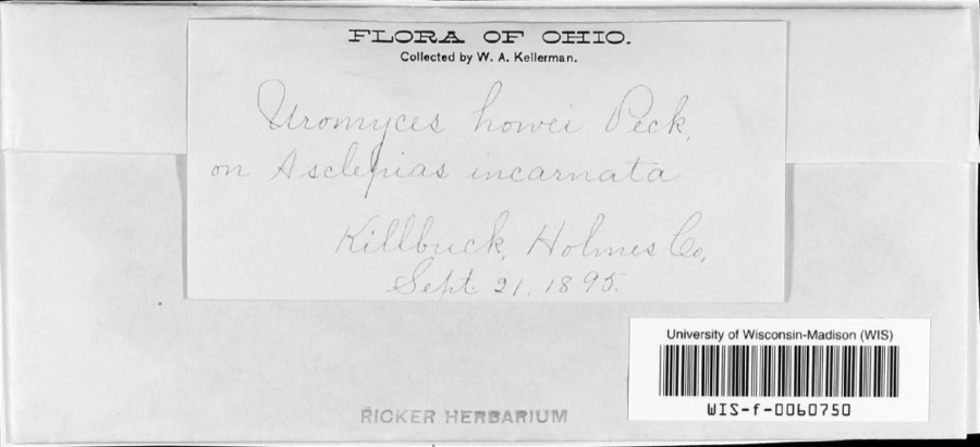
Specimen of Uromyces asclepiadis Cooke1895Uromyces asclepiadis CookeFungiKillbuckW.A. KellermanWIS WIS-F-0060750
A photograph of the species Agastache scrophulariifolia, not of this specimen1896Agastache scrophulariifolia (Willd.) KuntzePlantaeLakevillenot recordedCM CM142779
A photograph of the species Coreopsis tripteris, not of this specimen1896Coreopsis tripteris L.PlantaeLakevilleWilkinson, E.CM CM210751
A photograph of the species Decodon verticillatus, not of this specimen1896Decodon verticillatus (L.) ElliottPlantaeLakevilleWilkinson, E.CM CM178876
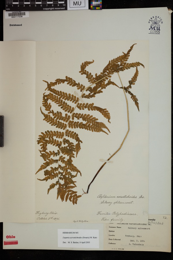
Specimen of Deparia acrostichoides (Sw.) M.Kato1896Deparia acrostichoides (Sw.) M.KatoPlantaeFryburgWetzstein, A.MU 000117238
A photograph of the species Polygonum coccineum, not of this specimen1896Polygonum coccineum f. terrestre (Willd.) StanfordPlantaeLakevilleWilkinson, E.CM CM435311

Every populated place in the county

37

Named settlements recorded in the Geographic Names Information System, each with the topographic sheets covering it. Villages, hamlets and abandoned places alike. Each is shown with the watercourse or landform it stands on and the survey quadrangle it falls on. The 1 places that were also surveyed for fire insurance come first, with the number of atlases and photographs held for them.

Recorded here

Millersburg, Ohio

17 topographic sheets and 7 fire insurance atlases, 1887 to 1935

Everything this county holds

The complete index, with nothing left out. Each of these is a separate record with its own page: a federal survey report, or the case file that argued a property on to the National Register. Both are public domain and reproduced word for word.

Nomination case files

13 case files

The vanished settlements of Holmes County, the places these records name that are no longer on the map.

Provenance

  • Topographic sheets. USGS Historical Topographic Map Collection, county index, measured from the bulk metadata.
  • Fire insurance maps. Library of Congress Sanborn collection, faceted to this county.
  • Photographs. Each place queried individually against the Library of Congress Prints and Photographs search.
  • Wildfire. Short, Karen C. 2022. Spatial wildfire occurrence data for the United States, 1992-2020 [FPA_FOD_20221014]. 6th Edition. Fort Collins, CO: Forest Service Research Data Archive. https://doi.org/10.2737/RDS-2013-0009.6 Collected with United States Government funding and usable without additional permissions or fees.
  • Specimens. Global Biodiversity Information Facility (GBIF), https://www.gbif.org/. Only records licensed CC0 or CC BY are used. Records licensed CC BY-NC are excluded because this site carries advertising. Images are checked individually and any whose licence is non-commercial, no-derivatives or unreadable is refused.
  • Mines and quarries. USGS Mineral Resources Data System (MRDS) https://mrdata.usgs.gov/mrds/ A work of the United States government, no copyright under 17 U.S.C. 105.
  • Storms. NOAA National Centers for Environmental Information, Storm Events Database https://www.ncei.noaa.gov/stormevents/ A work of the United States government, no copyright under 17 U.S.C. 105. Narratives are quoted verbatim from the National Weather Service report and are not edited or summarised.