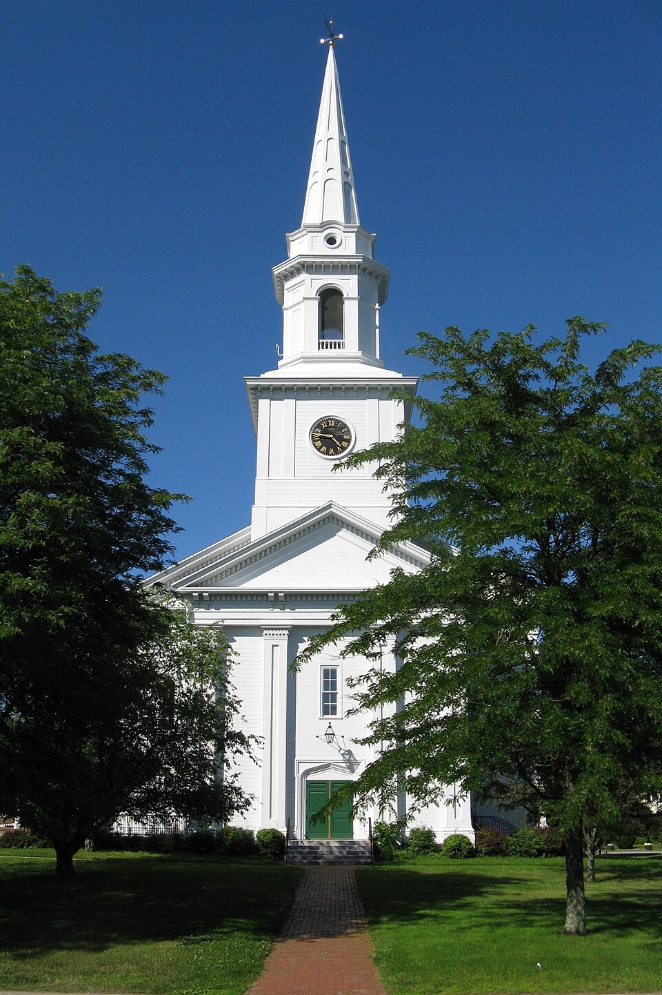
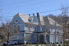
Built in 1854 in the Greek Revival architecture. Listed on the National Register of Historic Places in
1982. A historic map-sheet match is not published yet. The record needs a coordinate-quality review before it can be joined to a sheet boundary.
From the record
“The Old South Union Church is a congregational church in Weymouth, Massachusetts. The white clapboarded church is a replica of an 1853-54 building that was destroyed by fire in 1989.”
Wikipedia article Old South Union Church, CC BY-SA 4.0.
one of 249 National Register listings in Norfolk County · listed in 1982 · category: Building · built in 1854, Greek Revival architecture · one of 2 National Historic Landmarks in Norfolk County.
National Register reference number.82004422- the number the National Park Service assigned this property when it was listed, and the key its nomination file is catalogued under at the National Archives.
Fires near this property
381 since 2015
Regional context, not property-specific
evidence. The
federal wildfire occurrence database
lists 381 fires within 5 miles of Old South Union Church between
2015 and 2020, burning about 169 acres in total. None started naturally. 1 was recorded as arson.
Distance is straight-line from the map coordinates, so a fire counted
here may appear on a neighbouring settlement's page as well.
Reported cause
Fires
Recreation and ceremony
132
Debris and open burning
119
Missing data/not specified/undetermined
76
Smoking
37
Misuse of fire by a minor
13
Fireworks
2
Arson/incendiarism
1
Equipment and vehicle use
1
The most recent of
them, most recent first, with the day each was reported and the service
that recorded it.
Regional context, not property-specific
evidence. Museums hold 4,439 specimens
collected within 10 miles of Old South Union Church between 1832 and
1975: 2,130 Plantae, 1,471 Animalia, 768 Fungi, 27 Chromista, 26 Protozoa, 11 Unrecorded, 6 Bacteria. 12 distinct Species records are shown.
Collected by (MARSDEN, H W), A Loveridge, A W Cheever and others. Each is a
physical object with a catalogue
number, and each entry opens the museum's record. This is what was
collected and kept, not a survey of what lives here - nothing can be
concluded from a species being absent.
Regional context, not property-specific
evidence. The federal mineral resources record lists
20 workings within 5 miles of Old South Union Church: 10 past producers, 10 producers.
10 still produce. What was taken out: Sand and Gravel, Construction, Granite, Stone, Crushed/Broken. Distance is straight-line from the
map coordinates, so a quarry counted here may appear on a neighbouring
settlement's page as well.
Regional context, not property-specific
evidence. The National Weather Service names
Weymouth, the town this property stands in, in 22 storm reports between 1997 and 2025: 7 thunderstorm wind, 5 flash flood, 3 hail, 3 lightning.
No death or injury is recorded in these reports. Each account below is quoted exactly as the forecast office
filed it, from the NOAA Storm Events Database, and each date
opens the federal record of that event.
Minor flooding occurred along the Old Swamp River in South Weymouth, as a result of nearly 4 inches of rainfall in an 18-hour period. A crest of 4.6 feet was observed around 11 am EST on the 24th, which was just over its flood stage of 4.5 feet. No flood damage was reported.
No historic map-sheet match is published
for this property yet. That does not mean no map exists. This record needs
a coordinate-quality review before it can be joined to a sheet boundary.
Browse the county's mapped places while that work is
pending.
From the nomination file
1,807 words on record
When this property was proposed for the
National Register, someone wrote the case for it: what the building is,
and why it matters. That document is a federal record in the public domain.
It is quoted below word for word, never summarised. The text was read off the scanned case file by machine, so the
occasional stray character is the recogniser's and the 1970s
typewriter's.
Description of the property
Old South Union Church (1853) is a fine and unusual example of mid-nineteenth century eclecticism. The building stands at the civic core of the village of South Weymouth, facing Columbian Square. The main body of the church structure is rectangular in form and plan, with a pedimented frontispiece with a large 3-stage tower and spire. The building: is sheathed in clapboards, with flushboarding on the frontispiece and tower. The ornamentation of the building is a handsome combination of Greek Revival and Italianate forms. The pedimented gable end of the main block contains a raking modillion course; the modillions are repeated on the full entablature which crowns the walls, here accentuated by paired eaves brackets. Small corner quoins further articulate the walls.
The tall, narrow windows on this section have 9 over 9 sash with semicircular heads, bracketed sills, and heavy drip moldings. In contrast to the energetic Italianate details of the main block are the central pavilion and tower, which are more severely Greek. Great panelled Doric pilasters with modillioned capitals support a pediment like that on the main body of the structure. The rectangular windows and main doorway on this frontispiece have simple but very prominent molded architraves, while the doorway on each side of the projection has a Tudor-arched opening. The focal point of the Old South Union Church is its amply proportioned tower. Constructed in three stages, the tower has a flushboarded and panelled 'square base with roundfaced clocks and eaves brackets.
The octagonal second stage again has flushboarding, panelled sides, and eaves modillions; it also contains four semi- circular arched openings spanned at the base by low balustrades.
/Architect unknown Statement of Significance (in one paragraph) The Old South Union Church is a distinctive illustration of stylistic transition in the mid-nineteenth century. Its role as a cultural and architectural focus of the area meets criterion Cof the National Register of Historic Places. The present church building is the third structure housing the Congregational parish in South Weymouth, established in 1723. Because of the difficulties of attending services in the First Church at North Weymouth (about five miles away), the leading citizens of the southern part of town began the process of parish separation in 1721, culminating in the General Court's official division of the precincts two years later.
The parish's first two meetinghouses (1721 and 1785) were located on adjacent sites and no longer stand. The design of today's Old South Union Church is a striking interplay of forms and The repetition of arched openings, modillion courses, panelled surfaces, pedimented gable ends unifies the disparate stylistic elements of the com- position. Boldly executed proportions and a clean, clear treatment of surfaces-- particularly in the imaginative tower--indicate a highly sophisticated sense of design on the part of the unknown builder.
Quoted from the National Register nomination
for reference 82004422, 10 pages, held by the National Archives in Record
Group 79. See the
catalogue record.
Listed places nearby
6 within 8 miles
Other National Register properties close
enough to walk or drive between, ordered by distance from this one. Both
positions come from the same geocoding pass that matched these properties
to their map sheets.
Listing record. National Park Service National Register of Historic Places, listed-properties dataset, current to 2026-05-22.
Map join. Address geocoded through the United States Census geocoder, then tested against the published boundary of every sheet in the USGS Historical Topographic Map Collection.
How this page is made. Listing fields come from federal records; map-sheet coverage is a labelled coordinate-to-boundary calculation, not a source-field claim.
Wildfire. Short, Karen C. 2022. Spatial wildfire occurrence data for the United States, 1992-2020 [FPA_FOD_20221014]. 6th Edition. Fort Collins, CO: Forest Service Research Data Archive. https://doi.org/10.2737/RDS-2013-0009.6 Collected with United States Government funding and usable without additional permissions or fees.
Specimens. Global Biodiversity Information Facility (GBIF), https://www.gbif.org/. Only records licensed CC0 or CC BY are used. Records licensed CC BY-NC are excluded because this site carries advertising. Images are checked individually and any whose licence is non-commercial, no-derivatives or unreadable is refused.
Mines and quarries. USGS Mineral Resources Data System (MRDS) https://mrdata.usgs.gov/mrds/ A work of the United States government, no copyright under 17 U.S.C. 105.
Storms. NOAA National Centers for Environmental Information, Storm Events Database https://www.ncei.noaa.gov/stormevents/ A work of the United States government, no copyright under 17 U.S.C. 105. Narratives are quoted verbatim from the National Weather Service report and are not edited or summarised.
 Block
Block