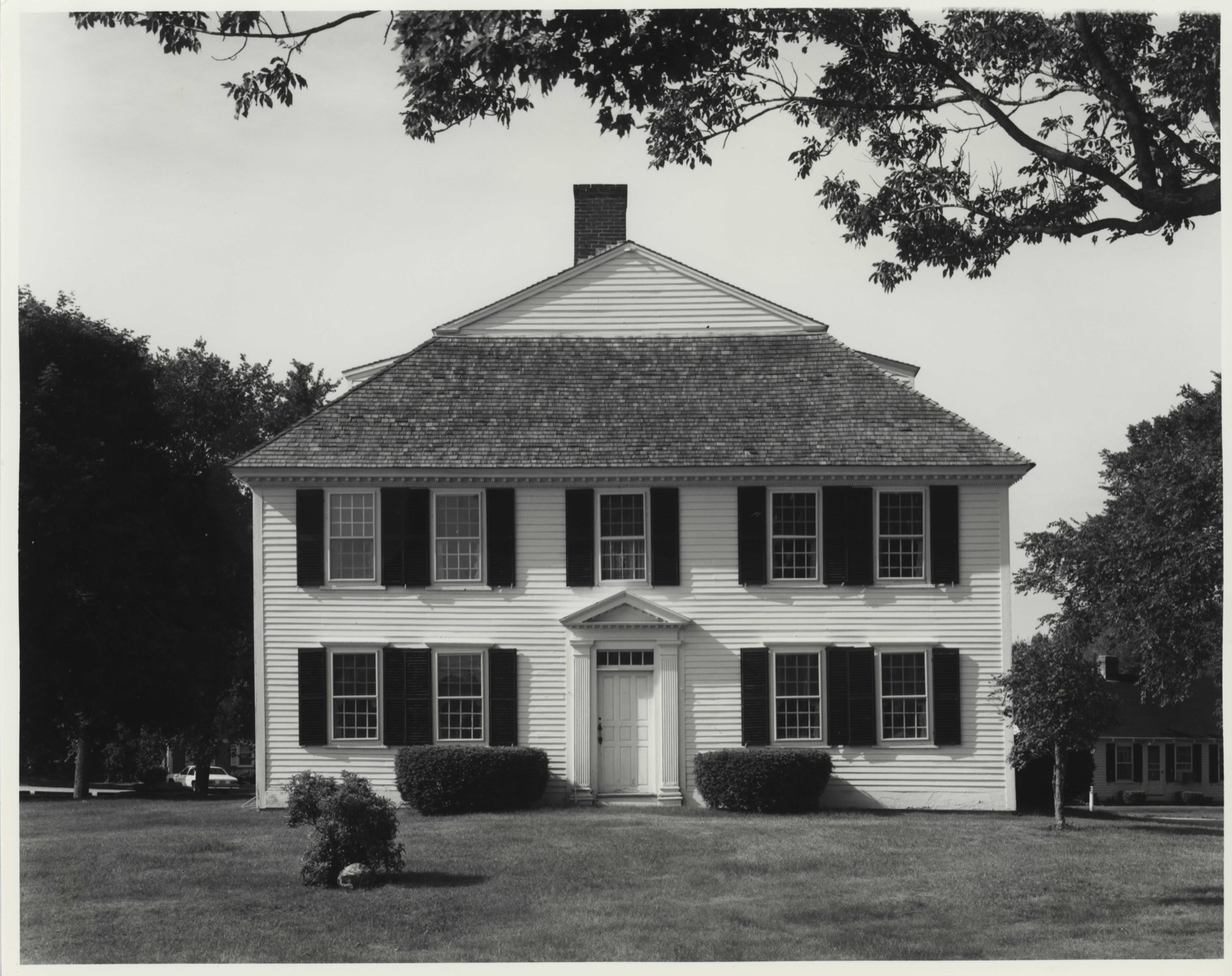
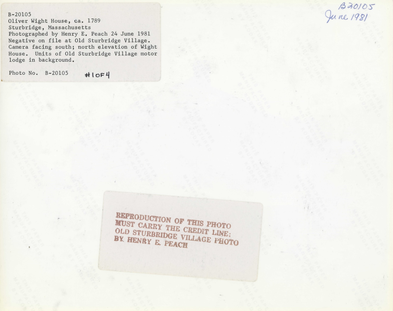
Photographs from the nomination case file, National Park Service records.
Wight, Oliver, House
Listed on the National Register of Historic Places in
1982. A historic map-sheet match is not published yet. The record needs a coordinate-quality review before it can be joined to a sheet boundary.
From the record
one of 500 National Register listings in Worcester County · listed in 1982 · category: Building · one of 1 National Historic Landmarks in Worcester County.
National Register reference number.82004483- the number the National Park Service assigned this property when it was listed, and the key its nomination file is catalogued under at the National Archives.
Fires near this property
34 since 2015
Regional context, not property-specific
evidence. The
federal wildfire occurrence database
lists 34 fires within 5 miles of Wight, Oliver, House between
2015 and 2020, burning about 12 acres in total. 2 started naturally. 2 were recorded as arson.
Distance is straight-line from the map coordinates, so a fire counted
here may appear on a neighbouring settlement's page as well.
Reported cause
Fires
Equipment and vehicle use
7
Smoking
7
Debris and open burning
6
Missing data/not specified/undetermined
4
Power generation/transmission/distribution
3
Arson/incendiarism
2
Natural
2
Recreation and ceremony
2
Railroad operations and maintenance
1
The most recent of
them, most recent first, with the day each was reported and the service
that recorded it.
Regional context, not property-specific
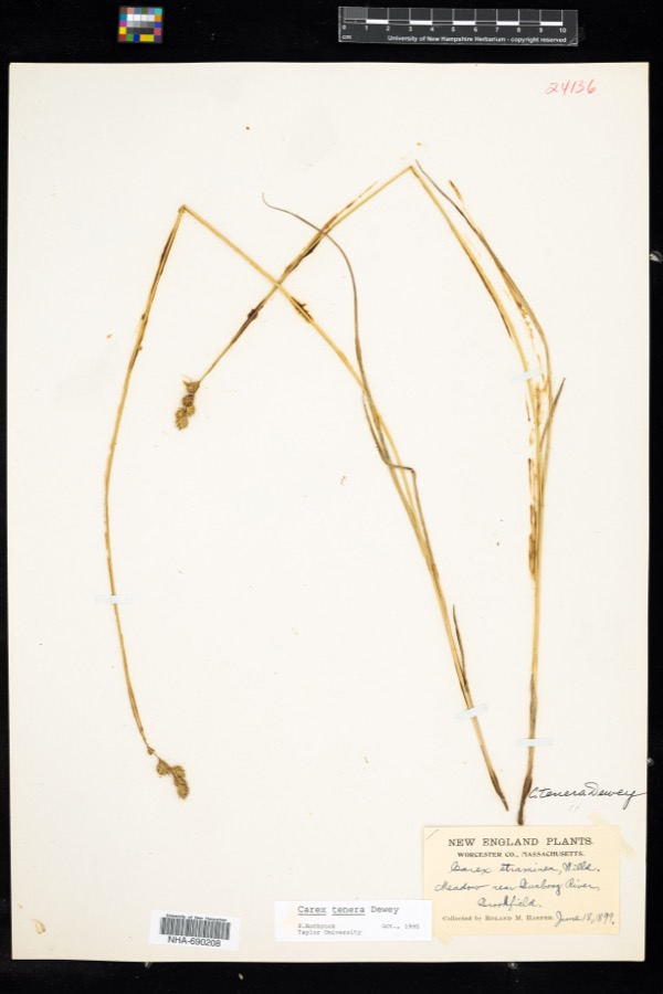
evidence. Museums hold 334 specimens
collected within 10 miles of Wight, Oliver, House between 1874 and
1975: 171 Plantae, 92 Animalia, 70 Fungi, 1 Unrecorded. 12 distinct Species records are shown.
Collected by A. F. Hill, H. St. John, G.S. Torrey, A. R. Hodgdon; L. B. Smith, A. R. Hodgdon; F. L. Steele and others. Each is a
physical object with a catalogue
number, and each entry opens the museum's record. This is what was
collected and kept, not a survey of what lives here - nothing can be
concluded from a species being absent.
Regional context, not property-specific
evidence. The federal mineral resources record lists
9 workings within 5 miles of Wight, Oliver, House: 9 past producers.
None of them still produces. What was taken out: Sand and Gravel, Construction. Distance is straight-line from the
map coordinates, so a quarry counted here may appear on a neighbouring
settlement's page as well.
Regional context, not property-specific
evidence. The National Weather Service names
Sturbridge, the town this property stands in, in 8 storm reports between 1995 and 2024: 6 thunderstorm wind, 2 hail.
No death or injury is recorded in these reports. Each account below is quoted exactly as the forecast office
filed it, from the NOAA Storm Events Database, and each date
opens the federal record of that event.
No historic map-sheet match is published
for this property yet. That does not mean no map exists. This record needs
a coordinate-quality review before it can be joined to a sheet boundary.
Browse the county's mapped places while that work is
pending.
Named in the fire insurance atlases
Sanborn surveyors printed an index of the
town's establishments at the front of each atlas. This property is named in
one, read straight off the scanned sheet.
When this property was proposed for the
National Register, someone wrote the case for it: what the building is,
and why it matters. That document is a federal record in the public domain.
It is quoted below word for word, never summarised. The text was read off the scanned case file by machine, so the
occasional stray character is the recogniser's and the 1970s
typewriter's.
Description of the property
The Oliver Wight House, c. 1789, is a timber-framed 2 1/2 story dwelling of high style, late Georgian design. The structure retains much of its original appearance and stand on its original site west of Sturbridge Center (NR - 11/9/77). However, its setting has changed drastically during this century, and all of its outbuildings have been lost. It now stands amidst the commercial congestion of Route 20, and serves as the focal point of the neo-colonial style Old Sturbridge Village Motor Lodge. Despite these disruptive factors, the motel complex is attractively landscaped, and its units were sympathetically sited to minimize encroachment upon the original building.
The Wight House is set well back from Route 20 with a broad expanse of trimmed lawn and Additionally, a row of mature maples lines one side of the drive leading from the highway. The freestanding structure has a square, central hall plan with twin interior chimneys rising through an unusual, steep, gable on hip roof. It stands on its original foundation which is dry-laid field stone, fragmentarily parged with clay, and capped with dressed granite at grade level. Ihe cellar 1s excavated oniy beneath the rear (east) half of the house, with a crawl space beneath the tront. sheathed with clapboards which appear to be largely original, or early replacements, and are fastened with large-headed wrought nails.
Trim consists of a wide, molded EEEZE water table, beaded cornerboards and a modillion cornice with a row of fine dentils Windows contain 12/12 double hung sash which may be original, and are set in simple frames; at the first story they have projecting caps, while at the second, they are set into the cornice.
/Architect Oliver Wight Statement of Significance (in one paragraph) The Oliver Wight House possesses integrity of location, design, materials and workmanship as well as associations with the settlement of eighteenth century Sturbridge. It is an excellent and well preserved example of high style, late Georgian design, particularly the Worcester County type which features gable on hip or hip on hip roofs. Additionally, its hallway exhibits extensive murals attributed to Rufus Porter. Thus, the Wight House meets criterion C of the National Register of Historic Places. The house was built c.
1789 by Oliver Wight (1753-1837), one of three brothers who built homes during the final decades of the eighteenth century in tnat portion of sturbridge which became known as Wightville in the nineteenth century. The home of one brother, Alpheus Wight, also survives, but in a much altered condition; that of a third brother, David, burned c. 1929. Oliver Wight was a cabinet maker by trade. An oil portrait of him, painted about 1790 (collections of the Abby Aldrich Rockefeller Folk Art Museum, Williamsburg, Va.) depicts an apparently successful and self-satisfied young man, dressed most stylishly in the costume of the period, and holding a walking stick.
In the early nineteenth century the house was sold to Ebenezer Howard who kept a hotel there, but it was returned to the Wight family in 1863 when it was purchased by George Wight. It remained in the Wight family until 1936 when it was purchased by Albert B. Wells for Old Sturbridge Village. The Oliver Wight House is an outstanding local example of high style Georgian architecture, and one which preserves almost all elements of its original design. It is a 2 1/2 story timber frame house with a nearly square, central hall plan.
Quoted from the National Register nomination
for reference 82004483, 14 pages, held by the National Archives in Record
Group 79. See the
catalogue record.
Listed places nearby
6 within 8 miles
Other National Register properties close
enough to walk or drive between, ordered by distance from this one. Both
positions come from the same geocoding pass that matched these properties
to their map sheets.
Listing record. National Park Service National Register of Historic Places, listed-properties dataset, current to 2026-05-22.
Map join. Address geocoded through the United States Census geocoder, then tested against the published boundary of every sheet in the USGS Historical Topographic Map Collection.
How this page is made. Listing fields come from federal records; map-sheet coverage is a labelled coordinate-to-boundary calculation, not a source-field claim.
Wildfire. Short, Karen C. 2022. Spatial wildfire occurrence data for the United States, 1992-2020 [FPA_FOD_20221014]. 6th Edition. Fort Collins, CO: Forest Service Research Data Archive. https://doi.org/10.2737/RDS-2013-0009.6 Collected with United States Government funding and usable without additional permissions or fees.
Specimens. Global Biodiversity Information Facility (GBIF), https://www.gbif.org/. Only records licensed CC0 or CC BY are used. Records licensed CC BY-NC are excluded because this site carries advertising. Images are checked individually and any whose licence is non-commercial, no-derivatives or unreadable is refused.
Mines and quarries. USGS Mineral Resources Data System (MRDS) https://mrdata.usgs.gov/mrds/ A work of the United States government, no copyright under 17 U.S.C. 105.
Storms. NOAA National Centers for Environmental Information, Storm Events Database https://www.ncei.noaa.gov/stormevents/ A work of the United States government, no copyright under 17 U.S.C. 105. Narratives are quoted verbatim from the National Weather Service report and are not edited or summarised.
 Block
Block