Built in 1863 in the Italianate architecture. Listed on the National Register of Historic Places in
1982. A historic map-sheet match is not published yet. The record needs a coordinate-quality review before it can be joined to a sheet boundary.
From the record
“The Port Royal House is a historic house in Chatham, Massachusetts. The two-story wood-frame house was built in 1863 by Seth Eldredge, a ship's captain.”
Wikipedia article Port Royal House, CC BY-SA 4.0.
one of 145 National Register listings in Barnstable County · listed in 1982 · category: Building · built in 1863, Italianate architecture.
National Register reference number.82004943- the number the National Park Service assigned this property when it was listed, and the key its nomination file is catalogued under at the National Archives.
Regional context, not property-specific
evidence. The
federal wildfire occurrence database
lists 44 fires within 5 miles of Port Royal House between
2003 and 2020, burning about 13 acres in total. 2 started naturally. 5 were recorded as arson.
Distance is straight-line from the map coordinates, so a fire counted
here may appear on a neighbouring settlement's page as well.
Reported cause
Fires
Missing data/not specified/undetermined
18
Debris and open burning
7
Arson/incendiarism
5
Equipment and vehicle use
5
Recreation and ceremony
3
Smoking
2
Natural
2
Fireworks
1
Power generation/transmission/distribution
1
The most recent of
them, most recent first, with the day each was reported and the service
that recorded it.
Regional context, not property-specific
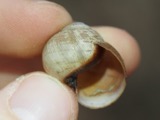
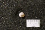
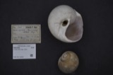
evidence. Museums hold 1,559 specimens
collected within 10 miles of Port Royal House between 1840 and
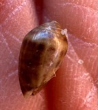
1975: 694 Animalia, 650 Plantae, 151 Fungi, 38 Unrecorded, 18 Bacteria, 8 Chromista. 12 distinct Species records are shown.
Collected by A. B. Seymour, A. Pealey, A. R. Hodgdon and others. Each is a
physical object with a catalogue
number, and each entry opens the museum's record. This is what was
collected and kept, not a survey of what lives here - nothing can be
concluded from a species being absent.
Regional context, not property-specific
evidence. The federal mineral resources record lists
2 workings within 5 miles of Port Royal House: 1 past producer, 1 producer.
1 still produces. What was taken out: Sand and Gravel, Construction. Distance is straight-line from the
map coordinates, so a quarry counted here may appear on a neighbouring
settlement's page as well.
Regional context, not property-specific
evidence. The National Weather Service names
Chatham, the town this property stands in, in 5 storm reports between 1999 and 2019: 2 flood, 1 heavy rain, 1 flash flood, 1 thunderstorm wind.
No death or injury is recorded in these reports. Each account below is quoted exactly as the forecast office
filed it, from the NOAA Storm Events Database, and each date
opens the federal record of that event.
In Chatham, a NWS survey found numerous large trees uprooted, consistent with 90+ mph microburst straight line winds, which is what remained after the Harwich tornado lifted. Two utility poles were leaning on Morris Island Road with one snapped in half and wires hanging low to the ground. A mesonet site reported a gust to 85 mph at 1115 AM EST (1215 PM EDT). Emergency management cited $426,000 in costs for the town to clean debris from roadways. Total damage estimates are much higher, accounting for individual homeowner and business claims.
At 112 AM EST, the Chatham Town Hall basement and parking lot were reported to be flooded. At 300 AM EST, the Automated Surface Observation platform at Chatham Airport reported storm total rainfall of 5.27 inches.
Several roads experienced street flooding, closing the roads. These included: Orleans Road at Frost Fish Road, Stepping Stones at Heritage Lane, Commerce Park South, Main Street near the Chatham Motel, and Route 28 near Stoney Hill Road.
No historic map-sheet match is published
for this property yet. That does not mean no map exists. This record needs
a coordinate-quality review before it can be joined to a sheet boundary.
Browse the county's mapped places while that work is
pending.
From the nomination file
1,844 words on record
When this property was proposed for the
National Register, someone wrote the case for it: what the building is,
and why it matters. That document is a federal record in the public domain.
It is quoted below word for word, never summarised. The text was read off the scanned case file by machine, so the
occasional stray character is the recogniser's and the 1970s
typewriter's.
Description of the property
The Port Royal House The Port Royal House stands within its original setting, over- 1ooking a major traffic intersection and the Veteran's Park with its Civil War monument. The building is approached by three low terraces and is generously setback from the street and from its neighboring structures. Port koyal was bullt in 1863 in the Tuscan Villa style. The small but imposing two-story house is rectangular in plan with a horizontal emphasis achieved by its flat roof, full-length front veranda, and heavy horizontal trim. The building is wood frame with clapboard siding. The overall design includes a pronounced root overhang which is supported by ornately carved paired brackets; a panelled" entabla- ture and panelled corner pilasters complete the basic surface or- namentation.
Original porch and roof balustrades and a balustra- ded fence have since been destroyed. The building has a simple three-bay facade with a center door- way. A one-story veranda across the front has a smaller-scale reproduction of the main entablature, supported by four fluted Doric columns on panelled pedestals. The center entrance has double glazed doors framed by panelled pilasters and a bold seg- metal arched entablature with paired brackets. Above the door- way is a single window with a segmental arched cornice. The outer windows on the facade are paired and have flat cornices. Ine side elevations, two bays wide, and the rear elevation have ymmetrical single windows.
Common to all of the house's windows are original 2/2 sash, heavy cornices on paired brackets, shouldered architraves, and small sill brackets. A one-story ell centered at the rear of the building (added soon after the original construction) has a flat roof, 2/2 windows with plain architraves, and much smaller and simpler paired entabla- ture brackets.
(in one paragraph) The Port Royal House is a remarkably intact representation of Cape Cod's maritime prosperity in the nineteenth century. The building is associated with several distinguished families and is an excellent example of the Tuscan Villa style in the region; thus it meet criteria B and C of the National Register of Historic Places. In 1862 Captain Seth Eldridge, a sailing master of Chatham, saw a house in Port Royal, Jamalca, which he so admired that he orocured the plans and had such a house built for himself ir Chatham the following year (1863). In l te huse was bought from Eldridge's estate by Emma Nickerson, whose husband John "followed the sea. in early life" and afterwards became a carpen- ter.
The house has remained in the ownership of the well-known Nickerson family (local merchants) ever since. When Port Royal was built, the center of Chatham was located several miles east on the Coast by the "Twin Lights". However, an 1877 storm cut so deeply into the shoreline that many buildings were moved away from the area of the lighthouses to the part of town in which the Port Royal House stands. This area of Main Street became, and continues to be, the hub of local activity, presently containing the town shopping center, three churches, town hall, and a fine range of over a dozen nineteenth century architectural styles.
The Port Royal House is one of the most clearly stated examples of the Tuscan Villa style extant on the Cape Cod and has remained virtually unchanged in its 117 years of life. 9. Ma 'or B'b iographica References Files of: Chatham Historical Commission P.O. Box 46 Chatham, MA 02633 Deyo, Simeon, History of Barnstable County, Voll. II. (New York: H.W. Blake and Co., 1890).
Quoted from the National Register nomination
for reference 82004943, 11 pages, held by the National Archives in Record
Group 79. See the
catalogue record.
Listed places nearby
6 within 8 miles
Other National Register properties close
enough to walk or drive between, ordered by distance from this one. Both
positions come from the same geocoding pass that matched these properties
to their map sheets.
Listing record. National Park Service National Register of Historic Places, listed-properties dataset, current to 2026-05-22.
Map join. Address geocoded through the United States Census geocoder, then tested against the published boundary of every sheet in the USGS Historical Topographic Map Collection.
How this page is made. Listing fields come from federal records; map-sheet coverage is a labelled coordinate-to-boundary calculation, not a source-field claim.
Wildfire. Short, Karen C. 2022. Spatial wildfire occurrence data for the United States, 1992-2020 [FPA_FOD_20221014]. 6th Edition. Fort Collins, CO: Forest Service Research Data Archive. https://doi.org/10.2737/RDS-2013-0009.6 Collected with United States Government funding and usable without additional permissions or fees.
Specimens. Global Biodiversity Information Facility (GBIF), https://www.gbif.org/. Only records licensed CC0 or CC BY are used. Records licensed CC BY-NC are excluded because this site carries advertising. Images are checked individually and any whose licence is non-commercial, no-derivatives or unreadable is refused.
Mines and quarries. USGS Mineral Resources Data System (MRDS) https://mrdata.usgs.gov/mrds/ A work of the United States government, no copyright under 17 U.S.C. 105.
Storms. NOAA National Centers for Environmental Information, Storm Events Database https://www.ncei.noaa.gov/stormevents/ A work of the United States government, no copyright under 17 U.S.C. 105. Narratives are quoted verbatim from the National Weather Service report and are not edited or summarised.
 Block
Block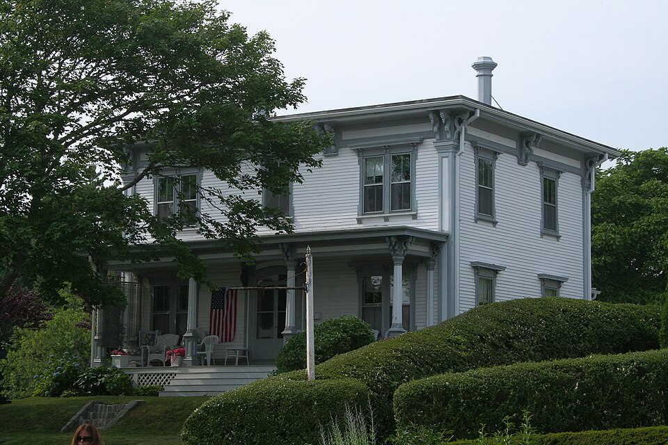

.jpeg)