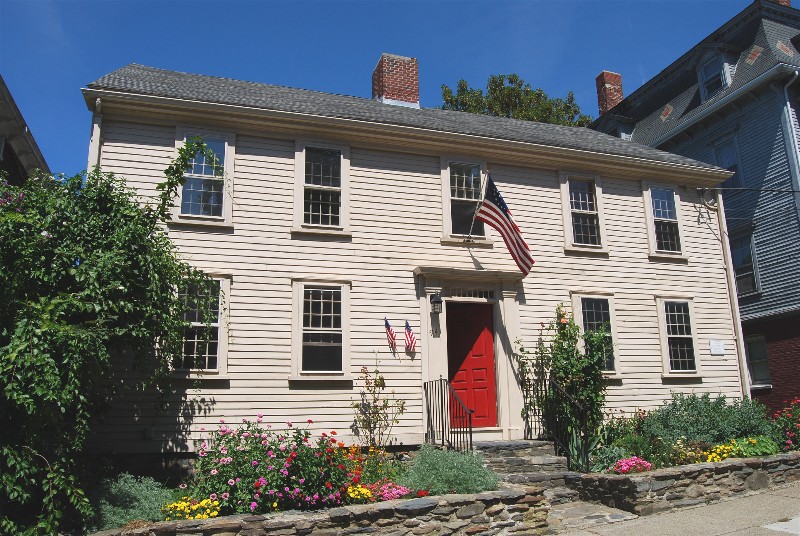
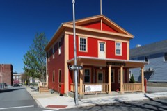
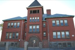
Photograph by Marcbela (Marc N. Belanger), Public domain. Via
Wikimedia Commons.
Lafayette-Durfee House
Listed on the National Register of Historic Places in
1982. A historic map-sheet match is not published yet. The record needs a coordinate-quality review before it can be joined to a sheet boundary.
From the record
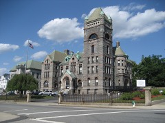
“The Lafayette-Durfee House is a historic house located at 94 Cherry Street in Fall River, Massachusetts. The house was originally located at the site of the old Fall River Superior Courthouse now the Fall River Children's Museum on 441 North Main Street, and owned by Judge Thomas Durfee.”
Wikipedia article Lafayette-Durfee House, CC BY-SA 4.0.
one of 272 National Register listings in Bristol County · listed in 1982 · category: Building · one of 8 National Historic Landmarks in Bristol County.
National Register reference number.82004959- the number the National Park Service assigned this property when it was listed, and the key its nomination file is catalogued under at the National Archives.
Fires near this property
25 since 2002
Regional context, not property-specific
evidence. The
federal wildfire occurrence database
lists 25 fires within 5 miles of Lafayette-Durfee House between
2002 and 2020, burning about 54 acres in total. None started naturally. 3 were recorded as arson.
Distance is straight-line from the map coordinates, so a fire counted
here may appear on a neighbouring settlement's page as well.
Reported cause
Fires
Missing data/not specified/undetermined
11
Debris and open burning
6
Arson/incendiarism
3
Misuse of fire by a minor
2
Recreation and ceremony
1
Power generation/transmission/distribution
1
Equipment and vehicle use
1
The most recent of
them, most recent first, with the day each was reported and the service
that recorded it.
Regional context, not property-specific
evidence. Museums hold 1,057 specimens
collected within 10 miles of Lafayette-Durfee House between 1844 and
1975: 582 Animalia, 365 Plantae, 77 Fungi, 29 Chromista, 4 Unrecorded. 12 distinct Species records are shown.
Collected by A E Schuyler, A. B. Hervey, A. Macrae and others. Each is a
physical object with a catalogue
number, and each entry opens the museum's record. This is what was
collected and kept, not a survey of what lives here - nothing can be
concluded from a species being absent.
Regional context, not property-specific
evidence. The federal mineral resources record lists
2 workings within 5 miles of Lafayette-Durfee House: 1 unknown, 1 plant.
1 still produces. What was taken out: Stone, Crushed/Broken, Sand and Gravel, Construction. Distance is straight-line from the
map coordinates, so a quarry counted here may appear on a neighbouring
settlement's page as well.
Regional context, not property-specific
evidence. The National Weather Service names
Fall River, the town this property stands in, in 24 storm reports between 1997 and 2025: 10 flood, 5 thunderstorm wind, 5 flash flood, 2 hail.
No death or injury is recorded in these reports. Each account below is quoted exactly as the forecast office
filed it, from the NOAA Storm Events Database, and each date
opens the federal record of that event.
At 1:25 PM EST, several cars were trapped in flood waters on Quequechan Street and Warren Street, near a Walmart store. The two streets were closed due to flooding.
Warren Street was flooded and impassable. A car was stuck in flood waters on Pleasant Street at the intersection with Quarry Street. Manhole covers popped off due to flooding on Globe Street.
No historic map-sheet match is published
for this property yet. That does not mean no map exists. This record needs
a coordinate-quality review before it can be joined to a sheet boundary.
Browse the county's mapped places while that work is
pending.
From the nomination file
3,007 words on record
When this property was proposed for the
National Register, someone wrote the case for it: what the building is,
and why it matters. That document is a federal record in the public domain.
It is quoted below word for word, never summarised. The text was read off the scanned case file by machine, so the
occasional stray character is the recogniser's and the 1970s
typewriter's.
Description of the property
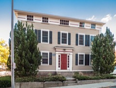
The Lafayette-Durfee House at 94 Cherry Street in Fall River's waterfront area is thought to have been built ca. 1747 by Thomas Durfee III. Georgian decorative detailing on the exterior of the house lends credence to this date during the Second Period (1725-1175) of colonial architecture. The interior was apparently altered, however, to the Federal style sometime late in the 18th or early in the 19th century. The house has been moved twice, in 1837 and 1876. It originally stood on the east side of the highway (later Main Street) that ran from Newport, R.I., to Boston, near the present site of the Superior Court House on North Main Street. When this street required widening in 1837, the Lafayette-Durfee House was moved to the west side ot it, becoming No. 116 Main Street.
In 1874 the house was sold (apparently separately from its lot) and within the following year a brick residence was constructed by its former owner on the 116 Main Street site. This necessitated the removal of the Lafayette-Durfee house by its new owner to its present location, originally numbered 14 Cherry Street, but renumbered 94 in 1896. The Lafayette-Durfee House is of frame construction, two stories plus an attic in height, and has a pitched roof, ridge parallel to the street. Its central chimney has been temporarily dismantled during the restoration of the building. The house's five-bay Cherry Street facade has a center entrance.
Decorative detailing is limited to narrow corner boards; sill boards; simple Georgian window caps; and a Georgian door surround consisting of fluted pilasters supporting a simple cornice, below which is a narrow transom with nine rectilinear lights. The door itself is not original. Characteristic of the period is the fact that the second floor window caps meet the simple wooden cornice.
(in one paragraph) Fall River citizen who continued to live in it until his death in 1796. long a member of the General Court of Massachusetts in both the House and Senate, and was for six years a member of the Governor's Council. Thomas Durfee's eldest son, Col. Joseph Durfee (1750-1841), became known for his command in May 1778 of a small group of patriots who defended the village against about 150 British troops. This Revolutionary War skirmish is known and celebrated as the "Battle of Fall River". Joseph's friendship, moreover, with the Marquis de Lafayette occasioned the latter's stays at the Durfee house when he travelled between Newport and Boston. The house thus acquired its present name.
Joseph Durfee and the French military leader not only had the Revolution in common, but also the fact that the Durfee (originally d'Orfé) family had come from France. When the Marquis returned to France, he sent Mrs. Durfee two greyhounds in appreciation of her hospitality. Joseph Durfee later started Fall River's first cotton mill and was a founder of the First Congregational Church. In 1836 Thomas Durfee IV, Joseph's youngest brother, finally sold the Lafayette-Durfee house out of the family. Today one of the founding members of the Lafayette-Durfee Historical Foundation, owner of the house since 1973, is a member of the Durfee family.
Quoted from the National Register nomination
for reference 82004959, 21 pages, held by the National Archives in Record
Group 79. See the
catalogue record.
Listed places nearby
6 within 8 miles
Other National Register properties close
enough to walk or drive between, ordered by distance from this one. Both
positions come from the same geocoding pass that matched these properties
to their map sheets.
Listing record. National Park Service National Register of Historic Places, listed-properties dataset, current to 2026-05-22.
Map join. Address geocoded through the United States Census geocoder, then tested against the published boundary of every sheet in the USGS Historical Topographic Map Collection.
How this page is made. Listing fields come from federal records; map-sheet coverage is a labelled coordinate-to-boundary calculation, not a source-field claim.
Wildfire. Short, Karen C. 2022. Spatial wildfire occurrence data for the United States, 1992-2020 [FPA_FOD_20221014]. 6th Edition. Fort Collins, CO: Forest Service Research Data Archive. https://doi.org/10.2737/RDS-2013-0009.6 Collected with United States Government funding and usable without additional permissions or fees.
Specimens. Global Biodiversity Information Facility (GBIF), https://www.gbif.org/. Only records licensed CC0 or CC BY are used. Records licensed CC BY-NC are excluded because this site carries advertising. Images are checked individually and any whose licence is non-commercial, no-derivatives or unreadable is refused.
Mines and quarries. USGS Mineral Resources Data System (MRDS) https://mrdata.usgs.gov/mrds/ A work of the United States government, no copyright under 17 U.S.C. 105.
Storms. NOAA National Centers for Environmental Information, Storm Events Database https://www.ncei.noaa.gov/stormevents/ A work of the United States government, no copyright under 17 U.S.C. 105. Narratives are quoted verbatim from the National Weather Service report and are not edited or summarised.
 Block
Block