Listed on the National Register of Historic Places in
1983. A historic map-sheet match is not published yet. The record needs a coordinate-quality review before it can be joined to a sheet boundary.
From the record
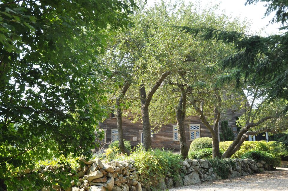
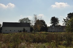
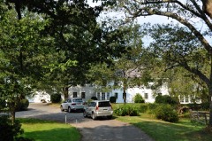
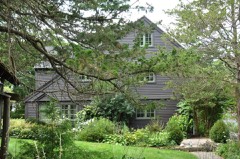
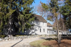
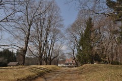
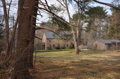
“The David Burnham House is a historic First Period house on Pond Street in Essex, Massachusetts. The two story five bay wood frame colonial is said to have been built c. 1685 by David Burnham, son of Thomas Burnham, an early settler of the Essex area.”
Wikipedia article David Burnham House, CC BY-SA 4.0.
one of 350 National Register listings in Essex County · listed in 1983 · category: Building · one of 2 National Historic Landmarks in Essex County.
National Register reference number.83000574- the number the National Park Service assigned this property when it was listed, and the key its nomination file is catalogued under at the National Archives.
What happened here
An account from the chapter on Essex town, The inset identifies its exact
source book and publication year.
We have but a faint conception of the sheep the privilege of grazing them on severe and varied labors of pioneer life, the common lands, and dogs that had Nearly everything we use today we buy killed sheep were hung, and the owners ready-made, while in the old days the of the guilty canines had also to pay colonists had to produce whatever they twice the value of the sheep killed, needed.
The following list is made up from the official records of the State, and contains the names of all soldiers and sailors of the Revolution that are given as belonging to Essex county. There are doubtless names of others on the official lists who belonged in the county, but the records do not state their residence.
Jonathan Abbot of Andover; ens., Capt. Joshua Holt's co., which marched on the alarm of April 19, 1775, to Cambridge; service, i^ dys.; also, 2d It., Capt. Joshua Holt's (nth) co.. Col. Samuel Johnson's (4th Essex co.) reg. ; list of officers of Mass. militia ; commissioned April 3, 1776; «/r^, Capt. John Abbot's CO., Col. Jonathan Cogswell, Jr's., reg., Brig.-Gen. Farley's brigade ; list of officers of Mass. militia dated Ipswich Sept. 30, 1776 ; CO. drafted from training band and alarm list of the 4th Essex co. reg., and ordered to march to Horse Neck ; also, capt., nth CO., 4th Essex co. reg. ; list of officers of Mass. militia ; commissioned Oct. 7, 1779.
Regional context, not property-specific
evidence. The
federal wildfire occurrence database
lists 41 fires within 5 miles of Burnham, David, House between
2015 and 2020, burning about 39 acres in total. None started naturally. None was recorded as arson.
Distance is straight-line from the map coordinates, so a fire counted
here may appear on a neighbouring settlement's page as well.
Reported cause
Fires
Debris and open burning
16
Recreation and ceremony
9
Smoking
7
Equipment and vehicle use
3
Railroad operations and maintenance
3
Misuse of fire by a minor
1
Missing data/not specified/undetermined
1
Power generation/transmission/distribution
1
The most recent of
them, most recent first, with the day each was reported and the service
that recorded it.
Regional context, not property-specific
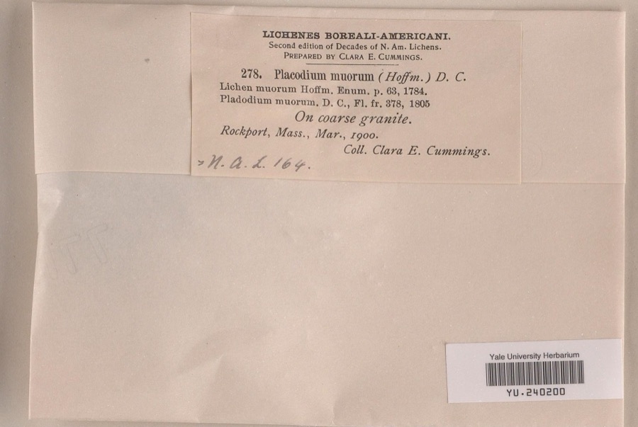
evidence. Museums hold 6,495 specimens
collected within 10 miles of Burnham, David, House between 1821 and
1975: 2,212 Animalia, 2,060 Plantae, 1,312 Fungi, 407 Unrecorded, 348 Chromista, 95 Protozoa, 61 Bacteria. 12 distinct Species records are shown.
Collected by A H HIGGINSON, A Perlmutter, A. A. Eaton and others. Each is a
physical object with a catalogue
number, and each entry opens the museum's record. This is what was
collected and kept, not a survey of what lives here - nothing can be
concluded from a species being absent.
Regional context, not property-specific
evidence. The federal mineral resources record lists
4 workings within 5 miles of Burnham, David, House: 3 past producers, 1 producer.
1 still produces. What was taken out: Sand and Gravel, Construction, Stone, Crushed/Broken. Distance is straight-line from the
map coordinates, so a quarry counted here may appear on a neighbouring
settlement's page as well.
Regional context, not property-specific
evidence. The National Weather Service names
Essex, the town this property stands in, in 2 storm reports between 2010 and 2020: 1 flood, 1 thunderstorm wind.
The reports record 1 injury. Each account below is quoted exactly as the forecast office
filed it, from the NOAA Storm Events Database, and each date
opens the federal record of that event.
Several small streams rose above flood stage across Essex County, including the Ipswich River at Ipswich and South Middleton, the Shawsheen River at Andover, and the Parker River at Byfield. This river flooding, coupled with heavy rain and poor drainage flooding, resulted in a federal disaster declaration for seven counties in Massachusetts, including Essex County. ||Numerous streets were closed and basements flooded in Peabody, Salem, Newbury, Haverhill, Topsfield, Andover, Gloucester, Newburyport, Byfield, Middleton, and Rowley, including Route 128 S in Peabody and Route 1 in Topsfield. Portions of Merrimack College in Andover were flooded, submerging trees downed by the wind. Several cars were stranded in floodwaters, including one in Saugus at the Shaws parking lot, three on Woburn Street in Andover, and two on Foster Street in Peabody. Several people were trapped in the cars in Peabody, but were successfully rescued. Many streets in downtown Peabody were under four feet of water. Collections at the Stevens Memorial Library in North Andover were damaged by floodwaters.||In Lawrence, a total of 50 homes on Willow Street, Exchange Street, and Myrtle Street were evacuated. In addition, twenty eight people in the Holiday Inn Express on Winthrop Street were evacuated due to flooding in the hotel. Approximately 25 three tenant homes along the Spicket River were evacuated. The Carriage Hill Apartments in Amesbury were evacuated due to flooding from a nearby pond. The Washington Park Condos and all 110 residents of the Marland Place Assisted Living Center in Andover were evacuated.||A 500 foot stretch of Route 62 in Danvers was closed when a fifteen foot deep sinkhole developed because of an underground culvert that was washed out after nearly eight inches of rain fell. It reopened nearly three weeks later after work was delayed by a second major rainstorm.|A sewer treatment plant in Gloucester processed roughly 15 million gallons of wastewater during the storm, nearly 5 times capacity. As a result, excess wastewater was combined with runoff and released into the harbor.||One fatality indirectly resulted from the flooding when a 49 year old man drowned while pumping water from his office. A 15 year old girl was hospitalized for hypothermia after spending 45 minutes in the Ipswich River when the canoe she was in capsized.
No historic map-sheet match is published
for this property yet. That does not mean no map exists. This record needs
a coordinate-quality review before it can be joined to a sheet boundary.
Browse the county's mapped places while that work is
pending.
From the nomination file
4,383 words on record
When this property was proposed for the
National Register, someone wrote the case for it: what the building is,
and why it matters. That document is a federal record in the public domain.
It is quoted below word for word, never summarised. The text was read off the scanned case file by machine, so the
occasional stray character is the recogniser's and the 1970s
typewriter's.
Description of the property
Built between 1680 and 1690, the Burnham House is situated on Pond Street in a wooded, sparsely settled area of Essex. The 2.5. acres immediately surrounding the house stalls andidescchpo oh. on aine late 12, meentoned imosphe of ahe carly deeds ls photo- located in the front and to the west of the house. A shortdistance to the west of the orchard and house lies a salt marsh, and just beyond that is the northeastern portion of Lake Chebacco. The main block of the Burnham House is approximately 30 feet long across its south or front elevation and is of basic five bay center-chimney construction with a one and one- half story lean-to along the rear elevation.
Various appended structures were attached on the west, north and east, and all remain, but do not seriously compromise the late 17th century appearance of the clapboarded main portion of the house, The diamond pane leaded sash with wrought hinges and probably the heavy front door with decorative nail pattern date from the restoration of the house by George Francis Dow in 1924. The 6/6 sash in the peaks of the gable ends appear to date from the late 1700's or early 1800's. The chimney has been rebuilt, but retains an early scale and proportion, if not design. The wood shingle roof adds to the early appearance of the house.
The later additions, which are all well documented as to dates (see attached plan and below), includes small, one story structures, some of which were originally outbuildings on the property. To the east of the house lies a large early 19th century barn and a shed.
/Architect Unknown Statement of Significance (in one paragraph) The Burnham House retains integrity of location, setting, design, workmanship, materials, feeling and association. It is extremely important architecturally as a well-preserved example of late17th century dwelling design, and for the quality and unusually detailed record of subsequent alterations and restoration work. In addition, the house was associated with a prominent and early Essex (or Chebacco as it was known originally)family whose history and geneology is well documented. Thus the Burnham House meets Criteria A & C of the National Register of Historic Places and is significant on the local, state, and national levels.
1 The architectural contribution offered by the Burnham House is based on its value as a largely intact First Period dwelling which has retained its original physical setting as well as its original architectural character and design. As such, it offers a continuity in style and material that makes it a valuable architecutral statement. Later additions, and restoration have not altered the massive structural system, the roof-line, original high ceilings, the interior floor plans, or much original material. Both the integrity of the house-seventeenth century portions, and eighteenth and twentieth century additions -reveal an interesting evolution, and one of national importance for the simple reason that it has so many original and well-preserved architectural elements.
The complete record including photographs of the 1924 restoration supervised by George Francis Dow has remained with the house and proves a valuable statement of the structure's architectural history. Rarely has a house: seen such an early preservation effort and so much recognition from local historians and private citizens.
Quoted from the National Register nomination
for reference 83000574, 30 pages, held by the National Archives in Record
Group 79. See the
catalogue record.
Listed places nearby
6 within 8 miles
Other National Register properties close
enough to walk or drive between, ordered by distance from this one. Both
positions come from the same geocoding pass that matched these properties
to their map sheets.
Listing record. National Park Service National Register of Historic Places, listed-properties dataset, current to 2026-05-22.
Map join. Address geocoded through the United States Census geocoder, then tested against the published boundary of every sheet in the USGS Historical Topographic Map Collection.
How this page is made. Listing fields come from federal records; map-sheet coverage is a labelled coordinate-to-boundary calculation, not a source-field claim.
Wildfire. Short, Karen C. 2022. Spatial wildfire occurrence data for the United States, 1992-2020 [FPA_FOD_20221014]. 6th Edition. Fort Collins, CO: Forest Service Research Data Archive. https://doi.org/10.2737/RDS-2013-0009.6 Collected with United States Government funding and usable without additional permissions or fees.
Specimens. Global Biodiversity Information Facility (GBIF), https://www.gbif.org/. Only records licensed CC0 or CC BY are used. Records licensed CC BY-NC are excluded because this site carries advertising. Images are checked individually and any whose licence is non-commercial, no-derivatives or unreadable is refused.
Mines and quarries. USGS Mineral Resources Data System (MRDS) https://mrdata.usgs.gov/mrds/ A work of the United States government, no copyright under 17 U.S.C. 105.
Storms. NOAA National Centers for Environmental Information, Storm Events Database https://www.ncei.noaa.gov/stormevents/ A work of the United States government, no copyright under 17 U.S.C. 105. Narratives are quoted verbatim from the National Weather Service report and are not edited or summarised.
 Block
Block