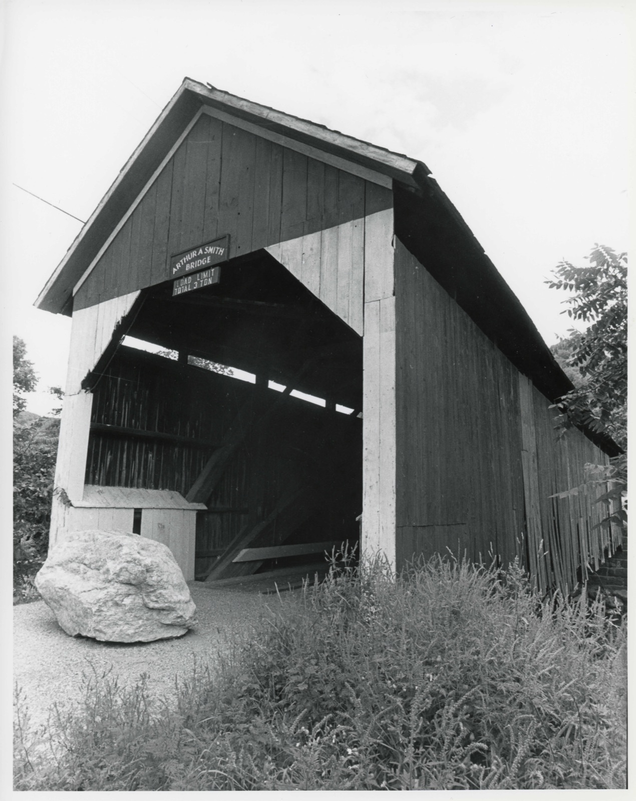
Photographs from the nomination case file, National Park Service records.
Smith, Arthur A., Covered Bridge
Listed on the National Register of Historic Places in
1983. A historic map-sheet match is not published yet. The record needs a coordinate-quality review before it can be joined to a sheet boundary.
From the record
one of 28 National Register listings in Franklin County · listed in 1983 · category: Structure · one of 1 National Historic Landmarks in Franklin County.
National Register reference number.83000592- the number the National Park Service assigned this property when it was listed, and the key its nomination file is catalogued under at the National Archives.
Fires near this property
30 since 2002
Regional context, not property-specific
evidence. The
federal wildfire occurrence database
lists 30 fires within 5 miles of Smith, Arthur A., Covered Bridge between
2002 and 2020, burning about 22 acres in total. None started naturally. None was recorded as arson.
Distance is straight-line from the map coordinates, so a fire counted
here may appear on a neighbouring settlement's page as well.
Reported cause
Fires
Debris and open burning
23
Recreation and ceremony
5
Missing data/not specified/undetermined
2
The most recent of
them, most recent first, with the day each was reported and the service
that recorded it.
Regional context, not property-specific
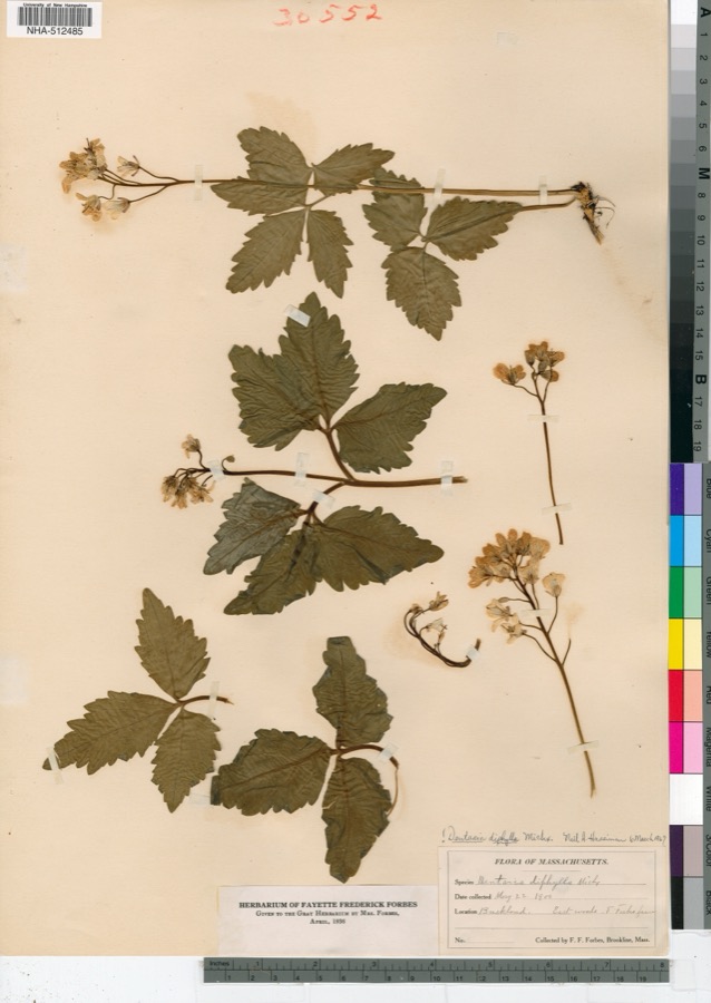
evidence. Museums hold 479 specimens
collected within 10 miles of Smith, Arthur A., Covered Bridge between 1847 and
1975: 260 Plantae, 126 Fungi, 86 Animalia, 7 Protozoa. 12 distinct Species records are shown.
Collected by A. S. Pease, A. T. Beals, A. W. Cheever and others. Each is a
physical object with a catalogue
number, and each entry opens the museum's record. This is what was
collected and kept, not a survey of what lives here - nothing can be
concluded from a species being absent.
Regional context, not property-specific
evidence. The federal mineral resources record lists
10 workings within 5 miles of Smith, Arthur A., Covered Bridge: 5 occurrences, 2 producers, 2 past producers, 1 prospect.
2 still produce. What was taken out: Stone, Dimension, Sulfur, Iron, Sulfur, Iron. Distance is straight-line from the
map coordinates, so a quarry counted here may appear on a neighbouring
settlement's page as well.
Regional context, not property-specific
evidence. The National Weather Service names
Colrain, the town this property stands in, in 21 storm reports between 1995 and 2025: 14 thunderstorm wind, 7 hail.
No death or injury is recorded in these reports. Each account below is quoted exactly as the forecast office
filed it, from the NOAA Storm Events Database, and each date
opens the federal record of that event.
A microburst occurred in the northwestern part of Greenfield and the southeastern portions of Leyden and Colrain, downing numerous trees and wires. Barton, Country Club, Bernardston, Plain, South Green River, Nelson, and Smead Hill Roads were all affected with a few trees that were downed onto houses. A utility pole was downed on Barton Road.
State police reported winds gusting up to 40 mph downed three trees and some wires, blocking Foundry Village Road. Heavy rain over the previous several days had saturated the ground allowing for lighter winds downing trees.
Pea to marble size hail fell in a swath from Colrain to Shelburne damaging apple and peach orchards from Colrain to Shelburne to Deerfield. An estimated 45 acres of apples and two to three acres of peaches were damaged by the hail.
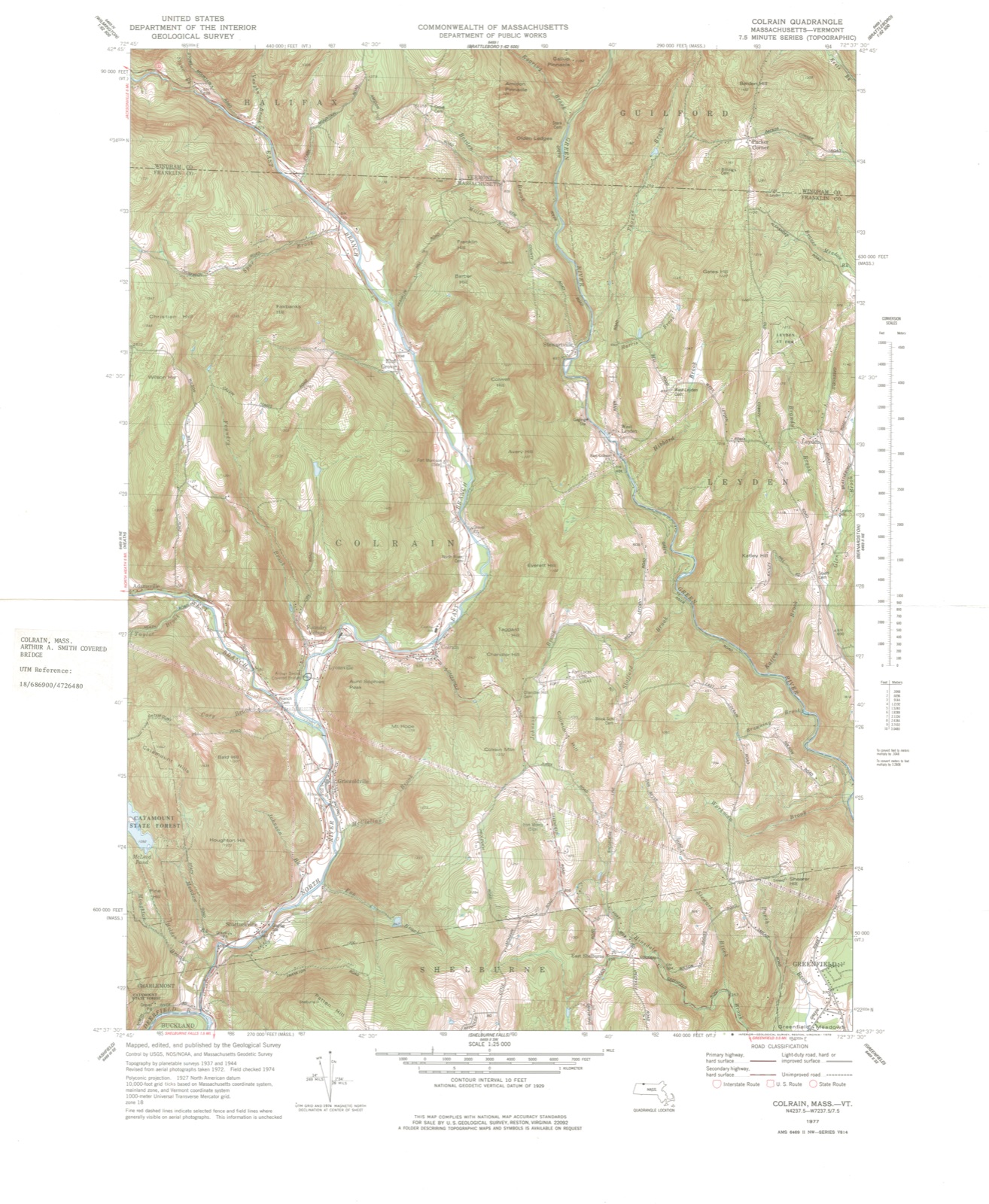
No historic map-sheet match is published
for this property yet. That does not mean no map exists. This record needs
a coordinate-quality review before it can be joined to a sheet boundary.
Browse the county's mapped places while that work is
pending.
From the nomination file
3,379 words on record
When this property was proposed for the
National Register, someone wrote the case for it: what the building is,
and why it matters. That document is a federal record in the public domain.
It is quoted below word for word, never summarised. The text was read off the scanned case file by machine, so the
occasional stray character is the recogniser's and the 1970s
typewriter's.
Description of the property
wica eore nd ho of ne bat of kouce il. The Arthur A. Smith Covered Bridge spans the North River at Lyonsville, about It is approached on a short stretch of secondary road leading west off Route 112. The setting is rural and picturesque with rocks and ledges bordering the river and a steep, wooded hill crowned by the First Baptist Church rising from the west bank. Fields of corn and grass line the east bank adjacent to the bridge. The bridge measures 100 feet in length, with an outside width of 17 feet, and an inside width of 12 feet. Its wooden structural design features the original multiple king post truss construction with added laminated Burr arches. The gable pitched roof is covered with slate shingles; exterior sheathing is vertical boards.
Originally, the bridge was constructed in 1869-70 farther down the river in Shattuckville, a Colrain village south of Lyonsville and Colrain Center. It was known as the Fox Bridge, in reference to the nearby Fox Tavern (now gone). Damaged by flood waters in 1878, the bridge was abandoned until 1896, when the Colrain selectmen had it re-erected on the "Arthur A. Smith Flats." It may have replaced an earlier plank bridge at this location. In 1920, laminated Burr arches were added to strengthen the bridge so that the Carey Cider and Vinegar Company could transport heavier loads across it. At present, it is uncertain whether Burr arches were present prior to this date. The bridge is presently in need of repair and has been closed to traffic for the past year.
Restoration efforts have been initiated by the town, but have not been completed due to lack of funds. In 1980, the original two-inch oak floor boards were replaced with four-inch hemlock boards.
(in one paragraph) Builder/Architect Unknown The Arthur A. Smith Covered Bridge retains integrity of design, setting, materials, workmanship, feeling and association. One of four extant covered bridges in the Commonwealth, it is unique in employing Burr truss construction. Although moved from its original location in 1896, the bridge has kept its essential physical charac- teristics and sits in a similar setting. It remains historically significant for its association with the development of the town of Colrain and, when moved, was ne ogm of Cotrain and, when aoyed, wat renamed for a locally prominent citizen. The bridge thus meets criteria A and C of the National Register of Historic Places.
The town of Colrain was initially settled in 1732 by members of the Smith family, possibly ancestors of Arthur A. Smith, and incorporated in 1761. The predominantly hilly terrain in the town proved suitable for grazing and dairy farming; the North River, which flows almost directly south through Colrain from the Vermont border to Shelburne, Massachusetts, provided abundant waterpower for sawmills, gristmills, fulling mills and - in the 19th century - large textile mills. One such cotton manufacturing firm was established in 1832 at Shattuckville, the site of the first cotton yarn mill in Franklin County (1814).
Following a major flood in 1869, which destroyed or damaged this and many other industries and bridges on the river, restorative work included reconstruction of the Shattuck Mills at double the previous capacity and erection of a new "Fox Bridge." In 1878, the waters of the North River again rose seriously high, leaving the bridge unsafe for travel and it sat, deteriorating, until moved to its present site in 1896.
Quoted from the National Register nomination
for reference 83000592, 20 pages, held by the National Archives in Record
Group 79. See the
catalogue record.
Listed places nearby
5 within 8 miles
Other National Register properties close
enough to walk or drive between, ordered by distance from this one. Both
positions come from the same geocoding pass that matched these properties
to their map sheets.
Listing record. National Park Service National Register of Historic Places, listed-properties dataset, current to 2026-05-22.
Map join. Address geocoded through the United States Census geocoder, then tested against the published boundary of every sheet in the USGS Historical Topographic Map Collection.
How this page is made. Listing fields come from federal records; map-sheet coverage is a labelled coordinate-to-boundary calculation, not a source-field claim.
Wildfire. Short, Karen C. 2022. Spatial wildfire occurrence data for the United States, 1992-2020 [FPA_FOD_20221014]. 6th Edition. Fort Collins, CO: Forest Service Research Data Archive. https://doi.org/10.2737/RDS-2013-0009.6 Collected with United States Government funding and usable without additional permissions or fees.
Specimens. Global Biodiversity Information Facility (GBIF), https://www.gbif.org/. Only records licensed CC0 or CC BY are used. Records licensed CC BY-NC are excluded because this site carries advertising. Images are checked individually and any whose licence is non-commercial, no-derivatives or unreadable is refused.
Mines and quarries. USGS Mineral Resources Data System (MRDS) https://mrdata.usgs.gov/mrds/ A work of the United States government, no copyright under 17 U.S.C. 105.
Storms. NOAA National Centers for Environmental Information, Storm Events Database https://www.ncei.noaa.gov/stormevents/ A work of the United States government, no copyright under 17 U.S.C. 105. Narratives are quoted verbatim from the National Weather Service report and are not edited or summarised.
 Block
Block