Listed on the National Register of Historic Places in
1983. A historic map-sheet match is not published yet. The record needs a coordinate-quality review before it can be joined to a sheet boundary.
From the record
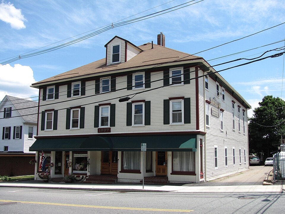
“The Foxboro Grange Hall is a historic Grange building at 11-15 Bird Street in Foxborough, Massachusetts. It is a three-story wood-frame structure, five bays wide at the upper levels and three storefronts wide on the first level, with a hip roof and clapboard siding.”
Wikipedia article Foxboro Grange Hall, CC BY-SA 4.0.
one of 249 National Register listings in Norfolk County · listed in 1983 · category: Building · one of 2 National Historic Landmarks in Norfolk County.
National Register reference number.83000595- the number the National Park Service assigned this property when it was listed, and the key its nomination file is catalogued under at the National Archives.
Fires near this property
113 since 2015
Regional context, not property-specific
evidence. The
federal wildfire occurrence database
lists 113 fires within 5 miles of Foxboro Grange Hall between
2015 and 2020, burning about 54 acres in total. 1 started naturally. 1 was recorded as arson.
Distance is straight-line from the map coordinates, so a fire counted
here may appear on a neighbouring settlement's page as well.
Reported cause
Fires
Recreation and ceremony
43
Missing data/not specified/undetermined
39
Smoking
16
Debris and open burning
9
Equipment and vehicle use
4
Natural
1
Arson/incendiarism
1
The most recent of
them, most recent first, with the day each was reported and the service
that recorded it.
Regional context, not property-specific
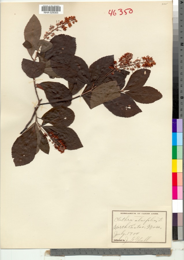
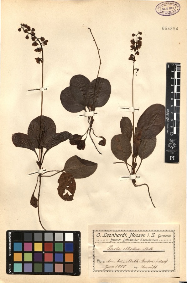
evidence. Museums hold 2,041 specimens
collected within 10 miles of Foxboro Grange Hall between 1870 and
1975: 884 Fungi, 700 Plantae, 321 Animalia, 102 Protozoa, 16 Chromista, 13 Unrecorded, 5 Bacteria. 12 distinct Species records are shown.
Collected by ?, A. A. Eaton, A. B. Seymour and others. Each is a
physical object with a catalogue
number, and each entry opens the museum's record. This is what was
collected and kept, not a survey of what lives here - nothing can be
concluded from a species being absent.
Regional context, not property-specific
evidence. The federal mineral resources record lists
14 workings within 5 miles of Foxboro Grange Hall: 10 past producers, 4 producers.
4 still produce. What was taken out: Sand and Gravel, Construction, Granite, Iron. Distance is straight-line from the
map coordinates, so a quarry counted here may appear on a neighbouring
settlement's page as well.
Regional context, not property-specific
evidence. The National Weather Service names
Foxboro, the town this property stands in, in 4 storm reports between 1996 and 2023: 1 hail, 1 thunderstorm wind, 1 tornado, 1 flash flood.
No death or injury is recorded in these reports. Each account below is quoted exactly as the forecast office
filed it, from the NOAA Storm Events Database, and each date
opens the federal record of that event.
Tornado confirmed to have touched down in a small neighborhood in|Foxboro near the Mansfield town line very close to the town of Easton. |Several locations on a west to east path in the neighborhood had several|large trees up to 2 feet in diameter snapped at the trunk.|Observed tree damage had a convergent pattern consistent with|violently rotating winds. No major damage to homes was observed,|but one chimney appeared to have been knocked over by a fallen|tree. Path width was estimated to be around 25 yards. Path length|of the surveyed damage points was just shy of 300 yards. Per|radar data, a velocity couplet was over the surveyed neighborhood|for only a minute or two before continuing east over conservation|land. It is possible that the tornado was on the ground for|longer, but surveyors were unable to access conservation land|east of the last surveyed damage point. Additional significant |tree damage was found east of aforementioned conservation land in Easton, |but patterns were more consistent with west to east straight line winds. |This is also consistent with archived KBOX radar which displayed strong|outbound (west to east) velocities over this area.
No historic map-sheet match is published
for this property yet. That does not mean no map exists. This record needs
a coordinate-quality review before it can be joined to a sheet boundary.
Browse the county's mapped places while that work is
pending.
Named in the fire insurance atlases
Sanborn surveyors printed an index of the
town's establishments at the front of each atlas. This property is named in
one, read straight off the scanned sheet.
When this property was proposed for the
National Register, someone wrote the case for it: what the building is,
and why it matters. That document is a federal record in the public domain.
It is quoted below word for word, never summarised. The text was read off the scanned case file by machine, so the
occasional stray character is the recogniser's and the 1970s
typewriter's.
Description of the property
The Foxboro Grange Hall is a late Victorian canmercial building in downtown Foxboro. It stands directly on the sidewalk of Bird Street, abutted by parking lots and an apartment building. The Town Carmon lies approximately 200 feet to the west. Sheathed in clapboard, the blocky wood frame structure is capped by an asphalt shingled roof. A granite ashlar foundation contains a full basement, while the roof frames a small slightly offset chimney and single, gabled dormers on the front (north) and back (south) . Although its roof height remains constant, the Grange Hall contains three stories in its forward section and - due to the exaggerated height of the second floor meeting roam - only two stories at the rear.
Plain corner boards and a simple frieze with cornice molding frame all elevations. The symmetrical facade (north side) rises fran two ground floor storefronts flanking, a central doorway. The plate glass store windows and recessed, canted entries are topped by glazed transans and framed by plain wooden posts, a simple entablature, and low vertical boarding. On the second floor are five 2/2 windows with a simple cornice molding, while the third floor contains five shorter 2/2 windows with plain architraves. The east and west sides of the forward part of the building have similar fenestration, substituting small rectangular windows with cornice moldinghigh of the first floor. Windows on the asymmetrical west side lack the decorative cornice molding.
The rear of the building projects eastward about five feet; it has regularly placed, unornamented 2/2 windows on the first floor and on the eastern side of the second floor. The rest of the second floor, which contained the original Grange hall, has taller 2/2 sash surmounted by two-light transans.
/Architect N/A Statement of Significance (in one paragraph) The Grange Hall is significant primarily for its association with the Foxboro Grange and with the regionally important straw hat industry. Secondarily, it remains as one of Foxboro's few extant and intact commercial blocks of the 19th century. The property meets Criterion A of the National Register, retaining integrity of design, materials, workmanship, setting, and location. The Grange Hall was built in 1897 as a meeting place for the Foxboro Grange, which occupied the second and third floors for 31 years. A grain store and other small retail businesses initially occupied the first f1o0r.
During the 19th century, Foxboro changed fran a small agricultural conmunity to a large industrial town - a result of the huge suocess of the straw hat industry. Membership in the Grange naturally fluctuated by the turn of the century, yet it remained an an important social organization to the people of Foxboro. Today the Grange Hall acts as a physical reminder of the town's agricultural heritage. The building's second historical association is with the straw hat industry, which daminated Foxbaro's ieconany in the 19th century. Smal1 scale manufacturing of hats began here in the 1930!'s, although the industry as a whole was. already in decline by then.
Francis Peterson, formerly an employee of the prominent Inman and Kimball Hat Factory, started his own hat business in the Grange Hall in 1937. Mrs. Wendell S. Young, Peterson's dau- ghter, still sells hats there today in the Foxboro Hat Shop. The building is one of the few sites remaining in Foxboro where straw hats were made. Although not stylistically distinctive, the Grange Hall is significant as an intact example of an important 19th century building type.
Quoted from the National Register nomination
for reference 83000595, 11 pages, held by the National Archives in Record
Group 79. See the
catalogue record.
Listed places nearby
6 within 8 miles
Other National Register properties close
enough to walk or drive between, ordered by distance from this one. Both
positions come from the same geocoding pass that matched these properties
to their map sheets.
Listing record. National Park Service National Register of Historic Places, listed-properties dataset, current to 2026-05-22.
Map join. Address geocoded through the United States Census geocoder, then tested against the published boundary of every sheet in the USGS Historical Topographic Map Collection.
How this page is made. Listing fields come from federal records; map-sheet coverage is a labelled coordinate-to-boundary calculation, not a source-field claim.
Wildfire. Short, Karen C. 2022. Spatial wildfire occurrence data for the United States, 1992-2020 [FPA_FOD_20221014]. 6th Edition. Fort Collins, CO: Forest Service Research Data Archive. https://doi.org/10.2737/RDS-2013-0009.6 Collected with United States Government funding and usable without additional permissions or fees.
Specimens. Global Biodiversity Information Facility (GBIF), https://www.gbif.org/. Only records licensed CC0 or CC BY are used. Records licensed CC BY-NC are excluded because this site carries advertising. Images are checked individually and any whose licence is non-commercial, no-derivatives or unreadable is refused.
Mines and quarries. USGS Mineral Resources Data System (MRDS) https://mrdata.usgs.gov/mrds/ A work of the United States government, no copyright under 17 U.S.C. 105.
Storms. NOAA National Centers for Environmental Information, Storm Events Database https://www.ncei.noaa.gov/stormevents/ A work of the United States government, no copyright under 17 U.S.C. 105. Narratives are quoted verbatim from the National Weather Service report and are not edited or summarised.
 Block
Block