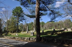
Listed on the National Register of Historic Places in
1986. A historic map-sheet match is not published yet. The record needs a coordinate-quality review before it can be joined to a sheet boundary.
From the record
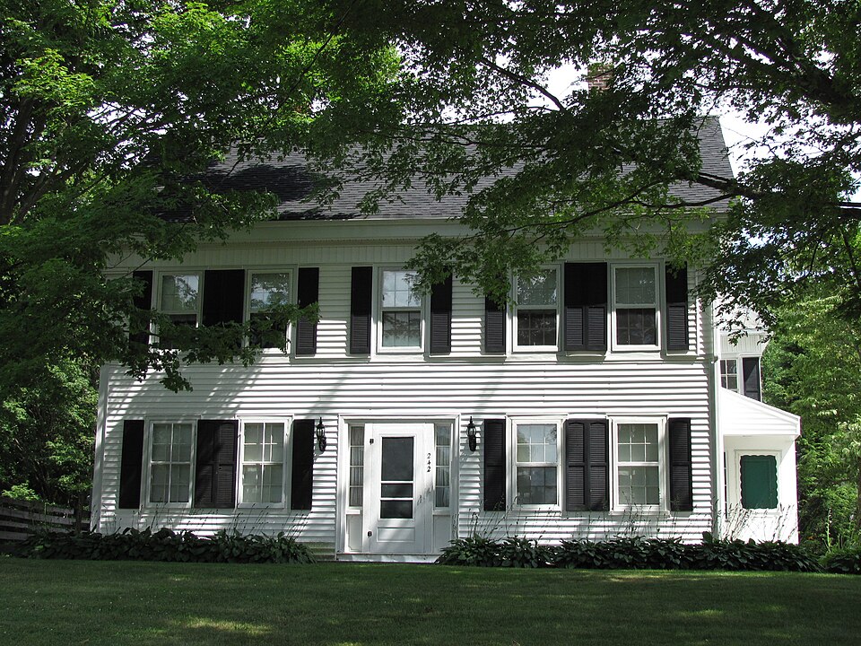
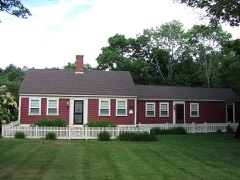
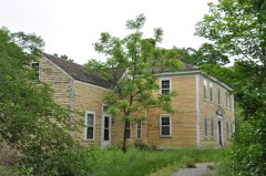
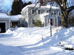
“The Otis Cary House is a historic house in Foxboro, Massachusetts. It is a wood-frame house, five bays wide, with a side-gable roof, twin end chimneys, and a central entrance with flanking sidelights.”
Wikipedia article Otis Cary House, CC BY-SA 4.0.
one of 249 National Register listings in Norfolk County · listed in 1986 · category: Building · one of 2 National Historic Landmarks in Norfolk County.
National Register reference number.86000379- the number the National Park Service assigned this property when it was listed, and the key its nomination file is catalogued under at the National Archives.
Fires near this property
104 since 2015
Regional context, not property-specific
evidence. The
federal wildfire occurrence database
lists 104 fires within 5 miles of Cary, Otis, House between
2015 and 2020, burning about 48 acres in total. None started naturally. 1 was recorded as arson.
Distance is straight-line from the map coordinates, so a fire counted
here may appear on a neighbouring settlement's page as well.
Reported cause
Fires
Missing data/not specified/undetermined
40
Recreation and ceremony
34
Smoking
16
Debris and open burning
8
Equipment and vehicle use
5
Arson/incendiarism
1
The most recent of
them, most recent first, with the day each was reported and the service
that recorded it.
Regional context, not property-specific
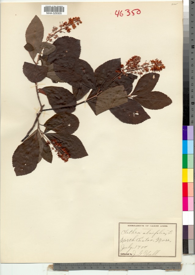
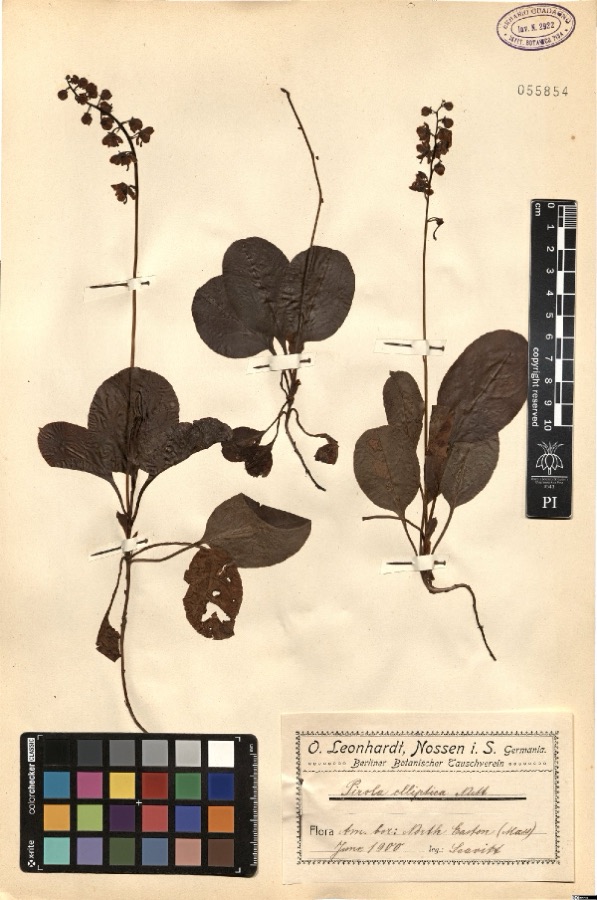
evidence. Museums hold 1,781 specimens
collected within 10 miles of Cary, Otis, House between 1870 and
1975: 804 Fungi, 569 Plantae, 278 Animalia, 100 Protozoa, 16 Chromista, 9 Unrecorded, 5 Bacteria. 12 distinct Species records are shown.
Collected by ?, A. A. Eaton, A. B. Seymour and others. Each is a
physical object with a catalogue
number, and each entry opens the museum's record. This is what was
collected and kept, not a survey of what lives here - nothing can be
concluded from a species being absent.
Regional context, not property-specific
evidence. The federal mineral resources record lists
16 workings within 5 miles of Cary, Otis, House: 10 past producers, 5 producers, 1 unknown.
5 still produce. What was taken out: Sand and Gravel, Construction, Stone, Crushed/Broken, Gold, PGE, Silver. Distance is straight-line from the
map coordinates, so a quarry counted here may appear on a neighbouring
settlement's page as well.
Regional context, not property-specific
evidence. The National Weather Service names
Foxboro, the town this property stands in, in 4 storm reports between 1996 and 2023: 1 hail, 1 thunderstorm wind, 1 tornado, 1 flash flood.
No death or injury is recorded in these reports. Each account below is quoted exactly as the forecast office
filed it, from the NOAA Storm Events Database, and each date
opens the federal record of that event.
Tornado confirmed to have touched down in a small neighborhood in|Foxboro near the Mansfield town line very close to the town of Easton. |Several locations on a west to east path in the neighborhood had several|large trees up to 2 feet in diameter snapped at the trunk.|Observed tree damage had a convergent pattern consistent with|violently rotating winds. No major damage to homes was observed,|but one chimney appeared to have been knocked over by a fallen|tree. Path width was estimated to be around 25 yards. Path length|of the surveyed damage points was just shy of 300 yards. Per|radar data, a velocity couplet was over the surveyed neighborhood|for only a minute or two before continuing east over conservation|land. It is possible that the tornado was on the ground for|longer, but surveyors were unable to access conservation land|east of the last surveyed damage point. Additional significant |tree damage was found east of aforementioned conservation land in Easton, |but patterns were more consistent with west to east straight line winds. |This is also consistent with archived KBOX radar which displayed strong|outbound (west to east) velocities over this area.
No historic map-sheet match is published
for this property yet. That does not mean no map exists. This record needs
a coordinate-quality review before it can be joined to a sheet boundary.
Browse the county's mapped places while that work is
pending.
From the nomination file
2,741 words on record
When this property was proposed for the
National Register, someone wrote the case for it: what the building is,
and why it matters. That document is a federal record in the public domain.
It is quoted below word for word, never summarised. The text was read off the scanned case file by machine, so the
occasional stray character is the recogniser's and the 1970s
typewriter's.
Description of the property
neighborhood in southern Foxboro. The two-acre site is primarily wooded, and 10 ect rone souin suret, ar ine pronereed, and highest point. The lot is fronted by a low fieldstone retaining wall. Built in 1837, the Otis Cary House is a five-bay, central entrance_Greek Revival-style building that rises 2 1/2 stories to a gable roof. The house consists of a main block with rear 2 1/2-story ell. The main block's front and side rest on a dressed granite foundation, while the rear and ell sit on ashlar rubble. The main facade's first floor is sheathed in its original wide horizontal boards. The remainder of the main block and the ell are presently sheathed in vinyl siding, which was applied in such a way that the building's details survive intact.
Beneath the siding is shake shingle siding and beneath that is the original clapboard sheathing. The building is joined to a barn (built in the mid 19th century) by a single-story modern breezeway. The building is oriented with its main facade facing northwest. The primary elevation's first story is fronted by a full-width porch whose slender posts are vernacular interpretations of Greek Revival columns. These are early-mid 20th century replacements of earlier columns. Three-quarter side lights over inset shadow panels flank the central entrance. Corner boards with flat pilasters and the hint of a capital, and a deep frieze beneath a projecting roof cornice, frame the building. 6/6 windows here and elsewhere in the building have molded window enframements.
Two brick interior chimneys are located behind the gable roof's ridge. The building's main block is two bays deep with a fully enclosed pediment at each gable end. The gable contains two windows on both east and west elevations.
(in one paragraph) Builder Architect Unk nown The Otis_Cary House, a Greek Revival-style dwelling located in the southern part of Foxboro, in southeastern Massachusetts, retains integrity of location, design, setting, feeling, and association. The house holds associations with the beginnings of industrialization in Foxboro, as Otis Cary was a successful Eury ass weil a manufactor in the town in the early and mid 19th century, as well as a local politician and community leader. While the building's primary significance lies in its historical assocations, the Otis Cary House is also architecturally significant as an example of the Greek Revival style. house thus fulfils Criteria A, B, and C of the National Register of Historic Places on the local level.
Otis Cary (1804-1888), the first owner of the nominated property, was born in Bridgewater but came to nearby Foxboro while in his twenties. In 1834, Cary bought the Mill Street Iron Foundry,_located near the cary_house, along the Cocasset River (no longer extant). The area was south of Foxboro's town center. Cary's business prospered when he discovered a new process for extracting additional ore from the vast quantities of waste ash that were dumped around the foundry. He was thus able to continue producing cast items while substantially reducing the cost of his raw materials.
In 1848, Cary purchased the Nason Cotton Mill on Water Street (also nonextant), which he then sold--at a profit--to Oliver Carpenter, who operated it as the South Branch of the Union Straw Works, Foxboro's prinary industry in the mid 19th century. Because both the foundry and the straw mill do not survive, the cary House stands as one of the only structures related to this early part of Foxboro's industrial development.
Quoted from the National Register nomination
for reference 86000379, 18 pages, held by the National Archives in Record
Group 79. See the
catalogue record.
Listed places nearby
6 within 8 miles
Other National Register properties close
enough to walk or drive between, ordered by distance from this one. Both
positions come from the same geocoding pass that matched these properties
to their map sheets.
Listing record. National Park Service National Register of Historic Places, listed-properties dataset, current to 2026-05-22.
Map join. Address geocoded through the United States Census geocoder, then tested against the published boundary of every sheet in the USGS Historical Topographic Map Collection.
How this page is made. Listing fields come from federal records; map-sheet coverage is a labelled coordinate-to-boundary calculation, not a source-field claim.
Wildfire. Short, Karen C. 2022. Spatial wildfire occurrence data for the United States, 1992-2020 [FPA_FOD_20221014]. 6th Edition. Fort Collins, CO: Forest Service Research Data Archive. https://doi.org/10.2737/RDS-2013-0009.6 Collected with United States Government funding and usable without additional permissions or fees.
Specimens. Global Biodiversity Information Facility (GBIF), https://www.gbif.org/. Only records licensed CC0 or CC BY are used. Records licensed CC BY-NC are excluded because this site carries advertising. Images are checked individually and any whose licence is non-commercial, no-derivatives or unreadable is refused.
Mines and quarries. USGS Mineral Resources Data System (MRDS) https://mrdata.usgs.gov/mrds/ A work of the United States government, no copyright under 17 U.S.C. 105.
Storms. NOAA National Centers for Environmental Information, Storm Events Database https://www.ncei.noaa.gov/stormevents/ A work of the United States government, no copyright under 17 U.S.C. 105. Narratives are quoted verbatim from the National Weather Service report and are not edited or summarised.
 Block
Block