BlockBefore
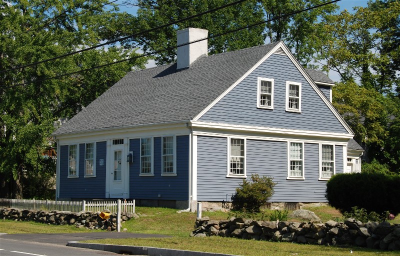
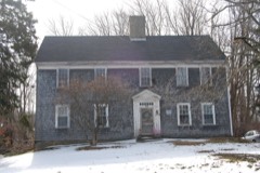
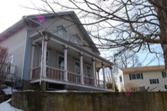
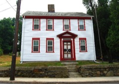
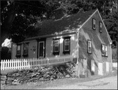
Photograph of Luther Winslow, Jr., House
Photograph by Marcbela (Marc N. Belanger), Public domain. Via Wikimedia Commons.

Winslow, Luther, Jr., House

Listed on the National Register of Historic Places in 1983. A historic map-sheet match is not published yet. The record needs a coordinate-quality review before it can be joined to a sheet boundary.

From the record

“House is a historic house located at 5225 North Main Street in Fall River, Massachusetts.”

Wikipedia article Luther Winslow Jr. House, CC BY-SA 4.0.

one of 272 National Register listings in Bristol County · listed in 1983 · category: Building · one of 8 National Historic Landmarks in Bristol County.

Sources: the Wikipedia article · the case file at the National Archives · the National Register database, National Park Service

The listing

  • What is counted as historic. The nomination lists 1 building as contributing to the listing.
  • Address. 5225 N. Main St., Fall River, 02720
  • When was it listed? 1983-02-16
  • Category. building
  • Also known as. Fall River MRA
  • Township. Fall River city
  • Architectural style. Federal architecture
  • National Register reference number. 83000732 - the number the National Park Service assigned this property when it was listed, and the key its nomination file is catalogued under at the National Archives.

Fires near this property

42 since 2015

Regional context, not property-specific evidence. The federal wildfire occurrence database lists 42 fires within 5 miles of Winslow, Luther, Jr., House between 2015 and 2020, burning about 65 acres in total. 1 started naturally. 4 were recorded as arson. Distance is straight-line from the map coordinates, so a fire counted here may appear on a neighbouring settlement's page as well.

Reported cause Fires
Missing data/not specified/undetermined20
Debris and open burning10
Arson/incendiarism4
Recreation and ceremony2
Misuse of fire by a minor2
Natural1
Power generation/transmission/distribution1
Equipment and vehicle use1
Fireworks1

The most recent of them, most recent first, with the day each was reported and the service that recorded it.

DateCause SizeReported by Name on the report
20 September 2015Missing data/not specified/undetermined1.0 acresMassachusetts Bureau of Forest Fire Controlnot named
16 September 2020Missing data/not specified/undeterminedunder an acreMassachusetts Bureau of Forest Fire Controlnot named
23 August 2016Debris and open burningunder an acreMassachusetts Bureau of Forest Fire Controlnot named
1 August 2020Arson/incendiarismunder an acreMassachusetts Bureau of Forest Fire Controlnot named
31 July 2017Missing data/not specified/undeterminedunder an acreMassachusetts Bureau of Forest Fire Controlnot named
23 July 2017Misuse of fire by a minorunder an acreMassachusetts Bureau of Forest Fire Controlnot named
20 July 2016Missing data/not specified/undeterminedunder an acreMassachusetts Bureau of Forest Fire Controlnot named
18 July 2020Fireworksunder an acreMassachusetts Bureau of Forest Fire Controlnot named

Every fire recorded in Bristol County

Specimens collected near this property

12 of 1,381 shown

Regional context, not property-specific evidence. Museums hold 1,381 specimens collected within 10 miles of Winslow, Luther, Jr., House between 1848 and 1975: 574 Animalia, 491 Fungi, 303 Plantae, 8 Chromista, 3 Unrecorded, 2 Bacteria. 12 distinct Species records are shown. Collected by A E Schuyler, A. Macrae, A.B. Hervey and others. Each is a physical object with a catalogue number, and each entry opens the museum's record. This is what was collected and kept, not a survey of what lives here - nothing can be concluded from a species being absent.

Image SpeciesYear Collected by Where, as recorded
A photograph of the species Trypethelium virens, not of this specimenTrypethelium virens Tuck.1848ex herb. OakesNew Bedford.
A photograph of the species Ranunculus bulbosus, not of this specimenRanunculus bulbosus L.1850not recorded
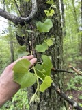
A photograph of the species Vitis labrusca, not of this specimenVitis labrusca L.1850not recorded
A photograph of the species Apocynum cannabinum, not of this specimenApocynum cannabinum L.1855F. C. SeymourRehoboth
A photograph of the species Menegazzia terebrata, not of this specimenMenegazzia terebrata (Hoffm.) A.Massal.1860H. WilleyNew Bedford
A photograph of the species Scolopax minor, not of this specimenScolopax minor J.F.Gmelin, 17891860Alan PooleWestport
A photograph of the species Anaptychia palmatula, not of this specimenAnaptychia palmatula (Michx.) Vain., 18991862H. WilleyNew Bedford.
A photograph of the species Anisomeridium polypori, not of this specimenAnisomeridium polypori (Ellis & Everh.) M.E.Barr1862H. WilleyNew Bedford
A photograph of the species Anzia colpodes, not of this specimenAnzia colpodes (Ach.) Stizenb.1862H. WilleyNew Bedford.
A photograph of the species Cladonia apodocarpa, not of this specimenCladonia apodocarpa Robb.1862H. WilleyNew Bedford.
A photograph of the species Cladonia atlantica, not of this specimenCladonia atlantica A.Evans1862H. WilleyNew Bedford.
A photograph of the species Cladonia bacillaris, not of this specimenCladonia bacillaris (Ach.) Nyl.1862H. WilleyNew Bedford.

All 1,381 specimens within 10 miles, at the Global Biodiversity Information Facility.

Mines and quarries near this property

4 within 5 miles

Regional context, not property-specific evidence. The federal mineral resources record lists 4 workings within 5 miles of Winslow, Luther, Jr., House: 3 past producers, 1 producer. 1 still produces. What was taken out: Sand and Gravel, Construction. Distance is straight-line from the map coordinates, so a quarry counted here may appear on a neighbouring settlement's page as well.

Where SiteCommodity StatusRecorded
Assonet Sand and Gravel CoSand and Gravel, ConstructionPast ProducerSedimentary
East Freetown Pit & Assonet PlantSand and Gravel, ConstructionProducer
Lanzisera PitSand and Gravel, ConstructionPast Producer
Randy PitSand and Gravel, ConstructionPast Producer

Every working recorded in Bristol County

Storms near this property

24 since 1997

Regional context, not property-specific evidence. The National Weather Service names Fall River, the town this property stands in, in 24 storm reports between 1997 and 2025: 10 flood, 5 thunderstorm wind, 5 flash flood, 2 hail. No death or injury is recorded in these reports. Each account below is quoted exactly as the forecast office filed it, from the NOAA Storm Events Database, and each date opens the federal record of that event.

WhenEvent Place namedHarm What the report says
August 2018FloodFall River$15,000At 1:25 PM EST, several cars were trapped in flood waters on Quequechan Street and Warren Street, near a Walmart store. The two streets were closed due to flooding.
June 2012FloodFall River$15,000A car was stuck in flood waters on Milliken Boulevard. It had to be towed out of the water.
July 2025Thunderstorm WindFall River$10,000In Fall River, a building that was under renovation had a portion of the facade of the building collapse.
July 2025Thunderstorm WindFall River$10,000In Fall River, several trees and large branches were down including a tree on a car.
August 2018FloodFall River$10,000At 12:37 PM EST, a basement at a house on Purchase Street in Fall River was reported flooded.
August 2015Thunderstorm WindFall River$5,000A tree on Robeson Street was downed by thunderstorm winds, blocking half the street.
August 2024Thunderstorm WindFall River$1,000In Fall River, there was a large tree blocking the road on Bush St. A tree also fell on a garage and two cars with a hole in the roof of the garage.
June 2017FloodFall River$1,000At 915 AM EST, a heavy downpour flooded a section of Pleasant Street in Fall River with one lane blocked off.
July 2025Flash FloodFall River-In Fall River, several roads were flooded throughout town.
August 2024Flash FloodFall River-In Fall River, Brayton Ave at Pleasant St was flooded and impassable.
August 2023Flash FloodFall River-In Fall River, Plymouth Ave between I-95 and Pleasant St was flooded and impassable.
July 2023Flash FloodFall River-In Fall River, Broadway at Ponte Delgada Blvd. was flooded and impassable.
July 2023FloodFall River-In Fall River, Plymouth Ave was flooded and impassable with a car stuck.
August 2018FloodFall River-At 11:53 AM EST, the intersection of Quarry Street and Pleasant Street in Fall River was reported flooded and impassable.
October 2017FloodFall River-At 230 AM EST, Bedford Street near Sixth Street in Fall River was reported flooded.
July 2015FloodFall River-Warren Street was flooded and impassable. A car was stuck in flood waters on Pleasant Street at the intersection with Quarry Street. Manhole covers popped off due to flooding on Globe Street.
July 2015FloodFall River-Portions of Warren and Jefferson Streets were closed due to flooding.
August 2012FloodFall River-Davol Street was closed due to flooding near the Global Gas Station.
July 2009Flash FloodFall River-Several streets in Fall River and Forest Street in Attleborough were closed due to flooding.
August 2015HailFall River-no account filed
July 1999LightningFall River-no account filed
June 1997HailFall River-no account filed
June 1997Thunderstorm WindFall River-no account filed
August 1997Funnel CloudFall River-no account filed

Every storm recorded in Bristol County

Map coverage status

No historic map-sheet match is published for this property yet. That does not mean no map exists. This record needs a coordinate-quality review before it can be joined to a sheet boundary. Browse the county's mapped places while that work is pending.

From the nomination file

1,012 words on record

When this property was proposed for the National Register, someone wrote the case for it: what the building is, and why it matters. That document is a federal record in the public domain. It is reproduced in full on its own page, word for word and never summarised. The text was read off the scanned case file by machine, so the occasional stray character is the recogniser's and the 1970s typewriter's.

The whole case file for this property - 1,012 words, 7 pages, reproduced complete.

Quoted from the National Register nomination for reference 83000732, 7 pages, held by the National Archives in Record Group 79. See the catalogue record.

Listed places nearby

6 within 8 miles

Other National Register properties close enough to walk or drive between, ordered by distance from this one. Both positions come from the same geocoding pass that matched these properties to their map sheets.

Photograph PropertyDistance Listed
Valentine-French House0.1 miles1983
North Christian Congregational Church1.1 miles1983
Ashley House1.4 miles1983
Brightman, Hathaway, House2.1 miles1983
Borden-Winslow House2.2 miles1983
Collins, William, House2.3 miles1983

Sources for this property

National Archives recordThe nomination case file for reference 83000732 in Record Group 79.
Wikipedia articleCommunity-written account of this property, licensed CC BY-SA.
Bristol CountyAll 272 listed properties in this county.

Provenance

  • Listing record. National Park Service National Register of Historic Places, listed-properties dataset, current to 2026-05-22.
  • Map join. Address geocoded through the United States Census geocoder, then tested against the published boundary of every sheet in the USGS Historical Topographic Map Collection.
  • How this page is made. Listing fields come from federal records; map-sheet coverage is a labelled coordinate-to-boundary calculation, not a source-field claim.
  • Wildfire. Short, Karen C. 2022. Spatial wildfire occurrence data for the United States, 1992-2020 [FPA_FOD_20221014]. 6th Edition. Fort Collins, CO: Forest Service Research Data Archive. https://doi.org/10.2737/RDS-2013-0009.6 Collected with United States Government funding and usable without additional permissions or fees.
  • Specimens. Global Biodiversity Information Facility (GBIF), https://www.gbif.org/. Only records licensed CC0 or CC BY are used. Records licensed CC BY-NC are excluded because this site carries advertising. Images are checked individually and any whose licence is non-commercial, no-derivatives or unreadable is refused.
  • Mines and quarries. USGS Mineral Resources Data System (MRDS) https://mrdata.usgs.gov/mrds/ A work of the United States government, no copyright under 17 U.S.C. 105.
  • Storms. NOAA National Centers for Environmental Information, Storm Events Database https://www.ncei.noaa.gov/stormevents/ A work of the United States government, no copyright under 17 U.S.C. 105. Narratives are quoted verbatim from the National Weather Service report and are not edited or summarised.