Listed on the National Register of Historic Places in
1983. A historic map-sheet match is not published yet. The record needs a coordinate-quality review before it can be joined to a sheet boundary.
From the record
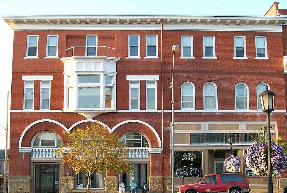
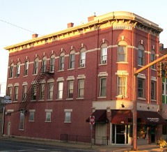
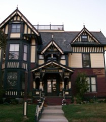
“The Berwick Hotel is located on the northeast corner of Wheeling Avenue and Sixth Street in Cambridge, Ohio, United States and was built in 1887 for Colonel Joseph D.”
Wikipedia article Berwick Hotel, CC BY-SA 4.0.
one of 18 National Register listings in Guernsey County · listed in 1983 · category: Building · one of 1 National Historic Landmarks in Guernsey County.
National Register reference number.83001975- the number the National Park Service assigned this property when it was listed, and the key its nomination file is catalogued under at the National Archives.
THE present volume of the Cambridge Medieval History covers the stormy period of about three hundred years from Justinian to Charles the Great inclusive. It is a time little known to the general reader, and even students of history in this country seldom turn their attention to any part of it but the Conversion of the English. Hence, English books are scarce - Dr Hodgkin's Italy and her Invaders is the brilliant exception which proves the rule - and the editors have had to rely more on foreign scholars than in the former volume. Some indeed of the chapters treat of subjects on which very little has ever been written in English, such as the Visigoths in Spain, the organisation of Imperial Italy and Africa, the Saracen invasions of Sicily and Italy, and the early history and expansion of the Slavs.
Taking all this for granted, then, we pass to the separate history of the individual countries just growing into states. For a time, they grow within the common mould of the Empire, and Carolingian traditions bind them to the past. Dimly to begin with, but with growing plainness, the realms of France, Germany, Italy, Lorraine, and Burgundy are seen taking their later territorial and constitutional shapes. England lay somewhat apart, insular, and therefore separated from the Empire, but by this very insularity everywhere exposed to Northmen and Danes. Here, too, as on the continent, statesman-like kings and far-sighted ecclesiastics worked together. The growth of territorial unity is easiest of all to trace, for it can be made plain in maps. But the growth of unity of thought and interests, of constitutions and social forms, is harder to see and to express; it is easier to estimate the work of Ecgbert, Edward the Elder, and Aethelstan than the more many-sided achievements of Alfred and Dunstan, or the more pervasive influence of the great Northern school which gave us Bede and Alcuin. But the peculiarity of England's position and history is most significant for constitutional growths, and it is, therefore, in connexion with English affairs that the origins of Feudalism are best investigated and discussed. Scientific history begins with the observation of resemblances and with classification by likeness. Then it passes on to detect differences, and to note their significance. Nowhere is there more need to remember these twin methods than in the study of Feudalism, where the Cambridge scholar Maitland was our daring and yet cautious guide. Processes and details which we notice in English history have their parallels elsewhere. If the centuries we traverse here have a large common inheritance, they also have at the same time, in spite of differences in place and character, something of a common history. What is said, therefore, as to the origins of English Feudalism also applies, with due allowance for great local differences, to Germany, France, and Italy ; even indeed to Spain, although there the presence and the conquests of the Muslims impressed a peculiar stamp upon its institutions.
Regional context, not property-specific
evidence. The
federal wildfire occurrence database
lists 46 fires within 5 miles of Berwick Hotel between
2007 and 2020, burning about 139 acres in total. None started naturally. 1 was recorded as arson.
Distance is straight-line from the map coordinates, so a fire counted
here may appear on a neighbouring settlement's page as well.
Reported cause
Fires
Debris and open burning
30
Missing data/not specified/undetermined
10
Recreation and ceremony
3
Smoking
2
Arson/incendiarism
1
The most recent of
them, most recent first, with the day each was reported and the service
that recorded it.
Regional context, not property-specific
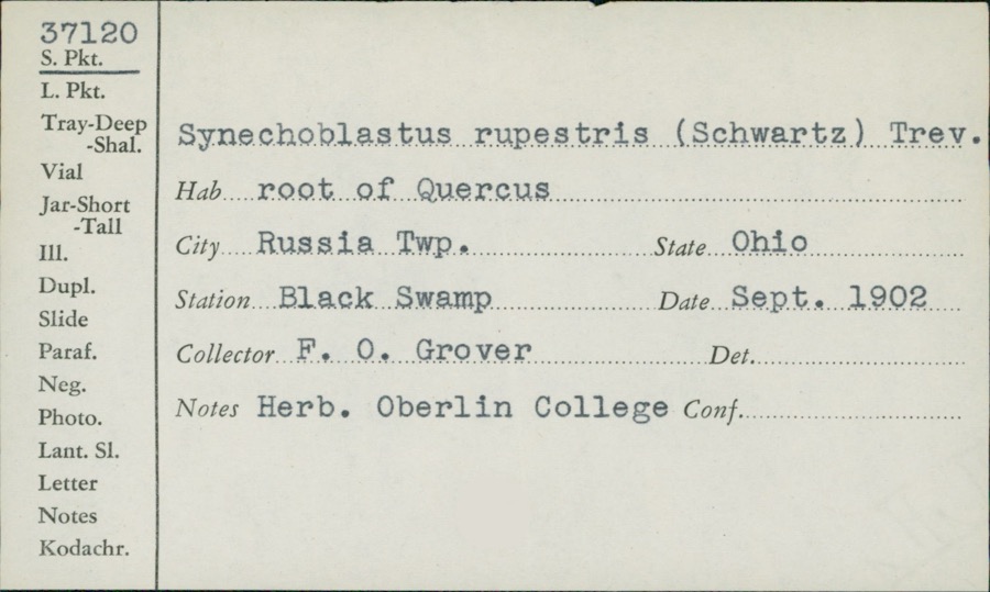
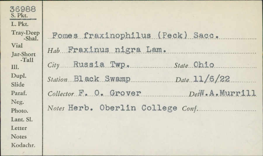
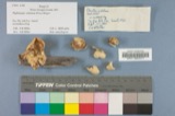
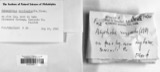
evidence. Museums hold 321 specimens
collected within 10 miles of Berwick Hotel between 1875 and
1975: 133 Fungi, 122 Animalia, 62 Plantae, 2 Unrecorded, 2 Protozoa. 12 distinct Species records are shown.
Collected by Adams, W., Adams, W. (William), Adams, W. (William), Trautman, M. B. (Milton Bernard) et al. and others. Each is a
physical object with a catalogue
number, and each entry opens the museum's record. This is what was
collected and kept, not a survey of what lives here - nothing can be
concluded from a species being absent.
Regional context, not property-specific
evidence. The federal mineral resources record lists
2 workings within 5 miles of Berwick Hotel: 1 occurrence, 1 producer.
1 still produces. What was taken out: Titanium, Silica, Iron, Aluminum, Vanadium, Zirconium, Iron. Distance is straight-line from the
map coordinates, so a quarry counted here may appear on a neighbouring
settlement's page as well.
Regional context, not property-specific
evidence. The National Weather Service names
Cambridge, the town this property stands in, in 78 storm reports between 1994 and 2026: 47 thunderstorm wind, 22 hail, 7 flash flood, 1 flood.
The reports record 3 injuries. Each account below is quoted exactly as the forecast office
filed it, from the NOAA Storm Events Database, and each date
opens the federal record of that event.
An intense thunderstorm gust known as a macroburst raked across central Guernsey County, wind gusts were estimated between 80 and 90 mph. The thunderstorm formed in northeast Guernsey County about 430 pm just ahead of another very intense thunderstorm moving through Muskingum County. It then moved southeast at nearly 40 mph.The swath of damage produced by this intense downburst of wind was estimated to be nearly 8 miles long. Its width fluctuated between 0.75 miles to over 2.5 miles. The damage started just south of Cambridge and continued southeast to near the town of Buffalo. There were 3 reported injuries which consisted of cuts and abrasions. One person was treated and released from the hospital. The town of Byesville was hardest hit. Hundreds of trees were snapped or toppled. Power lines and telephone poles were also downed which resulted in widespread power outages. There were some outbuildings destroyed, as well as damage to shingles, siding and roofs. Part of a roof of a school was torn off. Billboards, business signs and Interstate highway signs were also partially or totally destroyed. It was also reported that about 30 automobiles in a grocery store parking lot had their windows completely shattered. A plate glass window in a fast food restaurant was also shattered. The area was declared a disaster area by the Governor of Ohio. On Interstate 77, there was a report of a tractor-trailed truck which was stopped in its tracks by the tremendous gust as it tried to move forward. It actually spun its wheels as if it were on ice without moving and an automobile behind it collided with the truck.
Emergency manager reported damage to the clock tower of an 150 year old courthouse, the collapse of a church, and several other structures damaged in the city of Cambridge.
Between 840 PM EDT and 9 PM EDT, a microburst struck just southwest of Warrentown, about 4 miles northeast of Cambridge. Numerous trees toppled or snapped. Siding and shingles torn from a few houses. Two small barns knocked down. One mobile home was pushed off its foundation. Maximum estimated wind 75 mph (65 knots). This microburst made a swath of sporadic damage about half a mile in length and 350 yards wide. It started from just south of Lakespur Lane, and moved northeastward to just south of Route 22
No historic map-sheet match is published
for this property yet. That does not mean no map exists. This record needs
a coordinate-quality review before it can be joined to a sheet boundary.
Browse the county's mapped places while that work is
pending.
From the nomination file
1,825 words on record
When this property was proposed for the
National Register, someone wrote the case for it: what the building is,
and why it matters. That document is a federal record in the public domain.
It is quoted below word for word, never summarised. The text was read off the scanned case file by machine, so the
occasional stray character is the recogniser's and the 1970s
typewriter's.
Description of the property
framed the main door which was located above grade atop a raised basement;ap- - moveddate Check one was capped with a Mansard roof;this roof was altered to the present configuration storefronts located to the east of the hotel entrance;some transom elements on .deteriorated _ unaltered street grade. Set on a foundation of coursed ashlar, the brick hotel originally about 1922. Originally, a set of 3 intersecting Richardsonian Romanesque arches tained, but the entry was set on the ground story. With the exception of the roof alteration which removed dormered windows, the fenestration has remained dentil course. The 1920s remodeling remains essentially intact, including three along the Sixth Street elevation.
At this time a detatched boarding house, wherein lived some of the hotel's employees, was razed, to make room for a wire-cut brick In the basement along the Sixth Street elevation were three sample rooms, where present building dates from 1891, with alterations. The hotel is a 3- and 4- date is of pressed metal and features simple lines including modillions anda delicate -good - prehistoric - archeology-historic . law _ science _ agriculture . literature - sculpture - social/ - engineering X 1800-1899 .exploration/settlement - philosophy X 1900 Builder/Architect see below Statement of
Statement of significance
(in one paragraph) history of the town of Cambridge, Ohio, a major commercial center along the Col. Joseph Danner Taylor built the first Berwick on this site, a Romanesque Rivival house which burned in November, 1891. He immediately rebuilt and saw his hotel (named for his wife's home at North Berwick, Maine) become one of southeastern Ohio's most popular hostelries. Taylor (1830-1899) was Cambridge's leading citizen for many decades. A U. S.
Congressman for four terms, he was active in the Republican party, served as a newspaper editor, educator, and attorney, as well as having raised a company the railroad to Cambridge, and no doubt remained on this corner to take advantage As noted earlier, the French Second Empire design gave way to one of a more Jamison had a misunderstanding with the owners, and was fired; the remodeling was completed by day labor. 1600-1699 1700-1799 1400-1499 communications commerce architecture industry Period theater humanitarian invention music 1500-1599 lessened the architectural significance of the building it has sufficient historical education past the front door. 8.
Significance _economics _conservation Areas of Significance-Check and justify below next seventy-odd years the community enjoyed unbridled growth.In 1882, passed the central city. - other(specify) of the passanger station one block away as well as the National Road which ran restrained character in the 1920s. The remodeling was undertaken by architect/ Specific dates 1892; ca. 1922 military -art - archeology-prehistoric - community planning - landscape architecture - religion - politics/government _ transportation in the 1820s and the railroad followed some thirty years thereafter. For the of soldiers during the Civil War. In addition, he was instrumental in bringing contractor Walter S. Jamison, of Zanesville.
It is known, however, that Although the major change which took place in the facade of the Berwick Hotel than fifty years ago.
Quoted from the National Register nomination
for reference 83001975, 21 pages, held by the National Archives in Record
Group 79. See the
catalogue record.
Listed places nearby
6 within 8 miles
Other National Register properties close
enough to walk or drive between, ordered by distance from this one. Both
positions come from the same geocoding pass that matched these properties
to their map sheets.
Listing record. National Park Service National Register of Historic Places, listed-properties dataset, current to 2026-05-22.
Map join. Address geocoded through the United States Census geocoder, then tested against the published boundary of every sheet in the USGS Historical Topographic Map Collection.
How this page is made. Listing fields come from federal records; map-sheet coverage is a labelled coordinate-to-boundary calculation, not a source-field claim.
Wildfire. Short, Karen C. 2022. Spatial wildfire occurrence data for the United States, 1992-2020 [FPA_FOD_20221014]. 6th Edition. Fort Collins, CO: Forest Service Research Data Archive. https://doi.org/10.2737/RDS-2013-0009.6 Collected with United States Government funding and usable without additional permissions or fees.
Specimens. Global Biodiversity Information Facility (GBIF), https://www.gbif.org/. Only records licensed CC0 or CC BY are used. Records licensed CC BY-NC are excluded because this site carries advertising. Images are checked individually and any whose licence is non-commercial, no-derivatives or unreadable is refused.
Mines and quarries. USGS Mineral Resources Data System (MRDS) https://mrdata.usgs.gov/mrds/ A work of the United States government, no copyright under 17 U.S.C. 105.
Storms. NOAA National Centers for Environmental Information, Storm Events Database https://www.ncei.noaa.gov/stormevents/ A work of the United States government, no copyright under 17 U.S.C. 105. Narratives are quoted verbatim from the National Weather Service report and are not edited or summarised.
 Block
Block