BlockBefore
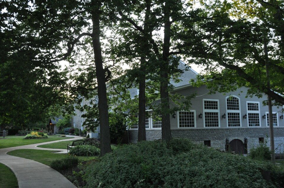
Photograph of Catawba Island Wine Company
Photograph by User:Magicpiano, CC BY-SA 4.0. Via Wikimedia Commons.

Catawba Island Wine Company

Listed on the National Register of Historic Places in 1983. A historic map-sheet match is not published yet. The record needs a coordinate-quality review before it can be joined to a sheet boundary.

From the record

one of 21 National Register listings in Ottawa County · listed in 1983 · category: Building.

Sources: the case file at the National Archives · the National Register database, National Park Service

The listing

  • What is counted as historic. The nomination lists 1 building as contributing to the listing.
  • Address. 3845 Wine Celler Rd., Port Clinton, 43452
  • When was it listed? 1983-05-05
  • Category. building
  • Township. Catawba Island township
  • National Register reference number. 83002019 - the number the National Park Service assigned this property when it was listed, and the key its nomination file is catalogued under at the National Archives.

Specimens collected near this property

12 of 6,778 shown

Regional context, not property-specific evidence. Museums hold 6,778 specimens collected within 10 miles of Catawba Island Wine Company between 1865 and 1975: 5,713 Animalia, 912 Plantae, 135 Fungi, 8 Chromista, 6 Protozoa, 4 Unrecorded. 12 distinct Species records are shown. Collected by A. D. Selby, A. F. Satterthwait, A. J. Eames and others. Each is a physical object with a catalogue number, and each entry opens the museum's record. This is what was collected and kept, not a survey of what lives here - nothing can be concluded from a species being absent.

Image SpeciesYear Collected by Where, as recorded
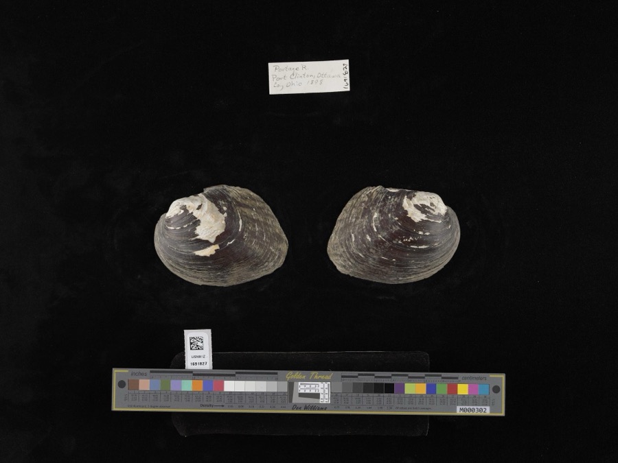
Specimen of Amblema plicata (Say, 1817)Amblema plicata (Say, 1817)1898not recordedPortage River
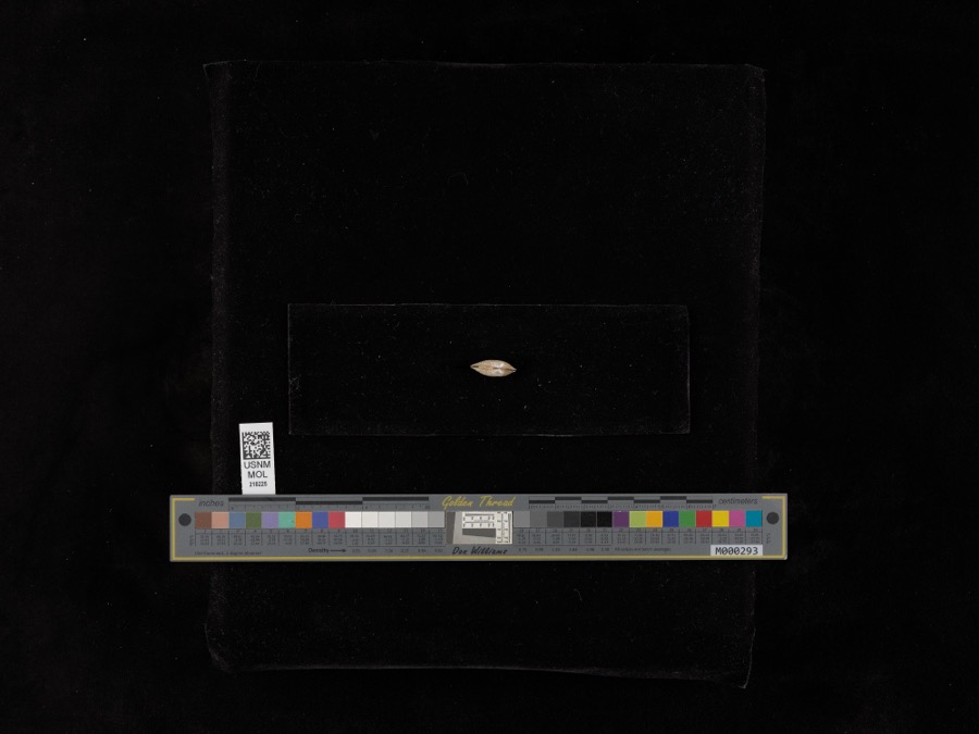
Specimen of Lampsilis radiata radiata (Gmelin, 1791)Lampsilis radiata radiata (Gmelin, 1791)1898United States Fish CommissionSandusky Bay
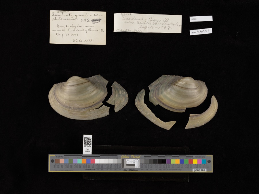
Specimen of Pyganodon grandis (Say, 1829)Pyganodon grandis (Say, 1829)1898United States Fish Commission & W. KendallSandusky Bay near mouth of Sandusky River
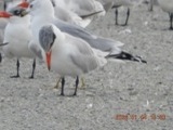
A photograph of the species Hydroprogne caspia, not of this specimenHydroprogne caspia (Pallas, 1770)1865Trautman, M. B. (Milton Bernard)Winous Pt., Bay Twp, Ottawa, Ohio, USA
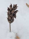
A photograph of the species Carex L., not of this specimenCarex L.1871H. GillmanPut-in-bay Island, Lake Erie.
A photograph of the species Astragalus canadensis, not of this specimenAstragalus canadensis var. canadensis1872T. MorongShores of the Is. at Put-in-Bay. Lake Erie
A photograph of the species Mentha arvensis, not of this specimenMentha arvensis var. glabrata (Benth.) Fernald1872T. MorongPut-in-Bay Is. Lake Erie. On the lake shore.
A photograph of the species Solidago hispida, not of this specimenSolidago hispida Muhl. ex Willd.1872T. MorongPut-in-Bay Island, Lake Erie
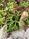
A photograph of the species Diphasiastrum complanatum, not of this specimenDiphasiastrum complanatum (L.) Holub1878Roberts, ThomasPut-in Bay;;;;
A photograph of the species Maianthemum trifolium, not of this specimenMaianthemum trifolium (L.) Sloboda1878Juni, B.Put in Bay;;;;
A photograph of the species Anemone canadensis, not of this specimenAnemone canadensis L.1881Mertz, H.Put-in-Bay
A photograph of the species Calystegia sepium, not of this specimenCalystegia sepium (L.) R.Br.1881Mertz, H.N.Put-in-Bay

All 6,778 specimens within 10 miles, at the Global Biodiversity Information Facility.

Mines and quarries near this property

6 within 5 miles

Regional context, not property-specific evidence. The federal mineral resources record lists 6 workings within 5 miles of Catawba Island Wine Company: 4 past producers, 2 producers. 2 still produce. What was taken out: Gypsum-Anhydrite, Stone, Crushed/Broken. Distance is straight-line from the map coordinates, so a quarry counted here may appear on a neighbouring settlement's page as well.

Where SiteCommodity StatusRecorded
Ottawa County Hwy Dept.Stone, Crushed/BrokenProducer
American Mine No 2Gypsum-AnhydriteProducer
American Mine Number 2 QuarryGypsum-AnhydritePast ProducerSedimentary
Lower MineGypsum-AnhydritePast Producer
U.S. Gypsum MillGypsum-AnhydritePast Producer
United States Gypsum Co. MineGypsum-AnhydritePast ProducerSedimentary

Every working recorded in Ottawa County

Storms near this property

53 since 1996

Regional context, not property-specific evidence. The National Weather Service names Port Clinton, the town this property stands in, in 53 storm reports between 1996 and 2023: 28 thunderstorm wind, 14 hail, 4 storm surge/tide, 3 flash flood. The reports record 22 injuries. Each account below is quoted exactly as the forecast office filed it, from the NOAA Storm Events Database, and each date opens the federal record of that event.

WhenEvent Place namedHarm What the report says
June 1998Tornado (F2)Port Clinton13 hurt, $20,000,000A tornado touched down approximately 10 miles west of Port Clinton and just west of the Davis Bessie power plant. Winds were between 113 and 157 miles per hour. Considerable damage occurred, with some barns completely destroyed and an apartment complex heavily damaged. Sixty three homes were destroyed, 63 sustained major damage, 238 had minor damage, semi trucks and mobile homes were overturned and trees and utility poles were downed. Loss of power lines outside Davis Bessie triggered a shutdown and a second stage alert; power was out for several days in places. A state of emergency was declared and all roads were closed in the county. Many buildings were destroyed and trees were downed at Camp Perry. A tree containing an eagle's nest with 2 eaglets was blown down. One of the eaglets survived.
May 2011Thunderstorm WindPort Clinton5 hurt, $20,000Damaging thunderstorm winds hit the area during the Annual Walleye Festival. Thunderstorm winds downed a large entertainment tent in Port Clinton. Between 25 and 30 people were trapped beneath the collapsed tent. The incident resulted in a total of five people sustaining minor injuries. Three individuals were transported to Magruder Hospital, while two others walked to the hospital.
November 2002Tornado (F2)Port Clinton4 hurt, $13,500,000A tornado touched down south of Port Clinton and then moved northeast entering the city just west of the intersection of Wilcox Road and Fulton Road. The tornado moved through the heart of the city reaching Lake Erie at Lakeview Park. From there, the tornado moved northeast over Lake Erie to Catawba Island where it finally dissipated after a ten mile long damage path. Four people suffered minor injuries as a result of the tornado. Hardest hit was the Lakeview Park area where two condominiums were blown off their stilts into Lake Erie and many other structures where destroyed. The initial storm damage in Port Clinton occurred along 11th Street where several homes were heavily damaged or destroyed. Significant damage also occurred near 8th and Fulton Streets. As the tornado moved through the city, it damaged the local high school and a hospital. Significant damage also occurred on Catawba Island with several homes damaged and destroyed before the tornado finally dissipated. A total of 24 homes and 16 apartments were destroyed along the damage path with approximately 60 additional homes damaged enough to be deemed uninhabitable. Another 80 structures sustained minor to moderate amounts of damage. The damage path was typically no more than 50 yards in width. Dozens of vehicles were damaged or destroyed by the tornado and hundreds of trees and power poles were toppled.
August 2011FloodPort Clinton$2,500,000An official NWS observer measured 6.58 inches over Port Clinton on the 14th. Emergency Management estimates at least half the town experienced some form of flooding as storm sewer systems were overwhelmed. The H.B. Magruder Hospital was inundated with ankle deep flood waters. Many homes and businesses in Port Clinton observed water in their basements, garages, or into their first floors. Many residents report this to be the worse flooding since the July 4-5th storm of 1969. EMA estimated a lot of property was affected with minor flooding, very few major, and no destroyed.
May 2009Flash FloodPort Clinton$2,000,000Slow moving, training thunderstorms produced torrential rainfall in Port Clinton, flooding nearly every street in town. Basement flooding was common due to the high water in the streets. The hospital lobby experienced flooding starting around 2:33pm local time, with water one to two feet deep just outside the main entrance. The foundation of a bank building at East 2nd and Madison collapsed around 3:55pm. 3.75 inches of rain fell in one hour at the sewage treatment plant between 1:30pm and 2:30pm. Storm total rainfall of 5.1 inches was measured in Port Clinton, with 4.5 inches measured on Harbor Road just east of town.
April 1998Storm Surge/TidePort Clinton$2,000,000no account filed
August 2023Flash FloodPort Clinton$400,000Reports of widespread flash flooding in Port Clinton. Multiple flooded and impassable roadways reported along with widespread basement flooding. Radar estimated around 4 inches of rainfall in just under a 3 hour period ending 300 AM EDT on August 24, 2023, with total rainfall of 5 to 5.5 inches ending 500 AM EDT on August 24, 2023.
June 2002Thunderstorm WindPort Clinton$125,000Thunderstorm winds downed at least a dozen trees. Three of the trees damaged houses. Three cars were also damaged.
August 2002Thunderstorm WindPort Clinton$100,000Thunderstorm winds downed trees and power poles along Lake Erie from Long Beach to Port Clinton. A 64 mph thunderstorm wind gust was measured in Port Clinton by an observer. Also in Port Clinton, a roof was torn off of a building and at least one car was damaged by trees. Many trees were also downed on Catawba Island.
March 1998Storm Surge/TidePort Clinton$100,000no account filed
February 1998Storm Surge/TidePort Clinton$100,000no account filed
May 2015Thunderstorm WindPort Clinton$75,000Thunderstorm winds tore a section of roofing off of a auto parts store in Port Clinton. No injuries were reported.
March 2003Thunderstorm WindPort Clinton$75,000Showers moved across Ottawa County during the evening hours. Although no thunder or lightning was reported, the showers were intense enough to cause some damage in the county. Wind gusts were estimated to be in excess of 50 mph. A few trees and large limbs were downed in Port Clinton. A barn was leveled near Oak Harbor and a nearby house was also damaged by the strong winds.
February 1998Storm Surge/TidePort Clinton$75,000no account filed
August 2016Thunderstorm WindPort Clinton$50,000Thunderstorm down burst winds downed many trees in the Port Clinton area.
September 2000Thunderstorm WindPort Clinton$40,000Thunderstorm winds downed many trees and large limbs. Two cars were damaged by fallen trees, one each in Port Clinton and Marblehead.
June 2010Thunderstorm WindPort Clinton$15,000Thunderstorm winds downed several large tree limbs. Scattered power outages were reported.
June 2009Thunderstorm WindPort Clinton$15,000Several power poles were reported down.
November 2005Thunderstorm WindPort Clinton$15,000Three trees were reported down. One of the trees fell onto a trailer.
July 2002Thunderstorm WindPort Clinton$10,000Thunderstorm winds downed a few trees.
June 1996Flash FloodPort Clinton$10,000no account filed
June 2005Thunderstorm WindPort Clinton$8,000Thunderstorm winds downed a few trees near Port Clinton.
May 2019Thunderstorm WindPort Clinton$5,000Several trees and power lines were blown down.
August 2011Thunderstorm WindPort Clinton$5,000Thunderstorm winds downed numerous large tree limbs.
July 2002Thunderstorm WindPort Clinton$5,000Thunderstorm winds downed several large tree limbs.
July 1999Thunderstorm WindPort Clinton$5,000Many trees and large limbs downed.
June 2009Thunderstorm WindPort Clinton$4,000Several trees were reported down.
May 1998Thunderstorm WindPort Clinton$4,000Trees were downed.
June 2008Thunderstorm WindPort Clinton$3,000Large limbs and power lines were reported down. Also, a few windows were broken at a hotel.
May 2002Thunderstorm WindPort Clinton$3,000Thunderstorm winds downed a large tree west of Port Clinton in Bay Township.
July 2012Thunderstorm WindPort Clinton$2,000Thunderstorm winds downed a few large tree limbs.
July 2011Thunderstorm WindPort Clinton$2,000Thunderstorm winds downed a tree and a large limb.
June 2009Thunderstorm WindPort Clinton$2,000A few trees were reported down.
July 2004Thunderstorm WindPort Clinton$2,000Thunderstorm winds downed one tree and one large limb.
July 2010HailPort Clinton$1,000Thunderstorms produced 1.00 inch hail.
July 2010HailPort Clinton$1,000Thunderstorms produced 0.88 inch hail.
July 2023Thunderstorm WindPort Clinton-Trees downed about two-miles WNW of Port Clinton.
September 2021Thunderstorm WindPort Clinton-Trees downed in Port Clinton.
November 2020Thunderstorm WindPort Clinton-Multiple trees and power lines down in the Port Clinton area.
May 2014HailPort Clinton-Amateur radio operator reported penny size hail in Port Clinton.
June 2013HailPort Clinton-Penny sized hail was observed.
March 2012HailPort Clinton-Nickel sized hail was observed.
July 2012HailPort Clinton-Quarter sized hail was observed.
May 2010HailPort Clinton-Nickel sized hail was observed.
May 2010HailPort Clinton-Nickel sized hail was reported.
May 2006HailPort Clinton-Penny size hail was observed.
June 2006HailPort Clinton-Penny size hail was observed.
May 2004HailPort Clinton-Penny size hail was observed.
September 1999WaterspoutPort Clinton-A waterspout was sighted on Lake Erie approximately 2 miles offshore from the Camp Perry military installation or about 10 miles northwest of Port Clinton. No damage was reported.
July 1998HailPort Clinton-Large hail fell in the north central portion of the county approximately 10 miles west of Port Clinton.

Every storm recorded in Ottawa County

Newspapers printed here

0 digitised pages

1 paper published in this town, digitised by the Library of Congress and free to read: 0 issues, 0 pages. Every page is searchable, so a name or a street can be looked for directly in what the town printed about itself at the time.

NewspaperPublished
Ottawa County News1931 to 1956

Map coverage status

No historic map-sheet match is published for this property yet. That does not mean no map exists. This record needs a coordinate-quality review before it can be joined to a sheet boundary. Browse the county's mapped places while that work is pending.

From the nomination file

3,243 words on record

When this property was proposed for the National Register, someone wrote the case for it: what the building is, and why it matters. That document is a federal record in the public domain. It is quoted below word for word, never summarised. The text was read off the scanned case file by machine, so the occasional stray character is the recogniser's and the 1970s typewriter's.

Description of the property

ing on Wine Cellar Road. It is located just east of the winery.A small, park- the lower cellar housed only sparkling wines and maintained a constant 50 degrees. Wine Company and like many wineries in the area, was constructed of native lime- ment sits between the winery and the road. shop, a special party room and the main dining room. Other rooms include offices The interior of the winery was reconstructed after a 1943 fire ghich gutted The Mon Ami winery was built between 1872 and 1873 for the Catawba Island and a small laboratory.The public rooms have been remodeled over the past two sits atop the east wall.

-unexposed bays on the east and west, with the north face a virtually solid limestone wall, and two floors of cellars below.It measured 124'x 54'and was 65'high from the - excellent . deteriorated _ unaltered X original site _moved date roads, West Catawba Road and East Catawba Road (State Route #53). The Betsy Mo- stored in the upper cellar, which held a constant temperature of 58 degrees, while the inside of the winery. Public rooms today include a wine tasting room, a gift John Cabin ( National Register ), a circa 1850 log cabin, is the only other build- good cabin. The completed four-story winery building included two stories above ground August 1982 used in the construction of the winery are located between the winery and the log today much as they did over 1o0 years ago.

Read the complete 3,243-word case file.

Statement of significance

(in one paragraph) as California and New York, coupled with the destruction by rot, mildew and other remainder of the 19th century, Ohio continued as a leading wine producing state, toll, Ohio remains a leading state in wine production today. early 1860's, Ohio's wine-growing industry shifted across the state to the shores inated wine-growing in Ohio, and over the years, wineries from this area have won numerous awards in state, national and international competition. of their homes. Much of the region's annual grape crop, however, was sold to large outside wineries, located in cities such as Toledo, Cincinnati and St.

Louis, which began forming large co-operative wineries, and in addition to the Kelleys Island the co-operatives were soon overshadowed by large, privately-owned wineries, they growers, although the Ellithorpe, Neal and Laudy families, who were pioneer settlers 1600-1699 1700-1799 1500-1599 architecture archeology-historic humanitarian Period commerce literature agriculture science exploration/settlement bridging the gap between the early grape growers and small wine producers and the acquired excellent reputations for their Lake Erie Island wines.Area grape growers with the Kelleys Island Wine Company in 1866, wine-growers on the various islands islands, which for various climatological reasons proved an ideal location for conservation Wine Company, other co-operatives were founded on North Bass Island in 1871,on The Mon Ami Restaurant and Historic Winery is significant as one of the oldest and although Prohibition and competition with California wines have taken their Catawba Island co-operative, the Catawba Island Wine Company, that constructed the diseases of the southern Ohio vineyards which had supported the wine industry led enjoyed a national and international reputation for its wines.The winery is of large, privately-owned wineries which later dominated wine production in the region.

Read the complete 3,243-word case file.

The whole case file for this property - 3,243 words, 20 pages, reproduced complete.

Quoted from the National Register nomination for reference 83002019, 20 pages, held by the National Archives in Record Group 79. See the catalogue record.

Listed places nearby

6 within 8 miles

Other National Register properties close enough to walk or drive between, ordered by distance from this one. Both positions come from the same geocoding pass that matched these properties to their map sheets.

Photograph PropertyDistance Listed
Mo-John, Betsy, Cabinunder 500 feet1976
Gill--Luchsinger--Bahnsen House and Barn4.2 miles1992
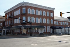
Port Clinton City Hall4.3 miles2000
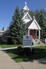
St. Thomas Episcopal Church4.4 miles1999
Island House4.5 miles2008
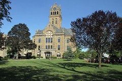
Ottawa County Courthouse4.5 miles1974

Sources for this property

National Archives recordThe nomination case file for reference 83002019 in Record Group 79.
Ottawa CountyAll 21 listed properties in this county.

Provenance

  • Listing record. National Park Service National Register of Historic Places, listed-properties dataset, current to 2026-05-22.
  • Map join. Address geocoded through the United States Census geocoder, then tested against the published boundary of every sheet in the USGS Historical Topographic Map Collection.
  • How this page is made. Listing fields come from federal records; map-sheet coverage is a labelled coordinate-to-boundary calculation, not a source-field claim.
  • Specimens. Global Biodiversity Information Facility (GBIF), https://www.gbif.org/. Only records licensed CC0 or CC BY are used. Records licensed CC BY-NC are excluded because this site carries advertising. Images are checked individually and any whose licence is non-commercial, no-derivatives or unreadable is refused.
  • Mines and quarries. USGS Mineral Resources Data System (MRDS) https://mrdata.usgs.gov/mrds/ A work of the United States government, no copyright under 17 U.S.C. 105.
  • Storms. NOAA National Centers for Environmental Information, Storm Events Database https://www.ncei.noaa.gov/stormevents/ A work of the United States government, no copyright under 17 U.S.C. 105. Narratives are quoted verbatim from the National Weather Service report and are not edited or summarised.