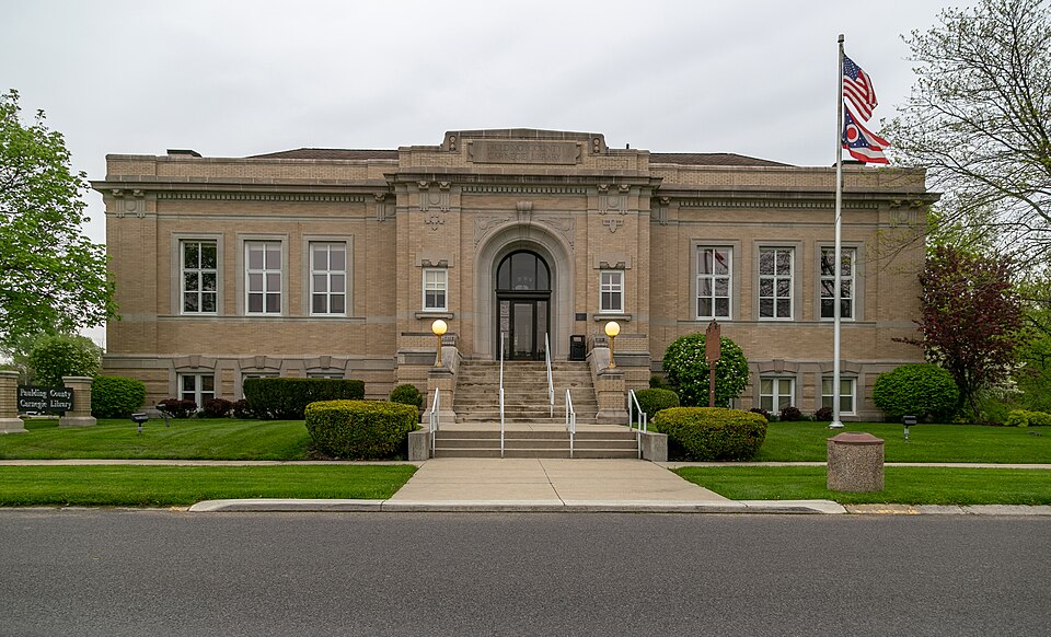
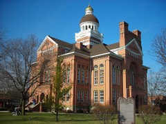
Listed on the National Register of Historic Places in
1983. A historic map-sheet match is not published yet. The record needs a coordinate-quality review before it can be joined to a sheet boundary.
From the record
“The Paulding County Carnegie Library is a historic Carnegie library in the village of Paulding, Ohio, United States. Constructed in the early twentieth century, it is a simple building that has served as the core of Paulding County's library system since its construction, and it has been designated a historic site.”
Wikipedia article Paulding County Carnegie Library, CC BY-SA 4.0.
one of 3 National Register listings in Paulding County · listed in 1983 · category: Building.
National Register reference number.83002021- the number the National Park Service assigned this property when it was listed, and the key its nomination file is catalogued under at the National Archives.
J. D. Bailey is one of the thriving young agriculturists of Paulding township. He first saw the light in Preble county, Ohio, on the 21st of April, 1854, the son of John I. and Mary (Lehmer) Bailey, natives of Pennsylvania and Ohio. The paternal grandparents were natives of Ireland and came to America during the Revolutionary war. The maternal ancestor was a farmer by occupation and one of the early settlers of Ohio. John I. Bailey came to Preble county in his boyhood and in early life worked at the carpenter's trade. He married Miss Fannie Harper, who died, leaving five children: Subsequently Miss Lehmer became his wife and they had ten children, nine of whom are living. Mr. Bailey 'was a self-made man and became a well-to-do farmer. He died in 1877, aged seventy-two years. Mrs. Bailey yet resides on the home farm, a 'venerable lady, beloved by all who know her. Three of her sons now reside in Paulding county, named: J. D., Oliver P. and S. M. Bailey. J. D. Bailey was married to Miss Josephine Bloom, of Preble county, on the 21st of December, 1876, and five children blessed this union, named: Rutherford H., Bertha M., Maud A., Grace A. and Chloe. Mr. Bailey came to Paulding county in May, 1885, locating on the farm where he now resides. He is one of the representative young men of the county, and as a politician, adheres to the principles of the republican party.
O. P. Bailey, farmer, was born in Preble county, Ohio, J anuary 15, 1861, the son of John I. Bailey. He was reared a farmer's boy, and received a common school education. He began life, first at saw-milling, in Darke county, Ohio; later engaged in farming, and in the fall of 1887 sold out and removed to Paulding county, purchasing his present farm of sixty-six acres, and where he has since resided. He is a progressive,
Regional context, not property-specific
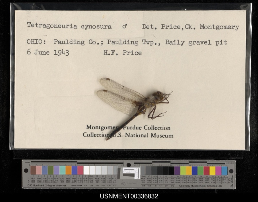
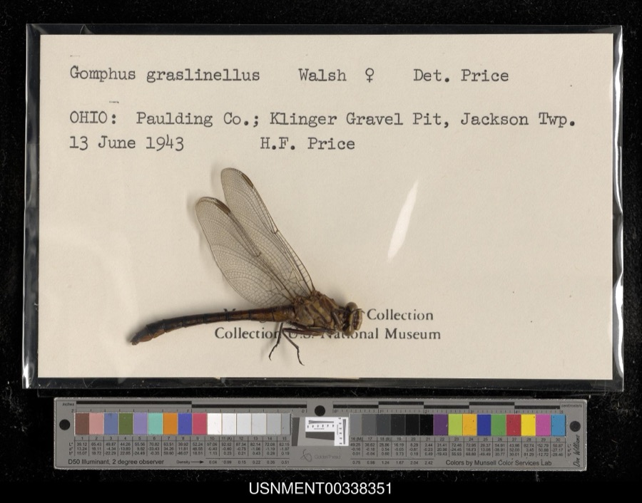
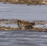
evidence. Museums hold 1,240 specimens
collected within 10 miles of Paulding County Carnegie Library between 1888 and
1973: 1,240 Animalia. 12 distinct Species records are shown.
Collected by Adler, K. K., C L CLARK FROM HOMER PRICE, CLARENCE CLARK and others. Each is a
physical object with a catalogue
number, and each entry opens the museum's record. This is what was
collected and kept, not a survey of what lives here - nothing can be
concluded from a species being absent.
Regional context, not property-specific
evidence. The federal mineral resources record lists
3 workings within 5 miles of Paulding County Carnegie Library: 1 past producer, 1 producer, 1 plant.
2 still produce. What was taken out: Limestone, General, Clay, Stone, Crushed/Broken, Magnesite, Stone, Crushed/Broken. Distance is straight-line from the
map coordinates, so a quarry counted here may appear on a neighbouring
settlement's page as well.
Regional context, not property-specific
evidence. The National Weather Service names
Paulding, the town this property stands in, in 35 storm reports between 1997 and 2017: 22 thunderstorm wind, 9 hail, 4 flash flood.
No death or injury is recorded in these reports. Each account below is quoted exactly as the forecast office
filed it, from the NOAA Storm Events Database, and each date
opens the federal record of that event.
A narrow band of thunderstorms continuously regenerated over Paulding county during the morning with emergency reporting flash flooding continuing into the afternoon. Numerous roads were closed with some completely washed out. The most serious flooding was around Blue Creek where more than two dozen homes had water into the first floor and some were evacuated. Sandbagging was needed in and around Blue Creek.
Emergency management officials reported estimated winds of at least 70 mph in many parts of the county with trees and tree limbs down. A tree was reported down onto a garage in the Paulding area.
Residents of the town of Payne began experiencing flash flooding during the early afternoon hours of the 27th as Flat Rock Creek responded rapidly to upstream runoff in Indiana as well as several inches of rain over the area. The threat increased the remainder of the day and into much of the 28th as several additional rounds of rain occurred. Numerous evacuations were needed along the creek in Payne and eventually about 8 miles downstream in Paulding where southern portions of the town were impacted. Several state and county roads were closed in the area due to the high water. Water levels began to recede late on the 28th into early on the 29th.
Emergency management officials reported shingles and siding blown off a house on County Road 117, just north of Highway 111. A six inch diameter tree was snapped, with a maple tree with signs of rot being blown over.
A narrow band of thunderstorms continuously regenerated over Paulding county during the morning. Rainfall was estimated to be over 8 inches in a 3 hour period. Emergency management reported flash flooding with 8 inches of water flowing over Ohio Route 613 and CR 87.
No historic map-sheet match is published
for this property yet. That does not mean no map exists. This record needs
a coordinate-quality review before it can be joined to a sheet boundary.
Browse the county's mapped places while that work is
pending.
From the nomination file
2,031 words on record
When this property was proposed for the
National Register, someone wrote the case for it: what the building is,
and why it matters. That document is a federal record in the public domain.
It is quoted below word for word, never summarised. The text was read off the scanned case file by machine, so the
occasional stray character is the recogniser's and the 1970s
typewriter's.
Statement of significance
(in one paragraph) county library funded by Andrew Carnegie, the noted philanthropist. Prior to the and towns of over 2,000 people. Paulding laid the groundwork for other small the county seat, the building is an important public edifice reflecting the community's they also designed the Rutherford B. Hayes Memorial Library in Fremont, Ohio, which was the first of the Presidential libraries. Vol. 20, April, 1981. 1800-1899 1500-1599 1600-1699 1700-1799 1400-1499 communications economics engineering transportation conservation Period industry philosophy theater humanitarian literature science music civic pride. agriculture 8.
Significance social/ The Paulding County Carnegie Library is historically and architecturally significant as law Builder/Architect Howard & Merriam Library represents the prevailing trend of the time toward adult education and self- Foundation concerning library grants.The Paulding County Carnegie Library is the first The library was designed by the Columbus-based architectural firm Howard and Merriam; representative of changes in the endowment and architectural policies of the Carnegie with these guidelines, the Paulding County Carnegie Library is a one story building ornamentation show influence of Beaux Arts Classicism.Within the context of Paulding, generosity as cities such as East Liverpool and Columbus.The Paulding County Carnegie politics/government _commerce _education -art invention X_1900- - archeology-prehistoric _ community planning _ landscape architecture _ religion establishment of the Paulding County Library, all Carnegie's grants had gone to cities improvement, adapted to the needs of a rural, rather than urban, community.
Quoted from the National Register nomination
for reference 83002021, 26 pages, held by the National Archives in Record
Group 79. See the
catalogue record.
Listed places nearby
1 within 8 miles
Other National Register properties close
enough to walk or drive between, ordered by distance from this one. Both
positions come from the same geocoding pass that matched these properties
to their map sheets.
Listing record. National Park Service National Register of Historic Places, listed-properties dataset, current to 2026-05-22.
Map join. Address geocoded through the United States Census geocoder, then tested against the published boundary of every sheet in the USGS Historical Topographic Map Collection.
How this page is made. Listing fields come from federal records; map-sheet coverage is a labelled coordinate-to-boundary calculation, not a source-field claim.
Specimens. Global Biodiversity Information Facility (GBIF), https://www.gbif.org/. Only records licensed CC0 or CC BY are used. Records licensed CC BY-NC are excluded because this site carries advertising. Images are checked individually and any whose licence is non-commercial, no-derivatives or unreadable is refused.
Mines and quarries. USGS Mineral Resources Data System (MRDS) https://mrdata.usgs.gov/mrds/ A work of the United States government, no copyright under 17 U.S.C. 105.
Storms. NOAA National Centers for Environmental Information, Storm Events Database https://www.ncei.noaa.gov/stormevents/ A work of the United States government, no copyright under 17 U.S.C. 105. Narratives are quoted verbatim from the National Weather Service report and are not edited or summarised.
 Block
Block