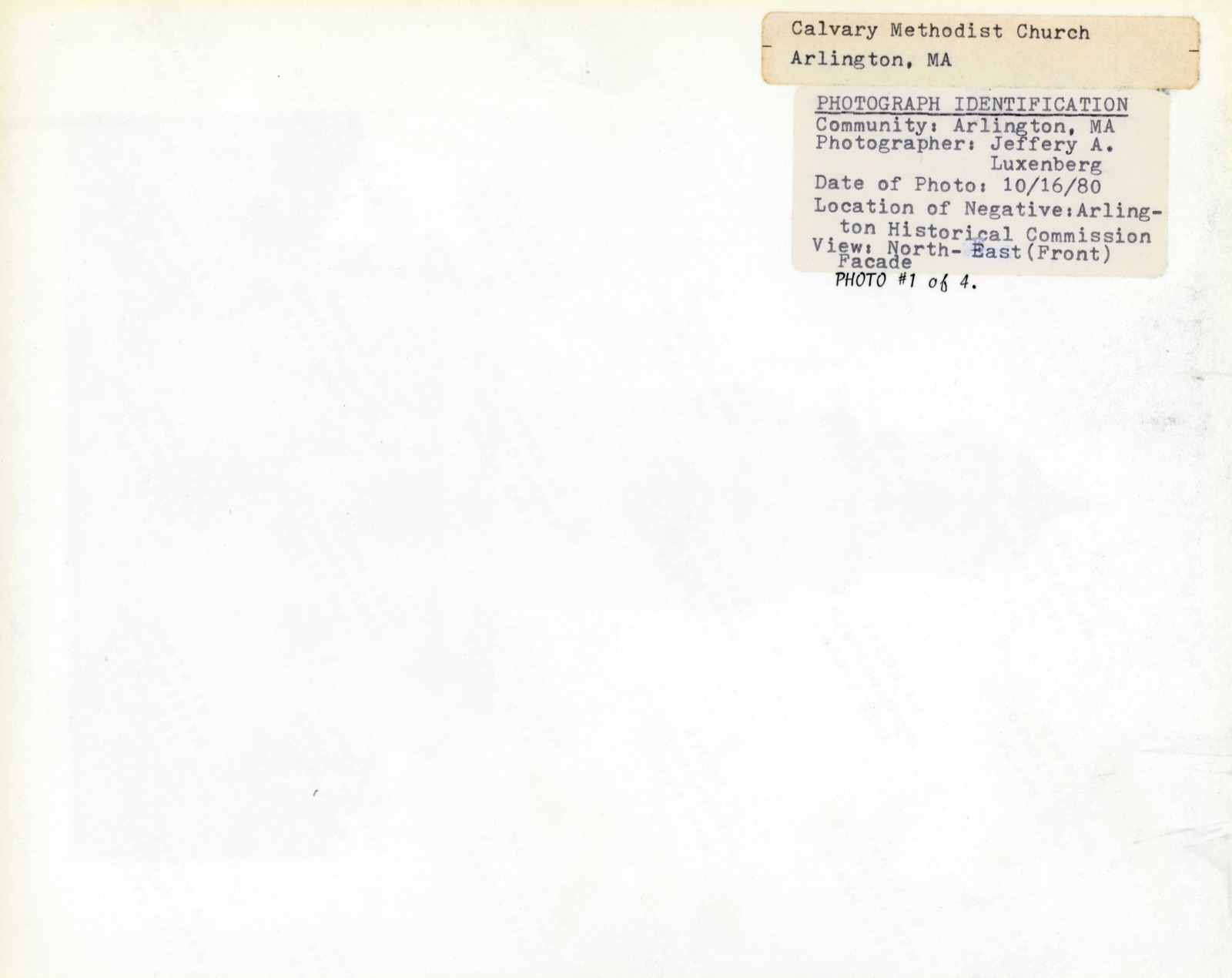
Photographs from the nomination case file, National Park Service records.
Calvary Methodist Church
Listed on the National Register of Historic Places in
1983. A historic map-sheet match is not published yet. The record needs a coordinate-quality review before it can be joined to a sheet boundary.
From the record
“Amos Bobbins was born in West Cambridge (now Arlington), Massachusetts, December 28,1817, and received a limited education in the public schools of the time and locality. At the age of fourteen he became a poultry buyer and dresser for his brother Nathan, who had been for some time established in Faneuil Hall Market in Boston.”
History of Middlesex County, Massachusetts, with Biographical Sketches of Many of Its Pioneers and Prominent Men (1890). Machine-read text.
one of 1100 National Register listings in Middlesex County · listed in 1983 · category: Building · one of 3 National Historic Landmarks in Middlesex County.
National Register reference number.83003433- the number the National Park Service assigned this property when it was listed, and the key its nomination file is catalogued under at the National Archives.
What happened here
An account from the chapter on Arlington town, The inset identifies its exact
source book and publication year.
The command of the party of exempts is variously attributed to Pavid Lams on, a private soldier from Cambridge during the French War (see Paige, 405, note),* and to Phillips Payson, A.M., pastor of a church in Chelsea [H. U. 1754, D.D. &c.], both of whom were probably present. Bancroft says two wagons sent out to the troops with supplies were waylaid and captured by Payson, the minister of Chelsea.' Gordon, Hist.
Particulars relating to the later years of the towns of West Cambridge and Arlington may not be so full, in certain respects, as some readers might wish ; but the comparative unimportance of the events of recent times in the place, and the increased accessibility of modern local records, are ^considered a suflScient explanation for any such apparent neglect.
In 1655 John Fownell sold to Henry Dunster, thirteen acres of the above laud in Charlestovvn, which he recovered by law, as we have already stated; being a portion of that land, which certain inhabitants of Charlestown, in 164G, gi-anted to Mr. Henry Dunster, President of the College, in Winottamy or Menotomy Field - Cambridge bounds one side, and Mystic Pond and River and Menotomy Brook the other sides. - Midd. Registry, i. 104, 5. This property is now included in the town of Arlington. The present Mystic street' is very near the former Charlestown line, which formed the eastern (or northern) boundary of Cooke's twenty acres, 1G42-1652. See Wyman's Clis. 312.
Regional context, not property-specific
evidence. The
federal wildfire occurrence database
lists 72 fires within 5 miles of Calvary Methodist Church between
2015 and 2020, burning about 98 acres in total. None started naturally. 28 were recorded as arson.
Distance is straight-line from the map coordinates, so a fire counted
here may appear on a neighbouring settlement's page as well.
Reported cause
Fires
Arson/incendiarism
28
Missing data/not specified/undetermined
16
Debris and open burning
12
Recreation and ceremony
10
Smoking
4
Misuse of fire by a minor
2
The most recent of
them, most recent first, with the day each was reported and the service
that recorded it.
Regional context, not property-specific
evidence. Museums hold 1,888 specimens
collected within 10 miles of Calvary Methodist Church between 1898 and
1975: 850 Animalia, 569 Plantae, 403 Fungi, 28 Protozoa, 17 Bacteria, 12 Chromista, 9 Unrecorded. 12 distinct Species records are shown.
Collected by ?, A B Seymour, A B. Proper and others. Each is a
physical object with a catalogue
number, and each entry opens the museum's record. This is what was
collected and kept, not a survey of what lives here - nothing can be
concluded from a species being absent.
Regional context, not property-specific
evidence. The federal mineral resources record lists
11 workings within 5 miles of Calvary Methodist Church: 7 plants, 4 past producers.
7 still produce. What was taken out: Iron, Lead, Tantalum, Niobium (Columbium). Distance is straight-line from the
map coordinates, so a quarry counted here may appear on a neighbouring
settlement's page as well.
Regional context, not property-specific
evidence. The National Weather Service names
Arlington, the town this property stands in, in 11 storm reports between 1998 and 2022: 7 thunderstorm wind, 2 hail, 1 flash flood, 1 flood.
No death or injury is recorded in these reports. Each account below is quoted exactly as the forecast office
filed it, from the NOAA Storm Events Database, and each date
opens the federal record of that event.
A microburst occurred in Arlington, downing numerous trees. Most of these trees were downed in an approximately 1 square mile section of eastern Arlington, between the intersection of Massachusetts Avenue and Broadway and Route 16 around the Cambridge/Arlington line. Numerous houses and vehicles were damaged by downed trees. Traffic signals and street lights were also damaged or downed by falling trees/wind.
Several trees and branches were downed at the corner of Washington and Arnold by thunderstorm winds. A tree was downed onto a car on Howard Street. A large branch on Dudley Street was downed onto wires.
In Arlington, a tree fell into a house on Hamlet Street. A tree was down on Quincy Street. |A tree was down on Allen Street near Broadway. A tree and wires were down on Sunnyside Avenue. A tree limb fell into the side of a house on Davis Avenue.
No historic map-sheet match is published
for this property yet. That does not mean no map exists. This record needs
a coordinate-quality review before it can be joined to a sheet boundary.
Browse the county's mapped places while that work is
pending.
From the nomination file
2,380 words on record
When this property was proposed for the
National Register, someone wrote the case for it: what the building is,
and why it matters. That document is a federal record in the public domain.
It is quoted below word for word, never summarised. The text was read off the scanned case file by machine, so the
occasional stray character is the recogniser's and the 1970s
typewriter's.
Description of the property
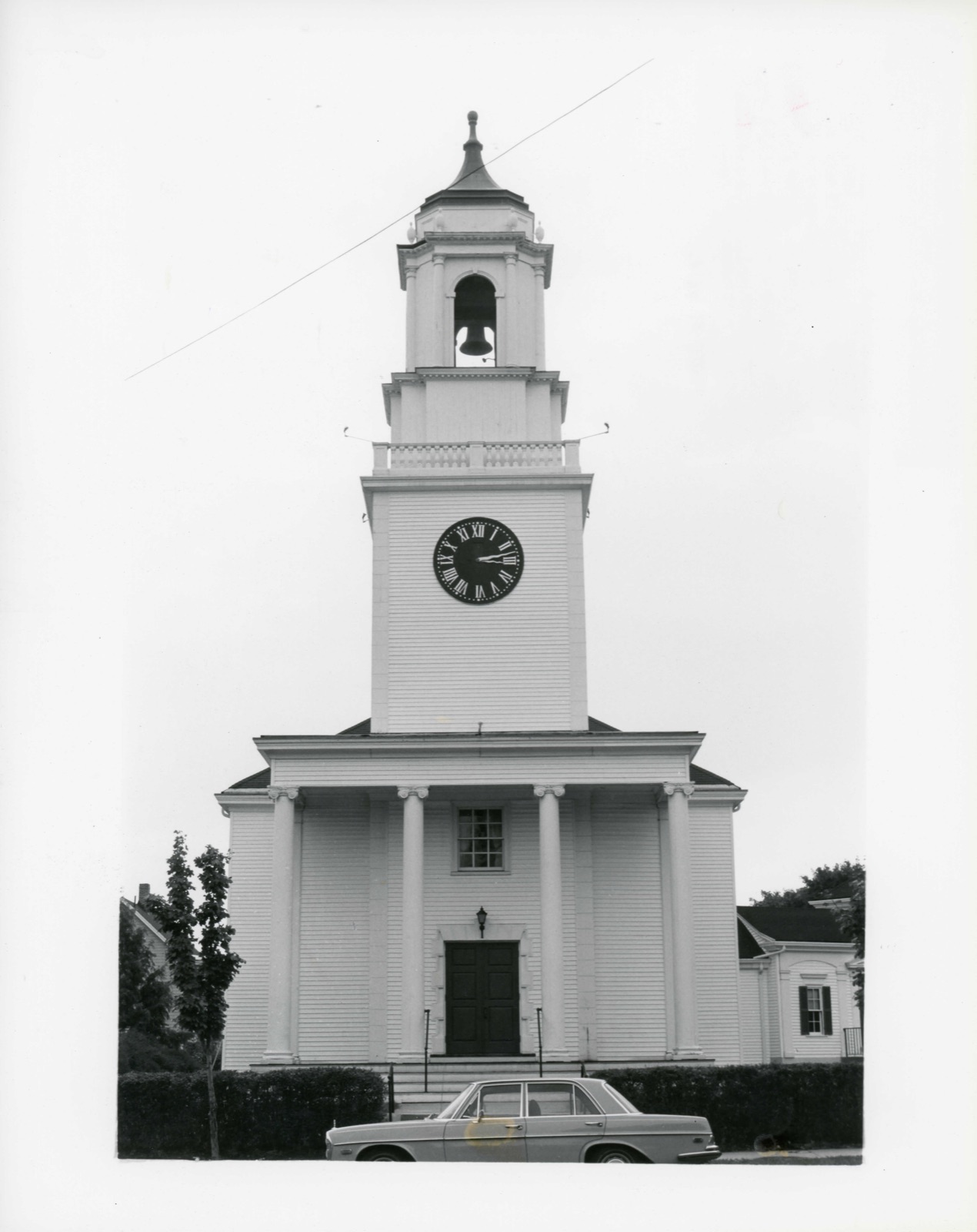
The Calvary Methodist Church (1923)is located at the corner of Massachusetts Avenue and Linwood Street adjacent to the civic core of Arlington, MA. Set back from the street, the church is surrounded by lawn and a low hedge at the It occupies a particularly prominent site on a broad curve of Massachusetts Avenue, thus being visible for several blocks. The plan and form of the Colonial Revival, wood-frame Calvary Methodist Church was inspired by the first stone church built in America, Kings Chapel (1749 , Peter Harrison; 1785, Charles Bulfinch modifications), at Tremont and School Streets, Boston. Among Bulfinch's contributions to this important piece of architecture were the execution in wood of Harrison's design for a colossal Ionic portico and plans for a belfry cupola, never built.
The Calvary Methodist Church departs from King's Chapel in material, detailing and fenestration, although basic similarities are evident; the belfry which terminates the tower is an original Bulfinch design (1809) for Boylston Market, Boston (demolished 1888 and donated to 1509) the church in 1921). The main body of the church is rectangular in plan with a hipped roof and minimal ornamentation; trim is confined to simple surrounds of four 2-story round-head windows on each side elevation. A range of small rectangular windows light the low basement level. The focal point of the church is its strongly projecting set on a stepped base, with a monumental tetrastyle Ionic portico and two stage tower and cupola.
The side elevations of the frontispiece contain' two 6/6 windows, arranged vertically and of slightly different proportions. Treatment of the central entry on the main facade is simple; large panelled double doors trimmed with rusticated blocks and surrounded by a 6/6 window set close to the portico soffit.
/Architect James H. MacNaughton and William J. Perry, Charles Bulfinch (cupola)Arlano Statement of Significance (in one paragraph) Durlan" ((parish house) The Calvary Methodist Church possesses integrity of location, design, materials, workmanship, feeling and association. Is is significant historically as a representation of continuing freedom of religion ex- pression in Arlington, and for its associations with the community's development in the early-mid 20th century.
Architecturally, the fact that it very nearly replicates King's Chapel, one of the most important ecclesiastical structures of the Colonial period combined with the integration of a genuinely important 18th century artifact sets it apart from the majority of Colonial Revival church buildings constructed in the early 20th century. Thus, the Calvary Methodist Church meets criteria A,. and C of the National Register of Historic Places. The Calvary Methodist Church can be considered the result of tertiary forces in the development of organized religion in the town of Arlington. Christian worship evolved from the prescribed "state" religion of the First Parish in the 17th and 18th centuries through splinter groups starting with the departure of the Baptists in 1790.
The development of Unitarian and Universalist faiths was even more tumultuous, with a major schism that occurred in 1840. In 1875, the first Episcopalian Church was established; it is from this congregation and through this evolutionary arm that : the Methodist sect emerged at the close of world war I. Calvary Methodist Church came to fruition through the efforts of a small but devoted group of Methodists who met at the Grand Army Hall for the first time in 1916. From this group of 64, the congregation grew to 107 in In 1918 join the Canadian Army, and the the first Pastor, Reverend Robert Bilsworth of Holliston was appointed minister.
Quoted from the National Register nomination
for reference 83003433, 13 pages, held by the National Archives in Record
Group 79. See the
catalogue record.
Listed places nearby
6 within 8 miles
Other National Register properties close
enough to walk or drive between, ordered by distance from this one. Both
positions come from the same geocoding pass that matched these properties
to their map sheets.
Listing record. National Park Service National Register of Historic Places, listed-properties dataset, current to 2026-05-22.
Map join. Address geocoded through the United States Census geocoder, then tested against the published boundary of every sheet in the USGS Historical Topographic Map Collection.
How this page is made. Listing fields come from federal records; map-sheet coverage is a labelled coordinate-to-boundary calculation, not a source-field claim.
Wildfire. Short, Karen C. 2022. Spatial wildfire occurrence data for the United States, 1992-2020 [FPA_FOD_20221014]. 6th Edition. Fort Collins, CO: Forest Service Research Data Archive. https://doi.org/10.2737/RDS-2013-0009.6 Collected with United States Government funding and usable without additional permissions or fees.
Specimens. Global Biodiversity Information Facility (GBIF), https://www.gbif.org/. Only records licensed CC0 or CC BY are used. Records licensed CC BY-NC are excluded because this site carries advertising. Images are checked individually and any whose licence is non-commercial, no-derivatives or unreadable is refused.
Mines and quarries. USGS Mineral Resources Data System (MRDS) https://mrdata.usgs.gov/mrds/ A work of the United States government, no copyright under 17 U.S.C. 105.
Storms. NOAA National Centers for Environmental Information, Storm Events Database https://www.ncei.noaa.gov/stormevents/ A work of the United States government, no copyright under 17 U.S.C. 105. Narratives are quoted verbatim from the National Weather Service report and are not edited or summarised.
 Block
Block