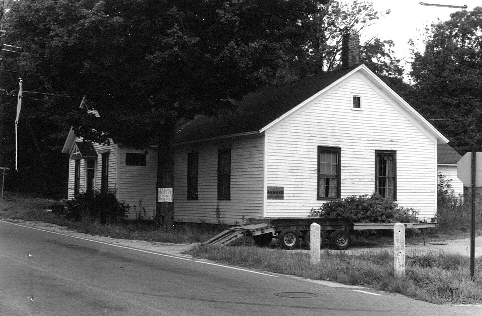
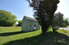
Photograph by Unknown author Unknown author, Public domain. Via
Wikimedia Commons.
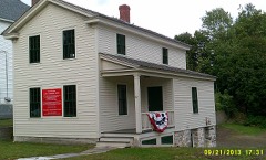
Dalton Grange Hall No. 23
Listed on the National Register of Historic Places in
1983. A historic map-sheet match is not published yet. The record needs a coordinate-quality review before it can be joined to a sheet boundary.
From the record
“Dalton Grange Hall No. 23 was a historic Grange hall in Dalton, Massachusetts. It was listed on the National Register of Historic Places in 1983, and demolished in 1987.”
Wikipedia article Dalton Grange Hall No. 23, CC BY-SA 4.0.
one of 94 National Register listings in Berkshire County · listed in 1983 · category: Building · one of 1 National Historic Landmarks in Berkshire County.
National Register reference number.83003924- the number the National Park Service assigned this property when it was listed, and the key its nomination file is catalogued under at the National Archives.
Fires near this property
99 since 2015
Regional context, not property-specific
evidence. The
federal wildfire occurrence database
lists 99 fires within 5 miles of Dalton Grange Hall No. 23 between
2015 and 2018, burning about 66 acres in total. None started naturally. 2 were recorded as arson.
Distance is straight-line from the map coordinates, so a fire counted
here may appear on a neighbouring settlement's page as well.
Reported cause
Fires
Debris and open burning
58
Recreation and ceremony
14
Smoking
7
Railroad operations and maintenance
5
Missing data/not specified/undetermined
5
Misuse of fire by a minor
4
Arson/incendiarism
2
Equipment and vehicle use
2
Other causes
1
Fireworks
1
The most recent of
them, most recent first, with the day each was reported and the service
that recorded it.
Regional context, not property-specific
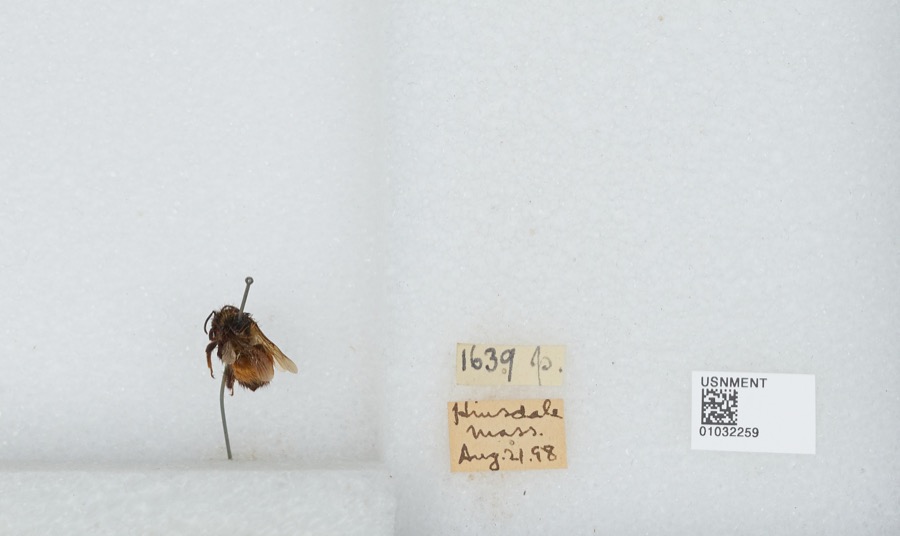
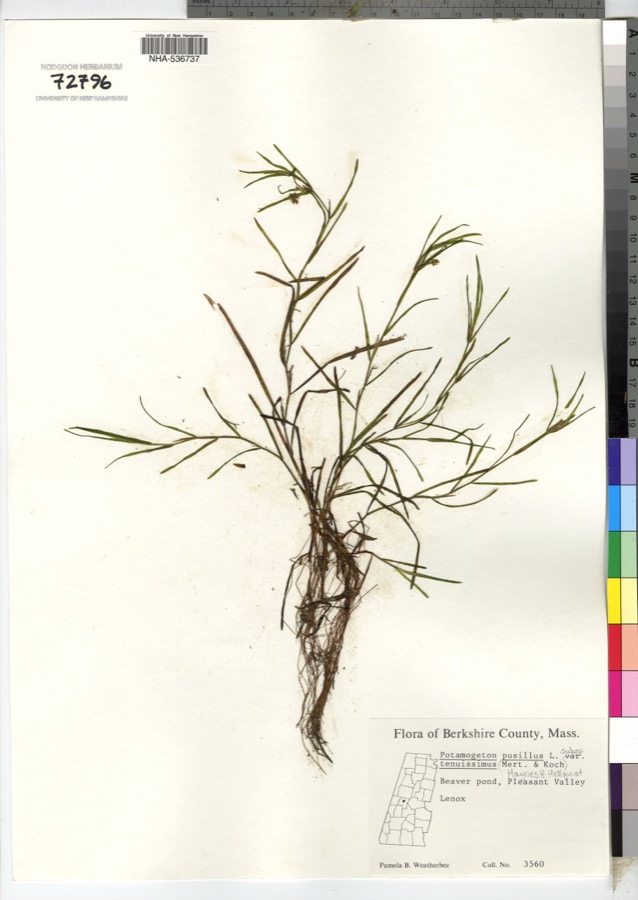
evidence. Museums hold 767 specimens
collected within 10 miles of Dalton Grange Hall No. 23 between 1835 and
1975: 350 Plantae, 224 Animalia, 189 Fungi, 4 Unrecorded. 12 distinct Species records are shown.
Collected by A K Harrison, A. K. Harrison, A. K. Harrison, Florence and others. Each is a
physical object with a catalogue
number, and each entry opens the museum's record. This is what was
collected and kept, not a survey of what lives here - nothing can be
concluded from a species being absent.
Regional context, not property-specific
evidence. The federal mineral resources record lists
12 workings within 5 miles of Dalton Grange Hall No. 23: 7 past producers, 4 producers, 1 unknown.
4 still produce. What was taken out: Sand and Gravel, Construction, Asbestos. Distance is straight-line from the
map coordinates, so a quarry counted here may appear on a neighbouring
settlement's page as well.
Regional context, not property-specific
evidence. The National Weather Service names
Dalton, the town this property stands in, in 19 storm reports between 1997 and 2024: 10 thunderstorm wind, 5 hail, 3 flash flood, 1 flood.
No death or injury is recorded in these reports. Each account below is quoted exactly as the forecast office
filed it, from the NOAA Storm Events Database, and each date
opens the federal record of that event.
During the afternoon of May 20, a cold frontal passage initiated an isolated severe thunderstorm in Berkshire County. The severe thunderstorm produced one inch hail at Dalton.
The National Weather Service in Albany, New York surveyed damage from the October 16, 2021 thunderstorm in and around Dalton, MA. There was sporadic damage in a southwest/northeast oriented path from just southeast of the center of Dalton to around two miles northeast of the center. The damage started at a lumber yard on West Housatonic Street where fiberglass sheathing and other debris was blown onto|the roadway. Nearby, a large tree was downed on a fence near Chamberlain Park. Continuing northeastward, several large trees and limbs were downed on the grounds of Wahconah Country Club. The most concentrated damage occurred along Orchard Road and its intersections with Appletree Lane and Pease Avenue. Several large hardwood and softwood trees were uprooted, and one large spruce tree was snapped, crushing a wooden pool house. Fence panels were blown in at two separate residences on Appletree Lane. There was also minor damage to roofs with some shingles missing at a couple of residences and one chimney damaged. The damage continued at Route 9 and Cleveland Avenue where trees were downed blocking both roads. The end of the visible damage swath occurred at Holiday Brook Farm, where the wind ripped off a couple of panels of aluminum roofing, tore a hole in a plastic greenhouse covering, and knocked over a wooden playset.||The trees were all downed in a south/north or southwest/northeast orientation, suggesting that the damage was due to strong straight-line winds. There was one tree downed onto a house and one onto a car, but no injuries were reported.
Moderate flooding occurred on the East Branch Housatonic River. The Coltsville |river gage located on right bank 250 feet downstream from the Hubbard Avenue Bridge at Coltsville, 1.2 miles upstream from Unkamet Brook, and 2 miles northeast of Pittsfield exceeded its 5 foot flood stage at 9:25 am EST August 28th, its 8 foot moderate flood stage 3:25 pm, crested at 8.20 feet at 4 pm, and fell below flood stage at 2:53 am August 29th.
No historic map-sheet match is published
for this property yet. That does not mean no map exists. This record needs
a coordinate-quality review before it can be joined to a sheet boundary.
Browse the county's mapped places while that work is
pending.
Named in the fire insurance atlases
Sanborn surveyors printed an index of the
town's establishments at the front of each atlas. This property is named in
one, read straight off the scanned sheet.
When this property was proposed for the
National Register, someone wrote the case for it: what the building is,
and why it matters. That document is a federal record in the public domain.
It is quoted below word for word, never summarised. The text was read off the scanned case file by machine, so the
occasional stray character is the recogniser's and the 1970s
typewriter's.
Description of the property
The Dalton Grange Hall No. 23, also known as the Bartonville Grange Hall, is located on a triangular ½ acre lot formed by the intersection of South Street and Grange Hall Road in western Dalton. Constructed in 1879, the Hall is a wood frame (clapboarded), 1½ story gable roof building distinguished by the asymmetry of its I-plan and spare simplicity of its vernacular Victorian design. Architectural interest is focussed on the three-bay gable end facade of the main hall which faces South Street (west) and is set close to the road. It retains all its original features: doub le door, center entry with two-light transom and gable hood; flanking narrow 4/4 windows with keavy projecting lintels; and small arched attic vent window in the gable field.
Narrow undecorated corner boards and cornice complete the building's frim. Fenestration elsewhere is composed of 6/6 double hung sash with plain surrounds, with one to three windows on each elevation. Those on the north, east, and south elevations of the main hall have been boarded over A secondary stagedoor entry is located on the north elevation in a lateral addition to the main hall constructed ca. 1900. Also added ca. 1900 and no longer standing was a single lane bowling alley shed entered through a door at the west corner of the north elevation. The decay and removal of this addition has caused sill damage to this area of the building (photo 1). A small one-story kitchen ell tucked at the rear (east) intersection of the two major wings dates from the original build or soon thereafter.
The building sits on a low mortared fieldstone foundation enclosing a crawl space. Iwo interior brick chimneys are located at the rear (east) of the main hall and south end of the dining hall.
/Architect Building Committee: John S. Barton Statement of Significance (inone paragraph) Robert A. Rice; Henry A. Barton, Sr.; W.M. Hathaway-sawed lumber; C.R. Lawrence & Brother Plastering; M. Shaw of Pittsfield - Lathing The Dalton Grange Hall #23 retains integrity of setting, location, design, materials, workmanship, and association. It is historically significant as an early and continuous representation of the Grange movement from the late 19th century to the present; it was the first Grange Hall in Massachusetts to have been constructed and owned by its members. In its simple and well-proportioned vernacular architectural design, it reflects both the efforts and aspiration of the rural community.
The Dalton Grange Hall #23 thus meets criteria A and C of the National Register of Historic Places. Founded in the last quarter of the 19th century by Oliver Kelley of Washington State, The National Grange movement grew out of earlier localized agricultural clubs. Its primary distinctive characteristics were emphasis on rural living as well as agriculture, secrecy, and lack of gender limitation. The organization of the Dalton Grange on formed. These early organizing steps occurred concurrently with the economic depression of 1873 and represent the agricultural community's urgent need for a powerful organization to protect their interests. Dalton Grange Hall #23 was among the earliest, and perhaps the pioneer, local grange association in the state.
The initial membership of the Dalton Grange #23 was 22 Charter members including: Henry A. Barton, Sr., Master; Sylvester L. Young, Secretary and John S. Barton, Treasurer. Meetings were first held in the Town Hall and later in the Baronville School House. Within six years membership numbers and local enthusiasum levels had risen sufficiently to warrant construction of a permanent home for the Grange; from conception to dedication, building committee, composed of John A. Barton, Robert A.
Quoted from the National Register nomination
for reference 83003924, 13 pages, held by the National Archives in Record
Group 79. See the
catalogue record.
Listed places nearby
6 within 8 miles
Other National Register properties close
enough to walk or drive between, ordered by distance from this one. Both
positions come from the same geocoding pass that matched these properties
to their map sheets.
Listing record. National Park Service National Register of Historic Places, listed-properties dataset, current to 2026-05-22.
Map join. Address geocoded through the United States Census geocoder, then tested against the published boundary of every sheet in the USGS Historical Topographic Map Collection.
How this page is made. Listing fields come from federal records; map-sheet coverage is a labelled coordinate-to-boundary calculation, not a source-field claim.
Wildfire. Short, Karen C. 2022. Spatial wildfire occurrence data for the United States, 1992-2020 [FPA_FOD_20221014]. 6th Edition. Fort Collins, CO: Forest Service Research Data Archive. https://doi.org/10.2737/RDS-2013-0009.6 Collected with United States Government funding and usable without additional permissions or fees.
Specimens. Global Biodiversity Information Facility (GBIF), https://www.gbif.org/. Only records licensed CC0 or CC BY are used. Records licensed CC BY-NC are excluded because this site carries advertising. Images are checked individually and any whose licence is non-commercial, no-derivatives or unreadable is refused.
Mines and quarries. USGS Mineral Resources Data System (MRDS) https://mrdata.usgs.gov/mrds/ A work of the United States government, no copyright under 17 U.S.C. 105.
Storms. NOAA National Centers for Environmental Information, Storm Events Database https://www.ncei.noaa.gov/stormevents/ A work of the United States government, no copyright under 17 U.S.C. 105. Narratives are quoted verbatim from the National Weather Service report and are not edited or summarised.
 Block
Block