Listed on the National Register of Historic Places in
1983. A historic map-sheet match is not published yet. The record needs a coordinate-quality review before it can be joined to a sheet boundary.
From the record
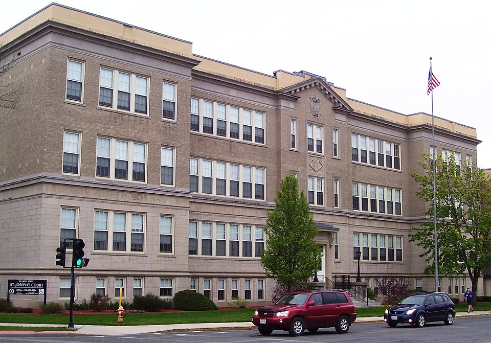
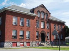
“Joseph's School is a historic former school building located at 85 Eagle Street at the intersection of Union Street in North Adams, Massachusetts. It is a brick Classical Revival structure, built, in 1928-29 as an expansion of an older building.”
Wikipedia article St. Joseph's School (North Adams, Massachusetts), CC BY-SA 4.0.
one of 94 National Register listings in Berkshire County · listed in 1983 · category: Building · one of 1 National Historic Landmarks in Berkshire County.
National Register reference number.83003928- the number the National Park Service assigned this property when it was listed, and the key its nomination file is catalogued under at the National Archives.
Fires near this property
31 since 2006
Regional context, not property-specific
evidence. The
federal wildfire occurrence database
lists 31 fires within 5 miles of St. Joseph's School between
2006 and 2020, burning about 310 acres in total. None started naturally. None was recorded as arson.
Distance is straight-line from the map coordinates, so a fire counted
here may appear on a neighbouring settlement's page as well.
Reported cause
Fires
Debris and open burning
15
Recreation and ceremony
5
Smoking
5
Equipment and vehicle use
4
Missing data/not specified/undetermined
2
The most recent of
them, most recent first, with the day each was reported and the service
that recorded it.
Regional context, not property-specific
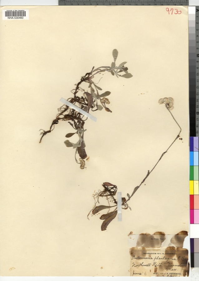
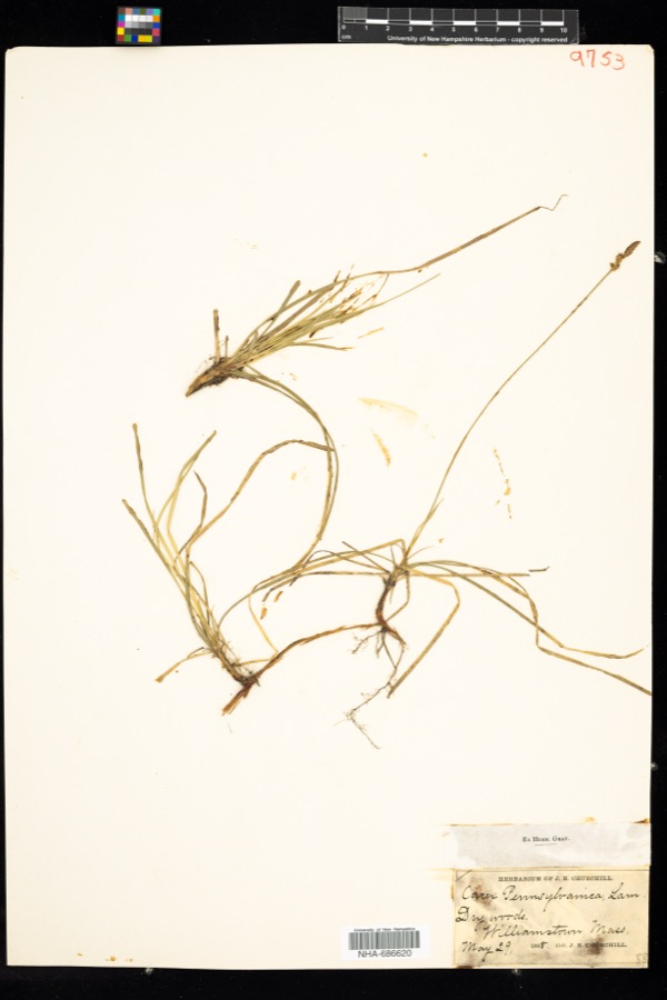
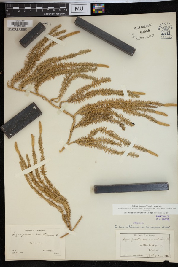
evidence. Museums hold 855 specimens
collected within 10 miles of St. Joseph's School between 1828 and
1975: 428 Plantae, 246 Animalia, 164 Fungi, 11 Protozoa, 3 Chromista, 3 Unrecorded. 12 distinct Species records are shown.
Collected by A K Harrison, A Schwartz, A. H. Gustafson and others. Each is a
physical object with a catalogue
number, and each entry opens the museum's record. This is what was
collected and kept, not a survey of what lives here - nothing can be
concluded from a species being absent.
Regional context, not property-specific
evidence. The federal mineral resources record lists
11 workings within 5 miles of St. Joseph's School: 4 producers, 4 past producers, 1 plant, 1 unknown.
5 still produce. What was taken out: Stone, Crushed/Broken, Limestone, General, Sand and Gravel, Construction, Calcium. Distance is straight-line from the
map coordinates, so a quarry counted here may appear on a neighbouring
settlement's page as well.
Regional context, not property-specific
evidence. The National Weather Service names
North Adams, the town this property stands in, in 50 storm reports between 1994 and 2024: 26 thunderstorm wind, 10 hail, 5 lightning, 5 flash flood.
The reports record 1 injury. Each account below is quoted exactly as the forecast office
filed it, from the NOAA Storm Events Database, and each date
opens the federal record of that event.
A National Weather Service Storm Survey Team found straight line wind damage in North Adams. Most of the damage was confined to a one half mile, by two block area on the campus of the Massachusetts College of Liberal Arts.||Significant roof damage occurred to three college dormitories, mostly from tin flashing that was torn off due to the strong winds. In addition, several trees and large tree limbs were also downed, one of which smashed a car in the parking lot near the alumni office on Montana Street. Approximately 400 students were evacuated due to the damage.||The damage was consistent with maximum wind speeds of near 100 MPH.
Clarksburg Town Administrator Carl McKinney reported Millard Avenue suffering serious damage from heavy rainfall. In addition, the Clarksburg Town Hall basement was taking on water.
Early on August 16, lightning from a thunderstorm struck a house in North Adams, narrowly missing a man. Lightning produced a hole inside a bedroom and damaged a peak in the house. A small fire, started by the same lightning bolt, briefly flared up. Firemen were also deployed to the house, but the fire had been extinguished before they arrived.
Lightning struck a utility pole outside the back of the North Adams Regional Hospital around 13:37 EST, which sent an electrical surge throughout the hospital. This melted a wire in the electrical panel inside the hospital that controlled an elevator, making the elevator unserviceable.
A routine inspection during the morning of Saturday, December 26th resulted in the discovery of a landslide outside the west portal of the Hoosac Tunnel near North Adams. Eight inches of mud and stone had to be cleared from the rails, resulting in two freight trains being delayed. The cause was likely due to the heavy rains on Friday, December 25th.
Flash flooding was reported in North Adams as a result of heavy rainfall from thunderstorms. State Street was impassable due to flooding and was temporarily closed.
Flash flooding was reported on Church Street north of Adams as a result of heavy rainfall from thunderstorms. The force of flooding removed manhole covers off the road.
Flash flooding was reported in North Adams due to heavy rainfall from repeated thunderstorms. Several roads in the downtown portion of the city were closed due to the flooding.
Persistent moderate to heavy rainfall led to isolated flooding in portions of Berkshire County during the late morning and early afternoon hours of Tuesday September 11th. Flooding closed a portion of Massachusetts Route 2 in the town of Florida from 1143 LST to 1400 LST. In addition, several roads were closed in and around North Adams due to high water, including a portion of River Street, from Houghton Street to Brown Street, as well as a portion of Beaver Street and Mohawk Forest Boulevard. North Adams City firefighters also pumped water out of several private residences on Pleasant Street and State Road.||
Numerous large tree limbs and wires were reported down in and near North Adams due to strong thunderstorm winds. One downed large tree limb on Massachusetts Avenue in North Adams between Roberts Drive and Demond Avenue obstructed the road, reducing traffic to one lane.
No historic map-sheet match is published
for this property yet. That does not mean no map exists. This record needs
a coordinate-quality review before it can be joined to a sheet boundary.
Browse the county's mapped places while that work is
pending.
From the nomination file
2,802 words on record
When this property was proposed for the
National Register, someone wrote the case for it: what the building is,
and why it matters. That document is a federal record in the public domain.
It is quoted below word for word, never summarised. The text was read off the scanned case file by machine, so the
occasional stray character is the recogniser's and the 1970s
typewriter's.
Description of the property
St. Joseph's School is a threestory masonry building prominently situated at the northwest corner of Eagle Street (NR-1972) and Route 2 (Veterans Memorial Drive). It is bounded on the east by Eagle Street, on the south by Lincoln Street and Route 2, on the west by a former convent, and on the north by modern development. The structure stands as an anchor marking a major entrance to downtown North Adams. St. Joseph's School is characteristic of the Neo-Classical Revival style. The three-story building consists of a main mass, broken by a projecting gabled pavilion, and flanking wings which also project from the central block (Map-A). include a three story, square wing which was placed at the northwest corner in 1959 (Map-B).
There is also a more recent five story addition attached to the north elevation. Constructed in 1982, this wing is part of a certified rehabilitation project which was completed for the entire building complex. This addition is faced with brick and connected to the main building by a recessed aluminum and glass curtain wall (Map-C).- The original building rests on a partially exposed basement story which is fully incorpor- ated intó the design of the maïn building. The basement" and first story are constructed of coursed concrete blocks textured with coal and pink marble chips. The upper two stories are faced with buff brick; end elevation brick is laid in a geometric pattern. Separating the basement and second stories is a cast concrete, moulded water course.
first and second stories are divided by a concrete frieze and belt course inscribed 'Bonitatem et Disciplinam et Scientia Doce Une Domine."1 A wide plain cornice and simple parapet walls complete the roofline. The original main entrance is set within the gabled pavilion of the facade.
/Architect Architect: Unknown; Builder: D.J. Donahue Statement of Significance (in one paragraph) St. Joseph's School possesses integrity of location, design, materials, setting, and work- manship. Architecturally, the building is important as a rare survivor of Neo-Classical architecture in North Adams. Its historical significance derives from its origins in the late 19th century as the only Roman Catholic parochial school in a city whose economic base relied heavily on its Irish population to constitute much of the city's labor force. The school today is one of the few extant buildings reflecting this impor- tant immigrant heritage. Thus, St. Joseph's School meets Criteria A and C of the National Fegister of Historic Places.
Irish inmigrants first came to North Adams in 1830 to work in the first cotton print works factory that had been started by Caleb Turner in the 1820s. The town's substantial growth, in terms of its industrial development at this time, is attributable to these immigrants who constituted much of the work force. Newly established mills existed in such areas as "The Beaver"' (NR 1973), ''The Union" , Braytonville and Blackinton. By the mid 1850s large numbers of Roman Catholic Irishmen and their families had immigrated to North Adams, finding employment in the North Adams Iron Company, a wholesale shoe factory and/or the textile (wool and cotton) mills. For nearly two decades the Irish conmunity lacked a church.
In 1848 a mission was established by Father Cavanaigh, and mass was performed four times a year. Sixteen years later, land was purchased at the corner of Eagle and Union Streets, and in 1869, St. Francis Church was completed. The construction of the town's first Catholic church, together with the incorporation of North Adams in 1878 as a municipality separate from Adams, prompted plans for a parochial school.
Quoted from the National Register nomination
for reference 83003928, 12 pages, held by the National Archives in Record
Group 79. See the
catalogue record.
Listed places nearby
6 within 8 miles
Other National Register properties close
enough to walk or drive between, ordered by distance from this one. Both
positions come from the same geocoding pass that matched these properties
to their map sheets.
Listing record. National Park Service National Register of Historic Places, listed-properties dataset, current to 2026-05-22.
Map join. Address geocoded through the United States Census geocoder, then tested against the published boundary of every sheet in the USGS Historical Topographic Map Collection.
How this page is made. Listing fields come from federal records; map-sheet coverage is a labelled coordinate-to-boundary calculation, not a source-field claim.
Wildfire. Short, Karen C. 2022. Spatial wildfire occurrence data for the United States, 1992-2020 [FPA_FOD_20221014]. 6th Edition. Fort Collins, CO: Forest Service Research Data Archive. https://doi.org/10.2737/RDS-2013-0009.6 Collected with United States Government funding and usable without additional permissions or fees.
Specimens. Global Biodiversity Information Facility (GBIF), https://www.gbif.org/. Only records licensed CC0 or CC BY are used. Records licensed CC BY-NC are excluded because this site carries advertising. Images are checked individually and any whose licence is non-commercial, no-derivatives or unreadable is refused.
Mines and quarries. USGS Mineral Resources Data System (MRDS) https://mrdata.usgs.gov/mrds/ A work of the United States government, no copyright under 17 U.S.C. 105.
Storms. NOAA National Centers for Environmental Information, Storm Events Database https://www.ncei.noaa.gov/stormevents/ A work of the United States government, no copyright under 17 U.S.C. 105. Narratives are quoted verbatim from the National Weather Service report and are not edited or summarised.
 Block
Block