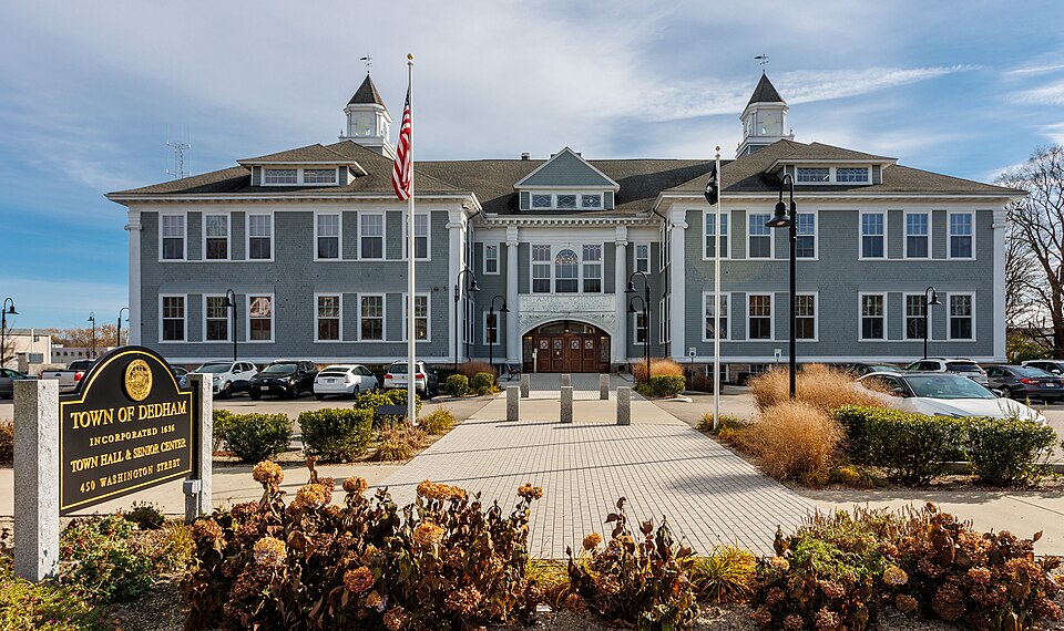
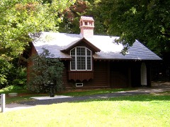
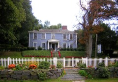
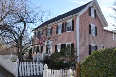
Built in 1898 in the Shingle style architecture. Listed on the National Register of Historic Places in
1983. A historic map-sheet match is not published yet. The record needs a coordinate-quality review before it can be joined to a sheet boundary.
From the record
“The Ames Schoolhouse is an historic school building at 450 Washington Street in Dedham, Massachusetts. It was originally part of the Dedham Public Schools.”
Wikipedia article Ames Schoolhouse, CC BY-SA 4.0.
one of 249 National Register listings in Norfolk County · listed in 1983 · category: Building · built in 1898, Shingle style architecture · one of 2 National Historic Landmarks in Norfolk County.
National Register reference number.83004284- the number the National Park Service assigned this property when it was listed, and the key its nomination file is catalogued under at the National Archives.
It is the design of this volume to show the origin and growth of school privileges in an old New England town. As the chief factor of every school is the teacher, special attention has been given to ascertain who have held that responsible office in Dedham ; for it is not to be doubted that their influence has shaped in a large degree the moral and intellectual character of the town. In making up this record we have often thought how difficult it would be to estimate the work of this long procession of public servants, under whose care the minds of Dedham citizens have been nurtured. We have therefore judged such a record worthy of preservation as a vital part of our town's history. As constant care was exercised that fit persons only should have charge of school instruction, it has been a chief pleasure in preparing this work to feel that it is done in behalf of men and women whose names ought not to be forgotten.
In 1634 the territory of Dedham, excepting the grassy meadows bordering on the Charles and Neponset rivers, and perhaps a few Indian cornfields, was still covered with a dense forest. A year later a small number of enterprising men from Watertown had discovered its value and desired to make it their permanent home ; and, to express entire satisfaction with their choice, would have called it Contentment. The next year, 1636, the town, in answer to their petition, was incorporated by the General Court of Massachusetts Bay, but it was named Dedham. The eight following years were a constant and hard struggle in subduing wild nature and making the place a safe and comfortable home for English emigrants. At the close of that period a little village or hamlet, consisting mostly of log houses covered with thatch, was clustered around the spot where the county buildings now stand ; and the area now occupied by Dedham Village was mostly cleared and under cultivation. A road connected the little settlement with Boston by way of Roxbury, and others were opened through East Street and to the estates occupying the tillage land of the Central plain. Thus the vigorous town was planted and had taken firm root in a congenial soil.
Regional context, not property-specific
evidence. The
federal wildfire occurrence database
lists 172 fires within 5 miles of Ames Schoolhouse between
2003 and 2020, burning about 435 acres in total. None started naturally. None was recorded as arson.
Distance is straight-line from the map coordinates, so a fire counted
here may appear on a neighbouring settlement's page as well.
Reported cause
Fires
Recreation and ceremony
91
Missing data/not specified/undetermined
49
Smoking
24
Equipment and vehicle use
5
Debris and open burning
3
The most recent of
them, most recent first, with the day each was reported and the service
that recorded it.
Regional context, not property-specific
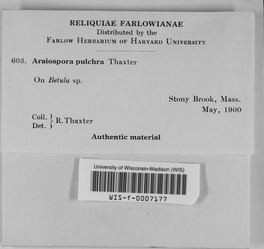
evidence. Museums hold 15,594 specimens
collected within 10 miles of Ames Schoolhouse between 1815 and
1975: 5,964 Plantae, 4,750 Fungi, 4,294 Animalia, 292 Protozoa, 191 Chromista, 66 Unrecorded, 37 Bacteria. 12 distinct Species records are shown.
Collected by (MARSDEN, H W), ?, ? ex Herb. W.G. Farlow and others. Each is a
physical object with a catalogue
number, and each entry opens the museum's record. This is what was
collected and kept, not a survey of what lives here - nothing can be
concluded from a species being absent.
Regional context, not property-specific
evidence. The federal mineral resources record lists
5 workings within 5 miles of Ames Schoolhouse: 3 past producers, 1 producer, 1 unknown.
1 still produces. What was taken out: Sand and Gravel, Construction, Granite, Stone, Stone, Crushed/Broken. Distance is straight-line from the
map coordinates, so a quarry counted here may appear on a neighbouring
settlement's page as well.
Regional context, not property-specific
evidence. The National Weather Service names
Dedham, the town this property stands in, in 6 storm reports between 1999 and 2023: 3 thunderstorm wind, 1 lightning, 1 heavy rain, 1 flash flood.
No death or injury is recorded in these reports. Each account below is quoted exactly as the forecast office
filed it, from the NOAA Storm Events Database, and each date
opens the federal record of that event.
No historic map-sheet match is published
for this property yet. That does not mean no map exists. This record needs
a coordinate-quality review before it can be joined to a sheet boundary.
Browse the county's mapped places while that work is
pending.
From the nomination file
2,931 words on record
When this property was proposed for the
National Register, someone wrote the case for it: what the building is,
and why it matters. That document is a federal record in the public domain.
It is quoted below word for word, never summarised. The text was read off the scanned case file by machine, so the
occasional stray character is the recogniser's and the 1970s
typewriter's.
Description of the property
The Ames School faces northwest on Washington Street (now Route 1A) just south of Dedham's Business District. Set back 120 feet from the street, on a 2.04 acre plot, the School- house is a freestanding structure presently surrounded by an asphalt playground which gradually slopes to the rear (photos 1 and 2). Fire Station, Town Offices, two gasoline stations, and densely packed commercial build- ings; architecturally they comprise Modern, 19th century and Colonial Revival styles. Across the street, and to the west, 19th century houses, separated from the road anc each other by lawns, Shrubs, and large trees, impart a domestic, suburban atmosphere. Several Greek Revival homes of brick or wooden frame constructionlead from the west, along Washington Street, to the Ames Schoolhouse.
Residences also abut the southern property line, but most of them are separated by back yards and a screen of deciduous trees- Occupying the largest site on this part of Washington Street, and standing larger than any of its neighbors, the Ames Schoolhouse physically dominates this area. By its restrained monumentality, and good state of preservation, it emerges not only as a functionally valuable link in Dedham's suburban fabric, but also as a commendable example of school architecture at the turn of the 19th century. Constructed in 1878, the Ames School is an imposing structure exhibiting elements of Colonial Revival and Shingle Style design.
It is symmetrically organized with a recessed central bay flanked by classroom wings, thus creating a H-Shaped plan which satisfied the requirements of a grammar school. It rises two stories from a foundation hangim of roughfaced pink Dedham granite to overhanging hip roofs currently covered with asphalt shingles.
/Architect Luther Greenleaf and Albert W. Cobb Statement of Significance (in one paragraph) The Ames Schoolpossesses integrity of location, design, materials, workmanship, feeding and association. Built on the site of Dedham's first school, it possesses romantic associations with the town's illustrious seventeenth century origins. As an impressive public building it directly represents the town's development as a prosperous suburb. Finally, it is an excellent example of a monumentally scaled turn-of-the-century school in a Colonial Revival/Shingle style design. Thus, the Ames School meets criteria A and C of the National Register of Historic Places. The Ames Schoolhouse was dedicated on Jüne 17th, 1896 to serve children in grades 1-6.
It was erected on the-site of a free school established in 1645 and tried to evoke Dedham's past in both its architectural style and its motto ("'1664" , The Ames SchooIhouse : 1897, named in honor of Fisher Ames, a native of Dedham, a wise statesman, and a friend of Washington"). Records of the dedication reveal that the style of the school was expected to inculcate patriotic virtues in the children who attended it. Funded by general taxation of the entire population, the first Dedham school predated the 1648 statewide decree establishing local public schools. By 1649, a sahoolhouse with a watch tower was built on the site of the present Ames School. Over the years, this became the First Middle School district, ah institution which continued until 1981, when the Ames School closed.
While Dedham is perhaps best known as a Colonial and Federal period town, it continued to develop in the late 19th and early 20th centuries as a prosperous Boston suburb. During the 1880's and 1890's, Dedham outgrew its rural character.
Quoted from the National Register nomination
for reference 83004284, 16 pages, held by the National Archives in Record
Group 79. See the
catalogue record.
Listed places nearby
6 within 8 miles
Other National Register properties close
enough to walk or drive between, ordered by distance from this one. Both
positions come from the same geocoding pass that matched these properties
to their map sheets.
Listing record. National Park Service National Register of Historic Places, listed-properties dataset, current to 2026-05-22.
Map join. Address geocoded through the United States Census geocoder, then tested against the published boundary of every sheet in the USGS Historical Topographic Map Collection.
How this page is made. Listing fields come from federal records; map-sheet coverage is a labelled coordinate-to-boundary calculation, not a source-field claim.
Wildfire. Short, Karen C. 2022. Spatial wildfire occurrence data for the United States, 1992-2020 [FPA_FOD_20221014]. 6th Edition. Fort Collins, CO: Forest Service Research Data Archive. https://doi.org/10.2737/RDS-2013-0009.6 Collected with United States Government funding and usable without additional permissions or fees.
Specimens. Global Biodiversity Information Facility (GBIF), https://www.gbif.org/. Only records licensed CC0 or CC BY are used. Records licensed CC BY-NC are excluded because this site carries advertising. Images are checked individually and any whose licence is non-commercial, no-derivatives or unreadable is refused.
Mines and quarries. USGS Mineral Resources Data System (MRDS) https://mrdata.usgs.gov/mrds/ A work of the United States government, no copyright under 17 U.S.C. 105.
Storms. NOAA National Centers for Environmental Information, Storm Events Database https://www.ncei.noaa.gov/stormevents/ A work of the United States government, no copyright under 17 U.S.C. 105. Narratives are quoted verbatim from the National Weather Service report and are not edited or summarised.
 Block
Block