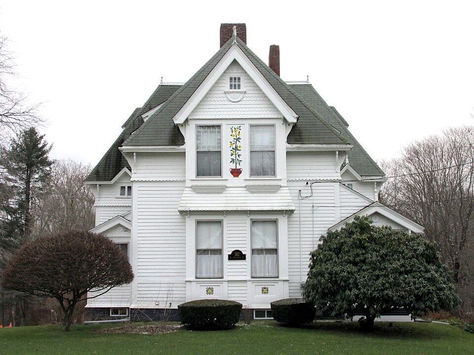
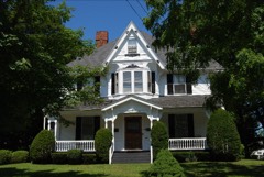
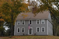
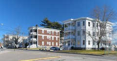
Built in 1885 in the Queen Anne style. Listed on the National Register of Historic Places in
1984. A historic map-sheet match is not published yet. The record needs a coordinate-quality review before it can be joined to a sheet boundary.
From the record
“Macomber House is a historic house located at 312 W. Macomber, who was employed at Reed & Barton.”
Wikipedia article Calvin T. Macomber House, CC BY-SA 4.0.
one of 272 National Register listings in Bristol County · listed in 1984 · category: Building · built in 1885, Queen Anne style · one of 8 National Historic Landmarks in Bristol County.
National Register reference number.84002174- the number the National Park Service assigned this property when it was listed, and the key its nomination file is catalogued under at the National Archives.
What happened here
An account from the chapter on Taunton city, The inset identifies its exact
source book and publication year.
How all the people are enjoying this nice weather we are having! Real summer weather. But to the farmers, or some in certain lines of farming, this moderate weather is "not so good." These premature samples of springtime are unfortunate, especially for the peach orchardist. As every groWar knows, peach trees are susceptible to cold weather, and if it does grow very cold again, and there is every likelihood of it, there will be much wood killed and a very small fruit yield in our section this coming season.
The Winslow Church. - The next church distinctively Congregational organized in Taunton was named, after the street where it worshiped, the Spring Street Church. Its membership of forty-four, with the exception of two from the West Taunton Church, came entirely from the Trinitarian Congregational Church, whose history has just been given. Its organization was in 1837, January 12th. S. Hopkins Emery, who studied at Amherst and Andover, was ordained and installed its first pastor Nov. 23, 1837, continuing in that relation until called to Bedford, January, 1841. Rev. Lathrop Taylor, a graduate of Middlebury College in 1839, succeeded him May 16, 1843, and resigned in July, 1845. He has been many years a most successful minister of the gospel in Illinois. The first pastor of the church was recalled and reinstalled Jan. 6, 1847, remaining pastor until the latter part of 1855, when he left to take the pastorate of the First Congregational Church in Quincy, 111., where he remained fourteen years, preaching afterward for limited periods in Chicago, Providence, Bridgeport, Conn., and North Middleborough, Mass. He was called to Taunton for the third time, and is now serving as secretary and superintendent of the
Associated Charities of Taunton. The Spring Street Church on leaving its first place of worship in 1853, March 23d, lor its new sanctuary, dropped its first name, and, in memory of Governor Edward Winslow, who in 1621 journeyed through the place, became the Winslow Church. Rev. Mortimer Blake, then the minister of Mansfield, was called to this church in 1855, and has remained its pastor twenty-seven years, with the manifest approval of heaven upon his labors.
Regional context, not property-specific
evidence. The
federal wildfire occurrence database
lists 69 fires within 5 miles of Macomber, Calvin T., House between
2003 and 2020, burning about 48 acres in total. 1 started naturally. None was recorded as arson.
Distance is straight-line from the map coordinates, so a fire counted
here may appear on a neighbouring settlement's page as well.
Reported cause
Fires
Missing data/not specified/undetermined
33
Debris and open burning
14
Recreation and ceremony
8
Smoking
7
Misuse of fire by a minor
2
Fireworks
2
Power generation/transmission/distribution
1
Equipment and vehicle use
1
Natural
1
The most recent of
them, most recent first, with the day each was reported and the service
that recorded it.
Regional context, not property-specific
evidence. Museums hold 1,569 specimens
collected within 10 miles of Macomber, Calvin T., House between 1855 and
1975: 1,014 Animalia, 367 Plantae, 179 Fungi, 6 Chromista, 2 Unrecorded, 1 Protozoa. 12 distinct Species records are shown.
Collected by ?, A E Schuyler, A. A. Eaton and others. Each is a
physical object with a catalogue
number, and each entry opens the museum's record. This is what was
collected and kept, not a survey of what lives here - nothing can be
concluded from a species being absent.
Regional context, not property-specific
evidence. The federal mineral resources record lists
9 workings within 5 miles of Macomber, Calvin T., House: 4 past producers, 4 producers, 1 unknown.
4 still produce. What was taken out: Sand and Gravel, Construction, Stone, Crushed/Broken. Distance is straight-line from the
map coordinates, so a quarry counted here may appear on a neighbouring
settlement's page as well.
Regional context, not property-specific
evidence. The National Weather Service names
Taunton, the town this property stands in, in 41 storm reports between 1995 and 2023: 18 thunderstorm wind, 8 hail, 5 heavy rain, 5 flood.
No death or injury is recorded in these reports. Each account below is quoted exactly as the forecast office
filed it, from the NOAA Storm Events Database, and each date
opens the federal record of that event.
Trees and branches were downed in several parts of town, including on Warner Boulevard, Somerset Avenue, and Glebe Street. One of these trees was downed onto a house, another onto a car.
An NWS storm survey team determined a microburst occurred in Taunton. Winds were estimated to be 70 to 80 mph. Six maple trees were uprooted on Tremont Street along Cobbs Creek, landing on four vehicles in the driveway behind a house. Several large branches were snapped and small sections of siding were torn off the house. A large spruce tree eight inches in diameter was blown onto a house and many other large tree limbs were snapped off trees. The house sustained minor damage. Two more trees fell behind this house. Numerous tree branches were downed. Behind another house, a tree fell taking down a portion of the back fence. On Eldridge Street, a silver maple tree about six inches in diameter was snapped near the base and fell onto a house. Several large branches were downed in this area as well. A sheet metal shed was blown into the next yard.
In Taunton, flash flooding stranded cars on Forest Street where the flood waters rose up to car doors. County Street was closed due to flooding at Ingell Street and in front of Pete's Market. In East Taunton, Middleboro Avenue was flooded near the Berkeley line and was described as a big lake. In Raynham, portions of North Street and Orchard Street were flooded and impassable.
Several streets were flooded with 3 to 5 inches of water. Washington Street was covered with 5 to 6 inches of water over a large area. This portion of the street was almost impassable.
No historic map-sheet match is published
for this property yet. That does not mean no map exists. This record needs
a coordinate-quality review before it can be joined to a sheet boundary.
Browse the county's mapped places while that work is
pending.
From the nomination file
978 words on record
When this property was proposed for the
National Register, someone wrote the case for it: what the building is,
and why it matters. That document is a federal record in the public domain.
It is reproduced in full on its own page, word for word and never summarised. The text was read off the scanned case file by machine, so the
occasional stray character is the recogniser's and the 1970s
typewriter's.
Quoted from the National Register nomination
for reference 84002174, 9 pages, held by the National Archives in Record
Group 79. See the
catalogue record.
Listed places nearby
6 within 8 miles
Other National Register properties close
enough to walk or drive between, ordered by distance from this one. Both
positions come from the same geocoding pass that matched these properties
to their map sheets.
Listing record. National Park Service National Register of Historic Places, listed-properties dataset, current to 2026-05-22.
Map join. Address geocoded through the United States Census geocoder, then tested against the published boundary of every sheet in the USGS Historical Topographic Map Collection.
How this page is made. Listing fields come from federal records; map-sheet coverage is a labelled coordinate-to-boundary calculation, not a source-field claim.
Wildfire. Short, Karen C. 2022. Spatial wildfire occurrence data for the United States, 1992-2020 [FPA_FOD_20221014]. 6th Edition. Fort Collins, CO: Forest Service Research Data Archive. https://doi.org/10.2737/RDS-2013-0009.6 Collected with United States Government funding and usable without additional permissions or fees.
Specimens. Global Biodiversity Information Facility (GBIF), https://www.gbif.org/. Only records licensed CC0 or CC BY are used. Records licensed CC BY-NC are excluded because this site carries advertising. Images are checked individually and any whose licence is non-commercial, no-derivatives or unreadable is refused.
Mines and quarries. USGS Mineral Resources Data System (MRDS) https://mrdata.usgs.gov/mrds/ A work of the United States government, no copyright under 17 U.S.C. 105.
Storms. NOAA National Centers for Environmental Information, Storm Events Database https://www.ncei.noaa.gov/stormevents/ A work of the United States government, no copyright under 17 U.S.C. 105. Narratives are quoted verbatim from the National Weather Service report and are not edited or summarised.
 Block
Block