BlockBefore
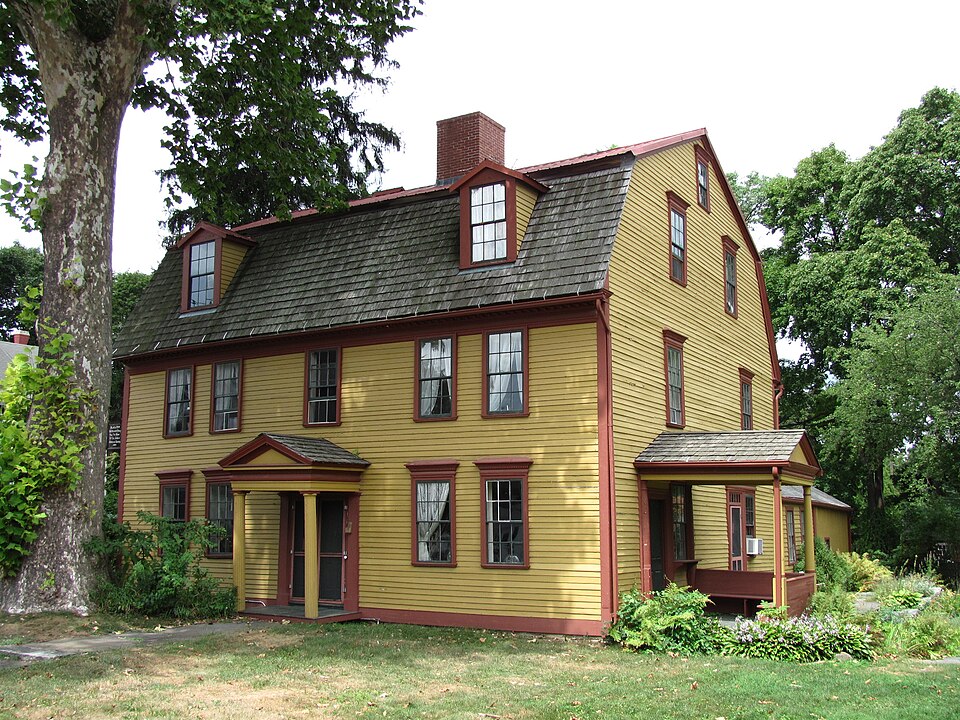
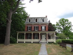
Photograph of Strong House
Photograph by John Phelan, CC BY 3.0. Via Wikimedia Commons.

Strong House

Listed on the National Register of Historic Places in 1984. A historic map-sheet match is not published yet. The record needs a coordinate-quality review before it can be joined to a sheet boundary.

From the record

“The Strong House is a historic house at 67 Amity Street in Amherst, Massachusetts. Built about 1744, it is one of Amherst's oldest surviving houses, and a fine example of mid-18th century Connecticut River Valley architecture.”

Wikipedia article Strong House (Amherst, Massachusetts), CC BY-SA 4.0.

one of 32 National Register listings in Hampshire County · listed in 1984 · category: Building.

Sources: the Wikipedia article · the case file at the National Archives · the National Register database, National Park Service · the Wikipedia article

The listing

  • What is counted as historic. The nomination lists 1 building as contributing to the listing.
  • Address. 67 Amity St., Amherst, 01002
  • When was it listed? 1984-07-05
  • Category. building
  • Township. Amherst Town city
  • National Register reference number. 84002457 - the number the National Park Service assigned this property when it was listed, and the key its nomination file is catalogued under at the National Archives.

Fires near this property

59 since 2002

Regional context, not property-specific evidence. The federal wildfire occurrence database lists 59 fires within 5 miles of Strong House between 2002 and 2020, burning about 53 acres in total. 3 started naturally. None was recorded as arson. Distance is straight-line from the map coordinates, so a fire counted here may appear on a neighbouring settlement's page as well.

Reported cause Fires
Missing data/not specified/undetermined30
Recreation and ceremony9
Debris and open burning8
Equipment and vehicle use8
Natural3
Railroad operations and maintenance1

The most recent of them, most recent first, with the day each was reported and the service that recorded it.

DateCause SizeReported by Name on the report
29 September 2017Missing data/not specified/undeterminedunder an acreMassachusetts Bureau of Forest Fire Controlnot named
28 September 2017Missing data/not specified/undeterminedunder an acreMassachusetts Bureau of Forest Fire Controlnot named
8 July 2004Naturalunder an acreMassachussetts State Fire Marshal's Officenot named
23 July 2016Missing data/not specified/undeterminedunder an acreMassachusetts Bureau of Forest Fire Controlnot named
23 July 2016Natural5.3 acresMassachusetts Bureau of Forest Fire Controlnot named
22 July 2017Equipment and vehicle useunder an acreMassachusetts Bureau of Forest Fire Controlnot named
14 July 2016Missing data/not specified/undeterminedunder an acreMassachusetts Bureau of Forest Fire Controlnot named
29 June 2002Recreation and ceremonyunder an acreMassachussetts State Fire Marshal's Officenot named

Every fire recorded in Hampshire County

Specimens collected near this property

12 of 10,189 shown

Regional context, not property-specific evidence. Museums hold 10,189 specimens collected within 10 miles of Strong House between 1781 and 1975: 4,233 Animalia, 3,541 Plantae, 2,190 Fungi, 132 Chromista, 80 Protozoa, 12 Unrecorded, 1 Bacteria. 12 distinct Species records are shown. Collected by A V Osmun, A. Albee, A. Allen and others. Each is a physical object with a catalogue number, and each entry opens the museum's record. This is what was collected and kept, not a survey of what lives here - nothing can be concluded from a species being absent.

Image SpeciesYear Collected by Where, as recorded
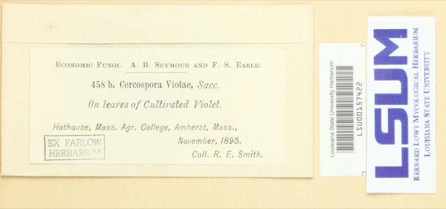
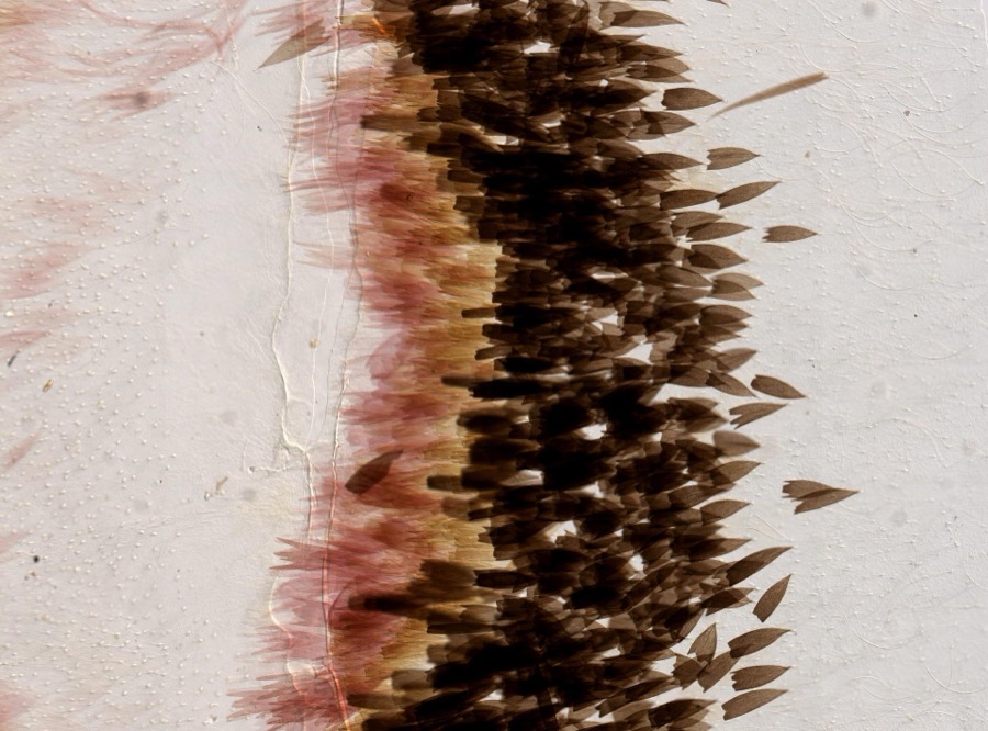
Specimen of Cercospora violae Sacc.Cercospora violae Sacc.1895Ralph E. SmithHothouse, Mass. Agr. College, Amherst
Specimen of Actias luna Linnaeus, 1758Actias luna Linnaeus, 17581896not recorded
Specimen of Plathemis lydia (Drury, 1773)Plathemis lydia (Drury, 1773)1896not recorded
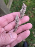
A photograph of the species Carex argyrantha, not of this specimenCarex argyrantha Tuck. ex Dewey1781H. G. JesupAmherst in Hampshire Co., and Leverett in Franklin Co., Massachusetts. [Inferred counties from precise loc.]
A photograph of the species Carex foenea, not of this specimenCarex foenea Willd.1781H. G. JesupAnd Leverett
A photograph of the species Ustilago nuda, not of this specimenUstilago nuda (C.N.Jensen) Kellerm. & Swingle1810J.E. Humphrey
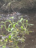
A photograph of the species Ranunculus ambigens, not of this specimenRanunculus ambigens S.Watson1831S. Shurtleff
A photograph of the species Kalmia angustifolia, not of this specimenKalmia angustifolia f. angustifolia1838L. DeWetteNorthampton.
A photograph of the species Kalmia latifolia, not of this specimenKalmia latifolia var. latifolia1838L. DeWetteNorthampton.
A photograph of the species Pogonia ophioglossoides, not of this specimenPogonia ophioglossoides (L.) Ker Gawl.1838L. DeWetteNorthampton.
A photograph of the species Dactylis glomerata, not of this specimenDactylis glomerata L.1839S J Ewer
A photograph of the species Solidago arguta, not of this specimenSolidago arguta Aiton1841Collector(s): Henry Holmes Babcock, Henry Griswold JesupAmherst

All 10,189 specimens within 10 miles, at the Global Biodiversity Information Facility.

Mines and quarries near this property

10 of 14 shown

Regional context, not property-specific evidence. The federal mineral resources record lists 14 workings within 5 miles of Strong House: 6 producers, 6 past producers, 1 occurrence, 1 unknown. 6 still produce. What was taken out: Sand and Gravel, Construction, Brick Clay, Clay, Stone, Crushed/Broken. Distance is straight-line from the map coordinates, so a quarry counted here may appear on a neighbouring settlement's page as well.

Where SiteCommodity StatusRecorded
Amherst Plant No. 5Stone, Crushed/BrokenProducer
Leverett Barite ProspectBarium-Barite, Lead, Zinc, CopperOccurrenceReplacement Vein
Pelham QuarryAsbestos, EmeryPast Producer
Clay PitBrick ClayProducerClay
Clay PitClayPast Producer
Blakeslee-Arpaia-Chapman S&G CoSand and Gravel, ConstructionProducer
D D Ruxton Co IncSand and Gravel, ConstructionPast ProducerSedimentary
Leverett PitSand and Gravel, ConstructionPast Producer

Every working recorded in Hampshire County

Storms near this property

42 since 1995

Regional context, not property-specific evidence. The National Weather Service names Amherst, the town this property stands in, in 42 storm reports between 1995 and 2023: 26 thunderstorm wind, 12 hail, 3 lightning, 1 flash flood. The reports record 6 injuries. Each account below is quoted exactly as the forecast office filed it, from the NOAA Storm Events Database, and each date opens the federal record of that event.

WhenEvent Place namedHarm What the report says
May 2010Thunderstorm WindAmherst6 hurt, $85,000Five solar panels were blown from the roof of the three story Knowles Engineering Building at the University of Massachusetts at Amherst. In addition, six people were injured when two event tents were blown down at a barbeque at the university. Construction fences and a tree were also downed.
June 2008LightningAmherst$90,000Lightning struck a home on Ridgecrest Road, setting a fire. Much of the home was damaged by the fire and the resulting smoke and water. Firefighters were able to put out the blaze, but the home is unlivable.
May 2010Thunderstorm WindAmherst$40,000Trees, large tree limbs, and wires were downed by thunderstorm winds. Multiple roads were closed in Granby due to downed trees blocking them. One tree was downed onto a house along Route 202 in Granby.
May 2010Thunderstorm WindAmherst$25,000Multiple trees and wires were downed by thunderstorm winds.
May 2010Thunderstorm WindAmherst$20,000Multiple trees were downed by thunderstorm winds resulting in power outages. In Northampton, a tree was downed onto a car.
June 2005Thunderstorm WindAmherst$15,000no account filed
September 2016Thunderstorm WindAmherst$10,000A tree was downed onto Phillips Road by thunderstorm winds. A tree was downed onto a house on Chestnut Street.
August 2015Thunderstorm WindAmherst$10,000A tree was downed onto a house on Flat Hills Road by thunderstorm winds.
July 2008Thunderstorm WindAmherst$10,000In Amherst, trees and wires on North and East Pleasant Streets and Sandhill and Sunderland Roads were downed by thunderstorm winds. Trees and wires on Route 9 and Hartness Road in Pelham also were downed by thunderstorm winds.
July 2008Thunderstorm WindAmherst$10,000Several trees on the University of Massachusetts-Amherst campus were downed by thunderstorm winds.
May 2006Thunderstorm WindAmherst$10,000no account filed
July 2010Thunderstorm WindAmherst$8,000A tree along Route 63 near the Leverett town line was downed by thunderstorm winds. Power lines were downed along Route 202.
September 2016Thunderstorm WindAmherst$5,000A tree was downed onto a house on Allen Street in Amherst.
August 2016Thunderstorm WindAmherst$5,000A tree and wires on Montague Road were downed by thunderstorm winds.
May 2015Thunderstorm WindAmherst$5,000A tree on Snell Street was downed by thunderstorm winds.
July 2011Thunderstorm WindAmherst$5,000A tree and wires on Middle Street were downed by thunderstorm winds, blocking the street.
April 2006Thunderstorm WindAmherst$5,000no account filed
September 2001LightningAmherst$5,000no account filed
September 2015Thunderstorm WindAmherst$3,000A tree on East Hadley Road was downed by thunderstorm winds.
August 2002Thunderstorm WindAmherst$2,000no account filed
September 2023LightningAmherst$1,000In Amherst, there was a tree down due to lightning on Meadow St.
July 2020Thunderstorm WindNorth Amherst$800In Amherst, a tree and wires were downed on Pulpit Hill Road.
June 2023Thunderstorm WindNorth Amherst$600In Amherst at 410 PM EDT (310 PM EST), a large tree branch and wires were down on Sunderland Road.
July 2021Thunderstorm WindAmherst$500In Amherst, a tree was down across Strong St.
July 2021HailAmherst-In Amherst, half dollar sized hail was reported.
June 2019HailSouth Amherst-Three-quarter inch diameter hail was reported in two locations in Amherst MA.
August 2019HailAmherst-Dime size hail was reported in Amherst.
September 2018Flash FloodAmherst-At 9:24 AM EST, the Hadley Police Department closed the eastbound lanes of State Route 9 near the University of Massachusetts due to flooding. Local media also reported that University Drive in the adjacent part of Amherst was flooded.
July 2007Thunderstorm WindAmherst-Trees and branches downed along Route 116.
August 1995Thunderstorm WindAmherst-The local fire department reported that trees and wires were blown down as a severe thunderstorm moved through the area.
August 2011HailAmherst-no account filed
June 2008HailAmherst-no account filed
May 2008HailSouth Amherst-no account filed
May 2007Thunderstorm WindAmherst-no account filed
June 2005HailAmherst-no account filed
June 2001HailSouth Amherst-no account filed
July 2001HailSouth Amherst-no account filed
October 1995Thunderstorm WindNorth Amherst-no account filed

Every storm recorded in Hampshire County

Map coverage status

No historic map-sheet match is published for this property yet. That does not mean no map exists. This record needs a coordinate-quality review before it can be joined to a sheet boundary. Browse the county's mapped places while that work is pending.

Listed places nearby

6 within 8 miles

Other National Register properties close enough to walk or drive between, ordered by distance from this one. Both positions come from the same geocoding pass that matched these properties to their map sheets.

Sources for this property

National Archives recordThe nomination case file for reference 84002457 in Record Group 79.
Wikipedia articleCommunity-written account of this property, licensed CC BY-SA.
Hampshire CountyAll 32 listed properties in this county.

Provenance

  • Listing record. National Park Service National Register of Historic Places, listed-properties dataset, current to 2026-05-22.
  • Map join. Address geocoded through the United States Census geocoder, then tested against the published boundary of every sheet in the USGS Historical Topographic Map Collection.
  • How this page is made. Listing fields come from federal records; map-sheet coverage is a labelled coordinate-to-boundary calculation, not a source-field claim.
  • Wildfire. Short, Karen C. 2022. Spatial wildfire occurrence data for the United States, 1992-2020 [FPA_FOD_20221014]. 6th Edition. Fort Collins, CO: Forest Service Research Data Archive. https://doi.org/10.2737/RDS-2013-0009.6 Collected with United States Government funding and usable without additional permissions or fees.
  • Specimens. Global Biodiversity Information Facility (GBIF), https://www.gbif.org/. Only records licensed CC0 or CC BY are used. Records licensed CC BY-NC are excluded because this site carries advertising. Images are checked individually and any whose licence is non-commercial, no-derivatives or unreadable is refused.
  • Mines and quarries. USGS Mineral Resources Data System (MRDS) https://mrdata.usgs.gov/mrds/ A work of the United States government, no copyright under 17 U.S.C. 105.
  • Storms. NOAA National Centers for Environmental Information, Storm Events Database https://www.ncei.noaa.gov/stormevents/ A work of the United States government, no copyright under 17 U.S.C. 105. Narratives are quoted verbatim from the National Weather Service report and are not edited or summarised.