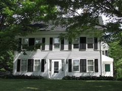
Listed on the National Register of Historic Places in
1984. A historic map-sheet match is not published yet. The record needs a coordinate-quality review before it can be joined to a sheet boundary.
From the record
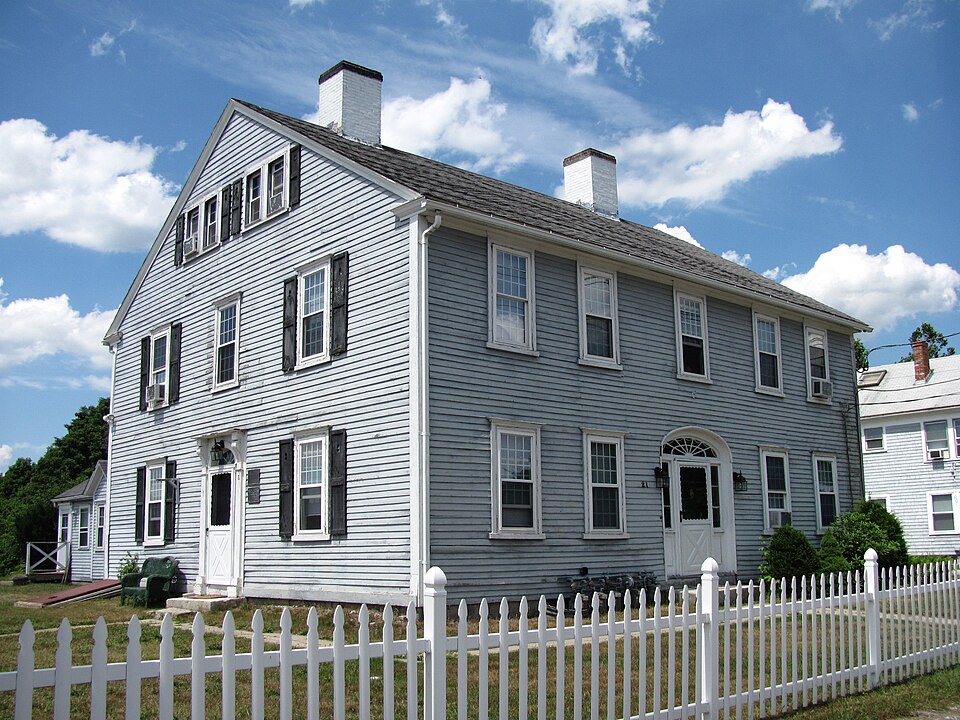
“The Roebuck Tavern is a historic tavern at 21 Dedham Street in Wrentham, Massachusetts. The two-story Federal style structure was built in 1795 by David Fisher, whose family was one of the earliest to settle the area in the 17th century.”
Wikipedia article Roebuck Tavern, CC BY-SA 4.0.
one of 249 National Register listings in Norfolk County · listed in 1984 · category: Building · one of 2 National Historic Landmarks in Norfolk County.
National Register reference number.84002878- the number the National Park Service assigned this property when it was listed, and the key its nomination file is catalogued under at the National Archives.
Fires near this property
164 since 2007
Regional context, not property-specific
evidence. The
federal wildfire occurrence database
lists 164 fires within 5 miles of Roebuck Tavern between
2007 and 2020, burning about 73 acres in total. None started naturally. 1 was recorded as arson.
Distance is straight-line from the map coordinates, so a fire counted
here may appear on a neighbouring settlement's page as well.
Reported cause
Fires
Recreation and ceremony
64
Missing data/not specified/undetermined
55
Smoking
24
Debris and open burning
15
Equipment and vehicle use
4
Arson/incendiarism
1
Power generation/transmission/distribution
1
The most recent of
them, most recent first, with the day each was reported and the service
that recorded it.
Regional context, not property-specific
evidence. Museums hold 1,377 specimens
collected within 10 miles of Roebuck Tavern between 1843 and
1975: 633 Fungi, 346 Plantae, 275 Animalia, 87 Protozoa, 16 Chromista, 15 Unrecorded, 5 Bacteria. 12 distinct Species records are shown.
Collected by A Herz, A. A. Eaton, A. B. Seymour and others. Each is a
physical object with a catalogue
number, and each entry opens the museum's record. This is what was
collected and kept, not a survey of what lives here - nothing can be
concluded from a species being absent.
Regional context, not property-specific
evidence. The federal mineral resources record lists
27 workings within 5 miles of Roebuck Tavern: 16 past producers, 10 producers, 1 unknown.
10 still produce. What was taken out: Sand and Gravel, Construction, Clay, Stone, Crushed/Broken, Gold. Distance is straight-line from the
map coordinates, so a quarry counted here may appear on a neighbouring
settlement's page as well.
Regional context, not property-specific
evidence. The National Weather Service names
Wrentham, the town this property stands in, in 20 storm reports between 1997 and 2025: 8 thunderstorm wind, 4 hail, 3 lightning, 3 flood.
The reports record 1 injury. Each account below is quoted exactly as the forecast office
filed it, from the NOAA Storm Events Database, and each date
opens the federal record of that event.
A deli on Shear Street was struck by lightning. The resulting fire gutted the second floor apartment and one firefighter was injured while fighting the fire.
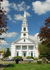
The tornado touched down just east of Lake Archer where tree top damage was observed. It then continued into the middle of downtown Wrentham, crossing the town common and uprooting an 80 foot tall maple tree. several trees were uprooted and large limbs were downed in the town cemetery east of the common. The tornado then lifted just east of the cemetery. No injuries were reported and many people interviewed received a Wireless Emergency Alert (WEA) on their cell phones when the warning was issued and took shelter.
At 1255 PM EST, Thurston Street in Wrentham was closed due to street flooding. At 119 PM EST, one lane of East Street was closed due to street flooding.
No historic map-sheet match is published
for this property yet. That does not mean no map exists. This record needs
a coordinate-quality review before it can be joined to a sheet boundary.
Browse the county's mapped places while that work is
pending.
From the nomination file
2,069 words on record
When this property was proposed for the
National Register, someone wrote the case for it: what the building is,
and why it matters. That document is a federal record in the public domain.
It is quoted below word for word, never summarised. The text was read off the scanned case file by machine, so the
occasional stray character is the recogniser's and the 1970s
typewriter's.
Description of the property
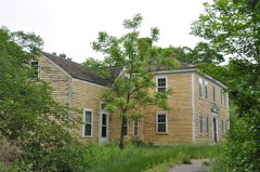
N/A Located in the historic center of Wrenthan, the Roebuck Tavern presently occupies 4 acre of land and is set back twenty feet from Dedham Street. The lot on which it stands is unelevated; landscaping features of note are four maple trees which serve as a buffer between the house and a municipal parking lot. The tavern itself consists of a main two story, center entry section built ca. 1795 and a one story rear ell built in two periods during the 19th century. Typically federal in design, the Main block of the Roebuck Tavern is a five bay, rec- tangular plan structure with twin interior chimneys. Rising from a granite foundation, the house is covered with clapboards and enclosed by a pitched roof. Fenestration throughout the main portion of the building is 12/12 sash.
The building's five bay symmetrical facade (south elevation ) is framed by a molded boxed cornice and narrow cornerboards.: Its focal point is the center entry which is framed by 3/4 side lights and amelliptical fanligiit. Two of the,three remaining elevations (north and east) have fenestration which is asy- mmetrically aligned. Ihe west end of the bullding, however, contalns symmetrical bays consisting of a center entry and two flanking windows on the tirst story, three windows onthe second level,and two on the third story. This elevation's entry features a fanlight, but it is narrower than the one on the main facade and is capped by a hood which is supported by simple brackets.
Placed at.a right angle to the main section of the building is a rear one story clap- boarded ell with a pitch roof pierced by a single tall chimney. This addition was built in two stages, and although its date is not confirmed, was most likely constructed during the 19th century.
(in one paragraph) Builder/Architect Unknown The Roebuck Taven possesses integrity of location, design, setting, materials, and workmanship, as well as documented associations with the development of rentham during the late 18th and 19th centuries. It is significant as one of the town's best preserved examples of residential Federal period architecture and is also important for its re- lationship with a prominent local family in the 18th and 19th centuries. The tavern thus meets Criteria A, B, and C of the National Register of Historic Places. Constructed in 1795 for David Fisher and his familý, the Roebuck Taven was located'ad-!
jacent to Wrentham's major Colonial Period crossroads in the towh's historic centér:*i More importantly, however, it stood on one of the Boston/Providence Turnpikes (Route 1A) which opened early in the 19th century. This new route spurred a period of growth in Wrentham and hada great impacton the early use of the nominated property. Dur ing this era , the building served as avtavern, post office, toll collector's house, as well as a family's residence. Although initially used for these various functions, the building was best known as an inn and tavern and continued to be used in this manner through the early 20th century. The Fisher Family, long associated with the tavern and owners of the property until 1910, were among the community's early settlers in the mid 17th century.
Serving as selectmen in the founding: years of the town, they were influential figures in its develop- ment.
Quoted from the National Register nomination
for reference 84002878, 9 pages, held by the National Archives in Record
Group 79. See the
catalogue record.
Listed places nearby
6 within 8 miles
Other National Register properties close
enough to walk or drive between, ordered by distance from this one. Both
positions come from the same geocoding pass that matched these properties
to their map sheets.
Listing record. National Park Service National Register of Historic Places, listed-properties dataset, current to 2026-05-22.
Map join. Address geocoded through the United States Census geocoder, then tested against the published boundary of every sheet in the USGS Historical Topographic Map Collection.
How this page is made. Listing fields come from federal records; map-sheet coverage is a labelled coordinate-to-boundary calculation, not a source-field claim.
Wildfire. Short, Karen C. 2022. Spatial wildfire occurrence data for the United States, 1992-2020 [FPA_FOD_20221014]. 6th Edition. Fort Collins, CO: Forest Service Research Data Archive. https://doi.org/10.2737/RDS-2013-0009.6 Collected with United States Government funding and usable without additional permissions or fees.
Specimens. Global Biodiversity Information Facility (GBIF), https://www.gbif.org/. Only records licensed CC0 or CC BY are used. Records licensed CC BY-NC are excluded because this site carries advertising. Images are checked individually and any whose licence is non-commercial, no-derivatives or unreadable is refused.
Mines and quarries. USGS Mineral Resources Data System (MRDS) https://mrdata.usgs.gov/mrds/ A work of the United States government, no copyright under 17 U.S.C. 105.
Storms. NOAA National Centers for Environmental Information, Storm Events Database https://www.ncei.noaa.gov/stormevents/ A work of the United States government, no copyright under 17 U.S.C. 105. Narratives are quoted verbatim from the National Weather Service report and are not edited or summarised.
 Block
Block