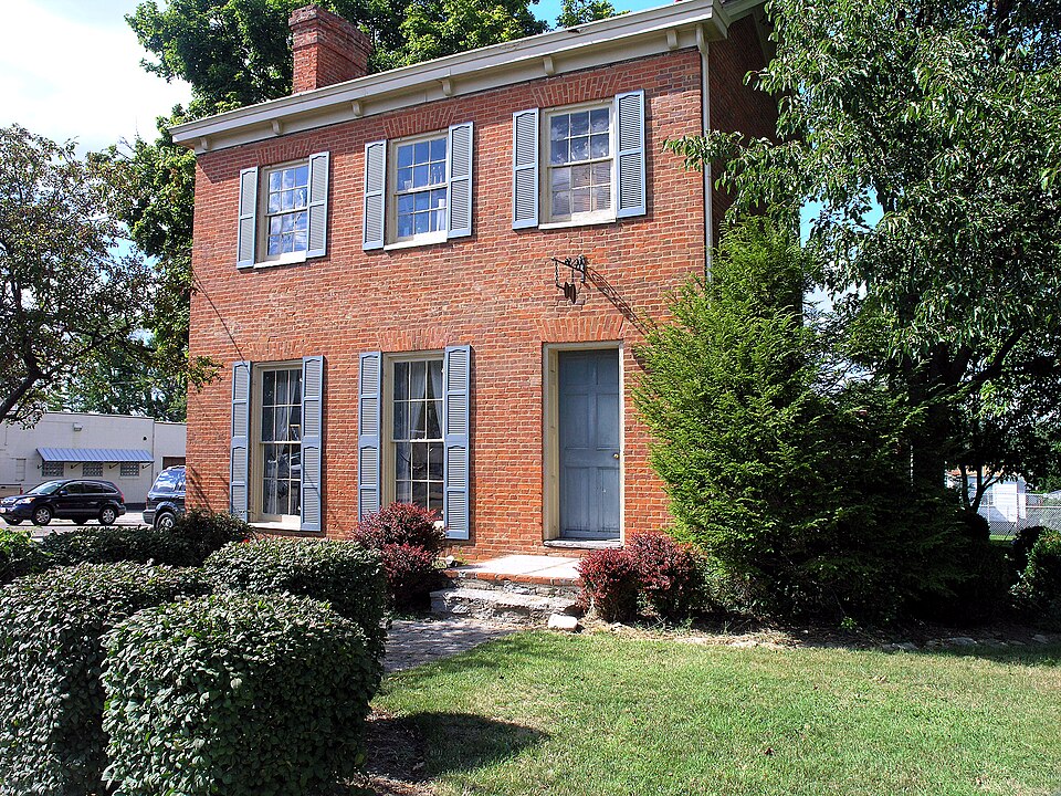
Built in 1825 in the Federal architecture. Listed on the National Register of Historic Places in
1984. A historic map-sheet match is not published yet. The record needs a coordinate-quality review before it can be joined to a sheet boundary.
From the record
“The Smith-Jessup House is a historic house at 1038 W. North Bend Road in Springfield Township, Hamilton County, Ohio.”
Wikipedia article Smith-Jessup House, CC BY-SA 4.0.
one of 314 National Register listings in Hamilton County · listed in 1984 · category: Building · built in 1825, Federal architecture · one of 9 National Historic Landmarks in Hamilton County.
National Register reference number.84003717- the number the National Park Service assigned this property when it was listed, and the key its nomination file is catalogued under at the National Archives.
The need of a new township, to be carved from the northern part of the originally great Cincinnati township, was not felt with any pressure or made necessary by the pushing of settlement up the Miami purchase, until after Wayne's victory in 1794. This greatly stimulated removal from the hamlets along the river to the rural districts and invited rapid immigration from abroad. The next year the court of general quarter sessions of the peace for Hamilton county answered a demand of the growing settlements and somewhat numerous stations up the Mill Creek valley for a new municipality. Springfield township was accordingly created, to begin at a point in the meridian bounding the east side of township three, in the first entire range, two miles south of the southeast corner of said township three (that is, the present corner of Springfield township); thence north two miles to said southeast corner of township three; thence east two miles to the meridian; thence north six miles to the northern line of the entire range one; thence west to the east boundary of Colerain, which was then as now; thence south along Colerain and South Bend townships eight miles; thence east to the place of beginning.
In 1792, Mr. Henry Tucker, who had come froin New Jersey to Columbia the same year with his relative, John Tucker; Henry Weaver, who came to the same place from New York, two years before; Luke and Zebulon Foster, Jonathan Pittman and James McCasken, formed a company to push up the valley of Mill creek, estabUsh a station and improve a farm. They found a suitable tract on what is now section four of this township, on the west branch of Mill creek, a little below Glendale, half a mile north of the site of the well-known tavern, afterwards kept by Mr. Pittman, and about as far east of the tracks of the Cincinnati, Hamilton & Dayton railroad. . The site known as Foster's Hill transmits the memory of their occupation here. It was then on the military trace cut through between Forts Washington and Hamilton. East of this, and at a point about a mile and a half northwest of the present Lochland, the party began the erection of a block-house. Mr. Olden says: "The old station-house stood on the east side of the road, immediately opposite the late residence of Manning Tucker, now owned by Mr. Horace Bugher." The farm owned by Mr. Bugher is identical, in part, with the location made by the Tuckers and their company. Cabins were also commenced; but the settlement, although unmolested by the Indians, was presently disturbed by a dissension between Henry Tucker and Luke Foster, the former alleging that Foster, in making the lines of his own division (for the settlers were not to hold in common), had encroached upon the site Tucker had selected for his home. The trouble was serious, and the complainant, unable to obtain satisfaction, seceded from the colony and returned to Columbia. During the winter of 1793-4, however, the difficulty was composed, Luke Foster accepting an offer of ten acres in the southwest corner of the section, and Zebulon Foster five acres next north of it, as compensation for their improvements made on section four. This was now divided again between the two Tuckers and Pittman, while the Fosters, with Weaver and McCashen, and two new men named James Seaward and Ziba Wingent, agreed to settle on sections nine and ten, next on the west and southwest. Under this arrangement Henry Tucker, with the rest, who had also returned to Columbia on the advice of Captain Wells, an experienced Indian fighter, to await the advent of Wayne's army, went out again in the spring of 1794 and recommenced their improvements.
Regional context, not property-specific
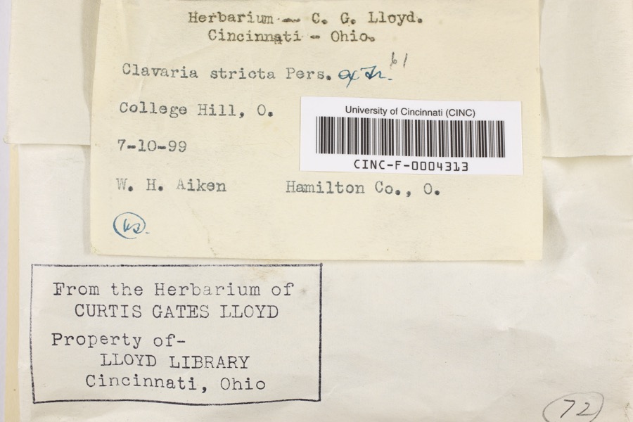
evidence. Museums hold 5,925 specimens
collected within 10 miles of Smith-Jessup House between 1819 and
1975: 2,903 Fungi, 1,764 Animalia, 883 Plantae, 323 Protozoa, 32 Unrecorded, 19 Chromista, 1 Bacteria. 12 distinct Species records are shown.
Collected by A Schwartz, A. Braun, A. F. Braun and others. Each is a
physical object with a catalogue
number, and each entry opens the museum's record. This is what was
collected and kept, not a survey of what lives here - nothing can be
concluded from a species being absent.
Regional context, not property-specific
evidence. The federal mineral resources record lists
3 workings within 5 miles of Smith-Jessup House: 1 past producer, 1 producer, 1 unknown.
1 still produces. What was taken out: Sand and Gravel, Construction, Tin, Lead, Antimony. Distance is straight-line from the
map coordinates, so a quarry counted here may appear on a neighbouring
settlement's page as well.
Regional context, not property-specific
evidence. The National Weather Service names
Cincinnati, the town this property stands in, in 70 storm reports between 1994 and 2025: 25 thunderstorm wind, 17 hail, 14 flash flood, 7 flood.
The reports record 1 injury. Each account below is quoted exactly as the forecast office
filed it, from the NOAA Storm Events Database, and each date
opens the federal record of that event.
Numerous roads were flooded throughout the Cincinnati area and some basements were flooded. Flooding also caused some damage at Reading High School and Whitaker Elementary School.
Lightning struck a home causing a fire in the attic, which spread toward the second floor before being extinguished. Significant fire and water damage occurred to the home.
High water was reported on several roads in the downtown Cincinnati area and the near West Side. A retaining wall collapsed onto a roadway near the intersection of State Avenue and Ernst Street and a building was flooded on Poplar Street. Also, an apartment basement flooded on Linn Street and one resident needed to be rescued.
14 papers published in this town,
digitised by the Library of Congress and free to read: 0 issues,
0 pages. Every page is searchable, so a name or a street can be
looked for directly in what the town printed about itself at the time.
No historic map-sheet match is published
for this property yet. That does not mean no map exists. This record needs
a coordinate-quality review before it can be joined to a sheet boundary.
Browse the county's mapped places while that work is
pending.
From the nomination file
2,140 words on record
When this property was proposed for the
National Register, someone wrote the case for it: what the building is,
and why it matters. That document is a federal record in the public domain.
It is quoted below word for word, never summarised. The text was read off the scanned case file by machine, so the
occasional stray character is the recogniser's and the 1970s
typewriter's.
Description of the property
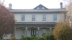
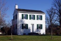
lies along a busy, four-lane road in Springfield Township, just outside of Cincinnati its Federal design. to the building's recent rehabilitation, there was a standing seam metal roof over old chimney with brick banding is located at the west end of the main roof and a smaller chimney with corbelling, now stuccoed, is located at the northern end of the original brick rear wing. A simple wood frieze with small modillions, the latter probably a mid- nineteenth century alteration, is present on the front facade. The front (south) facade, which has Flemish bond coursing, is three bays wide with a The windows of the small one-story frame section behind the front portion of the building have 8/8 sash; this frame section was formerly a side porch which was enclosed in the early twentieth century.
first story, while the west, and longer, facade contains several windows, the first section of the west side has a 1-story cinder-block addition projecting from it, which is hip-roofed and covered with wide vertical siding. completes the original first story plan of the building. Iwo rooms and the enclosed are located behind this room. A large sideyard containing trees to the east and an asphalt-topped parking lot, shaded 7. Description Condition Check one porch section are located behind these rooms.The second floor consists of a small room roofs over the back sections of the building are covered with asphalt shingles.A large the building have simple splayed brick lintels.
opposite the second story landing with a large room flanking the hall.The small rooms The interior plan of the building consists of a side hall which contains a simple, another one-story addition on the west side which dates from the early 2oth century.
(in one paragraph) Criterion C the mid-nineteenth century. Its Federal Style architecture is fairly rare in this town- ship, particularly outside of the boundaries of the early villages. the house from the 1830's until the late 1860's. The 1860 U.S. Census lists the Pennsylvania-born Jessup as a farmer, a fairly common occupation for this township at shows that Jessup possessed 63 acres in this section of Springfield Township and 50 acres directly south in Millcreek Township. township's boundaries are mostly located at the edges, along major roads, railroad lines century show a profusion of houses dispersed throughout this middle section, which seems belt community of Greenhills was built in the center of the township.
Several other a significant loss in the number of mid-19th century buildings. three are standing on Winton Road in the southern half of the township, although they three have been altered in varying degrees. A substantial Federal Style house, the Cottage on Hamilton Road in North College Hill is quite similar in age and scale to the included in the National Register. Not only is the Smith/Jessup House one of the few tion certainly makes it one of the best preserved. 1700-1799 1600-1699 1500-1599 1400-1499 communications education commerce engineering philosophy industry humanitarian theater exploration/settlement music science sculpture prehistoric social/ literature law 8.
Significance 1900- conservation - - other(specify) size and shape to the Smith/Jessup House,with gable roofs and a vertical emphasis.All Whallon-Marquand located on Winton Road in the community of the military --agriculture ..invention ._economics .. art landscape architecture The Daniel Smith/David Jessup House derives its name from its earliest resident and its have been built around 1825 by Daniel Smith.
Quoted from the National Register nomination
for reference 84003717, 21 pages, held by the National Archives in Record
Group 79. See the
catalogue record.
Listed places nearby
6 within 8 miles
Other National Register properties close
enough to walk or drive between, ordered by distance from this one. Both
positions come from the same geocoding pass that matched these properties
to their map sheets.
Listing record. National Park Service National Register of Historic Places, listed-properties dataset, current to 2026-05-22.
Map join. Address geocoded through the United States Census geocoder, then tested against the published boundary of every sheet in the USGS Historical Topographic Map Collection.
How this page is made. Listing fields come from federal records; map-sheet coverage is a labelled coordinate-to-boundary calculation, not a source-field claim.
Specimens. Global Biodiversity Information Facility (GBIF), https://www.gbif.org/. Only records licensed CC0 or CC BY are used. Records licensed CC BY-NC are excluded because this site carries advertising. Images are checked individually and any whose licence is non-commercial, no-derivatives or unreadable is refused.
Mines and quarries. USGS Mineral Resources Data System (MRDS) https://mrdata.usgs.gov/mrds/ A work of the United States government, no copyright under 17 U.S.C. 105.
Storms. NOAA National Centers for Environmental Information, Storm Events Database https://www.ncei.noaa.gov/stormevents/ A work of the United States government, no copyright under 17 U.S.C. 105. Narratives are quoted verbatim from the National Weather Service report and are not edited or summarised.
 Block
Block