Listed on the National Register of Historic Places in
1984. A historic map-sheet match is not published yet. The record needs a coordinate-quality review before it can be joined to a sheet boundary.
From the record
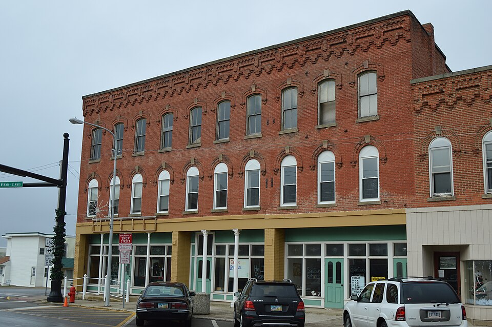
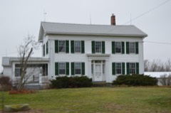
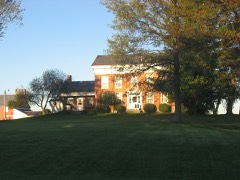
“The Gregory House is a historic hotel in central New London, Ohio, United States. Erected soon after a fire that devastated the community, it has occupied a significant place in the community since its construction, and it has been named a historic site.”
Wikipedia article Gregory House (New London, Ohio), CC BY-SA 4.0.
one of 15 National Register listings in Huron County · listed in 1984 · category: Building.
National Register reference number.84003746- the number the National Park Service assigned this property when it was listed, and the key its nomination file is catalogued under at the National Archives.
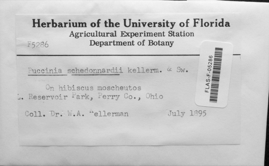
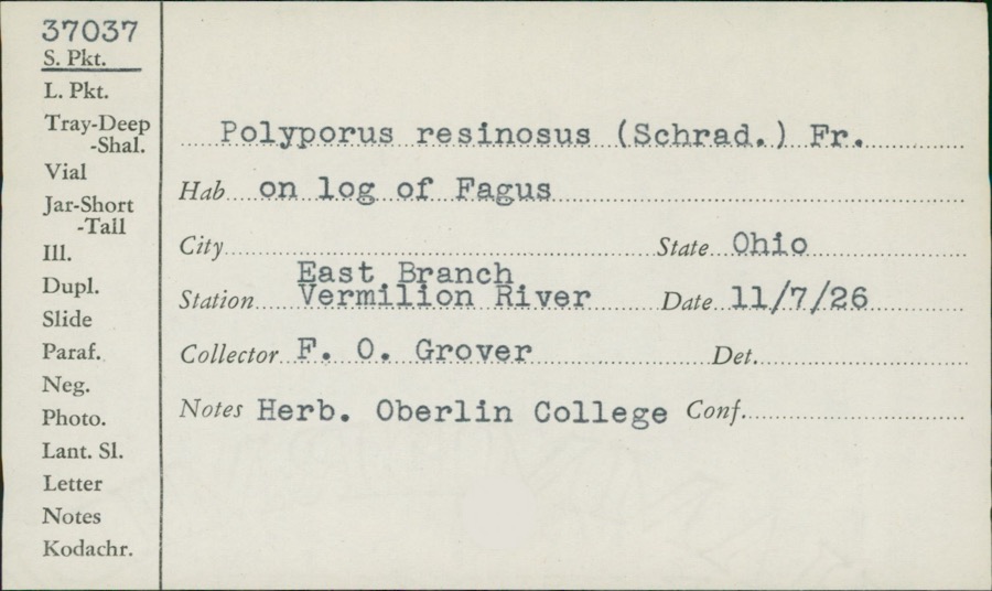
Specimens collected near this property
12 of 543 shown
Regional context, not property-specific
evidence. Museums hold 543 specimens
collected within 10 miles of Gregory House between 1888 and
1975: 372 Plantae, 105 Animalia, 64 Fungi, 1 Unrecorded, 1 Protozoa. 12 distinct Species records are shown.
Collected by A. Woolman, C. E. Jennings, C. Rutter and others. Each is a
physical object with a catalogue
number, and each entry opens the museum's record. This is what was
collected and kept, not a survey of what lives here - nothing can be
concluded from a species being absent.
Regional context, not property-specific
evidence. The federal mineral resources record lists
2 workings within 5 miles of Gregory House: 2 producers.
All of them still produce. What was taken out: Sand and Gravel, Construction, Clay. Distance is straight-line from the
map coordinates, so a quarry counted here may appear on a neighbouring
settlement's page as well.
Regional context, not property-specific
evidence. The National Weather Service names
New London, the town this property stands in, in 21 storm reports between 1994 and 2023: 15 thunderstorm wind, 5 hail, 1 tornado.
No death or injury is recorded in these reports. Each account below is quoted exactly as the forecast office
filed it, from the NOAA Storm Events Database, and each date
opens the federal record of that event.
A tornado briefly touched down near New London. Around 200 trees were blown down. The roof of a barn on State Route 60 was blown off and two other barns just east of town were completely destroyed. Two businesses in New London also suffered roof damage.
Several trees were downed in Monroeville. Damage was more widespread in New London were trees and limbs were downed, some on power lines, and signs were blown down.
No historic map-sheet match is published
for this property yet. That does not mean no map exists. This record needs
a coordinate-quality review before it can be joined to a sheet boundary.
Browse the county's mapped places while that work is
pending.
From the nomination file
1,667 words on record
When this property was proposed for the
National Register, someone wrote the case for it: what the building is,
and why it matters. That document is a federal record in the public domain.
It is quoted below word for word, never summarised. The text was read off the scanned case file by machine, so the
occasional stray character is the recogniser's and the 1970s
typewriter's.
Description of the property
ture of soft red brick with sandstone keystones,lintels and coping. Flat-roofed, its brick fenestration and rear entry of the first story's west facade.
fromithe secondary one by an interior bearing wall running parallel to the party wall on the unexposed date excellent deteriorated The structure originally contained two discrete elements,the main element being separated The storefronts of the ground story have been reconstructed (after an interval when they Xgood The shape of the structure reflects its site.Situated at the intersection of two main flect the angle of the adjacent street.Standing at New London's only traffic light and at Areas of Significance - Check and justify below - prehistoric - archeology-historic - agriculture _ sculpture * architecture - military - social/ - 1800-1899 - commerce - philosophy . communications .
transportation Criteria A & C Firelands region where it stands, providing an historical record of the life or New Lon- don's people, their aspirations and their enterprise. Tavern, the Potter Hotel, the Asher House and the American House as fashion and ownership The western-most two-thirds was built by and named for Charles Gregory, a local blacksmith and entreprenure; the eastern third was built for other commercial purposes by one Albert was the work of A. A. Powers, first Marshall of New London, who, with his brother, R.C. Powers, first mayor of the town, was known for his ventures in realestate and finance.
out an entire block of earlier commercial structures), the hotel was the centerpiece of a village established in what was known as the Firelands, a region in the Connecticut Western the Revolutionary War.
(in one paragraph) that both embodies and documents the commercial development of the town and of Ohio's a resident of the region from 1818 to 1839 when the town was known as "Kinsley's Corners. Porter, lawyer, twice mayor of New London, Postmaster, and three times Justice of the Peace of New London Township. structures across the land. For its new owner, the building is emblematic of his town, Builder/Architect Albert A. Powers Reserve set aside for the "sufferers" from four Connecticut towns (New London, Danbuty, 1873 Ohio.
- - communityplanning New Haven and Norwalk) to compensate their losses by fire at the hands of the British during Ohio.Built of local materials by local people,the building isa structural artifact Functioning asa hotel until 19o0,the building's upper floors became apartments for board- The foundation stone was from the Curtiss quarry one mile from the site; the brick was Atlas of Huron County, Ohio (Phila.: Titus, Simmons, Titus) 1873 UMT References Lots 3 and 4, Village of New London, Ohio List all states and counties for properties overlapping state or county boundaries .state January, 1983 street & number 2353 Woodmere Drive city or town Ohio 44106 The evaluated significance of this property within the state is: _ national A local As the designated State Historic Preservation Officer for the National Historic Preservation Act of 1966 (Public Law 89 665), I hereby nominate this property for inclusion in the National Register and certify that it has been evaluated according to the criteria and procedures set forth by the Heritage Conservation and Recreation Service.
State Historic Preservation Officer signature ~/ Keeper of the National Register date county Easting code Northing name/title Zone 9.
Quoted from the National Register nomination
for reference 84003746, 11 pages, held by the National Archives in Record
Group 79. See the
catalogue record.
Listed places nearby
2 within 8 miles
Other National Register properties close
enough to walk or drive between, ordered by distance from this one. Both
positions come from the same geocoding pass that matched these properties
to their map sheets.
Listing record. National Park Service National Register of Historic Places, listed-properties dataset, current to 2026-05-22.
Map join. Address geocoded through the United States Census geocoder, then tested against the published boundary of every sheet in the USGS Historical Topographic Map Collection.
How this page is made. Listing fields come from federal records; map-sheet coverage is a labelled coordinate-to-boundary calculation, not a source-field claim.
Specimens. Global Biodiversity Information Facility (GBIF), https://www.gbif.org/. Only records licensed CC0 or CC BY are used. Records licensed CC BY-NC are excluded because this site carries advertising. Images are checked individually and any whose licence is non-commercial, no-derivatives or unreadable is refused.
Mines and quarries. USGS Mineral Resources Data System (MRDS) https://mrdata.usgs.gov/mrds/ A work of the United States government, no copyright under 17 U.S.C. 105.
Storms. NOAA National Centers for Environmental Information, Storm Events Database https://www.ncei.noaa.gov/stormevents/ A work of the United States government, no copyright under 17 U.S.C. 105. Narratives are quoted verbatim from the National Weather Service report and are not edited or summarised.
 Block
Block