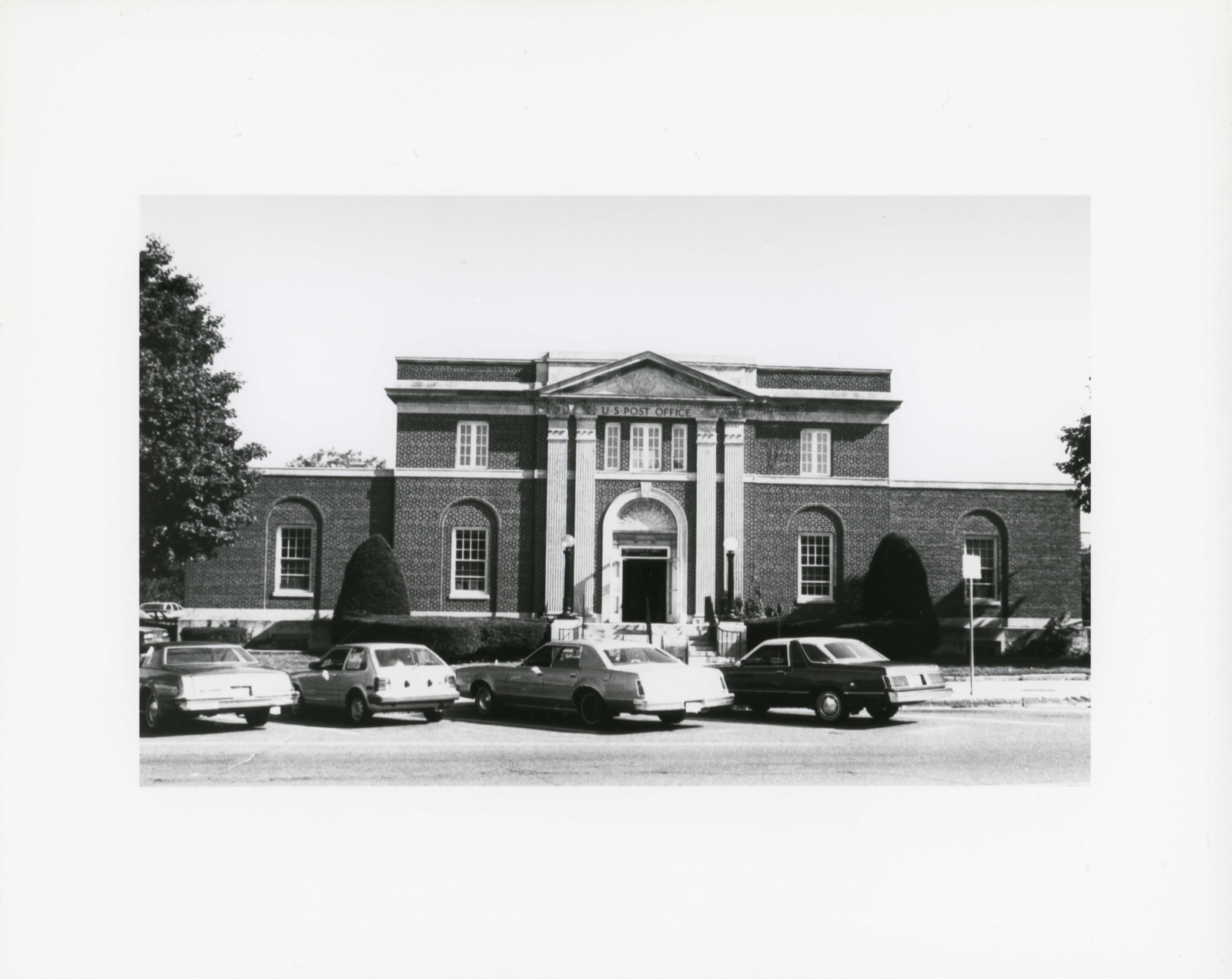
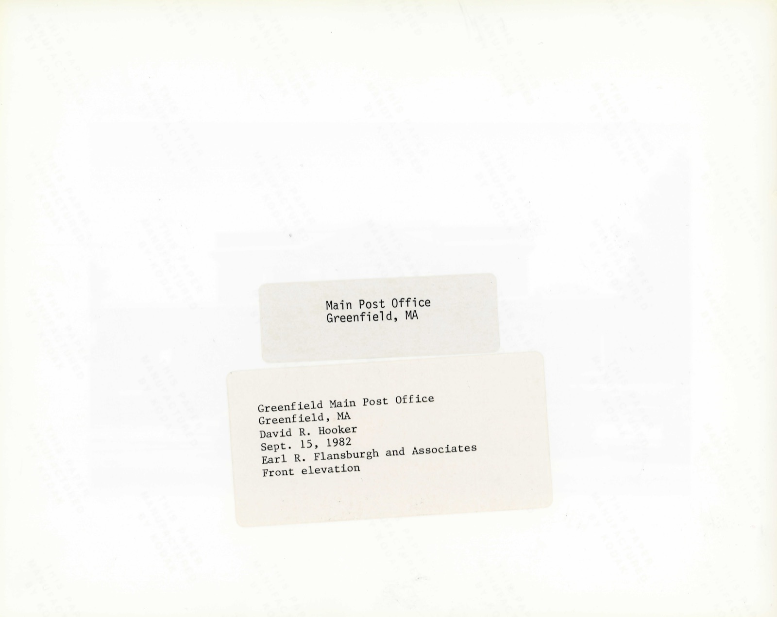
Photographs from the nomination case file, National Park Service records.
US Post Office--Greenfield Main
Listed on the National Register of Historic Places in
1985. A historic map-sheet match is not published yet. The record needs a coordinate-quality review before it can be joined to a sheet boundary.
From the record
“In 181 1, leading men of Greenfield, aided by men of the northern towns, succeeded in getting the old county of Hampshire, nearly fifty miles square, divided, and Greenfield made the shire town of Franklin County. Great efforts were made to have the county buildings located at Cheapside, then a flourishing hamlet, because of its shipping facilities upon the Connecticut river, and considerable excitement was the result.”
Greenfield (Massachusetts) Sesqui-centennial, 1753 June 9 1903 : a Model Town of 8000 People (1903). Machine-read text.
one of 28 National Register listings in Franklin County · listed in 1985 · category: Building · one of 1 National Historic Landmarks in Franklin County.
National Register reference number.85003224- the number the National Park Service assigned this property when it was listed, and the key its nomination file is catalogued under at the National Archives.
THE PUBLICATION of this little Souvenir is made possible by the assistance of the Publishers of The Boston Globe, The Gazette and Courier and The Greenfield Recorder, and that of other friends and the cordial co-operatiori of the Business Men of Greenfield. It has the indorsement of the Coaching Club and the Board of Trade.
Between 1630 and 1640, more than 20,000 settlers had gathered about the shores of Massachusetts Bay. In 1635 a few daring people had settled upon the lower Connecticut river and the richness and beauty of the river bottoms soon attracted many people searching for homes. Springfield was settled in 1635. Settlements at Northampton, Hadley and Hatfield soon followed and by 1662 the population had become sufficient for the organization of Hampshire County. Deerfield was purchased from the Pocumptuck Indians in 1667, and in 1669 vSamuel Hinsdale had built on the rich meadow his log cabin and plowed his field. Greenfield, Conway, Shelburne and Gill were originally a part of Deerfield.
Regional context, not property-specific
evidence. The
federal wildfire occurrence database
lists 39 fires within 5 miles of US Post Office--Greenfield Main between
2002 and 2020, burning about 16 acres in total. None started naturally. None was recorded as arson.
Distance is straight-line from the map coordinates, so a fire counted
here may appear on a neighbouring settlement's page as well.
Reported cause
Fires
Debris and open burning
24
Recreation and ceremony
5
Smoking
5
Railroad operations and maintenance
4
Equipment and vehicle use
1
The most recent of
them, most recent first, with the day each was reported and the service
that recorded it.
Regional context, not property-specific
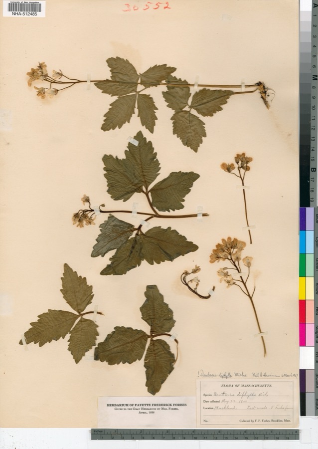
evidence. Museums hold 3,355 specimens
collected within 10 miles of US Post Office--Greenfield Main between 1822 and
1975: 1,259 Plantae, 1,103 Animalia, 861 Fungi, 114 Unrecorded, 14 Protozoa, 4 Chromista. 12 distinct Species records are shown.
Collected by A S Pease, A V Osmun, A. Clark and others. Each is a
physical object with a catalogue
number, and each entry opens the museum's record. This is what was
collected and kept, not a survey of what lives here - nothing can be
concluded from a species being absent.
black sh, [property of T.M. Stoughton, 1871 Beers County map, previously owned by Dr. Roswell Field], S side of Connecticut River, Horse Race, Montague
Regional context, not property-specific
evidence. The federal mineral resources record lists
8 workings within 5 miles of US Post Office--Greenfield Main: 4 past producers, 2 occurrences, 1 producer, 1 prospect.
1 still produces. What was taken out: Stone, Crushed/Broken, Sand and Gravel, Construction, Barium-Barite, Copper, Iron, Copper, Barium-Barite. Distance is straight-line from the
map coordinates, so a quarry counted here may appear on a neighbouring
settlement's page as well.
Regional context, not property-specific
evidence. The National Weather Service names
Greenfield, the town this property stands in, in 59 storm reports between 1994 and 2025: 36 thunderstorm wind, 9 hail, 9 flood, 4 flash flood.
The reports record 1 death. Each account below is quoted exactly as the forecast office
filed it, from the NOAA Storm Events Database, and each date
opens the federal record of that event.
A water soaked ridge near the Green River Cemetery gave way resulting in a mudslide 13 inches deep that slid over Meridan and Water Streets. Three cars were buried and the mud was up to the foundations of three houses. This resulted in the evacuation of 17 people. These people were evacuated first to a shelter at Greenfield School run by the American Red Cross and then to family members houses (2 families) and a hotel (1 family) for the night while crews cleaned the mud from their houses. A portion of Meridian Street where it ends at Deerfield Road remained closed through the night of the 7th.
At 4:12 PM EST heavy rain in Greenfield caused flooding of several basements on Franklin Street. At 4:33 PM EST Scout Road was flooded and impassable with some basement flooding. At 4:36 EST PM Sanderson Road near Kennemetal and the Medical Center was completely flooded. At 4:46 PM EST Adams Road was flooded and impassable. At 5:06 PM EST Green Street in Greenfield had significant basement flooding.
The intersections of Davis Road and Emily Lane and Chapman and Arch Streets were flooded and impassable. Basements were flooded on Norwood Street, O Street, and Elm Terrace. Part of the road was washed out at the intersection of Phillips and Elm Street. A manhole cover popped off on 7th Street from flooding. Columbus Avenue was flooded and impassable.
In Greenfield, power lines were downed on West Street and Wisdom Way. Tree limbs fell on a police cruiser on Route 2 but there were no injuries. In Gill, trees and wires were downed on River Street and West Gill Street. Thunderstorm winds also downed trees and wires on Chestnut Lane in Turners Falls, on Parmenter Road in Berndardston, and on Captain Bears Plain Road and Burnham Road in Northfield.
Several thunderstorms with heavy rain moved through Greenfield resulting in flooding. Ten basements were flooded and there was some sewage backup on Silver Street.
One of the TV meteorologists from WWLP reported a couple of large trees downed in front of a house on Forest Avenue in Greenfield. From pictures, it appears there was some damage to the roof of a front porch.
Several streets in Greenfield experienced minor street flooding (less than 6 inches of water flowing over the road), including Deerfield Street south of Meridan Street and Federal Street.
Large trees were blown down and a power line was knocked down. National Weather Service site inspection confirmed that a microburst occurred in Greenfield. In Turners Falls, trees and power lines were reported blown down.
No historic map-sheet match is published
for this property yet. That does not mean no map exists. This record needs
a coordinate-quality review before it can be joined to a sheet boundary.
Browse the county's mapped places while that work is
pending.
Named in the fire insurance atlases
Sanborn surveyors printed an index of the
town's establishments at the front of each atlas. This property is named in
one, read straight off the scanned sheet.
When this property was proposed for the
National Register, someone wrote the case for it: what the building is,
and why it matters. That document is a federal record in the public domain.
It is quoted below word for word, never summarised. The text was read off the scanned case file by machine, so the
occasional stray character is the recogniser's and the 1970s
typewriter's.
Description of the property
Main Street in Greenfield serves the principal business and commercial districts and continues on as a wide thoroughfare, tree lined with several municipal, religious and public buildings grouped in an area within which the Post Office is centered. Important neighboring buildings include the Greenfield Public Library which is housed in a fine residence known as the Leavitt Hovey House, built in 1797 and designed by the noted architect, Asher Benjamin. This structure is listed on the National Register of Historic Places and together with the Franklin County Court House, the First Church of Christian Science and the Post Office establishes an area of architectural and historical importance.
The Post Office has a two story center portion which is the original building built in 1915; one story addition added in 1939 to both sides blend harmoniously and continue the architectural theme and constructuion of the original structure. A granite base supports brick walls laid in English bond with recessed arched panels containing the first floor windows across the front. Broad granite steps with wrought iron rails lead to the front entrance which is the dominant architectural feature. The arched entranceway is executed in stone and is highly sculptured, centered between two pairs of fluted pilasters which extend to the top of the second floor windows and support a pediment with a denticulated cornice which is continued around the building and is surmounted by a brick parapet.
A stone belt course at the second floor window sill line continues as a coping for the later one story wings. The entrance also features free standing cast iron lighting standards with round globes; these mounted on granite piers on each side of the entrance steps. The building is set back from the street and is attractively landscaped.
BUILDER/ARCHITECT Oscar Wenderoth, Sup. Architect Louis A. Simon, Sup. Architect This buiding, designed in 1914 under the administration of Supervising Architect Oscar Wenderoth, reflects the architectural goals of the previous administration which favored stylistic elements from the French Beaux-Arts and Neo-Classical traditions. The trend was to create small post office buildings which would become the most architecturally important structure within the community. This property preserved through the years and enchanced by later additions achieves a dignified presence through the use of ornament, symmetry, and fine materials. Significant to the city as a contributing building, it also characteristically registers federal policy concerning post office construction in small towns.
Quoted from the National Register nomination
for reference 85003224, 14 pages, held by the National Archives in Record
Group 79. See the
catalogue record.
Listed places nearby
6 within 8 miles
Other National Register properties close
enough to walk or drive between, ordered by distance from this one. Both
positions come from the same geocoding pass that matched these properties
to their map sheets.
Listing record. National Park Service National Register of Historic Places, listed-properties dataset, current to 2026-05-22.
Map join. Address geocoded through the United States Census geocoder, then tested against the published boundary of every sheet in the USGS Historical Topographic Map Collection.
How this page is made. Listing fields come from federal records; map-sheet coverage is a labelled coordinate-to-boundary calculation, not a source-field claim.
Wildfire. Short, Karen C. 2022. Spatial wildfire occurrence data for the United States, 1992-2020 [FPA_FOD_20221014]. 6th Edition. Fort Collins, CO: Forest Service Research Data Archive. https://doi.org/10.2737/RDS-2013-0009.6 Collected with United States Government funding and usable without additional permissions or fees.
Specimens. Global Biodiversity Information Facility (GBIF), https://www.gbif.org/. Only records licensed CC0 or CC BY are used. Records licensed CC BY-NC are excluded because this site carries advertising. Images are checked individually and any whose licence is non-commercial, no-derivatives or unreadable is refused.
Mines and quarries. USGS Mineral Resources Data System (MRDS) https://mrdata.usgs.gov/mrds/ A work of the United States government, no copyright under 17 U.S.C. 105.
Storms. NOAA National Centers for Environmental Information, Storm Events Database https://www.ncei.noaa.gov/stormevents/ A work of the United States government, no copyright under 17 U.S.C. 105. Narratives are quoted verbatim from the National Weather Service report and are not edited or summarised.
 Block
Block