Listed on the National Register of Historic Places in
1985. A historic map-sheet match is not published yet. The record needs a coordinate-quality review before it can be joined to a sheet boundary.
From the record
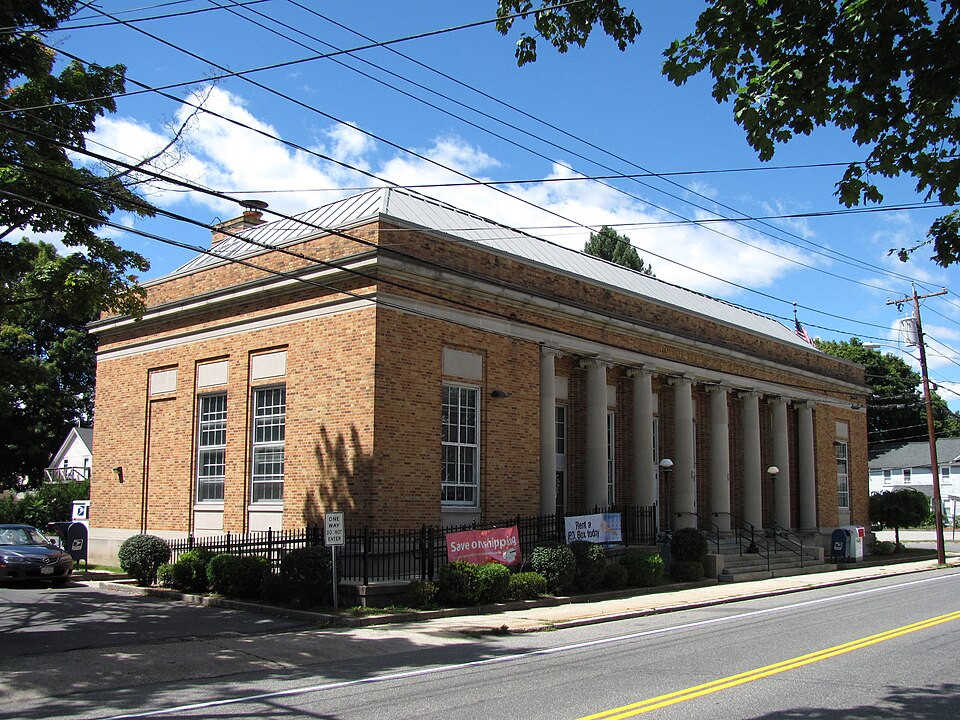
“The US Post Office - Palmer Main is a historic post office building at 1057 Park Street in Palmer, Massachusetts. Built in 1931, it is a good local example of Classical Revival architecture.”
Wikipedia article United States Post Office-Palmer Main, CC BY-SA 4.0.
one of 123 National Register listings in Hampden County · listed in 1985 · category: Building.
National Register reference number.85003336- the number the National Park Service assigned this property when it was listed, and the key its nomination file is catalogued under at the National Archives.
Fires near this property
82 since 2015
Regional context, not property-specific
evidence. The
federal wildfire occurrence database
lists 82 fires within 5 miles of US Post Office--Palmer Main between
2015 and 2020, burning about 77 acres in total. 10 started naturally. None was recorded as arson.
Distance is straight-line from the map coordinates, so a fire counted
here may appear on a neighbouring settlement's page as well.
Reported cause
Fires
Equipment and vehicle use
44
Missing data/not specified/undetermined
12
Recreation and ceremony
10
Natural
10
Debris and open burning
3
Smoking
1
Power generation/transmission/distribution
1
Railroad operations and maintenance
1
The most recent of
them, most recent first, with the day each was reported and the service
that recorded it.
Regional context, not property-specific
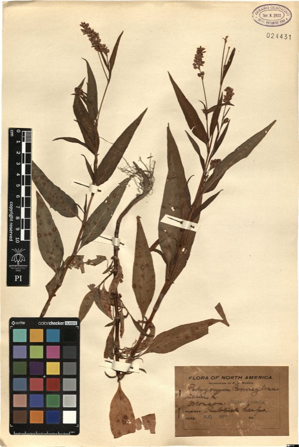
evidence. Museums hold 1,099 specimens
collected within 10 miles of US Post Office--Palmer Main between 1857 and
1975: 550 Fungi, 304 Plantae, 225 Animalia, 15 Chromista, 5 Unrecorded. 12 distinct Species records are shown.
Collected by A. B. Seymour, A. E. Kirk, A. Lavallee and others. Each is a
physical object with a catalogue
number, and each entry opens the museum's record. This is what was
collected and kept, not a survey of what lives here - nothing can be
concluded from a species being absent.
Regional context, not property-specific
evidence. The federal mineral resources record lists
7 workings within 5 miles of US Post Office--Palmer Main: 5 producers, 2 past producers.
5 still produce. What was taken out: Sand and Gravel, Construction. Distance is straight-line from the
map coordinates, so a quarry counted here may appear on a neighbouring
settlement's page as well.
Regional context, not property-specific
evidence. The National Weather Service names
Palmer, the town this property stands in, in 23 storm reports between 1999 and 2024: 15 thunderstorm wind, 4 flood, 2 hail, 2 lightning.
The reports record 1 injury. Each account below is quoted exactly as the forecast office
filed it, from the NOAA Storm Events Database, and each date
opens the federal record of that event.
Lightning struck the former Gales Newsstand building in Palmer at the corner of Main and Central Streets, setting the building on fire. The building was lost and the building next door was threatened but saved. No one was injured. Damage amount taken from the value of the building from the assessor's office.
Trees and wires in the Bondsville section of town and on Stewert, Maple, and High Streets were downed by thunderstorm winds. One of these trees fell on a house on High Street.
At 656 PM EST, an amateur radio operator reported U.S. Route 20 in Palmer was flooded with manhole covers popped off the road. At 705 PM EST, broadcast media reported flooding on Wilbraham Street, which is Route 20 west of town.
No historic map-sheet match is published
for this property yet. That does not mean no map exists. This record needs
a coordinate-quality review before it can be joined to a sheet boundary.
Browse the county's mapped places while that work is
pending.
From the nomination file
2,110 words on record
When this property was proposed for the
National Register, someone wrote the case for it: what the building is,
and why it matters. That document is a federal record in the public domain.
It is quoted below word for word, never summarised. The text was read off the scanned case file by machine, so the
occasional stray character is the recogniser's and the 1970s
typewriter's.
Description of the property
The United States Post Office at Palmer is a fine example of Neo-Classical design and is quite significant as a product of the U.S. Treasury Department. Designed in April of 1931 under the administration of Louis A. Simon and James A. Wetmore of the Treasury's Architectural Division, it is a two-story steel frame structure with buff-colored brick and limestone trimmings. It is located on the outskirts of the Central Business District in what is presently, and has been historically, a predominately residential neighborhood. There is a predominance of 2-1/2 story wood frame, one and two family houses to the South and East of the site. To the North diagonally across the intersection of Park and Central Streets, is the Gothic Style gray stone structure of St. Paul's Universalist Church.
On the Northwest side of Park Street a small one-story brick and wood shingle office building sits. The remainder of the surrounding neighborhood is of a residential scale. Although irregular in shape the building is primarily square in plan. However, when viewed from the major approach routes, its recessed colonade entry and corresponding side facades give the illusion of being rectangular. The recessed entrance portico served by seven (7) full width granite steps consists of eight Ionic limestone columns some fifteen feet in height. The central three bays consist of three pairs of wood doors with one glass light and a full height transom above each. The adjacent bays consist of four window openings of 12/12 double hung wood sashes (each with uncharacteristic aluminum storm windows).
Over the transom of each door and window is a plain face limestone plaque. These 12/12 windows are repeated "outside" the portico with one at each of the flanking bays and on most of the other three sides.
Completed: May, 1932 BUILDER/ARCHITECT L.A. Simon, Superintendent, Arch.Div James A. Wetmore, Sup. Architect Cianci Construction Co.: Contractors W. A. Newton & Company This Post Office is a fine example of Neo-Classical design and warrants a place on the National Register of Historic Places. Its location is a paradox. On the one hand it was conceived during hte Depression Era at a time when the Federal Government wanted to reach out to local communities. The grand proportion of the structure and the quality of work certainly bespeak of pride and integrity. On the other hand it is lost in a forest of residential homes, away from the downtown area.
Symmetry and the use of classical elements such as the columns and the sizeable entablature they support give an aura of grandeur and artistic understanding. The utilization of the light brick achieves a sense of human scale even at the grand proportion of the structure. The cost of construction in 1931 was $75,945.00. Yet even at this pricely sum, the contractor is reported to have gone bankrupt. Reports of close supervision created a building ofbeautiful construction but few:profits.. Indeed the original construction record photographs,+on file: at the Palmer Post Office, indicate a shift in the last remaining months from the Cianci Construction Company, originally awarded the project, the W.A Newton Company who completed it.
Quoted from the National Register nomination
for reference 85003336, 15 pages, held by the National Archives in Record
Group 79. See the
catalogue record.
Listed places nearby
4 within 8 miles
Other National Register properties close
enough to walk or drive between, ordered by distance from this one. Both
positions come from the same geocoding pass that matched these properties
to their map sheets.
Listing record. National Park Service National Register of Historic Places, listed-properties dataset, current to 2026-05-22.
Map join. Address geocoded through the United States Census geocoder, then tested against the published boundary of every sheet in the USGS Historical Topographic Map Collection.
How this page is made. Listing fields come from federal records; map-sheet coverage is a labelled coordinate-to-boundary calculation, not a source-field claim.
Wildfire. Short, Karen C. 2022. Spatial wildfire occurrence data for the United States, 1992-2020 [FPA_FOD_20221014]. 6th Edition. Fort Collins, CO: Forest Service Research Data Archive. https://doi.org/10.2737/RDS-2013-0009.6 Collected with United States Government funding and usable without additional permissions or fees.
Specimens. Global Biodiversity Information Facility (GBIF), https://www.gbif.org/. Only records licensed CC0 or CC BY are used. Records licensed CC BY-NC are excluded because this site carries advertising. Images are checked individually and any whose licence is non-commercial, no-derivatives or unreadable is refused.
Mines and quarries. USGS Mineral Resources Data System (MRDS) https://mrdata.usgs.gov/mrds/ A work of the United States government, no copyright under 17 U.S.C. 105.
Storms. NOAA National Centers for Environmental Information, Storm Events Database https://www.ncei.noaa.gov/stormevents/ A work of the United States government, no copyright under 17 U.S.C. 105. Narratives are quoted verbatim from the National Weather Service report and are not edited or summarised.
 Block
Block