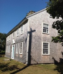
Built in 1908 in the American Craftsman. Listed on the National Register of Historic Places in
1986. A historic map-sheet match is not published yet. The record needs a coordinate-quality review before it can be joined to a sheet boundary.
From the record
“The Nickerson Mansion is a historic house in Brewster, Massachusetts. The large mansion was built in 1907 by Addie Nickerson and her son Samuel on the foundation of an 1890 mansion that was built by Addie's late father-in-law, Samuel Mayo Nickerson, for his son Roland's family to use as a summer home.”
Wikipedia article Nickerson Mansion, CC BY-SA 4.0.
one of 145 National Register listings in Barnstable County · listed in 1986 · category: Building · built in 1908, American Craftsman.
National Register reference number.86000300- the number the National Park Service assigned this property when it was listed, and the key its nomination file is catalogued under at the National Archives.
Regional context, not property-specific
evidence. The
federal wildfire occurrence database
lists 68 fires within 5 miles of Nickerson Mansion between
2015 and 2020, burning about 41 acres in total. 5 started naturally. 4 were recorded as arson.
Distance is straight-line from the map coordinates, so a fire counted
here may appear on a neighbouring settlement's page as well.
Reported cause
Fires
Missing data/not specified/undetermined
25
Equipment and vehicle use
14
Debris and open burning
12
Recreation and ceremony
8
Natural
5
Arson/incendiarism
4
The most recent of
them, most recent first, with the day each was reported and the service
that recorded it.
Regional context, not property-specific
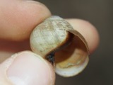
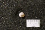
evidence. Museums hold 4,150 specimens
collected within 10 miles of Nickerson Mansion between 1819 and
1975: 2,394 Animalia, 1,315 Plantae, 228 Fungi, 100 Chromista, 68 Bacteria, 44 Unrecorded, 1 Protozoa. 12 distinct Species records are shown.
Collected by A. B. Seymour, A. R. Hodgdon, A. R. Hodgdon and others. Each is a
physical object with a catalogue
number, and each entry opens the museum's record. This is what was
collected and kept, not a survey of what lives here - nothing can be
concluded from a species being absent.
Regional context, not property-specific
evidence. The National Weather Service names
Brewster, the town this property stands in, in 10 storm reports between 2006 and 2019: 3 thunderstorm wind, 3 flood, 2 lightning, 1 hail.
No death or injury is recorded in these reports. Each account below is quoted exactly as the forecast office
filed it, from the NOAA Storm Events Database, and each date
opens the federal record of that event.
In Brewster, a large tree was down on Stony Brook Road. A tree and power lines were down on Run Hill Road. Numerous other trees were down throughout the town.
At 1139 PM EST, a basement was flooded on Robbins Hill Road in Brewster. At 1215 AM EST, the Ocean Edge Mansion on Main Street had flooding in the parking lot and the west wing of the building. At 1220 AM EST, a basement was reported flooded on Endicott Lane. At 1 AM EST, a basement was flooded on Lunds Farm Way.
No historic map-sheet match is published
for this property yet. That does not mean no map exists. This record needs
a coordinate-quality review before it can be joined to a sheet boundary.
Browse the county's mapped places while that work is
pending.
From the nomination file
4,157 words on record
When this property was proposed for the
National Register, someone wrote the case for it: what the building is,
and why it matters. That document is a federal record in the public domain.
It is quoted below word for word, never summarised. The text was read off the scanned case file by machine, so the
occasional stray character is the recogniser's and the 1970s
typewriter's.
Description of the property
The Nickerson Mansion (and adjacent Carriage House) is located on Route 6A in Brewster, Massachusetts on Cape Cod. It is just east of the center of Brewster on the north side of the road overlooking Cape Cod Bay. Route 6A is heavily tree lined but suddenly opens to reveal the broad lawn in front of the mansion and carriage house. The buildings are set back approximately 500' from the road. The front lawn is approxinately 500' wide. Cape Cod Bay is 1300' to the north of the buildings, but because the topography of the site slopes dramatically (a 30' change in elevation) toward the Bay, it is highly visible from the two buildings and from the approach to the building. The effect is a dramatic change from the scale, sitting and character of the neighboring village.
The parcel on which the Mansion stands preserves the property's original frontage as well as its major 1andscaping elements. The mansion was designed by Chapmnan and Frazer for Samuel Mayo Nickerson. The house was completed in 1908. It was built on the site of the Nickerson's previous summer house, a Victorian structure that was claimed by fire in 1906. EXTERIOR The Nickerson House is a two-and-one half story structure constructed in part of fireproof materials (steel frame, terracotta block and concrete slab floors at the basement and first stories) and wood framning (second story and attic). The building has a complex plan consisting of a main house with a service wing (east), porte-cochere (west) and terrace (north).
Elevations are covered with stucco trimned with cast-stone (copings and balustrades) and wood (cornices, window trimings and second-story balustrades). The structure is enclosed by a complex hip roof covered with red slates.
(in one paragraph) The Nickerson Mansion possesses integrity of design, materials, workinanship, setting, and historical associations with the Nickerson family of Chicago and Cape Cod, and with the Boston architectural firm of Chapman & Frazer. For its associations with the Nickerson family, and as a well-designed, early 20th century summer residence in the Arts and Crafts style, the Nickerson Mansion meets criteria B and C for listing to the National Register of Historic Places, with significance at the local level. A menher of the seventh generation of the Nickerson Family that settled in Cape Cod in 1640, Samuel Mayo Nickerson moved to Chicago as a young man.
Having engaged in various banking and railroad enterprises during the development of the west, the Nickerson was the founder and president of the First National Bank of Chicago from 1867 to 1891, now among the largest banks in the country. He also founded and was president of the Chicago Street Railroad Company. Samuel Nickerson served as president of the Union Stockyards Nationa! Bank and as a trustee of the Chicago Art Institute, to which he donated his large art collection. His business abilities were crucial to the rebuilding of Chicago after the great fire in 1871 and during the national depression of 1873.
In the late nineteenth century, Nickerson purchased the site of the present house, on which he but suner house.The original house of 1890, named "The Pines" by the family, was built as a gift for Nickerson's only son Roland, his wife Adeline and their three children. It was an ornate three-story Colonial Revival/Shingle Style dwelling with multiple chimney's, dormers and bays (see Figure 1).
Quoted from the National Register nomination
for reference 86000300, 17 pages, held by the National Archives in Record
Group 79. See the
catalogue record.
Listed places nearby
6 within 8 miles
Other National Register properties close
enough to walk or drive between, ordered by distance from this one. Both
positions come from the same geocoding pass that matched these properties
to their map sheets.
Listing record. National Park Service National Register of Historic Places, listed-properties dataset, current to 2026-05-22.
Map join. Address geocoded through the United States Census geocoder, then tested against the published boundary of every sheet in the USGS Historical Topographic Map Collection.
How this page is made. Listing fields come from federal records; map-sheet coverage is a labelled coordinate-to-boundary calculation, not a source-field claim.
Wildfire. Short, Karen C. 2022. Spatial wildfire occurrence data for the United States, 1992-2020 [FPA_FOD_20221014]. 6th Edition. Fort Collins, CO: Forest Service Research Data Archive. https://doi.org/10.2737/RDS-2013-0009.6 Collected with United States Government funding and usable without additional permissions or fees.
Specimens. Global Biodiversity Information Facility (GBIF), https://www.gbif.org/. Only records licensed CC0 or CC BY are used. Records licensed CC BY-NC are excluded because this site carries advertising. Images are checked individually and any whose licence is non-commercial, no-derivatives or unreadable is refused.
Storms. NOAA National Centers for Environmental Information, Storm Events Database https://www.ncei.noaa.gov/stormevents/ A work of the United States government, no copyright under 17 U.S.C. 105. Narratives are quoted verbatim from the National Weather Service report and are not edited or summarised.
 Block
Block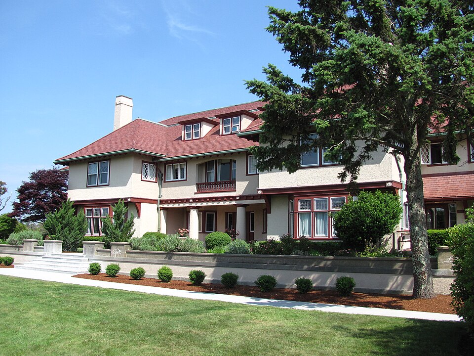



.jpeg)