Listed on the National Register of Historic Places in
1986. A historic map-sheet match is not published yet. The record needs a coordinate-quality review before it can be joined to a sheet boundary.
From the record
“The US Post Office - Easthampton Main is a historic post office building at 19 Union Street in Easthampton, Massachusetts. Built in 1933, this Classical Revival building is one of the town center's most architecturally sophisticated buildings.”
Wikipedia article United States Post Office-Easthampton Main, CC BY-SA 4.0.
one of 32 National Register listings in Hampshire County · listed in 1986 · category: Building.
National Register reference number.86000714- the number the National Park Service assigned this property when it was listed, and the key its nomination file is catalogued under at the National Archives.
Fires near this property
122 since 2004
Regional context, not property-specific
evidence. The
federal wildfire occurrence database
lists 122 fires within 5 miles of US Post Office--Easthampton Main between
2004 and 2020, burning about 117 acres in total. 18 started naturally. 5 were recorded as arson.
Distance is straight-line from the map coordinates, so a fire counted
here may appear on a neighbouring settlement's page as well.
Reported cause
Fires
Equipment and vehicle use
38
Missing data/not specified/undetermined
36
Natural
18
Debris and open burning
13
Recreation and ceremony
11
Arson/incendiarism
5
Smoking
1
The most recent of
them, most recent first, with the day each was reported and the service
that recorded it.
Regional context, not property-specific
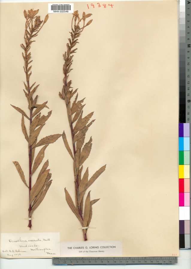
evidence. Museums hold 2,447 specimens
collected within 10 miles of US Post Office--Easthampton Main between 1822 and
1975: 1,657 Plantae, 571 Animalia, 200 Fungi, 12 Chromista, 5 Protozoa, 1 Unrecorded, 1 Bacteria. 12 distinct Species records are shown.
Collected by A., A. Albee, A. B. Seymour and others. Each is a
physical object with a catalogue
number, and each entry opens the museum's record. This is what was
collected and kept, not a survey of what lives here - nothing can be
concluded from a species being absent.
Regional context, not property-specific
evidence. The federal mineral resources record lists
26 workings within 5 miles of US Post Office--Easthampton Main: 13 producers, 12 past producers, 1 occurrence.
13 still produce. What was taken out: Brick Clay, Clay, Stone, Dimension, Stone, Crushed/Broken. Distance is straight-line from the
map coordinates, so a quarry counted here may appear on a neighbouring
settlement's page as well.
Regional context, not property-specific
evidence. The National Weather Service names
Easthampton, the town this property stands in, in 34 storm reports between 1994 and 2024: 21 thunderstorm wind, 7 hail, 2 lightning, 2 flash flood.
No death or injury is recorded in these reports. Each account below is quoted exactly as the forecast office
filed it, from the NOAA Storm Events Database, and each date
opens the federal record of that event.
A thunderstorm produced a strong microburst in Easthampton near the Holyoke line. Numerous trees were uprooted or snapped off on the west side of Mount Tom. A number of these trees were downed onto Route 141 and Mountain Road, trapping several cars on the roadway and causing Mountain Road to be closed by local officials.
Over three inches of rain fell in one hour in Easthampton resulting in flash flooding across the city. Pomery Road was impassable and closed because of the flooding. One person was rescued after being trapped in a car. Trees and wires were downed due to the ground washing out beneath them.
Numerous trees in the northeast section of town were downed by thunderstorm winds. This included trees on Ward Avenue, O'Neill Street, and Loudville Road.
There was a significant amount of damage in Easthampton. A tree was down on a car on Florence Road. A power line was down on a car on Lyman Street. A large tree was down on Route 10 about one-half mile north of Union Street. Numerous trees were down on Route 141.
In Easthampton, Park Street was flooded and impassable. Manhole covers were popping off on several side streets off of Park Street. Flooding was also reported on Garfield Avenue.
No historic map-sheet match is published
for this property yet. That does not mean no map exists. This record needs
a coordinate-quality review before it can be joined to a sheet boundary.
Browse the county's mapped places while that work is
pending.
Named in the fire insurance atlases
Sanborn surveyors printed an index of the
town's establishments at the front of each atlas. This property is named in
one, read straight off the scanned sheet.
When this property was proposed for the
National Register, someone wrote the case for it: what the building is,
and why it matters. That document is a federal record in the public domain.
It is quoted below word for word, never summarised. The text was read off the scanned case file by machine, so the
occasional stray character is the recogniser's and the 1970s
typewriter's.
Description of the property
DATE This post office, located on an attractively landscaped corner site, is situated in the downtown municipal district. The overall area is one of mixed development and high activity and this property is the principal attraction due to its architectural dignity, landscaping and maintenance. A building of Neo-Classical design executed in brick with limestone trim that is mostly in its original condition with the exception of aluminum and glass entrance doors and the addition of new mailing dock. Brick walls are laid in Flemish bond with rustication at the corners, stone water table, stone window trim and lintels and feature panels above.
The entrance portico has granite steps and quarry tile floor with wrought iron rails with brass finials; this railing detail being repeated at all areaways. Four limestone etruscian columns support an elaborate entablature and pediment. The architrave is carved limestone in a scroll and diamond pattern. The frieze contains the name of the facility and the denticulated cornice is elegant but simple. All small brick parapet supports a hipped asphalt shingle roof and the chimney is distinguished by it octagonal shape. The lobby is essentially in its original condition, whereas so many post offices dating from the early 1930's have been extensively remodelled.
The floor is quary tile with a wide marble border and a black veined white marble wainscot is carried around all sides of the "L" shaped lobby. Walls are plastered and contain open metal grill work above the service windows and boxes which also appear to be original. The marble stair to the basement is intact and except for some minor alteration for additional new boxes, no changes are evident.
Statement of significance
BUILDER/ARCHITECT Louis A. Simon, Supervising Architect In 1933, 210 post offices were constructed, 180 of them government owned. This reflected the increased funding made available for public buildings to relieve unemployment and stablize the economy. Building plans for post offices were largely developed within the office of the supervising architect where the work staff numbered nearly eight hundred people. Design policy was geared to the production of standardized plans for small post offices with the large facilities commissioned to private architectural firms.
Individual treatment of exterior details was encouraged for the work executed within the office of the supervising architect and with the effort of staff architect, it was inevitable that the nation would be rewarded with properties of considerable architectural merit. The Easthampton Post Office, with a facade of studied restraint, is a building of contributing architectural significance in a small town with few examples of architectural achievement.
Quoted from the National Register nomination
for reference 86000714, 13 pages, held by the National Archives in Record
Group 79. See the
catalogue record.
Listed places nearby
6 within 8 miles
Other National Register properties close
enough to walk or drive between, ordered by distance from this one. Both
positions come from the same geocoding pass that matched these properties
to their map sheets.
Listing record. National Park Service National Register of Historic Places, listed-properties dataset, current to 2026-05-22.
Map join. Address geocoded through the United States Census geocoder, then tested against the published boundary of every sheet in the USGS Historical Topographic Map Collection.
How this page is made. Listing fields come from federal records; map-sheet coverage is a labelled coordinate-to-boundary calculation, not a source-field claim.
Wildfire. Short, Karen C. 2022. Spatial wildfire occurrence data for the United States, 1992-2020 [FPA_FOD_20221014]. 6th Edition. Fort Collins, CO: Forest Service Research Data Archive. https://doi.org/10.2737/RDS-2013-0009.6 Collected with United States Government funding and usable without additional permissions or fees.
Specimens. Global Biodiversity Information Facility (GBIF), https://www.gbif.org/. Only records licensed CC0 or CC BY are used. Records licensed CC BY-NC are excluded because this site carries advertising. Images are checked individually and any whose licence is non-commercial, no-derivatives or unreadable is refused.
Mines and quarries. USGS Mineral Resources Data System (MRDS) https://mrdata.usgs.gov/mrds/ A work of the United States government, no copyright under 17 U.S.C. 105.
Storms. NOAA National Centers for Environmental Information, Storm Events Database https://www.ncei.noaa.gov/stormevents/ A work of the United States government, no copyright under 17 U.S.C. 105. Narratives are quoted verbatim from the National Weather Service report and are not edited or summarised.
 Block
Block