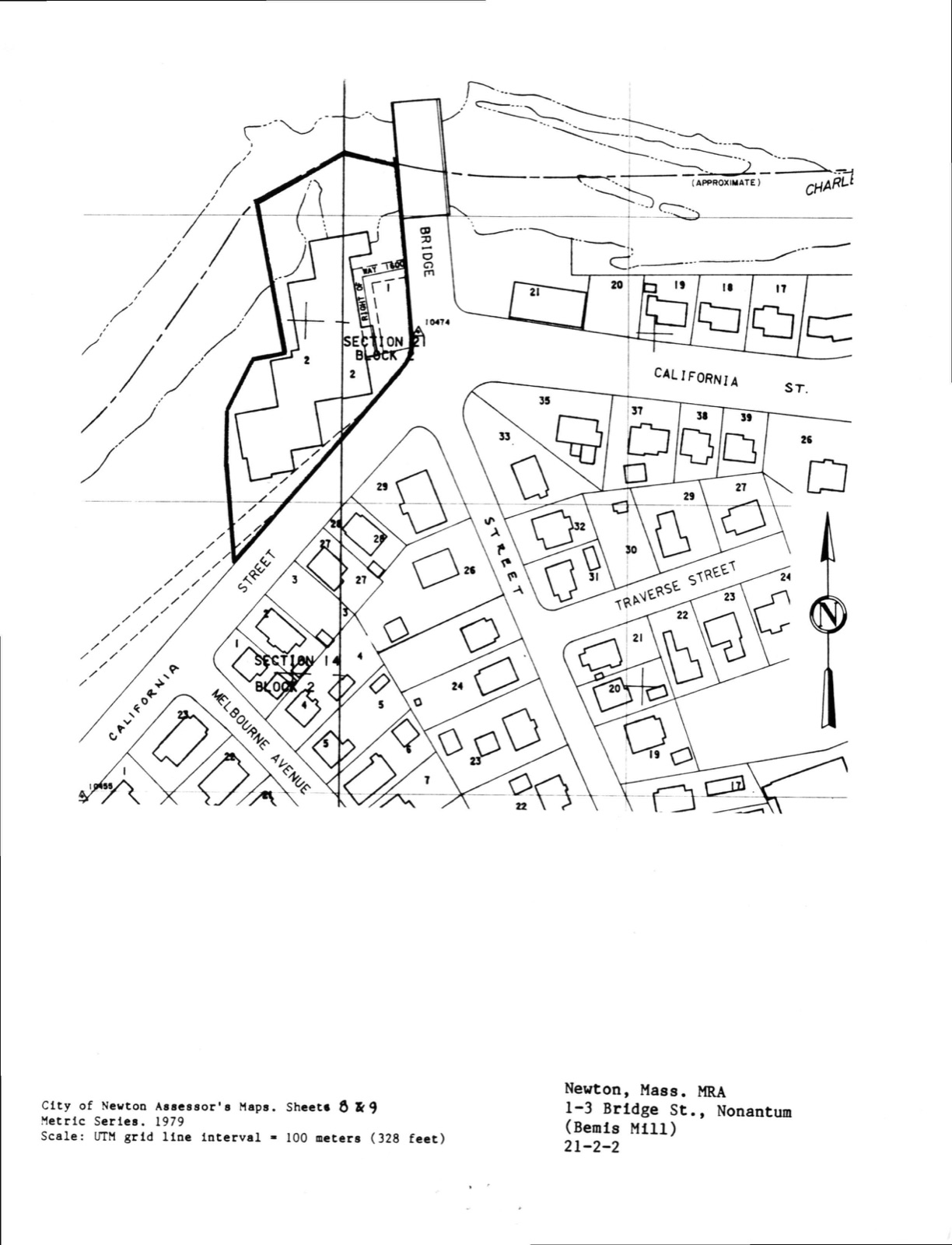
Photographs from the nomination case file, National Park Service records.
Bemis Mill
Listed on the National Register of Historic Places in
1986. A historic map-sheet match is not published yet. The record needs a coordinate-quality review before it can be joined to a sheet boundary.
From the record
“At ^is point a fall fumished water-power for the first mill built in the town. Other falls above fumish powerfor the Etna Mills and for the upper and lower Waltham factories.”
History of Middlesex County, Massachusetts (1880). Machine-read text.
one of 1100 National Register listings in Middlesex County · listed in 1986 · category: Building · one of 3 National Historic Landmarks in Middlesex County.
National Register reference number.86001773- the number the National Park Service assigned this property when it was listed, and the key its nomination file is catalogued under at the National Archives.
On the morning of the memorable 10th of April, 1775, the Middlesex regiment, under Colonel Thomas Gardner, assembled at the Watertown meeting-house. Michael Jackson, who commanded the Newton compain- that day, and afterwards, as colonel of the Stli Alassachiisitts Regiment, served through the Revolutionary AVar, found, on his arrival at the meeting-house, that the officers were in council in the adjacent school-house. Obtaining the floor, he told them that the time for talking had passed and the time for fighting had come; that if they meant to op])ose the march of the British troops they must forthwith leave the schoolhouse and take up their march for Lexington, and that he intended that his company should take the shortest route to get a shot at the British. His blunt, vigorous speech broke up the council, each company behig left to take its own course. Those of Newton and Watertown, joining near Lexington, eneoiiiilcred Lord Percy's retre.itiiig column, exchanging shots with it, and h.mging upon its flank and rear, until, at nightfall, it reached Charlestown, completely exhausted and demoralized. They received upon the field the thanks of Dr. Warren, president of the Provincial Congress, for their bravery. The Watertown men wen- led that day by Captain, afterwards ^lajor, Samuel Barnard, one of the Boston Tea-Party, losing only one of their number, Joseph Coolidge, in the action.
In 17^0j soon after the decease of Rev. Mr. Angier, the town, which before the iucorporation of Weston had been divided into tliree precincts, was re-divided into two, witli independent ecclesiastical organizations, each society building its own house. . The West Precinct (Mr. Angler's) purchased tlie old Newton meeting-house in 1721, wiiich they set up a little north of Waltham Plain, near the old Livermore homestead, since known as the Lyman Place. The Eastern Precinct (Mr. Gibbs's) in 17iJ.'3 built their house on School-house Hill, afterwards known as Meeting-house Hill, the ancient Strawberry Hill. This structure gave place to that built at the corner of Mount Auburn and Common streets. In May, 1754, before its completion, the new house was burned to the ground. The historic edifice in. which were held the sessions of the Provincial Congress of Massachusetts, built on the same spot, was completed in February, 1755. Until lS:i7 this was the only meeting-house in Watertown. It was enlarged in 1819, but was taken down in 1837, a new edifice having been completed and dedicated September 7, 1836. This was destroyed by the great fire of 1841. The present house, erected on the site of the latter, was dedicated August 3, 1842.
Regional context, not property-specific
evidence. The
federal wildfire occurrence database
lists 64 fires within 5 miles of Bemis Mill between
2015 and 2020, burning about 29 acres in total. None started naturally. 3 were recorded as arson.
Distance is straight-line from the map coordinates, so a fire counted
here may appear on a neighbouring settlement's page as well.
Reported cause
Fires
Recreation and ceremony
25
Missing data/not specified/undetermined
21
Debris and open burning
9
Smoking
3
Arson/incendiarism
3
Equipment and vehicle use
1
Power generation/transmission/distribution
1
Misuse of fire by a minor
1
The most recent of
them, most recent first, with the day each was reported and the service
that recorded it.
Regional context, not property-specific
evidence. Museums hold 2,431 specimens
collected within 10 miles of Bemis Mill between 1898 and
1975: 1,222 Animalia, 662 Plantae, 478 Fungi, 29 Protozoa, 17 Bacteria, 14 Chromista, 9 Unrecorded. 12 distinct Species records are shown.
Collected by ?, A B Seymour, A. B. Seymour and others. Each is a
physical object with a catalogue
number, and each entry opens the museum's record. This is what was
collected and kept, not a survey of what lives here - nothing can be
concluded from a species being absent.
Regional context, not property-specific
evidence. The federal mineral resources record lists
6 workings within 5 miles of Bemis Mill: 4 past producers, 1 producer, 1 plant.
2 still produce. What was taken out: Sand and Gravel, Construction, Stone, Crushed/Broken, Tantalum, Niobium (Columbium). Distance is straight-line from the
map coordinates, so a quarry counted here may appear on a neighbouring
settlement's page as well.
Regional context, not property-specific
evidence. The National Weather Service names
Newton, the town this property stands in, in 17 storm reports between 1997 and 2025: 8 thunderstorm wind, 4 hail, 3 flood, 1 flash flood.
The reports record 1 injury. Each account below is quoted exactly as the forecast office
filed it, from the NOAA Storm Events Database, and each date
opens the federal record of that event.
A 62-year old woman was struck by lightning. She endured a side flash after lightning struck a tree near her. She was alert and breathing at the scene but was transported to a hospital for further evaluation.
In Newton, a tree was down on a car near 1750 Commonwealth Avenue. Also, a tree was down on a house at 111 Prospect Street. A tree was down on Park Drive. A tree was down on Adams Street at Wiltshire Road.
In Newton, urban flooding caused two cars to have to be removed from flood waters near 100 Walnut Street. Also, Adams Street was flooded and impassable from Watertown Street (Route 16) to Cottage Court.
In Newton, a 20 foot stretch of Beacon Street was flooded with 1 foot of water. Also, Route 9 at the Parker Street underpass was flooded with 6 to 12 inches of water. Route 9 westbound near the Chestnut Hill Mall was flooded with 10 to 12 inches of water. In Natick, Speen Street near the Natick Mall was flooded with a foot of water. A few cars stalled out in the water.
After receiving two to three inches of rain with Tropical Storm Irene, the intersection of Commonwealth Avenue and Washington Street was impassable due to flooding in Newton. A car was stuck in flood waters on Commonwealth Avenue.
No historic map-sheet match is published
for this property yet. That does not mean no map exists. This record needs
a coordinate-quality review before it can be joined to a sheet boundary.
Browse the county's mapped places while that work is
pending.
From the nomination file
1,982 words on record
When this property was proposed for the
National Register, someone wrote the case for it: what the building is,
and why it matters. That document is a federal record in the public domain.
It is reproduced in full on its own page, word for word and never summarised. The text was read off the scanned case file by machine, so the
occasional stray character is the recogniser's and the 1970s
typewriter's.
Quoted from the National Register nomination
for reference 86001773, 9 pages, held by the National Archives in Record
Group 79. See the
catalogue record.
Listed places nearby
6 within 8 miles
Other National Register properties close
enough to walk or drive between, ordered by distance from this one. Both
positions come from the same geocoding pass that matched these properties
to their map sheets.
Listing record. National Park Service National Register of Historic Places, listed-properties dataset, current to 2026-05-22.
Map join. Address geocoded through the United States Census geocoder, then tested against the published boundary of every sheet in the USGS Historical Topographic Map Collection.
How this page is made. Listing fields come from federal records; map-sheet coverage is a labelled coordinate-to-boundary calculation, not a source-field claim.
Wildfire. Short, Karen C. 2022. Spatial wildfire occurrence data for the United States, 1992-2020 [FPA_FOD_20221014]. 6th Edition. Fort Collins, CO: Forest Service Research Data Archive. https://doi.org/10.2737/RDS-2013-0009.6 Collected with United States Government funding and usable without additional permissions or fees.
Specimens. Global Biodiversity Information Facility (GBIF), https://www.gbif.org/. Only records licensed CC0 or CC BY are used. Records licensed CC BY-NC are excluded because this site carries advertising. Images are checked individually and any whose licence is non-commercial, no-derivatives or unreadable is refused.
Mines and quarries. USGS Mineral Resources Data System (MRDS) https://mrdata.usgs.gov/mrds/ A work of the United States government, no copyright under 17 U.S.C. 105.
Storms. NOAA National Centers for Environmental Information, Storm Events Database https://www.ncei.noaa.gov/stormevents/ A work of the United States government, no copyright under 17 U.S.C. 105. Narratives are quoted verbatim from the National Weather Service report and are not edited or summarised.
 Block
Block