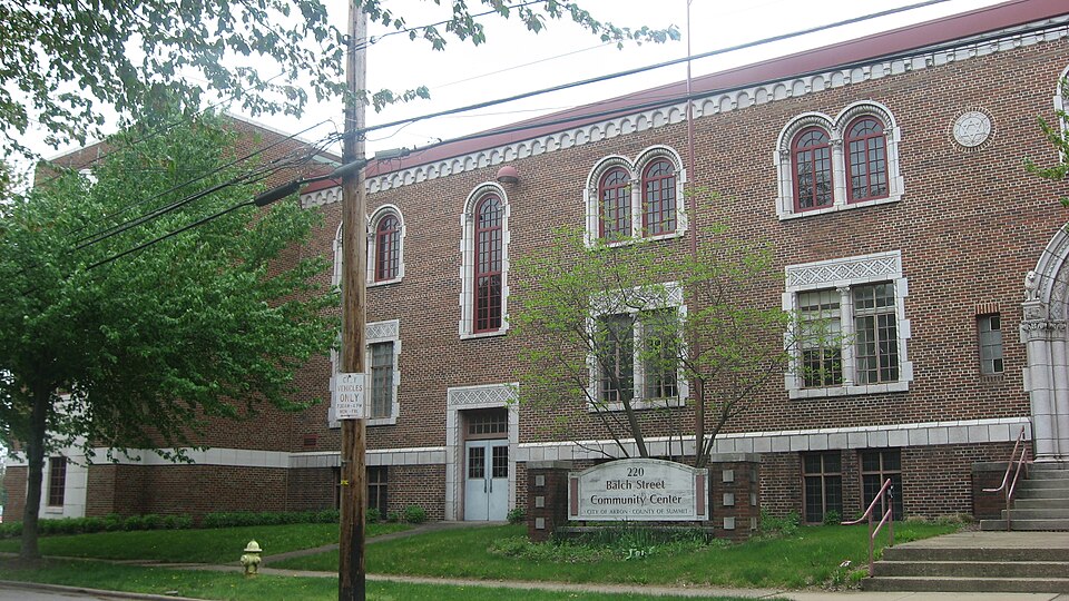
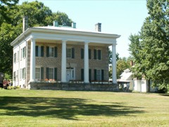
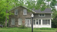
Built in 1929 in the Romanesque Revival architecture. Listed on the National Register of Historic Places in
1986. A historic map-sheet match is not published yet. The record needs a coordinate-quality review before it can be joined to a sheet boundary.
From the record
“The Akron Jewish Center is a historic building in Akron, Ohio, in the United States. It was built in 1929 and expanded in 1951 as a synagogue, Jewish community center, and headquarters for the organization with the same name for over 45 years.”
Wikipedia article Akron Jewish Center, CC BY-SA 4.0.
one of 137 National Register listings in Summit County · listed in 1986 · category: Building · built in 1929, Romanesque Revival architecture · one of 1 National Historic Landmarks in Summit County.
National Register reference number.86001919- the number the National Park Service assigned this property when it was listed, and the key its nomination file is catalogued under at the National Archives.
It is inaccurate to say that the Ohio Canal made Akron. The city as it stands today is the resultant of many causes. Many and different influences, and various men and measures, have co-operated toward the end now attained. The start was made long before the Ohio Canal was built. - Within the present limits of the city, settlements at two different points had been made, which antedate the canal by nearly two decades. In 1807 the first settlement had been made in Middlebury. In 1811 Miner Spicer had started "Spicertown." In the same year Paul Williams settled upon the lands immediately west of the Spicer settlement and adjoining the land of General Simon Perkins on the east. When the canal was opened in 1827 Middlebury was an important village. It had attracted many settlers from the East, principally from Connecticut, and boasted of half a dozen mills and factories, a dozen stores, three inns and about five hundred inhabitants. It certainly deserved a place on the maps of the time.
Let us search that we may find, if we can, the economic reasons for the existence of Akron. The sentence that begins this chapter contains the idea that is ordinarily advanced as the sole reason for the Akron of today. The unthinking man repeats: "The canal made Akron." The wTiter on Akron history records: "Dr. Eliakim G. Crosby made Akron."
Regional context, not property-specific
evidence. The
federal wildfire occurrence database
lists 1 fire within 5 miles of Akron Jewish Center between
2014 and 2014, burning about 0 acres in total. None started naturally. None was recorded as arson.
Distance is straight-line from the map coordinates, so a fire counted
here may appear on a neighbouring settlement's page as well.
Reported cause
Fires
Missing data/not specified/undetermined
1
The most recent of
them, most recent first, with the day each was reported and the service
that recorded it.
Regional context, not property-specific
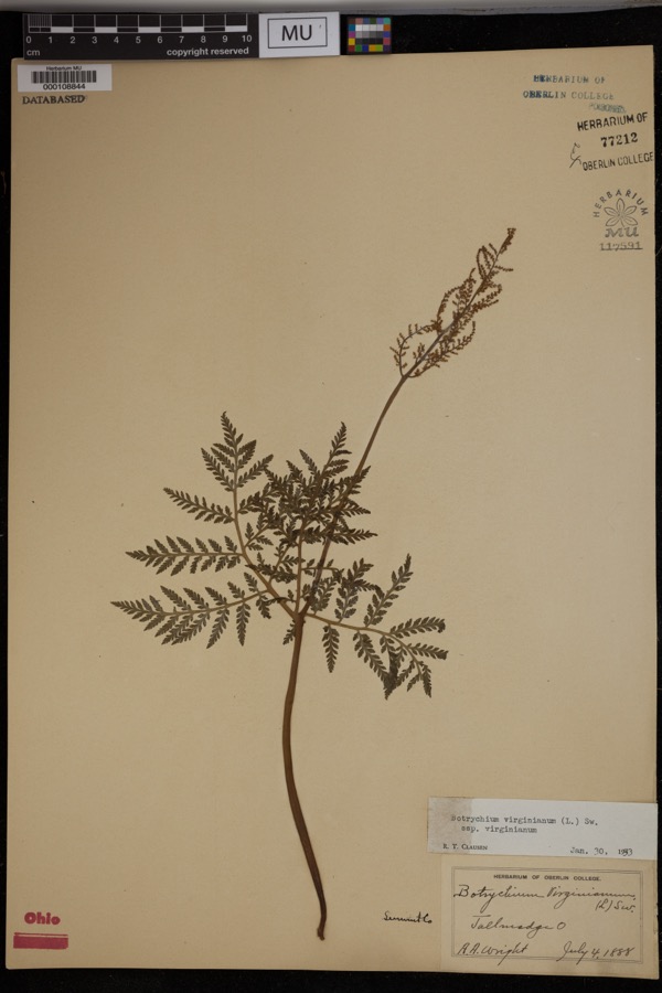
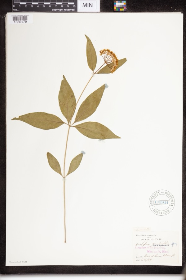
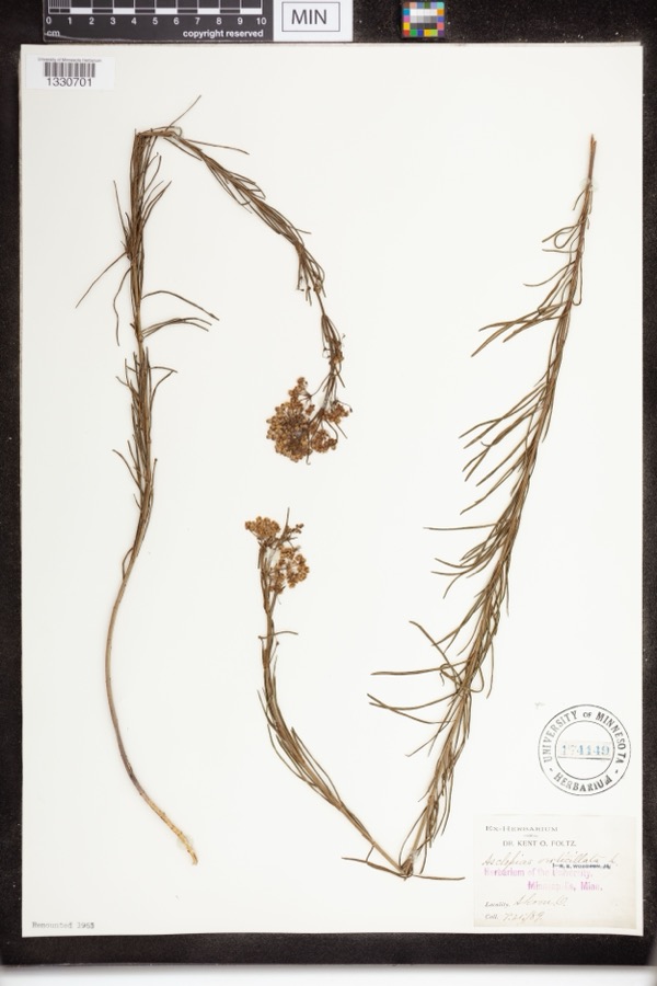
evidence. Museums hold 816 specimens
collected within 10 miles of Akron Jewish Center between 1867 and
1975: 699 Animalia, 70 Plantae, 45 Fungi, 1 Unrecorded, 1 Bacteria. 12 distinct Species records are shown.
Collected by (no collector listed), A. Black, A. W. Cusick and others. Each is a
physical object with a catalogue
number, and each entry opens the museum's record. This is what was
collected and kept, not a survey of what lives here - nothing can be
concluded from a species being absent.
Regional context, not property-specific
evidence. The federal mineral resources record lists
11 workings within 5 miles of Akron Jewish Center: 9 past producers, 2 producers.
2 still produce. What was taken out: Sand and Gravel, Construction. Distance is straight-line from the
map coordinates, so a quarry counted here may appear on a neighbouring
settlement's page as well.
Regional context, not property-specific
evidence. The National Weather Service names
Akron, the town this property stands in, in 75 storm reports between 1996 and 2025: 38 hail, 31 thunderstorm wind, 5 flash flood, 1 lightning.
The reports record 2 deaths. Each account below is quoted exactly as the forecast office
filed it, from the NOAA Storm Events Database, and each date
opens the federal record of that event.
On Wednesday afternoon, July 10, the City of Akron experienced 3 to 4 inches of rain in an hour and a half. Flooding occurred causing the closings of roadways and expressways. Along with the roadway flooding, the City received reports of nearly 200 flooded basements. Widespread flooding was reported throughout the city and numerous homes, businesses, and vehicles were inundated by the rain.
Weakened tree fell onto home in Akron and killed occupant. Thunderstorm was likely sub-severe per radar data. The nearby Akron-Fulton International Airport ASOS recorded a peak convective wind gust of 44 mph at 9:26 AM EST. No other reports of thunderstorm-related damage or severe convective weather were received as the cluster of storms moved through the Akron area.
A severe thunderstorm moved across Summit County and caused unprecedented damage. Hail as large as softballs fell across much of the county. Extensive damage was done to homes and vehicles in Akron and surrounding areas. Nearly 51,100 insurance claims were filed for damage in the county. The south side of Akron was the hardest hit.
Thunderstorm winds downed trees and limbs in the Akron and Stow areas resulting in scattered power outages. At the peak of the storm a few thousand customers were without power.
Route 8 northbound was closed from Perkins St to E. Tallmadge Avenue. Akron police reported traffic accidents and delays due to the high water conditions. Route 8 southbound closed at Seasons Rd in Hudson/Stow to flooding. Storm total rainfall from Hudson 4.75.
2 papers published in this town,
digitised by the Library of Congress and free to read: 0 issues,
0 pages. Every page is searchable, so a name or a street can be
looked for directly in what the town printed about itself at the time.
No historic map-sheet match is published
for this property yet. That does not mean no map exists. This record needs
a coordinate-quality review before it can be joined to a sheet boundary.
Browse the county's mapped places while that work is
pending.
From the nomination file
2,353 words on record
When this property was proposed for the
National Register, someone wrote the case for it: what the building is,
and why it matters. That document is a federal record in the public domain.
It is quoted below word for word, never summarised. The text was read off the scanned case file by machine, so the
occasional stray character is the recogniser's and the 1970s
typewriter's.
Description of the property
floriated square pattern.The entire arch is supported at either side by two and rests at the center on an engaged lonic column.Flanking the window over Check one with brownish-red textured brick laid in American bond.Trim is executed paired windows with:terra-cotta surrounds is repeated on the second floor in the entrance are two large round terra-cotta panels with a Star-of-David first-floor double window whose broad lintel bears a floriated diamond design half-round lonic columns placed at right angles to each other.Four wood up six steps from ground level.The flat built-up roof is hidden by a low ornamented cornice of low profile.
Built in 1929,The Akron Jewish Center was designed by the local architectural Fronting a wide double side entryway placed in an ell of this addition and built in 195l,expanding the Center!s classroom and athletic departments. embellished arch with multiple archivolts springs from a pseudo-purlin boss at symbol.All of the window sash is metal casement. Set at ground level to the left is a subordinate entry with a deep transom and X altered of wood separates the glazed tympanum and is incised with the words AKRON four other of the original six front bays, each time aligned with a trabeated within. At the left of the original facade is a large addition of great depth frieze along the top of the building. Michael M.
Konarski, architect for the terra cotta suggests, in a simplified almost Art Deco interpretation, the - good unexposed ornamented round arch resting on engaged lonic columns.This same device of entirely in flecked grey terra cotta to suggest granite.The raised basement Byzantine influence in its detailing.The building is of masonry construction serving as transition between the old and the new sectionsis a projecting OMB No.
(in one paragraph) and Eleanor Roosevelt.America's Town Meeting of the Air twice originated -prehistoric Areas of Significance-Check and justify below Criteria A and C Came to Dinner:to "The Diary of Anne Frank," while the Women's Day Program on -science _music --archeology-prehistoric -_community planning cultural, educational, social, recreational, and athletic services. Aside and domestic commissions had been highly visible on the local scene for two :n community, it was the public-event series that constantly drew attention and attendance..
The Theatre Gulld offered its own plays ranging rom "The .Man Who 1800's, it was in 1924 that a small group of prominent Jewish men organized to established, and by April of 1928 $58,000 had been raised, with further and decades, culminating in the ten-storey Akron Y.W.C.A. building in 1930. 1929 art Anshe Emeth Congregation had been meeting.A board of trustees was with subjects of area concern, was begun shortly after the Center's opening.
the Center prodigiously fulfilled its intentions of service to the Jewish the general public the vents of its Center Theatre Guild, Sunday Evening the Akron Jewish Center contributed greatly not only to the city's Jewish sufficient funds soon following.On November 4,1928,the cornerstone was In the nearly forty-five years that it was headquartered in this building, community but also to the citizenry at large through its many and varied national repute.The Center:building:itself was a:major work by a premier secure a charter for the building of a Jewish Center.ln 1926 a women's 9.
Quoted from the National Register nomination
for reference 86001919, 15 pages, held by the National Archives in Record
Group 79. See the
catalogue record.
Listed places nearby
6 within 8 miles
Other National Register properties close
enough to walk or drive between, ordered by distance from this one. Both
positions come from the same geocoding pass that matched these properties
to their map sheets.
Listing record. National Park Service National Register of Historic Places, listed-properties dataset, current to 2026-05-22.
Map join. Address geocoded through the United States Census geocoder, then tested against the published boundary of every sheet in the USGS Historical Topographic Map Collection.
How this page is made. Listing fields come from federal records; map-sheet coverage is a labelled coordinate-to-boundary calculation, not a source-field claim.
Wildfire. Short, Karen C. 2022. Spatial wildfire occurrence data for the United States, 1992-2020 [FPA_FOD_20221014]. 6th Edition. Fort Collins, CO: Forest Service Research Data Archive. https://doi.org/10.2737/RDS-2013-0009.6 Collected with United States Government funding and usable without additional permissions or fees.
Specimens. Global Biodiversity Information Facility (GBIF), https://www.gbif.org/. Only records licensed CC0 or CC BY are used. Records licensed CC BY-NC are excluded because this site carries advertising. Images are checked individually and any whose licence is non-commercial, no-derivatives or unreadable is refused.
Mines and quarries. USGS Mineral Resources Data System (MRDS) https://mrdata.usgs.gov/mrds/ A work of the United States government, no copyright under 17 U.S.C. 105.
Storms. NOAA National Centers for Environmental Information, Storm Events Database https://www.ncei.noaa.gov/stormevents/ A work of the United States government, no copyright under 17 U.S.C. 105. Narratives are quoted verbatim from the National Weather Service report and are not edited or summarised.
 Block
Block