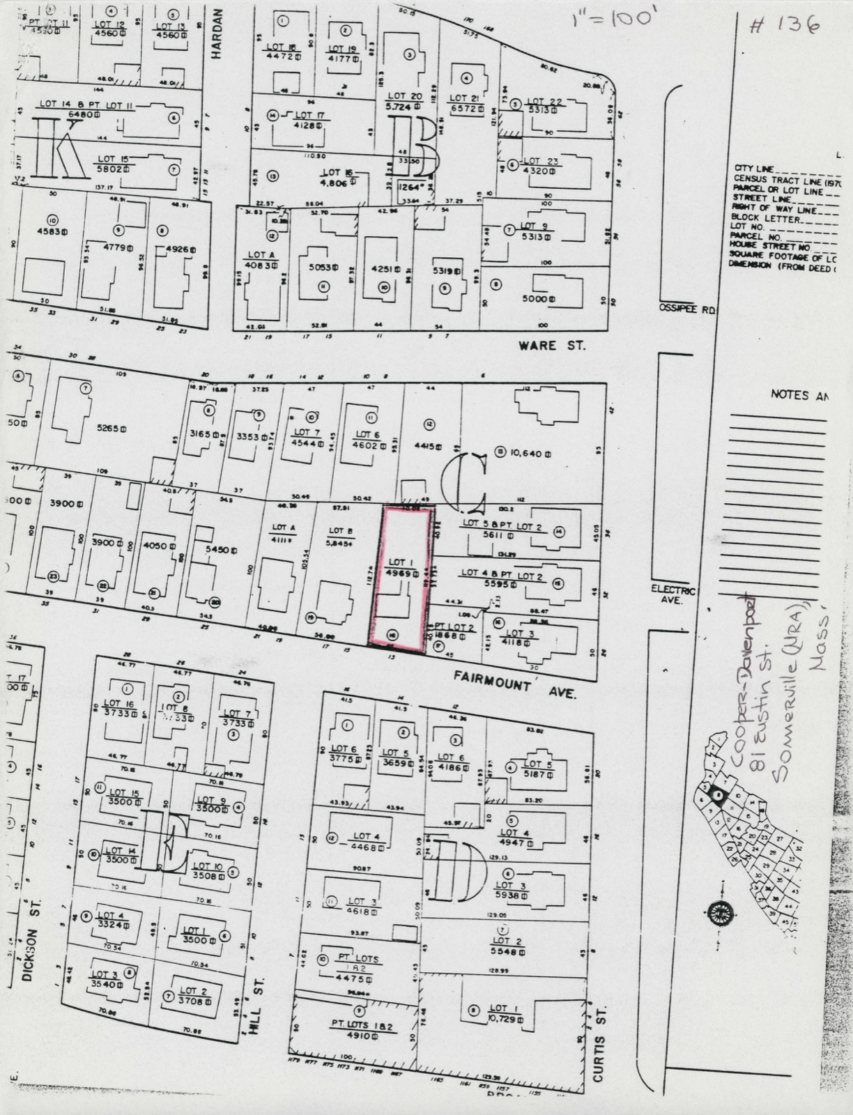
Photographs from the nomination case file, National Park Service records.
Cooper--Davenport Tavern Wing
Listed on the National Register of Historic Places in
1989. A historic map-sheet match is not published yet. The record needs a coordinate-quality review before it can be joined to a sheet boundary.
From the record
“He bought his sugar in small quantities and brought it out of Boston himself, and after it was made into candy carried it into Boston to sell. From this small beginning by untiring industry, strict economy and fair dealing was built up the largest confectionery manufactory at that time in New England, sending wagons all over these states.”
A History of Cambridge, Massachusetts, 1630-1913 (1913). Machine-read text.
one of 1100 National Register listings in Middlesex County · listed in 1989 · category: Building · one of 3 National Historic Landmarks in Middlesex County.
National Register reference number.89001257- the number the National Park Service assigned this property when it was listed, and the key its nomination file is catalogued under at the National Archives.
Within a few years afterwards, a desire was manifested to abandon this pleasant spot, which had attained a greatly increased marketable value, and to try the experiment of farming on a larger scale. Accordingly the city purchased, Aug. 7, 1849, of Samuel Smith and Spencer Cook, for $12,000, about thirtytwo acres of land, situated partly in the northwesterly corner of Cambridge and partly in the southwesterly corner of Somerville, and erected a stone Almshouse of the size and fashion then prevalent. The cost of the whole establishment was reported by a committee to be, - for the land, $12,000; for the house, $32,970.69; for fences, furniture, etc., $3,000; total, $47,970.69. The house was formally placed in the custody of the Overseers of the Poor, April 3, 1851, with much congratulatory speech-making, in presence of a large assembly of citizens, and the paupers were transferred to their new home. When this house was erected, its magnificent proportions were considered necessary for the accommodation of the large number of State paupers then under the charge of the city. Shortly afterwards, the Commonwealth adopted a new policy, erected State Almshouses, and withdrew its paupers from the care of cities and towns. Complaints were uttered, that the erection of so large a house for so few inmates was unnecessary, and involved an extravagant outlay of money. But such complaints are no longer heard ; partly, because the increase of city paupers has kept pace with the rapidly increasing population, until the house is nearly if not altogether filled ; and partly, because the citizens have become accustomed to expenditures so much more unnecessary and extravagant, that this has dwindled into comparative insignificance. The old Almshouse (together with the land) was sold, May 22, 1851, to Little & Brown, publishers and booksellers, for $24,000 ; they converted it into an establishment for the manufacture of books, and erected many additional buildings. Subsequently the larger part of the estate became the property of H. O. Houghton & Co., by whom it was further embellished and rendered famous as the seat of the Riverside Press.
Eastward from Holyoke(then called Crooked) Street ran Back Lane, while Braintree Street, deflecting southeastward, took the name of Field Lane. These two lanes, meeting near the present junction of Bow and Arrow Streets, formed the "highway into the Neck." "The Neck," was a name for the territory now covered by Cambridgeport and East Cambridge. It was largelj' a salt marsh but the arable land was parceled out among the inhabitants in severalty. The western part was cut up into small portions of from one to three acres, but to the eastward of the site of Hancock Street it was granted in large tracts of from twenty to sixty acres. This region of the Neck was marked off and protected by a fence which ran - to use modem names - from Holyoke Place to Gore Hall, and thence to the line between Cambridge and Somerville at Line Street near Cambridge Street. "Thus we find," said John Fiske, "in the beginnings of Cambridge clear traces of the ancient English method of forming a town, with its threefold partition into town mark, arable mark, and common."
Regional context, not property-specific
evidence. The
federal wildfire occurrence database
lists 80 fires within 5 miles of Cooper--Davenport Tavern Wing between
2015 and 2020, burning about 108 acres in total. None started naturally. 29 were recorded as arson.
Distance is straight-line from the map coordinates, so a fire counted
here may appear on a neighbouring settlement's page as well.
Reported cause
Fires
Arson/incendiarism
29
Missing data/not specified/undetermined
21
Recreation and ceremony
11
Debris and open burning
11
Smoking
6
Equipment and vehicle use
1
Misuse of fire by a minor
1
The most recent of
them, most recent first, with the day each was reported and the service
that recorded it.
Regional context, not property-specific
evidence. Museums hold 1,989 specimens
collected within 10 miles of Cooper--Davenport Tavern Wing between 1898 and
1975: 867 Animalia, 605 Plantae, 453 Fungi, 27 Protozoa, 17 Bacteria, 12 Chromista, 8 Unrecorded. 12 distinct Species records are shown.
Collected by ?, A B Seymour, A B. Proper and others. Each is a
physical object with a catalogue
number, and each entry opens the museum's record. This is what was
collected and kept, not a survey of what lives here - nothing can be
concluded from a species being absent.
Regional context, not property-specific
evidence. The federal mineral resources record lists
12 workings within 5 miles of Cooper--Davenport Tavern Wing: 10 plants, 2 past producers.
10 still produce. What was taken out: Iron, Lead, Tantalum, Niobium (Columbium). Distance is straight-line from the
map coordinates, so a quarry counted here may appear on a neighbouring
settlement's page as well.
Regional context, not property-specific
evidence. The National Weather Service names
Somerville, the town this property stands in, in 7 storm reports between 2006 and 2021: 5 thunderstorm wind, 2 flood.
No death or injury is recorded in these reports. Each account below is quoted exactly as the forecast office
filed it, from the NOAA Storm Events Database, and each date
opens the federal record of that event.
Water flooded Medford Street up to the roof of a vehicle. Two vehicles were stuck in flood waters on Medford Street. In addition, a large sinkhole opened up as a result of the flooding. This resulted in the street closing through Wednesday, December 10 while crews figured out how to repair the sinkhole.
No historic map-sheet match is published
for this property yet. That does not mean no map exists. This record needs
a coordinate-quality review before it can be joined to a sheet boundary.
Browse the county's mapped places while that work is
pending.
From the nomination file
1,274 words on record
When this property was proposed for the
National Register, someone wrote the case for it: what the building is,
and why it matters. That document is a federal record in the public domain.
It is reproduced in full on its own page, word for word and never summarised. The text was read off the scanned case file by machine, so the
occasional stray character is the recogniser's and the 1970s
typewriter's.
Quoted from the National Register nomination
for reference 89001257, 8 pages, held by the National Archives in Record
Group 79. See the
catalogue record.
Listed places nearby
6 within 8 miles
Other National Register properties close
enough to walk or drive between, ordered by distance from this one. Both
positions come from the same geocoding pass that matched these properties
to their map sheets.
Listing record. National Park Service National Register of Historic Places, listed-properties dataset, current to 2026-05-22.
Map join. Address geocoded through the United States Census geocoder, then tested against the published boundary of every sheet in the USGS Historical Topographic Map Collection.
How this page is made. Listing fields come from federal records; map-sheet coverage is a labelled coordinate-to-boundary calculation, not a source-field claim.
Wildfire. Short, Karen C. 2022. Spatial wildfire occurrence data for the United States, 1992-2020 [FPA_FOD_20221014]. 6th Edition. Fort Collins, CO: Forest Service Research Data Archive. https://doi.org/10.2737/RDS-2013-0009.6 Collected with United States Government funding and usable without additional permissions or fees.
Specimens. Global Biodiversity Information Facility (GBIF), https://www.gbif.org/. Only records licensed CC0 or CC BY are used. Records licensed CC BY-NC are excluded because this site carries advertising. Images are checked individually and any whose licence is non-commercial, no-derivatives or unreadable is refused.
Mines and quarries. USGS Mineral Resources Data System (MRDS) https://mrdata.usgs.gov/mrds/ A work of the United States government, no copyright under 17 U.S.C. 105.
Storms. NOAA National Centers for Environmental Information, Storm Events Database https://www.ncei.noaa.gov/stormevents/ A work of the United States government, no copyright under 17 U.S.C. 105. Narratives are quoted verbatim from the National Weather Service report and are not edited or summarised.
 Block
Block