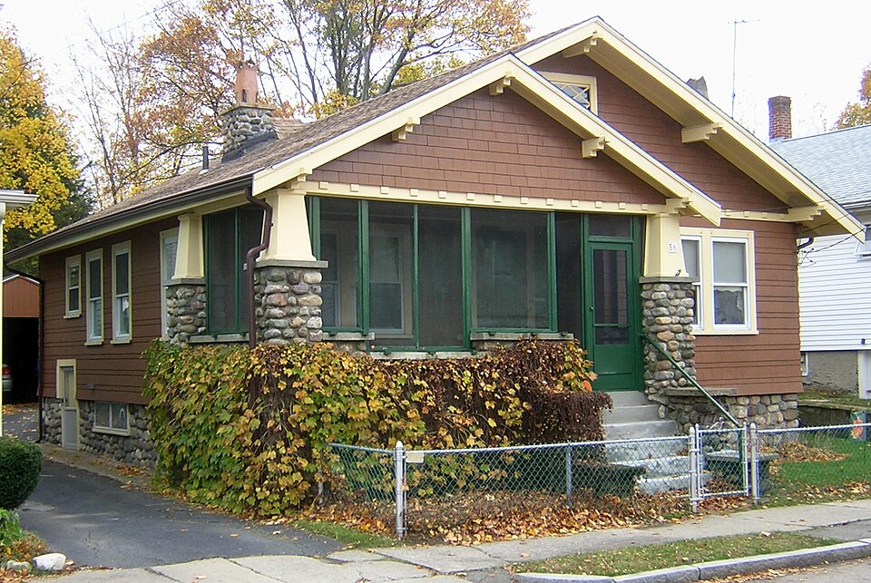
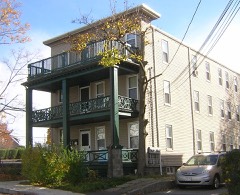
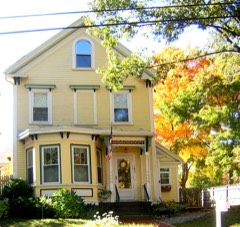
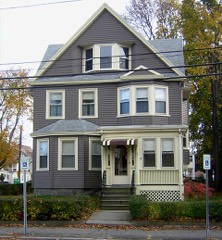
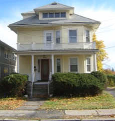
Listed on the National Register of Historic Places in
1989. A historic map-sheet match is not published yet. The record needs a coordinate-quality review before it can be joined to a sheet boundary.
From the record
“Dicey House is a historic house at 56 Pope Street in Quincy, Massachusetts. The wood-frame house was built in 1918, and is a well-preserved example of a modest Craftsman bungalow.”
Wikipedia article Russell M. Dicey House, CC BY-SA 4.0.
one of 249 National Register listings in Norfolk County · listed in 1989 · category: Building · one of 2 National Historic Landmarks in Norfolk County.
National Register reference number.89001363- the number the National Park Service assigned this property when it was listed, and the key its nomination file is catalogued under at the National Archives.
Fires near this property
194 since 2015
Regional context, not property-specific
evidence. The
federal wildfire occurrence database
lists 194 fires within 5 miles of Dicey, Russell M., House between
2015 and 2020, burning about 109 acres in total. None started naturally. None was recorded as arson.
Distance is straight-line from the map coordinates, so a fire counted
here may appear on a neighbouring settlement's page as well.
Reported cause
Fires
Recreation and ceremony
139
Smoking
33
Missing data/not specified/undetermined
17
Debris and open burning
3
Equipment and vehicle use
2
The most recent of
them, most recent first, with the day each was reported and the service
that recorded it.
Regional context, not property-specific
evidence. Museums hold 12,519 specimens
collected within 10 miles of Dicey, Russell M., House between 1810 and
1975: 5,472 Plantae, 3,502 Fungi, 2,852 Animalia, 396 Chromista, 204 Protozoa, 61 Unrecorded, 32 Bacteria. 12 distinct Species records are shown.
Collected by (MARSDEN, H W), ?, ? ex Herb. W.G. Farlow and others. Each is a
physical object with a catalogue
number, and each entry opens the museum's record. This is what was
collected and kept, not a survey of what lives here - nothing can be
concluded from a species being absent.
Regional context, not property-specific
evidence. The federal mineral resources record lists
3 workings within 5 miles of Dicey, Russell M., House: 2 producers, 1 past producer.
2 still produce. What was taken out: Granite, Stone, Crushed/Broken, Sand and Gravel, Construction. Distance is straight-line from the
map coordinates, so a quarry counted here may appear on a neighbouring
settlement's page as well.
Regional context, not property-specific
evidence. The National Weather Service names
Quincy, the town this property stands in, in 29 storm reports between 1995 and 2025: 10 thunderstorm wind, 8 flood, 5 flash flood, 3 hail.
No death or injury is recorded in these reports. Each account below is quoted exactly as the forecast office
filed it, from the NOAA Storm Events Database, and each date
opens the federal record of that event.
Several streets in the area of Quincy, Braintree, and Milton were flooded with one to two feet of water. One car was stuck in flood waters at Granite and Chickatawbut Roads in Quincy.
In Quincy, a tree was down on a car at the intersection of Evans Street and West Squantum Street. A person was trapped and extricated, but fortunately was uninjured. Police report relayed by amateur radio.
No historic map-sheet match is published
for this property yet. That does not mean no map exists. This record needs
a coordinate-quality review before it can be joined to a sheet boundary.
Browse the county's mapped places while that work is
pending.
From the nomination file
1,239 words on record
When this property was proposed for the
National Register, someone wrote the case for it: what the building is,
and why it matters. That document is a federal record in the public domain.
It is quoted below word for word, never summarised. The text was read off the scanned case file by machine, so the
occasional stray character is the recogniser's and the 1970s
typewriter's.
Statement of significance
/Architect Statement of Significance (in one paragraph) summary paragraph completeness clarity applicable criteria justification of areas checked relating significance to the resource context relationship of integrity to significance justification of exception other BIBLIOGRAPHY GEOGRAPHICAL DAIA acreage UTMS verbal boundary description boundary justification ACCOMPANYING DOCUMENTATION/PRESENTATION sketch maps USGS maps _photographs presentation OTHER COMMENTS Questions concerning this nomination may be directed to Phone Signed Date 56 Pope Street RussEll M. Dicey House t:panning Dept- uuinc -Spry n y: Fannid/Lenner dute: Spring 1986 view: South plt f 561 G/ MRA Quincy, Mass.
JuL 1987 SEE PLAN 6143 ST .ot 120 738 T6.28078 - -22*_-2-- Robinal Outhe A, Plot 3, 7949 T( 24807 TC.M9R TCi5984 EebendEkeneté UxMade T.C 94349 + PLA <361 Plot 39 7 45,3- w Mre.f M.snecherr At... SEE PLAN 6145 POPE Piot: 1500 70 Pío-= 1300 T: 8.93 Francis Whitoker et un Mridred 42 69 Flot:) 90 1500 Morgonciwl neleno, Josephp.Murray = A Barba 4500 anJwalsh Dorothy Irving HHarris EUux Emmal. Tc 62:3, MareldJ.Blase e/ux Gledys 43558 RES, A RD "5001 Rosne KC33234 Ma Plot 66 2,576 1Feta "N Address 56 Pope Street QUINCY, MASSACHUSETTS /MRA Assessors Map #_6144 1979 Scale: 1 inch equals 80 feet Sa-ae Please refer to the map in the Multiple Property Cover Sheet for this property Multiple Property Cover Sheet Reference Number: 64000289
Quoted from the National Register nomination
for reference 89001363, 10 pages, held by the National Archives in Record
Group 79. See the
catalogue record.
Listed places nearby
6 within 8 miles
Other National Register properties close
enough to walk or drive between, ordered by distance from this one. Both
positions come from the same geocoding pass that matched these properties
to their map sheets.
Listing record. National Park Service National Register of Historic Places, listed-properties dataset, current to 2026-05-22.
Map join. Address geocoded through the United States Census geocoder, then tested against the published boundary of every sheet in the USGS Historical Topographic Map Collection.
How this page is made. Listing fields come from federal records; map-sheet coverage is a labelled coordinate-to-boundary calculation, not a source-field claim.
Wildfire. Short, Karen C. 2022. Spatial wildfire occurrence data for the United States, 1992-2020 [FPA_FOD_20221014]. 6th Edition. Fort Collins, CO: Forest Service Research Data Archive. https://doi.org/10.2737/RDS-2013-0009.6 Collected with United States Government funding and usable without additional permissions or fees.
Specimens. Global Biodiversity Information Facility (GBIF), https://www.gbif.org/. Only records licensed CC0 or CC BY are used. Records licensed CC BY-NC are excluded because this site carries advertising. Images are checked individually and any whose licence is non-commercial, no-derivatives or unreadable is refused.
Mines and quarries. USGS Mineral Resources Data System (MRDS) https://mrdata.usgs.gov/mrds/ A work of the United States government, no copyright under 17 U.S.C. 105.
Storms. NOAA National Centers for Environmental Information, Storm Events Database https://www.ncei.noaa.gov/stormevents/ A work of the United States government, no copyright under 17 U.S.C. 105. Narratives are quoted verbatim from the National Weather Service report and are not edited or summarised.
 Block
Block