Photographs from the nomination case file, National Park Service records.
Houghton Memorial Building
Listed on the National Register of Historic Places in
1991. A historic map-sheet match is not published yet. The record needs a coordinate-quality review before it can be joined to a sheet boundary.
From the record
“While a divinity student he shouldered his musket and went to face the enemy at Concord and Lexington. He represented his district both in the senate and house after the war of 1812 (hi wliich three of his sons held commissions) ; on one occasion preached the election scnnon,and was a delegate to the constitiUinii;il enuveution of 1S20.”
History of Middlesex County, Massachusetts : Containing Carefully Prepared Histories of Every City and Town in the County (1880). Machine-read text.
one of 1100 National Register listings in Middlesex County · listed in 1991 · category: Building · one of 3 National Historic Landmarks in Middlesex County.
National Register reference number.91000242- the number the National Park Service assigned this property when it was listed, and the key its nomination file is catalogued under at the National Archives.
It is remarkable that the southeastern part of Littleton, now called Nashoba, w-as not a part of the Indian town, but was very early settled by white people and called Nashoba Farm. A family by the name of Shepard was living there in 1676, during King Philip's War. Tradition says that, in February of that year, Mary Shepard, a girl of fifteen, was stationed on Quagana Hill, a small rising south of Nashoba Hill, to warn her brothers, who were threshing, if any Indians" appeared ; but they stole up behind her, killed the brothers, and carried the girl away to Nashaway [Lancaster], from which place she escaped the same night, mounted a horse, swam the river, and rode home. The Reed house, the ruins of which may still be seen at the foot of Nashoba Hill, was built as a garrison probably about this time.
The name Littleton was given to the town by act of the General Court, December 3, 1715 (a date which has been erroneously given for the incorporation), as a compliment, it is said, to the Hon. George Lyltleton, M. P., one of the commissioners of the treasury, in return for which the noble gentleman presented the town with a church bell ; but on account of an error in spelling, by substituting "i" for "y," the present was withheld, with the excuse that no such town as Lyttleton could be found, and was sold by the person having it in charge. The first recorded townmeeting, for the choice of officers, was held March 13, 1715-16; the selectmen chosen were Samuel Dudley, John Perrum, John Cobleigh, Moses Whitney, and William Powers. On the 9th of May following, the Rev. Benjamin Shattuck, A. M., was chosen minister for the town, at a salary of £55 a year, to advance 'IQs a year until it amounted to £70.
Regional context, not property-specific
evidence. The
federal wildfire occurrence database
lists 40 fires within 5 miles of Houghton Memorial Building between
2015 and 2020, burning about 36 acres in total. None started naturally. None was recorded as arson.
Distance is straight-line from the map coordinates, so a fire counted
here may appear on a neighbouring settlement's page as well.
Reported cause
Fires
Debris and open burning
25
Missing data/not specified/undetermined
9
Railroad operations and maintenance
3
Equipment and vehicle use
2
Recreation and ceremony
1
The most recent of
them, most recent first, with the day each was reported and the service
that recorded it.
Regional context, not property-specific
evidence. Museums hold 536 specimens
collected within 10 miles of Houghton Memorial Building between 1898 and
1975: 312 Animalia, 137 Plantae, 57 Fungi, 27 Protozoa, 3 Chromista. 12 distinct Species records are shown.
Collected by A. B. Seymour, A. C. Gibson, A. F. Newton and others. Each is a
physical object with a catalogue
number, and each entry opens the museum's record. This is what was
collected and kept, not a survey of what lives here - nothing can be
concluded from a species being absent.
Regional context, not property-specific
evidence. The federal mineral resources record lists
14 workings within 5 miles of Houghton Memorial Building: 8 past producers, 4 producers, 1 occurrence, 1 plant.
5 still produce. What was taken out: Sand and Gravel, Construction, Kyanite, Graphite. Distance is straight-line from the
map coordinates, so a quarry counted here may appear on a neighbouring
settlement's page as well.
Regional context, not property-specific
evidence. The National Weather Service names
Littleton, the town this property stands in, in 12 storm reports between 1994 and 2022: 6 thunderstorm wind, 3 hail, 1 lightning, 1 funnel cloud.
The reports record 2 injuries. Each account below is quoted exactly as the forecast office
filed it, from the NOAA Storm Events Database, and each date
opens the federal record of that event.
A peak wind gust to 58 mph during a thunderstorm was recorded by the Littleton Police Dept. Pea-size hail reportedly covered the ground in Westford and pea- to marble-size hail was reported in Groton.
No historic map-sheet match is published
for this property yet. That does not mean no map exists. This record needs
a coordinate-quality review before it can be joined to a sheet boundary.
Browse the county's mapped places while that work is
pending.
From the nomination file
6,131 words on record
When this property was proposed for the
National Register, someone wrote the case for it: what the building is,
and why it matters. That document is a federal record in the public domain.
It is quoted below word for word, never summarised. The text was read off the scanned case file by machine, so the
occasional stray character is the recogniser's and the 1970s
typewriter's.
Statement of significance
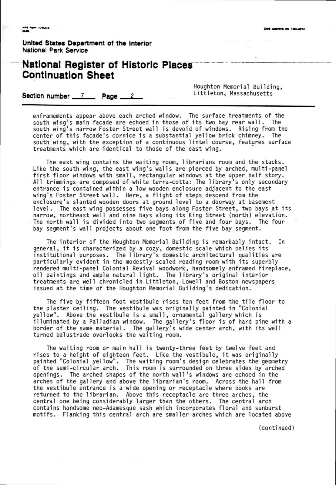
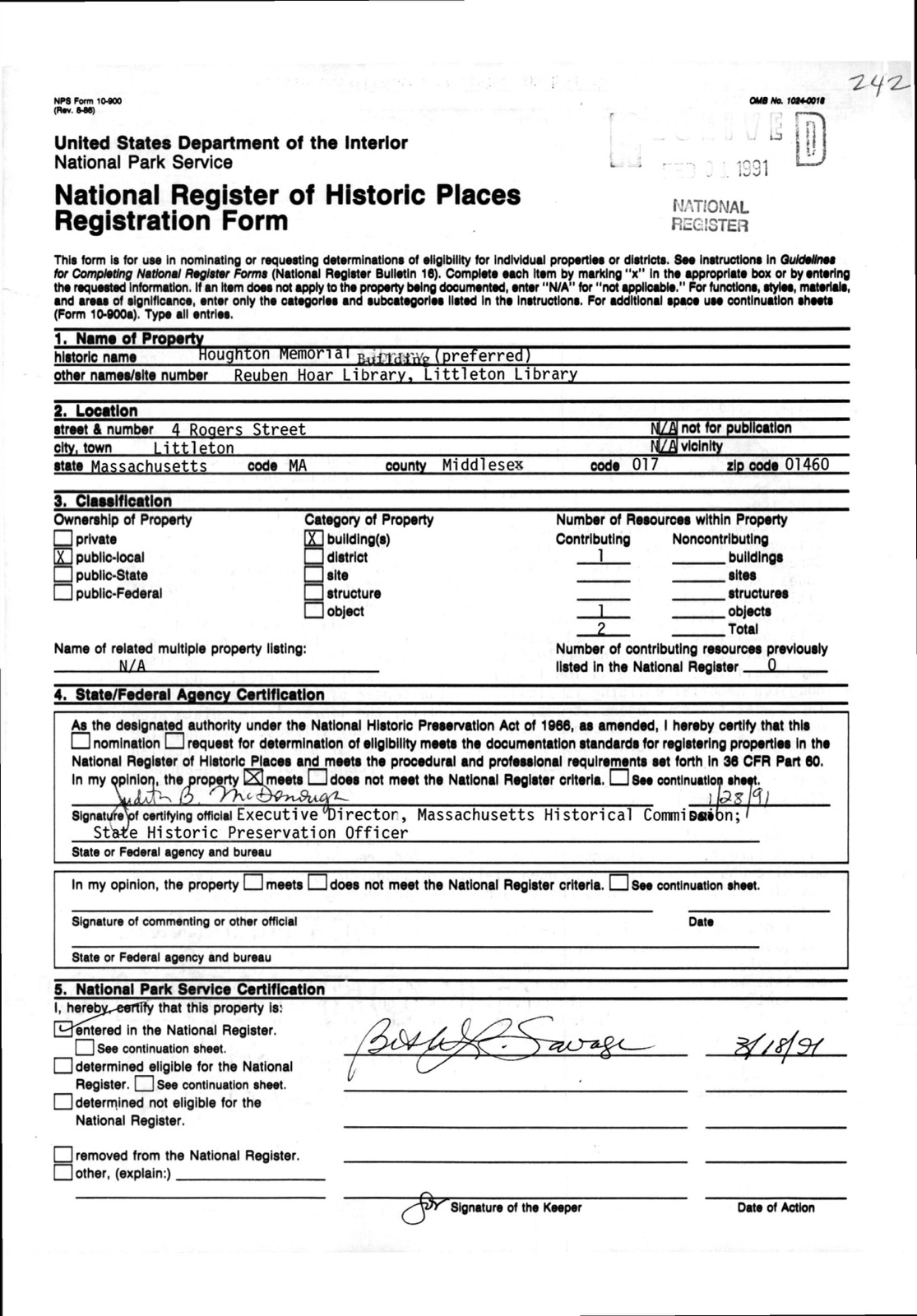
Ceariying oficial has considered the signi atio nt thie pr etalo rilaion to thoc ptoperties: Applicable National Register Criteria Xc Criteria Considerations (Exceptions) ]c Areas of Significance (enter categories from instructions) Architecture Community Planning and Development Education LE LF LG Period of Significance 1895-1940 Significant Dates 1895 Cultural Affiliation N/A Significant Person Architect/Builder Perkins, Charles Bruen; Betton, Corneliüs Grinnell State significance of property, and justify criteria, criteria considerations, and areas and periods of significance noted above. The Houghton Memorial Building, Littleton, Massachusetts is highly significant as a well-crafted example of yellow brick, terra-cotta-trimmed institutional building in the Colonial Revival style.
This modestly scaled masonry building exhibits an academic stylistic formalism which is unique within Littleton, a country town whose building stock is overwhelmingly vernacular, residential and constructed of wood. It is also important as an example of the work of the Boston architectural firm of Perkins and Betton. It is also significant as an important public institution within Littleton that, through the generosity of it s citizens, Reuben Hoar and the Houghton family, was created to serve in the education of the community. as the town library for about 100 years. Therefore, the Houghton Memorial Building possesses integrity of location, design, materials and workmanship and meets Criteria A and C of the National Register of Historic Places on the local level.
As early as 1654, Littleton was established as the Indian Praying Town of Nashoba. : It was incorporated as the town of Littleton in 1714. The first English settlers were evidently drawn to Littleton's forests, meadows, ponds and rich farming land. As early as 1742 the area known as Littleton Center acquired an architectural identity recognizable as a rural village. year an orthodox Congregational meeting house was added to the homes clustered around Foster, Rogers and King Streets.
Quoted from the National Register nomination
for reference 91000242, 29 pages, held by the National Archives in Record
Group 79. See the
catalogue record.
Listed places nearby
6 within 8 miles
Other National Register properties close
enough to walk or drive between, ordered by distance from this one. Both
positions come from the same geocoding pass that matched these properties
to their map sheets.
Listing record. National Park Service National Register of Historic Places, listed-properties dataset, current to 2026-05-22.
Map join. Address geocoded through the United States Census geocoder, then tested against the published boundary of every sheet in the USGS Historical Topographic Map Collection.
How this page is made. Listing fields come from federal records; map-sheet coverage is a labelled coordinate-to-boundary calculation, not a source-field claim.
Wildfire. Short, Karen C. 2022. Spatial wildfire occurrence data for the United States, 1992-2020 [FPA_FOD_20221014]. 6th Edition. Fort Collins, CO: Forest Service Research Data Archive. https://doi.org/10.2737/RDS-2013-0009.6 Collected with United States Government funding and usable without additional permissions or fees.
Specimens. Global Biodiversity Information Facility (GBIF), https://www.gbif.org/. Only records licensed CC0 or CC BY are used. Records licensed CC BY-NC are excluded because this site carries advertising. Images are checked individually and any whose licence is non-commercial, no-derivatives or unreadable is refused.
Mines and quarries. USGS Mineral Resources Data System (MRDS) https://mrdata.usgs.gov/mrds/ A work of the United States government, no copyright under 17 U.S.C. 105.
Storms. NOAA National Centers for Environmental Information, Storm Events Database https://www.ncei.noaa.gov/stormevents/ A work of the United States government, no copyright under 17 U.S.C. 105. Narratives are quoted verbatim from the National Weather Service report and are not edited or summarised.
 Block
Block