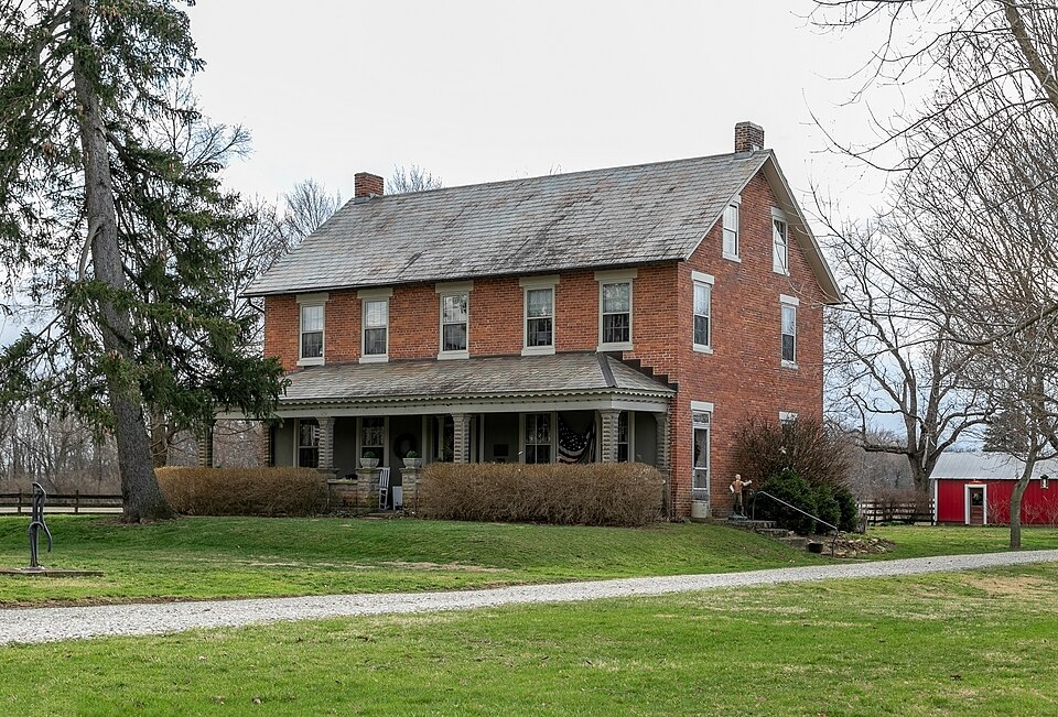
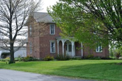
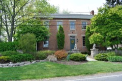
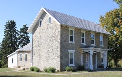
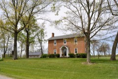
Listed on the National Register of Historic Places in
1993. A historic map-sheet match is not published yet. The record needs a coordinate-quality review before it can be joined to a sheet boundary.
From the record
one of 49 National Register listings in Delaware County · listed in 1993 · category: Building.
National Register reference number.93000294- the number the National Park Service assigned this property when it was listed, and the key its nomination file is catalogued under at the National Archives.
Specimens collected near this property
12 of 547 shown
Regional context, not property-specific
evidence. Museums hold 547 specimens
collected within 10 miles of Detwiller, John, Tavern and Farmstead between 1871 and
1975: 486 Animalia, 44 Plantae, 13 Fungi, 2 Unrecorded, 2 Protozoa. 12 distinct Species records are shown.
Collected by A. Spreitzer & K. Borror, B. R. Laughlin, Binning, M. B. and others. Each is a
physical object with a catalogue
number, and each entry opens the museum's record. This is what was
collected and kept, not a survey of what lives here - nothing can be
concluded from a species being absent.
Regional context, not property-specific
evidence. The federal mineral resources record lists
3 workings within 5 miles of Detwiller, John, Tavern and Farmstead: 2 producers, 1 past producer.
2 still produce. What was taken out: Stone, Crushed/Broken, Limestone, General. Distance is straight-line from the
map coordinates, so a quarry counted here may appear on a neighbouring
settlement's page as well.
Regional context, not property-specific
evidence. The National Weather Service names
Radnor, the town this property stands in, in 15 storm reports between 1996 and 2022: 13 thunderstorm wind, 1 tornado, 1 flood.
No death or injury is recorded in these reports. Each account below is quoted exactly as the forecast office
filed it, from the NOAA Storm Events Database, and each date
opens the federal record of that event.
The tornado briefly touched down on the west side of Highway 257 southwest of Radnor. The tornado initially hit two barns, destroying one and heavily damaging another. One barn consisted of cinder block walls and tin roofing. Much of the cinder block collapsed, while roofing of this structure with some of the attached cinder block and other bard roofing and walls was lifted across Highway 257 where much of the material was wrapped around trees along the Scioto River. Large portions of the barn roofing was lofted over the tree line along the Scioto River and deposited in the back yards of residences along River Road, on the east side of the river, a distance of two tenths of a mile away. Tree damage along the south side of the brief tornado track was lying in a northeast orientation which was inward toward the tornado track which confirms the convergent circulation. Other damage along the path included snapped large trees, complete destruction of a small shed, and large amounts of debris wrapped around trees. Corn stalks were found in yards of residence on the east side of the Scioto River, with the nearest corn fields nearly a quarter of a mile away. Based on the damage surveyed, the maximum wind speed of this tornado was approximately 85 miles per hour.
No historic map-sheet match is published
for this property yet. That does not mean no map exists. This record needs
a coordinate-quality review before it can be joined to a sheet boundary.
Browse the county's mapped places while that work is
pending.
From the nomination file
4,087 words on record
When this property was proposed for the
National Register, someone wrote the case for it: what the building is,
and why it matters. That document is a federal record in the public domain.
It is quoted below word for word, never summarised. The text was read off the scanned case file by machine, so the
occasional stray character is the recogniser's and the 1970s
typewriter's.
Statement of significance
Applicable National Register Criteria Significant Dates The property is also significant under Criterion C in the area of architecture as example of a typical central Ohio farmstead. HISTORICAL SIGNIFICANCE AND BACKGROUND The property, originally part of a Revolutionary War land grant to Johnathan Clark, was River along what later became State Route 257. According to W. P. Crawford: family settled in the township) were built close to the banks of the river The gravelling was an improvement much needed by the old settlers up and down lakes to the state capitol.
Like others of its time, the Detwiller Tavern served merchants, adventurers, settlers, movers, wagoners, land speculators, circuit-riding judges and lawyers, foreign tourists, visitors at the tavern got information on the condition of the roads, directions to the next town, read the newspaper, broadsides, notices, and posted advertisements, got encouragement, warmth, and sympathy, and not occasionally nursing for illness, and consolation for a death on the road (Yoder).
Ihe Twentieth Century History ef Delaware X] See continuation sheet Commerce Architecture Unknown Architect/Builder Areas of Significance (enter categories from instructions) Significant Person Cultural Affiliation -nationally ] statewide [X locally Period of Signiticance 1856 - 194( state signiticance ot property, and justity criteria, criteria considerations, and areas and periods of significance noted above ings of the old military road. (It was) quite crooked in many places . . itinerant doctors, and frontier preachers.
Frequently, taverns provided housing for local lodging for travelers and a neighborhood civic center were extremely important to the all the cabins at that time (understood to be about 1815 when Crawford's from the fact that the Indian Trail (Sandusky to Columbus) and the old mili- tary road followed the meanderings of the river.
Quoted from the National Register nomination
for reference 93000294, 40 pages, held by the National Archives in Record
Group 79. See the
catalogue record.
Listed places nearby
6 within 8 miles
Other National Register properties close
enough to walk or drive between, ordered by distance from this one. Both
positions come from the same geocoding pass that matched these properties
to their map sheets.
Listing record. National Park Service National Register of Historic Places, listed-properties dataset, current to 2026-05-22.
Map join. Address geocoded through the United States Census geocoder, then tested against the published boundary of every sheet in the USGS Historical Topographic Map Collection.
How this page is made. Listing fields come from federal records; map-sheet coverage is a labelled coordinate-to-boundary calculation, not a source-field claim.
Specimens. Global Biodiversity Information Facility (GBIF), https://www.gbif.org/. Only records licensed CC0 or CC BY are used. Records licensed CC BY-NC are excluded because this site carries advertising. Images are checked individually and any whose licence is non-commercial, no-derivatives or unreadable is refused.
Mines and quarries. USGS Mineral Resources Data System (MRDS) https://mrdata.usgs.gov/mrds/ A work of the United States government, no copyright under 17 U.S.C. 105.
Storms. NOAA National Centers for Environmental Information, Storm Events Database https://www.ncei.noaa.gov/stormevents/ A work of the United States government, no copyright under 17 U.S.C. 105. Narratives are quoted verbatim from the National Weather Service report and are not edited or summarised.
 Block
Block