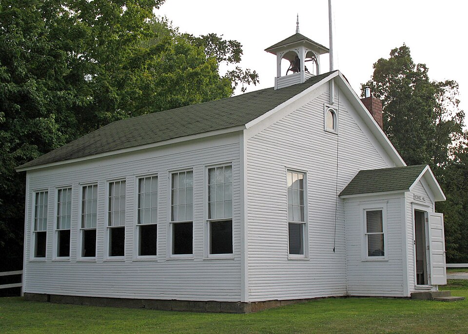
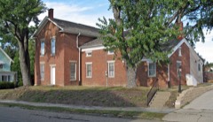
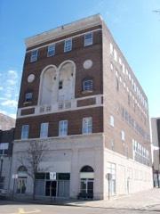
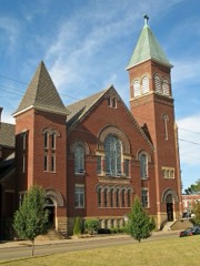
Listed on the National Register of Historic Places in
1994. A historic map-sheet match is not published yet. The record needs a coordinate-quality review before it can be joined to a sheet boundary.
From the record
“The only house or cabin, in 1318, between Salem and the present site of Alliance, stood half o mile west of Damascus, and was built by Sir. Charles Hamlin and others wont down to the mouth of Little Reaver to get wheat fiourcd.”
Combination Atlas Map of Stark County, Ohio, Compiled, Drawn and Published from Personal Examinations and Surveys (1875). Machine-read text.
one of 81 National Register listings in Stark County · listed in 1994 · category: Building.
National Register reference number.94000776- the number the National Park Service assigned this property when it was listed, and the key its nomination file is catalogued under at the National Archives.
Tho first house in Lexington distinguished by & shingle roof was builtin 1808, by A. HoHowny. Herein Gideon Hughes opened tho first store, and, not suceecding, was tho first mercantile failure. Tho house then became of use for tho first I religious meetings, by the Friends, and when not so used was slill further utilized as the first seat of learning, witn Daniel Votaw aa ita first pedagogue, who'o services wero secured by subscription among the Friends. The first itnprovomcnt cast of Alliance was on Mercer Clearing, situated at the junction of County line and Mt. Union roads.
The only house or cabin, in 1318, between Salem and the present site of Alliance, stood half o mile west of Damascus, and was built by Sir. Morris. Charles Hamlin and others wont down to the mouth of Little Reaver to get wheat fiourcd. Corn was floated down tbo Ohio in barges, and sold to tbo settlers until ilicir clearings yielded a sufficiency. It oceupiod three days to lake two bushels of corn to bo ground, carrying it on horseback. Tbo first grist-mill in the township was on the river south of Lexington. It was built by Aarou Stratton ; a saw-mill was built in connection with it. Here Amos Hallowny lost a son by tho falling of a beam upon him. The next mill was built by Byron Elliot, on Doer Creek, one mile west of the village of Limavillc, and is still in use. Saw-mitis are necessities of early days, and transitory in existence. Rolla Day built the first iu Lexington Townahip, on the Mahoning. Prior to 1840, ton to twelve had been built, and none since. Steam mills havo supplanted the water mills, but tho limber has become scarce and is small. George Stroup erected one in 1857, at Alliance.
Regional context, not property-specific
evidence. The
federal wildfire occurrence database
lists 1 fire within 5 miles of Science Hill School between
2002 and 2002, burning about 0 acres in total. None started naturally. None was recorded as arson.
Distance is straight-line from the map coordinates, so a fire counted
here may appear on a neighbouring settlement's page as well.
Reported cause
Fires
Recreation and ceremony
1
The most recent of
them, most recent first, with the day each was reported and the service
that recorded it.
Regional context, not property-specific
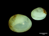
evidence. Museums hold 101 specimens
collected within 10 miles of Science Hill School between 1890 and
1975: 93 Animalia, 6 Plantae, 2 Fungi. 12 distinct Species records are shown.
Collected by Allen, John, Armbruster, D. C. (Daniel C.), Bryan, J. M. and others. Each is a
physical object with a catalogue
number, and each entry opens the museum's record. This is what was
collected and kept, not a survey of what lives here - nothing can be
concluded from a species being absent.
Regional context, not property-specific
evidence. The federal mineral resources record lists
3 workings within 5 miles of Science Hill School: 2 past producers, 1 producer.
1 still produces. What was taken out: Clay, Sand and Gravel, Construction, Coal. Distance is straight-line from the
map coordinates, so a quarry counted here may appear on a neighbouring
settlement's page as well.
Regional context, not property-specific
evidence. The National Weather Service names
Alliance, the town this property stands in, in 38 storm reports between 1995 and 2021: 22 thunderstorm wind, 13 hail, 2 flash flood, 1 lightning.
No death or injury is recorded in these reports. Each account below is quoted exactly as the forecast office
filed it, from the NOAA Storm Events Database, and each date
opens the federal record of that event.
Thunderstorm winds caused considerable damage in Alliance and adjacent Washington Township. Dozens of trees were downed in these areas. A house just south of Alliance was heavily damaged by a fallen tree. Several barns in Washington Township lost portions of roof and a couple mobile homes were also damaged.
Thunderstorm winds downed many trees south of Alliance. A large pole building sustained considerable damage and a home nearby was damaged by a fallen tree. Scattered power outages were reported in the area.
No historic map-sheet match is published
for this property yet. That does not mean no map exists. This record needs
a coordinate-quality review before it can be joined to a sheet boundary.
Browse the county's mapped places while that work is
pending.
From the nomination file
2,294 words on record
When this property was proposed for the
National Register, someone wrote the case for it: what the building is,
and why it matters. That document is a federal record in the public domain.
It is quoted below word for word, never summarised. The text was read off the scanned case file by machine, so the
occasional stray character is the recogniser's and the 1970s
typewriter's.
Statement of significance
X C Property embodies the distinctive characteristics of a type, period, or method of construction or represents the work of a master, or possesses high artistic values, or represents a significant and ca. 1870 - D Property has yielded, or is likely to yield, (Mark "x" in all the boxes that apply.) -A ownedby a religious institution or used for X B removed from its original location. - C a birthplace or grave. - D a cemetery. - E a reconstructed building, object, or structure. - F a commemorative property. within the past 50 years.
- preliminary determination of individual listing (36 - State Historic Preservation Office - Other State agency - Federal agency ] Local government - University - designated a National Historic Landmark - Other - recorded by Historic American Engineering 1884 Bibilography Architecture Education Register Architect/Builder Significant Dates Unknown religious purposes. Property is: Name of repository: Science Hill School Applicable National Register Criteria Criteria Considerations significant in our past.
Quoted from the National Register nomination
for reference 94000776, 17 pages, held by the National Archives in Record
Group 79. See the
catalogue record.
Listed places nearby
6 within 8 miles
Other National Register properties close
enough to walk or drive between, ordered by distance from this one. Both
positions come from the same geocoding pass that matched these properties
to their map sheets.
Listing record. National Park Service National Register of Historic Places, listed-properties dataset, current to 2026-05-22.
Map join. Address geocoded through the United States Census geocoder, then tested against the published boundary of every sheet in the USGS Historical Topographic Map Collection.
How this page is made. Listing fields come from federal records; map-sheet coverage is a labelled coordinate-to-boundary calculation, not a source-field claim.
Wildfire. Short, Karen C. 2022. Spatial wildfire occurrence data for the United States, 1992-2020 [FPA_FOD_20221014]. 6th Edition. Fort Collins, CO: Forest Service Research Data Archive. https://doi.org/10.2737/RDS-2013-0009.6 Collected with United States Government funding and usable without additional permissions or fees.
Specimens. Global Biodiversity Information Facility (GBIF), https://www.gbif.org/. Only records licensed CC0 or CC BY are used. Records licensed CC BY-NC are excluded because this site carries advertising. Images are checked individually and any whose licence is non-commercial, no-derivatives or unreadable is refused.
Mines and quarries. USGS Mineral Resources Data System (MRDS) https://mrdata.usgs.gov/mrds/ A work of the United States government, no copyright under 17 U.S.C. 105.
Storms. NOAA National Centers for Environmental Information, Storm Events Database https://www.ncei.noaa.gov/stormevents/ A work of the United States government, no copyright under 17 U.S.C. 105. Narratives are quoted verbatim from the National Weather Service report and are not edited or summarised.
 Block
Block