 Block
Arthur, South Carolina
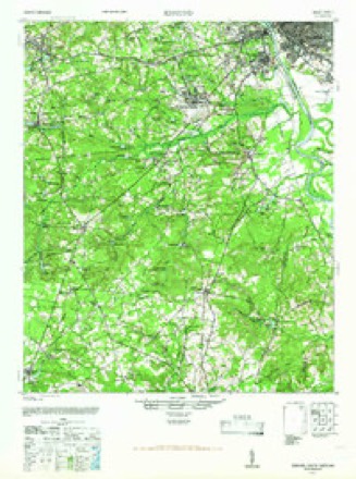
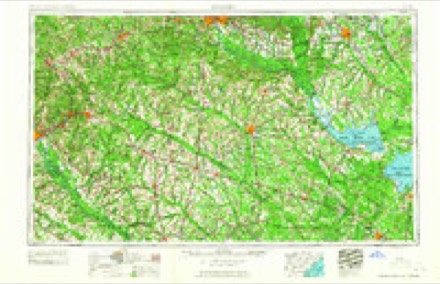
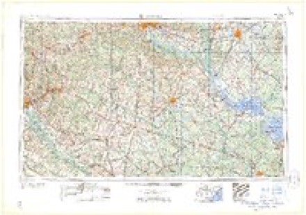
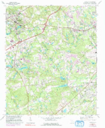
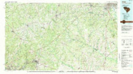
13 topographic sheets cover this place, the earliest surveyed in 1944 and the latest in 1983. It stands in the West Columbia-Cayce census division. It lies in ZIP code area 29170. The Survey maps it on the Lexington quadrangle.
Topographic sheets covering this place
8 surveys from 13 printed sheetsMatched by testing this settlement's coordinate against the published boundary of every sheet in the United States Geological Survey's historical collection. Each opens the scanned sheet at the Survey.
- 1944 USGS Edmund quadrangle1:62500
- 1954 USGS Augusta quadrangle1:250000
- 1957 USGS Augusta quadrangle1:250000, 3 printings
- 1958 USGS Augusta quadrangle1:250000
- 1961 USGS Augusta quadrangle1:250000, 2 printings
- 1962 USGS Augusta quadrangle1:250000
- 1972 USGS Lexington quadrangle1:24000, 3 printings
- 1983 USGS Aiken quadrangle1:100000
Fires near this place
480 since 1992Regional context, not property-specific evidence. The federal wildfire occurrence database lists 480 fires within 5 miles of Arthur between 1992 and 2020, burning about 708 acres in total. 3 started naturally. 23 were recorded as arson. Distance is straight-line from the map coordinates, so a fire counted here may appear on a neighbouring settlement's page as well.
| Reported cause | Fires |
|---|---|
| Missing data/not specified/undetermined | 234 |
| Misuse of fire by a minor | 93 |
| Debris and open burning | 72 |
| Arson/incendiarism | 23 |
| Equipment and vehicle use | 20 |
| Recreation and ceremony | 12 |
| Smoking | 12 |
| Railroad operations and maintenance | 5 |
| Power generation/transmission/distribution | 4 |
| Natural | 3 |
| Fireworks | 1 |
| Other causes | 1 |
The most recent of them, most recent first, with the day each was reported and the service that recorded it.
| Date | Cause | Size | Reported by | Name on the report |
|---|---|---|---|---|
| 9 September 1999 | Missing data/not specified/undetermined | under an acre | South Carolina Forestry Commission | not named |
| 8 September 1995 | Missing data/not specified/undetermined | 1.0 acres | South Carolina Forestry Commission | not named |
| 3 September 1997 | Debris and open burning | under an acre | South Carolina Forestry Commission | not named |
| 3 September 1993 | Missing data/not specified/undetermined | under an acre | South Carolina Forestry Commission | not named |
| 27 September 1996 | Missing data/not specified/undetermined | under an acre | South Carolina Forestry Commission | not named |
| 26 September 1993 | Missing data/not specified/undetermined | 1.5 acres | South Carolina Forestry Commission | not named |
| 25 September 2019 | Recreation and ceremony | 1.5 acres | South Carolina Forestry Commission | not named |
| 24 September 2019 | Arson/incendiarism | 2.0 acres | South Carolina Forestry Commission | not named |
Settlements close enough to share some of these fires:
Mines and quarries near this place
10 of 14 shownRegional context, not property-specific evidence. The federal mineral resources record lists 14 workings within 5 miles of Arthur: 6 unknowns, 5 past producers, 3 producers. 3 still produce. What was taken out: Clay, Sand and Gravel, Construction, Granite, Stone, Crushed/Broken, Zirconium, Titanium, Iron, Thorium. Distance is straight-line from the map coordinates, so a quarry counted here may appear on a neighbouring settlement's page as well.
| Where | Site | Commodity | Status | Recorded |
|---|---|---|---|---|
| Casparis Stone Quarry | Granite, Stone, Crushed/Broken | Past Producer | 1902 | |
| Cayce Silica Plant | Silica | Unknown | ||
| Green Hole | Stone, Crushed/Broken, Stone, Dimension, Granite | Past Producer | Igneous | |
| Harleys Mill Pond | Iron, Titanium, Zirconium | Unknown | Placer , Modern , Fluvial | |
| Lexington Mine | Fire Clay (Refractory) | Past Producer | ||
| Red Bank Creek | Zirconium, Titanium, Iron, Thorium | Unknown | Placer , Modern , Fluvial | |
| Lexington Pit | Sand and Gravel, Construction | Unknown | Sedimentary | |
| South Congaree Pit | Sand and Gravel, Construction | Past Producer | ||
| Unidentified Mine | Sand and Gravel, Construction | Past Producer | Sedimentary | |
| Corley Mill Rd Pit | Clay | Producer | Metamorphic |
Storms near this place
48 since 2011Regional context, not property-specific evidence. The National Weather Service names Arthur in 48 storm reports between 2011 and 2026: 36 thunderstorm wind, 9 hail, 2 flood, 1 flash flood. The reports record 1 death. Each account below is quoted exactly as the forecast office filed it, from the NOAA Storm Events Database, and each date opens the federal record of that event.
| When | Event | Place named | Harm | What the report says |
|---|---|---|---|---|
| February 2020 | Thunderstorm Wind | Arthur | 1 killed | SCHP reported a tree down on Interstate 20 near mile marker 58. Later media reports indicated that the tree fell onto a vehicle and killed a female inside the car. |
| October 2015 | Flash Flood | Arthur | $300,000 | NWS employee reports Laurel Road at Mineral Springs Road flooded and impassable. |
| July 2012 | Hail | Arthur | $20,000 | Public reported Hen egg size hail on Old Barnwell road. |
| October 2015 | Flood | Arthur | $5,000 | Ponding of water on Emanuel Church Road at Foxhill Place. |
| June 2011 | Thunderstorm Wind | Arthur | $5,000 | Highway Patrol reported trees down on Old Barnwell road near US 1. |
| October 2011 | Thunderstorm Wind | Arthur | $4,000 | Highway Patrol reported trees down along Corley Mill road near Hwy 378. |
| May 2011 | Thunderstorm Wind | Arthur | $4,000 | NWS employee reported trees down off Mineral Springs road near Lexington. |
| August 2015 | Thunderstorm Wind | Arthur | $3,000 | Sheriff reported trees down on I-20 east bound between U.S. 378 and U.S. 1. |
| June 2015 | Thunderstorm Wind | Arthur | $2,000 | SC Highway Patrol reported several trees down on Bradley Drive south of US 1. |
| June 2015 | Thunderstorm Wind | Arthur | $2,000 | Sheriff reported trees down on Woodberry Road at the US 1 intersection. |
| August 2012 | Thunderstorm Wind | Arthur | $2,000 | Sheriff reported trees down on Mineral Springs Road at Shoal Creek Road. |
| June 2013 | Thunderstorm Wind | Arthur | $1,000 | A social media report had a large tree down completely blocking the Millstream Road half way between Hope Ferry Road and Corley Mill Road. |
| June 2013 | Thunderstorm Wind | Arthur | $500 | Sheriff reported a tree down near the intersection of Cromer Road and Oak Drive. |
| July 2012 | Thunderstorm Wind | Arthur | $500 | Highway Patrol reported a tree down along I-26 in the westbound direction at mile marker 61. |
| June 2011 | Thunderstorm Wind | Arthur | $500 | Highway Patrol reported a tree in the road near I-20 and Dooley road. |
| February 2024 | Hail | Arthur | $100 | Public report of pea size hail in Oak Grove. |
| September 2016 | Flood | Arthur | $100 | Street flooding reported on St Davids Church Rd and Bradley Dr. |
| May 2022 | Hail | Arthur | $10 | Social media video shows pea sized hail accompanied by gusty winds near the intersection of Emanuel Church Rd and Old Barnwell Rd. |
| July 2021 | Hail | Arthur | $10 | Video shared on social media of pea sized hail on Pebble Creek Dr in West Columbia. Time estimated. |
| March 2026 | Thunderstorm Wind | Arthur | - | SC DPS reported a tree down along Baskin Hills Rd. Time estimated by radar. |
| June 2025 | Thunderstorm Wind | Arthur | - | Spotter estimated 50-60 mph winds near Mineral Springs Road. Radar suggests a downburst in this area. |
| June 2025 | Thunderstorm Wind | Arthur | - | SC DPS reported trees down on Mill Stream Rd near Hope Ferry Rd. Time estimated by radar. |
| June 2025 | Thunderstorm Wind | Arthur | - | SC Highway Patrol reports a tree down in the roadway at I20 and Sunset Blvd. Time estimated by radar. |
| July 2024 | Thunderstorm Wind | Arthur | - | SC Department of Public Safety reported trees down on Emanuel Church Road near the intersection of Two Notch Road. |
| July 2024 | Thunderstorm Wind | Arthur | - | NWS Employee reported tree down near the intersection of Old Barnwell Rd and Emmanuel Church Rd. |
| April 2024 | Thunderstorm Wind | Arthur | - | Columbia FD relayed a report of a tree that fell through a home on Meadow Wood Dr in Oak Grove. |
| August 2024 | Thunderstorm Wind | Arthur | - | Multiple trees reported down by SC Department of Public Safety and the public. Tree down on Oak Drive and trees down on Snow Lane near Cromer Road. |
| August 2023 | Thunderstorm Wind | Arthur | - | County Emergency Manager reported trees down along with other debris in the roadway along Continental Drive. |
| July 2023 | Thunderstorm Wind | Arthur | - | Public report, via social media, of a tree down on power lines in the 200 block of Ermine Rd in West Columbia. The tree damaged the windshield of a truck. Also, trees and power lines down on Methodist Park Rd in West Columbia. Times estimated. |
| September 2023 | Thunderstorm Wind | Arthur | - | Lexington County EM reported downed power lines on Partridge Ln. near the intersection of Collumwood Cir. Time estimated by radar. |
| September 2023 | Thunderstorm Wind | Arthur | - | Lexington County EM reported downed power lines on Jessamine Rd near the intersection of Orangeburg Dr. Time estimated by radar. |
| July 2022 | Thunderstorm Wind | Arthur | - | Highway patrol reported the roadway blocked by a downed tree at Cromer Rd and Autumn Oaks Ln. |
| July 2022 | Thunderstorm Wind | Arthur | - | Highway patrol reported a tree in the roadway at Cromer Rd and Mineral Springs Rd. |
| May 2021 | Thunderstorm Wind | Arthur | - | Reported a tree down on a vehicle with a person trapped inside. |
| May 2021 | Hail | Arthur | - | A trained spotter reported dime to penny size hail at the intersection of I-20 and US Hwy 378. Time estimated. |
| May 2021 | Hail | Arthur | - | Public reported pea to dime size hail on Old Barnwell Road near the Airport. Time estimated. |
| February 2020 | Thunderstorm Wind | Arthur | - | Tree and power lines down at Wattling Rd and Delree St. Time estimated. |
| June 2019 | Thunderstorm Wind | Arthur | - | Public and trained spotter reported downed trees and power lines near US Hwy 378 and Leaphart Rd. Time estimated. |
| June 2019 | Thunderstorm Wind | Arthur | - | SCHP reported a tree down on Interstate 20 eastbound at mile marker 60. Time estimated. |
| July 2019 | Thunderstorm Wind | Arthur | - | SCDOT and local media reported a large tree down blocking the eastbound lanes of Interstate 20 near mile marker 60. Time estimated. |
| April 2018 | Thunderstorm Wind | Arthur | - | Trees and power lines downed at Mineral Springs Rd at Oak Dr. Time estimated. |
| June 2018 | Hail | Arthur | - | Report of nickel size hail 3 miles west of the Columbia Metropolitan Airport. |
| June 2018 | Hail | Arthur | - | Quarter size hail reported along Emanuel Church Rd just west of Columbia Metropolitan Airport. |
| March 2017 | Thunderstorm Wind | Arthur | - | SC Highway Patrol reported trees down on Sunset Blvd at White Oak Lane. |
| March 2017 | Thunderstorm Wind | Arthur | - | SC Highway Patrol reported trees down at US Hwy 378 and Leaphart Rd. |
| April 2017 | Hail | Arthur | - | Public reported golf ball size hail at the rental car service facility near the Columbia Metropolitan Airport. |
| April 2017 | Thunderstorm Wind | Arthur | - | Tree down blocking roadway at Dogwood Trail and Woodside Rd. |
| July 2016 | Thunderstorm Wind | Arthur | - | Lexington dispatch reported trees down on Kitti Wake Dr. |
Nearest settlements
The eight closest, with where each one stands in the county. Distances are straight-line, computed from the Geographic Names Information System coordinates.
| Map | Place | Distance | Sheets |
|---|---|---|---|
| Rose Gardens | 0.3 miles | 13 | |
| Oak Grove | 0.3 miles | 13 | |
| Kings Grant | 0.5 miles | 13 | |
| Lakeview Terrace | 0.7 miles | 13 | |
| Oakwood | 0.9 miles | 13 | |
| Parkwood | 1.0 miles | 13 | |
| Westgate | 1.0 miles | 13 | |
| Oak Grove Estates | 1.3 miles | 13 |
Provenance
This settlement is recorded in the Geographic Names Information System as feature 1244086. The sheet list is computed by point-in-boundary test against the United States Geological Survey's historical topographic inventory. Both are works of the United States government and carry no copyright under 17 U.S.C. 105.
Wildfire. Short, Karen C. 2022. Spatial wildfire occurrence data for the United States, 1992-2020 [FPA_FOD_20221014]. 6th Edition. Fort Collins, CO: Forest Service Research Data Archive. https://doi.org/10.2737/RDS-2013-0009.6 Collected with United States Government funding and usable without additional permissions or fees.
Mines and quarries. USGS Mineral Resources Data System (MRDS) https://mrdata.usgs.gov/mrds/ A work of the United States government, no copyright under 17 U.S.C. 105.
Storms. NOAA National Centers for Environmental Information, Storm Events Database https://www.ncei.noaa.gov/stormevents/ A work of the United States government, no copyright under 17 U.S.C. 105. Narratives are quoted verbatim from the National Weather Service report and are not edited or summarised.