 Block
Bamberg, South Carolina
15 topographic sheets cover this place, the earliest surveyed in 1919 and the latest in 1982. It stands in the Bamberg census division. It lies in ZIP code area 29003. The Survey maps it on the Bamberg quadrangle. 3,076 people lived here at the 2020 count. It stands 167 feet above sea level.
Research this city
On record in Bamberg
Buildings and businesses the archive holds for this place. Each opens its own page, with the source record it came from.
On the National Register 5 records
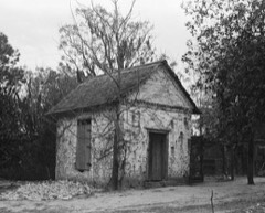 WoodlandsNational Historic Landmark · listed 1971
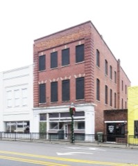 Bamberg City Halllisted 2005
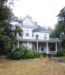 Bamberg Historic Districtlisted 1983
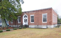 Bamberg Post Officelisted 2007
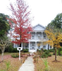 Gen. Francis Marion Bamberg Houselisted 1976
Surveyed buildings and structures 3 records
- Bamberg Cotton Mill, Main Street, Bambergfederal building survey, 30 photographs
- Coffee Pot Diner, SC Route 301 at Route 601, Bambergfederal building survey, 1 photograph
- Woodlands (Ruins), U.S. Route 78, Bambergfederal building survey, 3 photographs
Population over time
2 figuresBamberg fell from 3,607 to 3,076 between 2010 and 2020. These are the recorded population figures Wikidata holds for this place, reached through the Geographic Names Information System number this page is keyed on rather than by name, so they belong to this place and not to another of the same name. Most are census counts, but not all are: an early figure may be a founding or settlement estimate, and an estimate published within five years of a census is left out. The change column is computed, and is left blank where more than 20 years separate a figure from the one before it, because a gap that long is not a change between two counts.
| Year | People | Change |
|---|---|---|
| 2010 | 3,607 | |
| 2020 | 3,076 | -531 (-15%) |
Topographic sheets covering this place
10 surveys from 15 printed sheetsMatched by testing this settlement's coordinate against the published boundary of every sheet in the United States Geological Survey's historical collection. Each opens the scanned sheet at the Survey.
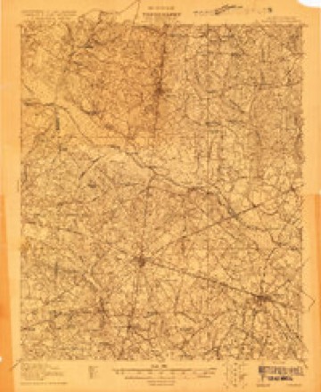
- 1919 USGS Bamberg quadrangle1:48000
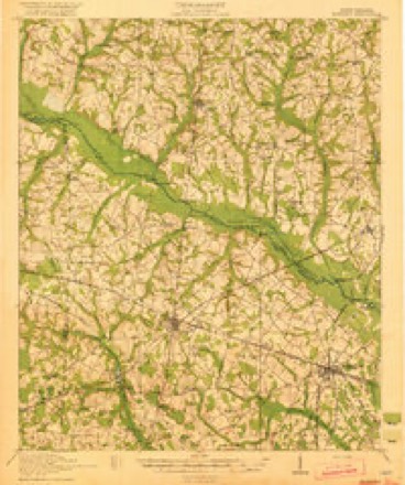
- 1920 USGS Bamberg quadrangle1:62500, 2 printings
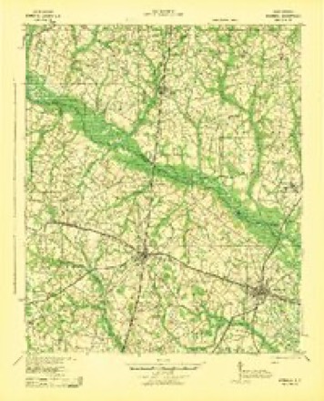
- 1943 USGS Bamberg quadrangle1:62500
- 1954 USGS Augusta quadrangle1:250000
- 1957 USGS Augusta quadrangle1:250000, 3 printings
- 1958 USGS Augusta quadrangle1:250000
- 1961 USGS Augusta quadrangle1:250000, 2 printings
- 1962 USGS Augusta quadrangle1:250000
- 1979 USGS Bamberg quadrangle1:24000, 2 printings
- 1982 USGS Barnwell quadrangle1:100000
Photographs
5 photographs,Taken for the Office of War Information and the Farm Security Administration, who photographed the country between 1935 and 1944. Works of United States government photographers, with no known restriction on use. Each opens its catalogue record.
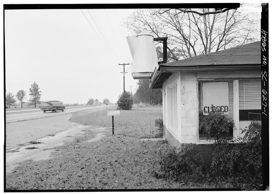
Photographer not recorded. Library of Congress
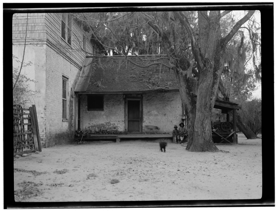
Photographer not recorded. Library of Congress
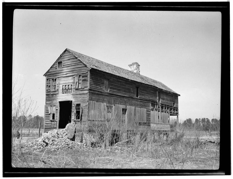
Photographer not recorded. Library of Congress
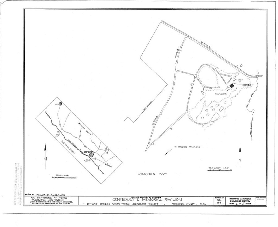
Photographer not recorded. Library of Congress
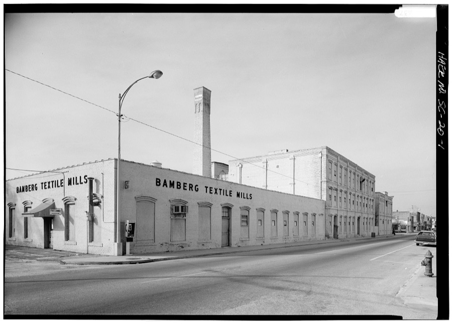
Photographer not recorded. Library of Congress
Fires near this place
214 since 1992Regional context, not property-specific evidence. The federal wildfire occurrence database lists 214 fires within 5 miles of Bamberg between 1992 and 2020, burning about 713 acres in total. 5 started naturally. 12 were recorded as arson. Distance is straight-line from the map coordinates, so a fire counted here may appear on a neighbouring settlement's page as well.
| Reported cause | Fires |
|---|---|
| Debris and open burning | 100 |
| Missing data/not specified/undetermined | 72 |
| Equipment and vehicle use | 14 |
| Arson/incendiarism | 12 |
| Misuse of fire by a minor | 6 |
| Natural | 5 |
| Smoking | 2 |
| Other causes | 2 |
| Power generation/transmission/distribution | 1 |
The most recent of them, most recent first, with the day each was reported and the service that recorded it.
| Date | Cause | Size | Reported by | Name on the report |
|---|---|---|---|---|
| 8 September 2011 | Debris and open burning | 2.0 acres | South Carolina Forestry Commission | not named |
| 6 September 2009 | Equipment and vehicle use | under an acre | South Carolina Forestry Commission | not named |
| 28 September 1996 | Missing data/not specified/undetermined | under an acre | South Carolina Forestry Commission | not named |
| 27 September 1996 | Missing data/not specified/undetermined | under an acre | South Carolina Forestry Commission | not named |
| 25 September 2019 | Debris and open burning | 30 acres | South Carolina Forestry Commission | not named |
| 23 September 2002 | Equipment and vehicle use | under an acre | South Carolina Forestry Commission | not named |
| 2 September 2018 | Natural | under an acre | South Carolina Forestry Commission | not named |
| 19 September 1999 | Debris and open burning | under an acre | South Carolina Forestry Commission | not named |
Settlements close enough to share some of these fires:
Mines and quarries near this place
1 within 5 milesRegional context, not property-specific evidence. The federal mineral resources record lists 1 working within 5 miles of Bamberg: 1 past producer. None of them still produces. What was taken out: Calcium. Distance is straight-line from the map coordinates, so a quarry counted here may appear on a neighbouring settlement's page as well.
| Where | Site | Commodity | Status | Recorded |
|---|---|---|---|---|
| Kirkland Pit | Calcium | Past Producer |
Storms near this place
60 of 68 shownRegional context, not property-specific evidence. The National Weather Service names Bamberg in 68 storm reports between 1994 and 2024: 46 thunderstorm wind, 16 hail, 3 flash flood, 3 tornado. No death or injury is recorded in these reports. Each account below is quoted exactly as the forecast office filed it, from the NOAA Storm Events Database, and each date opens the federal record of that event.
| When | Event | Place named | Harm | What the report says |
|---|---|---|---|---|
| January 2024 | Tornado (EF2) | Bamberg | $1,800,000 | A National Weather storm survey team confirmed an EF2 tornado, with peak winds of|125 mph, in Bamberg SC. The tornado began 1.75 miles south of the City of Bamberg|along US Hwy 601, near Cry Baby Road.||Moving north, the tornado then proceeded to flip a mobile home and cause substantial|EF2 damage to a barrel plant at the intersection of US Hwy 601 and US Hwy 301. Door|and window failure contributed to the collapse of the middle section of the building|and partial collapse of the front section. The collapsed portions of the building were|tossed across Chevrolet St into a water tower.||The tornado continued north-northeast along US-301 causing widespread EF1 roof and|tree damage before moving into downtown Bamberg.||As the tornado entered downtown Bamberg, it strengthened to EF2 intensity and|caused substantial structural damage to a series of 2-3 story historic buildings just|south of the intersection of US Hwy 78 and US Hwy 301. The newer roof section of a|building on the west side of US Hwy 301 was thrown completely off onto the adjacent|structure. There was a complete collapse of the upper stories of two buildings on the|east side of US Hwy 301 with the corner torn off another. Preexisting missing portions|of the roof and gaps in the exterior wall of the former City Hall likely contributed to its|collapse due to wind intrusion. ||The tornado then moved north and quickly weakened as it crossed US Hwy 78 before|dissipating 0.4 miles north of downtown Bamberg along US Hwy 301.||The National Weather Service would like to thank wind engineers from the Insurance|Institute for Business and Home Safety for their expertise assisting with surveying|some of the structural damage. |
| July 2012 | Thunderstorm Wind | Bamberg | $80,000 | Times Democrat reported trees down in Bamberg. One fell on a home causing moderate damage and another destroyed a barbershop. |
| June 2010 | Thunderstorm Wind | Bamberg | $20,000 | Sheriff reported numerous trees down in Bamberg. |
| July 2012 | Thunderstorm Wind | Bamberg | $16,000 | Sheriff reported trees and powerlines down arcoss northern portions of the county. |
| April 2011 | Thunderstorm Wind | Bamberg | $14,000 | The Highway Patrol reported several trees down in Bamberg. Media also reported a pet shelter had its roof partially torn off. |
| July 2012 | Thunderstorm Wind | Bamberg | $12,000 | Sheriff reported many trees and powerlines down in Bamberg with widespread outages in town. |
| June 2011 | Thunderstorm Wind | Bamberg | $12,000 | Dispatch reported trees down countrywide. |
| July 2010 | Thunderstorm Wind | Bamberg | $12,000 | Sheriff reported trees down in the area of Charleston Augusta Highway as well as Govan and Voorhees. |
| July 1998 | Thunderstorm Wind | Bamberg | $12,000 | A home off Hunters Chapel Road had minor damage to the porch and roof and moderate damage to the carport. Trees were also down and debris from the carport was found 30 yds away. |
| September 2024 | Flash Flood | Bamberg | $10,000 | Bamberg County Government reported significant flooding along Hwy 301 in the town of Bamberg. |
| June 1995 | Thunderstorm Wind | Bamberg | $5,000 | Trees blown down and a transformer knocked out by winds. |
| July 2012 | Thunderstorm Wind | Bamberg | $4,000 | DOT reported a few trees down in the Bamberg area and over to Denmark. |
| July 2009 | Thunderstorm Wind | Bamberg | $4,000 | Sheriff reported trees down in Bamberg. |
| May 2009 | Flash Flood | Bamberg | $4,000 | Sheriff reported several roads flooded with 1 to 3 feet of water in Bamberg and the surrounding area. |
| March 2012 | Thunderstorm Wind | Bamberg | $3,000 | Several trees down in Bamberg. |
| July 2010 | Thunderstorm Wind | Bamberg | $2,000 | Storm survey found several trees down along SC49 northwest of Bamberg. |
| August 2009 | Thunderstorm Wind | Bamberg | $2,000 | DOT reported trees down on hwy 645. |
| May 2022 | Thunderstorm Wind | Bamberg | - | Reported power lines down in the road along North Street in the Town of Bamberg. |
| June 2016 | Thunderstorm Wind | Bamberg | - | Reported trees down on Orange Grove Road. |
| September 2014 | Hail | Bamberg | - | Bamberg Fire Dept. reported quarter size hail in the town of Bamberg. |
| March 2012 | Hail | Bamberg | - | Sheriff dispatch reported nickel to qaurter size hail along Hwy 301 southwest of Bamberg. |
| March 2012 | Hail | Bamberg | - | The public reported lots of nickel size hail in Bamberg. |
| March 2012 | Hail | Bamberg | - | Sheriff reported quarter size hail in Bamberg. |
| May 2012 | Hail | Bamberg | - | Bamberg police reported quarter size hail on the north side of town. |
| May 2011 | Hail | Bamberg | - | Sheriff reported quarter size hail near Bamberg. |
| May 2008 | Thunderstorm Wind | Bamberg | - | Emergency Manager reported trees down in Bamberg and Ehrhardt. |
| April 2008 | Thunderstorm Wind | Bamberg | - | Sheriff reported trees down on hwy 301 just south of the Orangeburg county line. |
| June 2008 | Thunderstorm Wind | Bamberg | - | Paw Paw Country Club reported trees down in the area. |
| June 2008 | Hail | Bamberg | - | Sheriff reported nickel size hail on highway 78. |
| June 2008 | Thunderstorm Wind | Bamberg | - | EM reported many trees down in the Canaan Community and on Hudson and Canaan roads. |
| April 2007 | Thunderstorm Wind | Bamberg | - | Sheriff reported numerous trees down in and around the Bamberg area. |
| June 2007 | Thunderstorm Wind | Bamberg | - | DOT reported several trees down SC Hwy 81. |
| January 2006 | Tornado (F0) | Bamberg | - | Sheriff reported a small tornado touched down on Jay Street and took down a grove of trees. |
| April 2006 | Thunderstorm Wind | Bamberg | - | Utility reported trees down on power lines |
| May 2006 | Thunderstorm Wind | Bamberg | - | Sheriff reported powerlines down on hwy 362. |
| May 2006 | Tornado (F0) | Bamberg | - | Storm survey found trees and powerlines down south of Midway off hwy 78. Utility company was present repairing powerlines. |
| July 2006 | Thunderstorm Wind | Bamberg | - | Public reported trees down in Bamberg. |
| July 2006 | Hail | Bamberg | - | Public reported 1.75 inch hail. |
| August 2006 | Thunderstorm Wind | Bamberg | - | Sheriff reported trees down on SC Hwy 362 southeast of Bamberg. |
| July 2005 | Thunderstorm Wind | Bamberg | - | Sheriff reported trees down. |
| May 2004 | Thunderstorm Wind | Bamberg | - | Sheriff reported trees down on hwy 601. |
| May 2003 | Thunderstorm Wind | Bamberg | - | Edisto Electric reported trees and powerlines down on Edisto River Road. |
| July 2003 | Hail | Bamberg | - | Public reported 3/4 inch hail. |
| June 2003 | Thunderstorm Wind | Bamberg | - | Sheriff reported trees down on hwy 78 and also near Ehrhardt. |
| August 2003 | Flash Flood | Bamberg | - | Police and Sheriff reported roads flooded in Olar and on Hwy 301 near Bamberg. |
| May 2002 | Hail | Bamberg | - | Emergency manager reported dime size hail in Bamberg. |
| May 2002 | Hail | Bamberg | - | Sheriff reported dime size hail. |
| March 2001 | Thunderstorm Wind | Bamberg | - | Sheriff reported trees down on hwy 301 north of Bamberg. |
| August 2001 | Thunderstorm Wind | Bamberg | - | Rivers Bridge State Park reported trees down. |
| June 2000 | Thunderstorm Wind | Bamberg | - | Post Office reported trees down along hwy 21. |
| June 2000 | Thunderstorm Wind | Bamberg | - | Hwy Maint reported trees down on hwy 301 s of Bamberg. |
| August 2000 | Thunderstorm Wind | Bamberg | - | Police reported numerous trees down in the Bamberg area. |
| July 1999 | Thunderstorm Wind | Bamberg | - | Newspaper reported trees down. One fell on propane tanks and ingnited a large blaze. |
| July 1999 | Hail | Bamberg | - | Sheriff reported 3/4 inch hail in town of Bamberg. |
| August 1999 | Thunderstorm Wind | Bamberg | - | EPD reported trees down around Bamberg. |
| May 1998 | Thunderstorm Wind | Bamberg | - | Highway Maintenance Dept reported trees down along SC highway 20 from Bamberg to the Orangeburg county line. |
| May 1998 | Hail | Bamberg | - | SKYWARN spotter reported 3/4 inch hail. |
| July 1997 | Thunderstorm Wind | Bamberg | - | A cluster of thunderstorms produced several downed trees in Bamberg, Barnwell, Calhoun, and Sumter counties. |
| August 1995 | Thunderstorm Wind | Bamberg | - | Trees and power lines down. |
| July 1997 | Thunderstorm Wind | Bamberg | - | no account filed |
Newspapers printed here
10,509 digitised pages1 paper published in this town, digitised by the Library of Congress and free to read: 1,440 issues, 10,509 pages. Every page is searchable, so a name or a street can be looked for directly in what the town printed about itself at the time.
| Newspaper | Published |
|---|---|
| The Bamberg Herald | 1891 to 1972 |
What the paper printed
13,375 wordsFront pages of the local paper, read from the Library of Congress scans: 5 issues spread across its run from 1899 to 1927, 13,375 words in total. Each is reproduced on its own page, exactly as the recogniser returned it.
These pages read less well than anything else here, and the number is worth stating: about three words in four come through cleanly, against nine in ten for the building records. An 1896 broadsheet sets eight-point type in seven columns on microfilm, which is the hardest thing in this archive to read by machine. We tested our own recognisers against the Library's and they were not better, so the Library's text is what appears, with the wholly unreadable columns removed. Read it as a guide to what the paper covered, and follow the link to the scan before quoting anything.
| Issue | Paper | Length |
|---|---|---|
| 1899-07-13 | The Bamberg Herald | 1,947 words |
| 1899-10-12 | The Bamberg Herald | 2,707 words |
| 1899-11-23 | The Bamberg Herald | 2,834 words |
| 1899-12-28 | The Bamberg Herald | 2,334 words |
| 1927-12-29 | The Bamberg Herald | 3,553 words |
Nearest settlements
The eight closest, with where each one stands in the county. Distances are straight-line, computed from the Geographic Names Information System coordinates.
| Map | Place | Distance | Sheets |
|---|---|---|---|
| Bobcat Landing | 2.9 miles | 15 | |
| Midway | 3.1 miles | 18 | |
| Ott (historical) | 3.3 miles | 15 | |
| Loraine (historical) | 4.5 miles | 15 | |
| Sato | 5.2 miles | 15 | |
| Finland | 5.7 miles | 15 | |
| Denmark | 6.0 miles | 15 | |
| Luther (historical) | 6.5 miles | 15 |
Elsewhere
Matched on this settlement's Geographic Names Information System number rather than its name, so it cannot be a different place of the same name in another state.
| Wikipedia article on Bamberg | An encyclopaedic summary. Its text is share-alike, so it is linked here rather than copied. |
| Wikidata item Q805942 | The structured record the population and elevation above come from. Public domain (CC0). |
Provenance
This settlement is recorded in the Geographic Names Information System as feature 1244955. The sheet list is computed by point-in-boundary test against the United States Geological Survey's historical topographic inventory. Both are works of the United States government and carry no copyright under 17 U.S.C. 105.
Wildfire. Short, Karen C. 2022. Spatial wildfire occurrence data for the United States, 1992-2020 [FPA_FOD_20221014]. 6th Edition. Fort Collins, CO: Forest Service Research Data Archive. https://doi.org/10.2737/RDS-2013-0009.6 Collected with United States Government funding and usable without additional permissions or fees.
Mines and quarries. USGS Mineral Resources Data System (MRDS) https://mrdata.usgs.gov/mrds/ A work of the United States government, no copyright under 17 U.S.C. 105.
Storms. NOAA National Centers for Environmental Information, Storm Events Database https://www.ncei.noaa.gov/stormevents/ A work of the United States government, no copyright under 17 U.S.C. 105. Narratives are quoted verbatim from the National Weather Service report and are not edited or summarised.