 Block
Bishopville, South Carolina
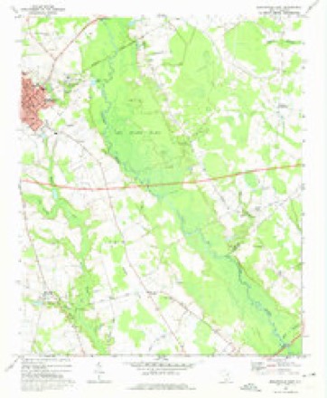
15 topographic sheets cover this place, the earliest surveyed in 1941 and the latest in 1986. It stands in the Bishopville census division. It lies in ZIP code area 29010. The Survey maps it on the Bishopville East quadrangle. 3,024 people lived here at the 2020 count. It stands 226 feet above sea level.
Research this city
On record in Bishopville
Buildings and businesses the archive holds for this place. Each opens its own page, with the source record it came from.
On the National Register 12 of 14 shown
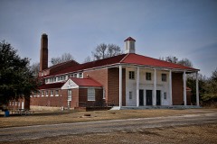 Ashwood School Gymnasium and Auditoriumlisted 2011
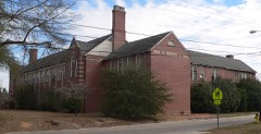 Bishopville High School
 James Carnes Houselisted 1986
 Dennis High Schoollisted 2005
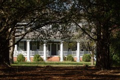 Thomas Fraser Houselisted 1986
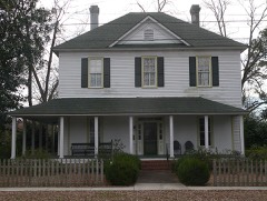 William Apollos James Houselisted 1999
 Lee County Courthouselisted 1981
 Manor, Thelisted 1986
 Mt. Zion Presbyterian Churchlisted 2003
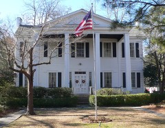 William Rogers Houselisted 1986
 Spencer Houselisted 1986
- Bishopville Commercial Historic Districtlisted 1986
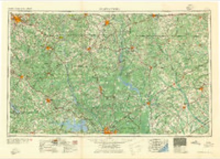
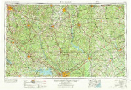
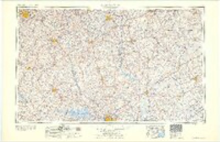
Topographic sheets covering this place
8 surveys from 15 printed sheetsMatched by testing this settlement's coordinate against the published boundary of every sheet in the United States Geological Survey's historical collection. Each opens the scanned sheet at the Survey.
- 1941 USGS Spartanburg quadrangle1:250000
- 1953 USGS Spartanburg quadrangle1:250000, 4 printings
- 1960 USGS Spartanburg quadrangle1:250000, 2 printings
- 1963 USGS Spartanburg quadrangle1:250000
- 1964 USGS Spartanburg quadrangle1:250000
- 1969 USGS Bishopville East quadrangle1:24000, 2 printings
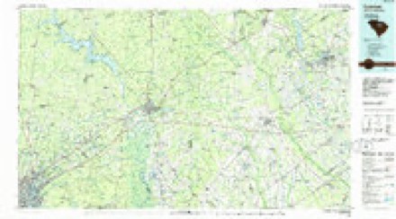
- 1986 USGS Camden quadrangle1:100000, 2 printings
- 1986 USGS Camden South quadrangle1:100000, 2 printings
Fires near this place
202 since 1992Regional context, not property-specific evidence. The federal wildfire occurrence database lists 202 fires within 5 miles of Bishopville between 1992 and 2020, burning about 1,159 acres in total. 4 started naturally. 32 were recorded as arson. Distance is straight-line from the map coordinates, so a fire counted here may appear on a neighbouring settlement's page as well.
| Reported cause | Fires |
|---|---|
| Debris and open burning | 95 |
| Missing data/not specified/undetermined | 52 |
| Arson/incendiarism | 32 |
| Equipment and vehicle use | 10 |
| Smoking | 4 |
| Natural | 4 |
| Misuse of fire by a minor | 2 |
| Power generation/transmission/distribution | 1 |
| Railroad operations and maintenance | 1 |
| Recreation and ceremony | 1 |
The most recent of them, most recent first, with the day each was reported and the service that recorded it.
| Date | Cause | Size | Reported by | Name on the report |
|---|---|---|---|---|
| 6 September 2018 | Debris and open burning | 2.5 acres | South Carolina Forestry Commission | not named |
| 6 September 2011 | Debris and open burning | under an acre | South Carolina Forestry Commission | not named |
| 5 September 2005 | Debris and open burning | 15 acres | South Carolina Forestry Commission | not named |
| 4 September 2005 | Debris and open burning | under an acre | South Carolina Forestry Commission | not named |
| 29 September 1992 | Missing data/not specified/undetermined | 5.0 acres | South Carolina Forestry Commission | not named |
| 21 September 1997 | Arson/incendiarism | 10 acres | South Carolina Forestry Commission | not named |
| 20 September 2001 | Arson/incendiarism | under an acre | South Carolina Forestry Commission | not named |
| 19 September 2005 | Missing data/not specified/undetermined | 3.0 acres | South Carolina Forestry Commission | not named |
Settlements close enough to share some of these fires:
Storms near this place
60 of 79 shownRegional context, not property-specific evidence. The National Weather Service names Bishopville in 79 storm reports between 1994 and 2025: 47 thunderstorm wind, 25 hail, 3 flash flood, 2 tornado. The reports record 1 injury. Each account below is quoted exactly as the forecast office filed it, from the NOAA Storm Events Database, and each date opens the federal record of that event.
| When | Event | Place named | Harm | What the report says |
|---|---|---|---|---|
| May 1999 | Thunderstorm Wind | Bishopville | 1 hurt | NWS employee and sheriff reported trees down in and around the Bishopville area. One persone was injured when a tree fell on their car. |
| July 2000 | Lightning | Bishopville | $60,000 | Lightning struck a tree and a home causing the home to burn to the ground. |
| April 2011 | Thunderstorm Wind | Bishopville | $8,000 | Sheriff reported trees down on Kelly Bridge Road in Bishopville. |
| June 2011 | Thunderstorm Wind | Bishopville | $7,000 | Sheriff reported several trees and powerlines down in the Bishopville area. |
| July 2012 | Thunderstorm Wind | Bishopville | $6,000 | Sheriff reported powerlines down in Bishopville. |
| July 2010 | Thunderstorm Wind | Bishopville | $6,000 | EM reported several trees down just west of Bishopville on Hwy 34. |
| June 2010 | Thunderstorm Wind | Bishopville | $4,000 | Sheriff reported trees down on St. Charles road. |
| July 2009 | Thunderstorm Wind | Bishopville | $4,000 | County official reported trees and powerlines down on Sandy Grove Church road east of Bishopville. |
| June 2009 | Thunderstorm Wind | Bishopville | $4,000 | DOT reported several trees down and a large highway sign from the intersection of Hwy 15 and I-20 to just south of Bishopville. |
| May 2011 | Thunderstorm Wind | Bishopville | $3,000 | Sheriff reported trees down on the southe side of Bishopville. |
| September 2020 | Flash Flood | Bishopville | $2,000 | Roads were flooded and impassable in the city of Bishopville, including S Heyward St, S Calhoun St, and along Main St. 2 to 4 inches of water entered a duplex on S. Heyward St. Times estimated. |
| June 2015 | Thunderstorm Wind | Bishopville | $2,000 | Sheriff reported a couple of trees and powerlines down on St. Charles Road South of Bishopville. |
| February 2012 | Thunderstorm Wind | Bishopville | $2,000 | Highway Patrol reported a couple of trees down around Bishopville on Shadygrove Church and Cypress roads. |
| June 2011 | Thunderstorm Wind | Bishopville | $2,000 | Sheriff reported a few trees down on St. Charles Highway. |
| June 2011 | Thunderstorm Wind | Bishopville | $2,000 | Sheriff reported several trees down on Woodrow Road. |
| March 1996 | Thunderstorm Wind | Bishopville | $2,000 | no account filed |
| February 2024 | Hail | Bishopville | $100 | Public report of pea size hail in Bishopville. |
| February 2025 | Thunderstorm Wind | Bishopville | - | Lee County dispatch reported downed trees in Bishopville. |
| July 2025 | Thunderstorm Wind | Bishopville | - | Lee County dispatch reported trees down on powerlines on Main St as well as trees down on Dogwood Dr in Bishopville, SC. |
| May 2024 | Thunderstorm Wind | Bishopville | - | A tree was downed, taking down a power line, at Law St and S Heyward St in Bishopville. | Time estimated. |
| December 2024 | Thunderstorm Wind | Bishopville | - | SC Highway Patrol reported multiple trees down near the I-20 and Route 15 interchange. |
| April 2019 | Thunderstorm Wind | Bishopville | - | Media relayed photo, via social media, of a tree down on a house in Bishopville. |
| March 2017 | Thunderstorm Wind | Bishopville | - | Lee Co Sheriff's Dept reported trees down across the county, as well as power lines down in the town of Bishopville. |
| March 2016 | Heavy Rain | Bishopville | - | Lee County Sheriff Dispatch reported that DOT was sent to a few roadways around Bishopville where some localized roadway flooding was occurring. |
| July 2016 | Thunderstorm Wind | Bishopville | - | Dispatch reported multiple trees down and power lines down on several roads near Bishopville. Mulitple trees down on Light Wood Knot Road...Dogwood Road and Spring Hill Road. |
| May 2009 | Hail | Bishopville | - | A&T Truckstop reported 1 inch hail. |
| June 2009 | Hail | Bishopville | - | Reported penny size hail just north of Bishopville. |
| June 2009 | Hail | Bishopville | - | Public reported penny size hail. |
| June 2009 | Hail | Bishopville | - | Spotter reported quarter size hail in Bishopville. |
| May 2009 | Hail | Bishopville | - | Convenience store reported nicke size hail near I-20. |
| May 2008 | Thunderstorm Wind | Bishopville | - | Sheriff reported trees down on highway 15. |
| May 2008 | Hail | Bishopville | - | CITCO Food Mart reported penny size hail near exit 108 on I-20. |
| June 2008 | Hail | Bishopville | - | Public reported nickel size hail in Bishopville. |
| June 2008 | Thunderstorm Wind | Bishopville | - | Sheriff reported several trees down on highway 441 and Spring Hill road. |
| August 2008 | Thunderstorm Wind | Bishopville | - | Sheriff reported trees down on Redhill road. |
| March 2008 | Thunderstorm Wind | Bishopville | - | Emergency Manager reported trees and powerlines down. Large dump trucks at X-tra Mile Trucking Company on hwy 341 were damaged. A roof was partially torn off a home on Sumter highway (15). |
| March 2008 | Hail | Bishopville | - | SKYWARN spotter reported penny size hail south of Bishopville. |
| May 2008 | Hail | Bishopville | - | The public reported nickel size hail in Bishopville and west. Hail covered the ground 5 miles west of Bishopville. |
| March 2007 | Thunderstorm Wind | Bishopville | - | Sheriff reported about a dozen trees down around the county. |
| June 2007 | Thunderstorm Wind | Bishopville | - | Emergency Manager reported trees and powerlines down along with pea size hail. |
| June 2007 | Thunderstorm Wind | Bishopville | - | DOT reported several trees down on hwy 441. |
| June 2007 | Hail | Bishopville | - | Highway Patrol repoted nickel size hail on I-20. |
| July 2007 | Thunderstorm Wind | Bishopville | - | Large limbs were down on Ashland Stokes Bridge road. |
| April 2006 | Thunderstorm Wind | Bishopville | - | Utility company reported large limbs down on powerlines with outages. |
| April 2006 | Thunderstorm Wind | Bishopville | - | Storm survey found scattered trees down in western Lee county. |
| April 2006 | Hail | Bishopville | - | Convenience store reported 1 inch hail. |
| May 2006 | Hail | Bishopville | - | Public reported quarter size hail. |
| May 2006 | Hail | Bishopville | - | Post Office reported quarter size hail hwy 15. |
| May 2006 | Hail | Bishopville | - | Highway Patrol repoted nickel size hail on I-20 near the Darlington County line. |
| May 2006 | Hail | Bishopville | - | SKYWARN spotter reported nickel size hail in Bishopville. |
| July 2006 | Thunderstorm Wind | Bishopville | - | Electric company reported large branches and powerlines down. |
| May 2005 | Hail | Bishopville | - | Park Service reported 3/4 inch hail. |
| October 2005 | Hail | Bishopville | - | Sheriff reported penny size hail. |
| October 2005 | Hail | Bishopville | - | Sheriff reported golf ball size hail in the vicinity of Una. |
| May 2004 | Thunderstorm Wind | Bishopville | - | Emergency Manager reported trees down in Bishopville. |
| June 2004 | Thunderstorm Wind | Bishopville | - | EOC reported numerous trees down in Bishopville. |
| September 2004 | Tornado (F0) | Bishopville | - | An F0 touched down in Bishopville then again in the Lucknow area. Trees and powerlines were down with minor damage to a couple of homes. |
| September 2004 | Tornado (F0) | Bishopville | - | Storm Chaser reported an F0 did minor damage to a mobile home and took down some trees and powerlines. |
| August 2004 | Flash Flood | Bishopville | - | Sheriff reported flash flooding on several rural roads closing them to through traffic. |
| May 2003 | Thunderstorm Wind | Bishopville | - | Emergency manager reported trees and powerlines down in Bishopville. |
Nearest settlements
The eight closest, with where each one stands in the county. Distances are straight-line, computed from the Geographic Names Information System coordinates.
| Map | Place | Distance | Sheets |
|---|---|---|---|
| Thursa | 3.2 miles | 14 | |
| Weatherly (historical) | 3.3 miles | 15 | |
| Shannon Hill | 3.3 miles | 14 | |
| McCutchen (historical) | 3.6 miles | 16 | |
| Browntown | 3.8 miles | 16 | |
| Alcot | 4.3 miles | 14 | |
| Spur | 4.3 miles | 16 | |
| McCutchens Crossroads | 5.0 miles | 15 |
Elsewhere
Matched on this settlement's Geographic Names Information System number rather than its name, so it cannot be a different place of the same name in another state.
| Wikipedia article on Bishopville | An encyclopaedic summary. Its text is share-alike, so it is linked here rather than copied. |
| Wikidata item Q2301062 | The structured record the population and elevation above come from. Public domain (CC0). |
Provenance
This settlement is recorded in the Geographic Names Information System as feature 1220758. The sheet list is computed by point-in-boundary test against the United States Geological Survey's historical topographic inventory. Both are works of the United States government and carry no copyright under 17 U.S.C. 105.
Wildfire. Short, Karen C. 2022. Spatial wildfire occurrence data for the United States, 1992-2020 [FPA_FOD_20221014]. 6th Edition. Fort Collins, CO: Forest Service Research Data Archive. https://doi.org/10.2737/RDS-2013-0009.6 Collected with United States Government funding and usable without additional permissions or fees.
Storms. NOAA National Centers for Environmental Information, Storm Events Database https://www.ncei.noaa.gov/stormevents/ A work of the United States government, no copyright under 17 U.S.C. 105. Narratives are quoted verbatim from the National Weather Service report and are not edited or summarised.