 Block
Bluffton, South Carolina
18 topographic sheets cover this place, the earliest surveyed in 1920 and the latest in 1978. It stands in the Bluffton census division. It lies in ZIP code area 29910. It sits by Kirk Bluff. The Survey maps it on the Bluffton quadrangle. 27,716 people lived here at the 2020 count. It stands 20 feet above sea level.
On record in Bluffton
Buildings and businesses the archive holds for this place. Each opens its own page, with the source record it came from.
On the National Register 4 records
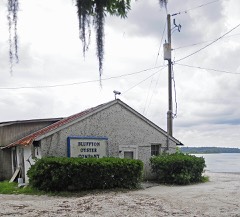 Bluffton Historic Districtlisted 1996
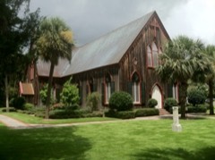 Church of the Crosslisted 1975
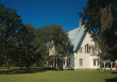 Rose Hill Plantation Houselisted 1983
- Campbell Chapel AME Churchlisted 2019
Surveyed buildings and structures 1 record
- Rose Hill Plantation House, 2.5 miles Northwest of intersection of U.S. HIghway 278 & State Route 46, Blufftonfederal building survey, 19 photographs
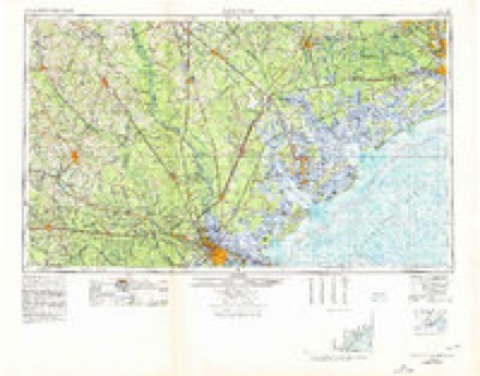
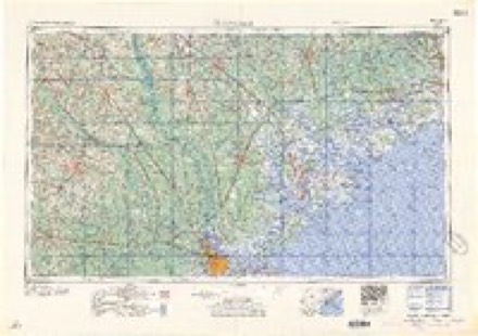
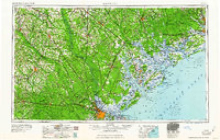
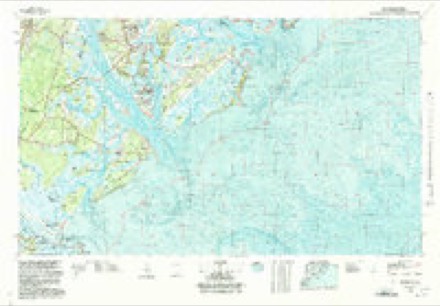
Topographic sheets covering this place
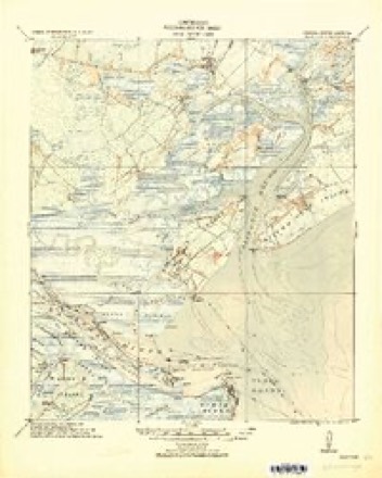
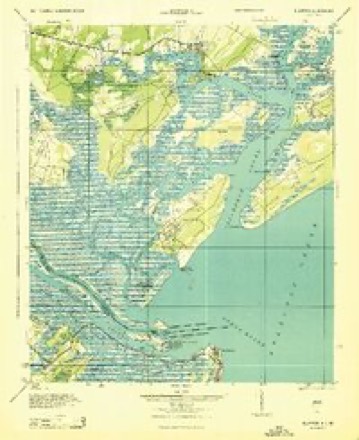
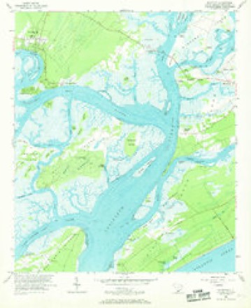
9 surveys from 18 printed sheetsMatched by testing this settlement's coordinate against the published boundary of every sheet in the United States Geological Survey's historical collection. Each opens the scanned sheet at the Survey.
- 1920 USGS Bluffton quadrangle1:62500
- 1945 USGS Bluffton quadrangle1:62500
- 1947 USGS Savannah quadrangle1:250000
- 1948 USGS Savannah quadrangle1:250000
- 1956 USGS Bluffton quadrangle1:24000, 5 printings
- 1957 USGS Savannah quadrangle1:250000, 4 printings
- 1960 USGS Savannah quadrangle1:250000
- 1961 USGS Savannah quadrangle1:250000, 2 printings
- 1978 USGS Beaufort quadrangle1:100000, 2 printings
Photographs
1 photograph,Taken for the Office of War Information and the Farm Security Administration, who photographed the country between 1935 and 1944. Works of United States government photographers, with no known restriction on use. Each opens its catalogue record.
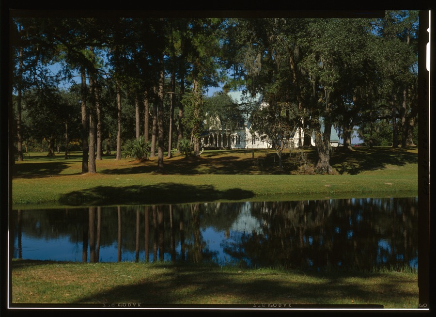
Photographer not recorded. Library of Congress
Fires near this place
85 since 1992Regional context, not property-specific evidence. The federal wildfire occurrence database lists 85 fires within 5 miles of Bluffton between 1992 and 2020, burning about 663 acres in total. 1 started naturally. 12 were recorded as arson. Distance is straight-line from the map coordinates, so a fire counted here may appear on a neighbouring settlement's page as well.
| Reported cause | Fires |
|---|---|
| Missing data/not specified/undetermined | 40 |
| Debris and open burning | 19 |
| Arson/incendiarism | 12 |
| Misuse of fire by a minor | 12 |
| Recreation and ceremony | 1 |
| Natural | 1 |
The most recent of them, most recent first, with the day each was reported and the service that recorded it.
| Date | Cause | Size | Reported by | Name on the report |
|---|---|---|---|---|
| 6 August 1993 | Missing data/not specified/undetermined | 149 acres | South Carolina Forestry Commission | not named |
| 3 August 2002 | Misuse of fire by a minor | 1.0 acres | South Carolina Forestry Commission | not named |
| 23 August 1993 | Missing data/not specified/undetermined | 1.0 acres | South Carolina Forestry Commission | not named |
| 16 August 2001 | Natural | 10 acres | South Carolina Forestry Commission | not named |
| 31 July 1996 | Missing data/not specified/undetermined | 2.0 acres | South Carolina Forestry Commission | not named |
| 3 July 1996 | Missing data/not specified/undetermined | 1.0 acres | South Carolina Forestry Commission | not named |
| 28 July 1992 | Missing data/not specified/undetermined | 2.0 acres | South Carolina Forestry Commission | not named |
| 27 July 1992 | Missing data/not specified/undetermined | 9.0 acres | South Carolina Forestry Commission | not named |
Settlements close enough to share some of these fires:
Mines and quarries near this place
1 within 5 milesRegional context, not property-specific evidence. The federal mineral resources record lists 1 working within 5 miles of Bluffton: 1 past producer. None of them still produces. What was taken out: Sand and Gravel, Construction. Distance is straight-line from the map coordinates, so a quarry counted here may appear on a neighbouring settlement's page as well.
| Where | Site | Commodity | Status | Recorded |
|---|---|---|---|---|
| Cleckley Number 5 | Sand and Gravel, Construction | Past Producer | Sedimentary |
Storms near this place
60 of 112 shownRegional context, not property-specific evidence. The National Weather Service names Bluffton in 112 storm reports between 1995 and 2025: 59 thunderstorm wind, 26 hail, 12 lightning, 7 flash flood. The reports record 4 injuries. Each account below is quoted exactly as the forecast office filed it, from the NOAA Storm Events Database, and each date opens the federal record of that event.
| When | Event | Place named | Harm | What the report says |
|---|---|---|---|---|
| June 1998 | Thunderstorm Wind | Bluffton | 2 hurt | Trees down. A couple suffered minor injuries when a tree fell on their car. |
| August 2011 | Thunderstorm Wind | Bluffton | 1 hurt | A fire department reported one tree down and on a car near the intersection of Highway 46 and Rose DHU Creek Plantation. One person was injured. Extent of injuries unknown. |
| June 1998 | Lightning | Bluffton | 1 hurt | A 62 year old man was struck by lightning while standing under a tree. |
| April 2010 | Tornado (EF0) | Bluffton | $40,000 | The National Weather Service in Charleston, South Carolina, in conjunction with Beaufort county Emergency Management, confirmed a small EF-0 tornado touched down at 1111 pm on April 8, 2010, two miles west of Bluffton and traveled northeast approximately 0.15 miles before dissipating. The tornado snapped off the tops of a few pine trees, a few of which landed on and damaged vehicles, tore off some aluminum flashing from homes, knocked down several fences, destroyed a shed and damaged a swing set. Maximum winds were estimated near 75 mph and the maximum path width was around 20 yards wide. |
| August 1996 | Lightning | Bluffton | $40,000 | no account filed |
| July 2025 | Lightning | Bluffton | $25,000 | Beaufort County Fire Department reported that a lightning strike ignited a fire in the lower portion of a home resulting in moderate damage to the structure. |
| July 2024 | Lightning | Bluffton | $10,000 | A lightning strike started a structure fire on Foxchase Lane. |
| June 2015 | Lightning | Bluffton | $10,000 | An emergency manager reported a structure fire caused by lightning in the 20 block area of Ironwood Circle. |
| June 2022 | Lightning | Bluffton | $5,000 | The Beaufort County 911 Call Center reported a lightning strike to a home along the 20 Block of West Morningside Drive. The strike caused a brush fire and melted water lines and power lines at the home. |
| July 2017 | Lightning | Bluffton | $5,000 | Beaufort County Emergency Management reported a suspected lightning strike resulted in a building fire off of Burnt Church Road. Extent of resulting damage is unknown. |
| August 2010 | Lightning | Bluffton | $5,000 | Lightning caused a fire at the Golden Corral in Bluffton, South Carolina. Firefighters found smoke and flames coming from the roof. The fire was quickly extinguished. |
| April 2006 | Thunderstorm Wind | Bluffton | $5,000 | Power lines down at Myrtle island. |
| May 2006 | Thunderstorm Wind | Bluffton | $5,000 | Trees and powerlines down along Bluffton Parkway. |
| May 2006 | Thunderstorm Wind | Bluffton | $5,000 | Trees and powerlines down on Old Bailey Rd. |
| July 2006 | Thunderstorm Wind | Bluffton | $5,000 | Trees down on Harrison Island Road. |
| June 1995 | Thunderstorm Wind | Bluffton | $5,000 | Trees and power lines down. |
| August 2020 | Lightning | Bluffton | $3,500 | A Beaufort County emergency manager reported a lightning strike to a residence along Farnsleigh Road which produced minor roof damage. |
| August 2020 | Lightning | Bluffton | $3,500 | Law enforcement relayed a report of a structure fire resulting from a lightning strike. |
| September 2009 | Flash Flood | Bluffton | $3,000 | Law Enforcement reported road closures due to flooding caused by heavy rains at 9th Avenue, 3rd Avenue, and Pinecrest Circle in Bluffton, South Carolina. |
| September 2021 | Thunderstorm Wind | Bluffton | $2,000 | Beaufort County Emergency Management reported a tree and powerlines down on Oyster Street. |
| July 2010 | Thunderstorm Wind | Bluffton | $2,000 | The public reported several 80 to 90 foot tall pine trees were blown down on Cat Brier Lane, 3 miles east-northeast of Bluffton, South Carolina. |
| May 2010 | Thunderstorm Wind | Bluffton | $2,000 | The public reported trees down in the roadway on White Oaks Circle at Rosehall Plantation, in Bluffton, South Carolina. |
| August 2008 | Thunderstorm Wind | Bluffton | $1,500 | Law Enforcement reported trees down on a house in the Shadygrove Subdivision in Bluffton, South Carolina. |
| July 2025 | Lightning | Bluffton | $1,000 | Beaufort County Fire Department reported that a lightning strike ignited a small brush fire. |
| March 2023 | Thunderstorm Wind | Bluffton | $1,000 | Beaufort County Sheriff's Office reported a tree down near the intersection of Ann Smith Drive and Soperton Drive. |
| August 2023 | Thunderstorm Wind | Bluffton | $1,000 | The Beaufort County 911 Call Center reported a tree down near the intersection of Fording Island Road and Malphrus Road. |
| October 2020 | Thunderstorm Wind | Bluffton | $1,000 | A Beaufort County emergency manager reported a tree down near the intersection of White Oaks Circle and Crabtree Lane in the Rose Hill neighborhood. |
| August 2019 | Thunderstorm Wind | Bluffton | $1,000 | An emergency manager reported a tree down near the intersection of Minuteman Drive and Alljoy Road due to thunderstorm outflow. |
| June 2013 | Thunderstorm Wind | Bluffton | $1,000 | The South Carolina Department of Highways reported one tree down near the intersection of Bluffton Parkway and Red Cedar Street. |
| May 2009 | Thunderstorm Wind | Bluffton | $1,000 | The public reported 2 trees down in Bluffton, South Carolina. |
| September 2009 | Flash Flood | Bluffton | $1,000 | The Beaufort County Warning Point reported that H.E. McCracken Circle was closed after two vehicles stalled out due to high water on the roadway. |
| June 2008 | Thunderstorm Wind | Bluffton | $1,000 | The Beaufort county warning point reported a tree blocking Highway 46 in Bluffton, South Carolina. |
| June 2008 | Thunderstorm Wind | Bluffton | $1,000 | Two trees were reported down in Bluffton, South Carolina. |
| April 2007 | Thunderstorm Wind | Bluffton | $1,000 | A large Oak Tree was reported down in downtown Bluffton off of Mayriver Road near the intersection with Calhoun Street. 1 Tree was reported down in Mayriver Plantation. |
| May 2006 | Thunderstorm Wind | Bluffton | $1,000 | Trees down at base of Hilton Head bridge. |
| August 1999 | Lightning | Bluffton | $1,000 | Lightning strikes resulted in a residence shed fire and several business fires. |
| June 2025 | Thunderstorm Wind | Bluffton | $500 | A trained spotter reported a 10-12 inch diameter hardwood limb snapped off by thunderstorm winds. |
| September 2021 | Thunderstorm Wind | Bluffton | $500 | Beaufort County Sheriff's Office reported a large tree down on Buck Island Road near the intersection with May River Road. |
| July 2009 | Thunderstorm Wind | Bluffton | $500 | A National Weather Service employee reported a 15 foot tall, 8 inch diameter pine tree down near the intersection of Highway 278 and Burnt Church Road, near Bluffton, South Carolina. |
| June 2009 | Thunderstorm Wind | Bluffton | $500 | The public reported a tree down in the backyard of their residence along Lakeside Drive in Bluffton, South Carolina. |
| July 2008 | Thunderstorm Wind | Bluffton | $500 | A tree was reported down 3 miles west of Bluffton, South Carolina. |
| June 2008 | Thunderstorm Wind | Bluffton | $500 | A tree was reported down on a road in Bluffton, South Carolina. |
| August 2025 | Flash Flood | Bluffton | - | The Beaufort County Sheriff Office reported a vehicle stalled in floodwaters in the 100 Block of H.E. McCracken Circle. |
| May 2024 | Hail | Bluffton | - | A trained spotter reported penny sized hail near Bluffton. |
| May 2024 | Thunderstorm Wind | Bluffton | - | Beaufort County Emergency Management reported a tree down at 10 Wharf Street. |
| August 2024 | Flood | Bluffton | - | Law enforcement reported an incident where a vehicle hydroplaned in a neighborhood and went off a bridge into a pond on Hampton Hall Boulevard. No injuries were reported. |
| August 2024 | Flood | Bluffton | - | Bluffton Fire District reported that a driver was pulled from a vehicle in a flooded parking lot at Parker's Gas Station along Gateway Village Road. |
| August 2024 | Flash Flood | Bluffton | - | Fire officials reported flood waters entered a home at the intersection of Farm Lake Drive and Cattle Run Way. Waters were also about to enter several homes nearby. |
| June 2023 | Thunderstorm Wind | Bluffton | - | A 911 call center reported a tree down on a house at 40 Wilkerson Way. |
| June 2023 | Thunderstorm Wind | Bluffton | - | A firefighter reported a tree down near the intersection of Buckwalter Parkway and Lake Point Drive. |
| June 2023 | Thunderstorm Wind | Bluffton | - | A firefighter reported a tree down near the intersection of May River Road and Linden Park Drive. |
| August 2023 | Thunderstorm Wind | Bluffton | - | The Beaufort County 911 Call Center reported a tree down along Innovation Drive. |
| August 2023 | Thunderstorm Wind | Bluffton | - | The Beaufort County 911 Call Center reported a tree down along Waterford Drive. |
| June 2022 | Thunderstorm Wind | Bluffton | - | The Beaufort County 911 Call Center reported a tree down on Fording Island Road in Rose Hill. |
| April 2020 | Thunderstorm Wind | Bluffton | - | The Beaufort County 911 Call Center reported two trees down and blocking the road near the intersection of Buck Island Road and U.S. 278. |
| April 2020 | Thunderstorm Wind | Bluffton | - | The Beaufort County 911 Call Center reported a tree down on a house along Fernlakes Drive. |
| April 2020 | Thunderstorm Wind | Bluffton | - | An emergency manager reported a tree down on power lines. |
| December 2020 | Thunderstorm Wind | Bluffton | - | A Beaufort County emergency manager reported a tree down along Fording Island Road near the intersection with Moss Creek Village. The downed tree also resulted in a vehicle accident. |
| June 2020 | Thunderstorm Wind | Bluffton | - | A tree was reported down near the intersection of Alljoy Road and Confederate Avenue. |
| April 2019 | Thunderstorm Wind | Bluffton | - | A trained spotter reported tree limbs down and a tree on a house in Bluffton, SC near 9th Avenue. |
Nearest settlements
The eight closest, with where each one stands in the county. Distances are straight-line, computed from the Geographic Names Information System coordinates.
| Map | Place | Distance | Sheets |
|---|---|---|---|
| Brighton Beach | 1.6 miles | 18 | |
| Myrtle Island | 1.8 miles | 18 | |
| Palmetto Bluff | 2.4 miles | 17 | |
| Buckingham Landing | 3.3 miles | 18 | |
| Horse Landing | 4.2 miles | 18 | |
| Bryan Landing | 4.6 miles | 18 | |
| Windmill Harbor | 4.6 miles | 18 | |
| Copp Landing | 4.8 miles | 17 |
Elsewhere
Matched on this settlement's Geographic Names Information System number rather than its name, so it cannot be a different place of the same name in another state.
| Wikipedia article on Bluffton | An encyclopaedic summary. Its text is share-alike, so it is linked here rather than copied. |
| Wikidata item Q3243593 | The structured record the population and elevation above come from. Public domain (CC0). |
Provenance
This settlement is recorded in the Geographic Names Information System as feature 1220833. The sheet list is computed by point-in-boundary test against the United States Geological Survey's historical topographic inventory. Both are works of the United States government and carry no copyright under 17 U.S.C. 105.
Wildfire. Short, Karen C. 2022. Spatial wildfire occurrence data for the United States, 1992-2020 [FPA_FOD_20221014]. 6th Edition. Fort Collins, CO: Forest Service Research Data Archive. https://doi.org/10.2737/RDS-2013-0009.6 Collected with United States Government funding and usable without additional permissions or fees.
Mines and quarries. USGS Mineral Resources Data System (MRDS) https://mrdata.usgs.gov/mrds/ A work of the United States government, no copyright under 17 U.S.C. 105.
Storms. NOAA National Centers for Environmental Information, Storm Events Database https://www.ncei.noaa.gov/stormevents/ A work of the United States government, no copyright under 17 U.S.C. 105. Narratives are quoted verbatim from the National Weather Service report and are not edited or summarised.