 Block
Frogmore, South Carolina
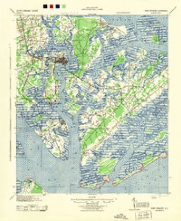
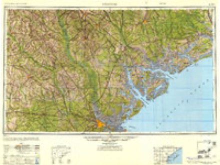
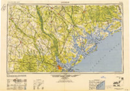
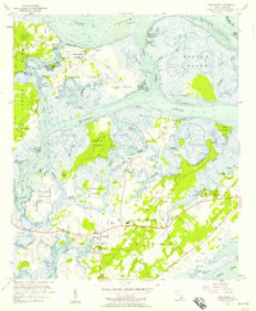
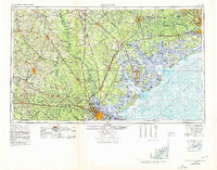
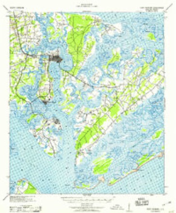
16 topographic sheets cover this place, the earliest surveyed in 1944 and the latest in 1978. It stands in the St. Helena Island census division. It lies in ZIP code area 29920. It lies near Indian Hill. The Survey maps it on the Frogmore quadrangle.
On record in Frogmore
Buildings and businesses the archive holds for this place. Each opens its own page, with the source record it came from.
On the National Register 12 of 22 shown
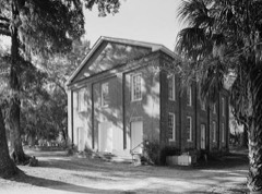 Brick ChurchNational Historic Landmark · listed 1974
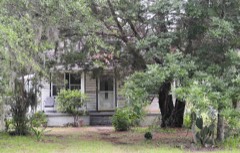 Emanuel Alston Houselisted 1988
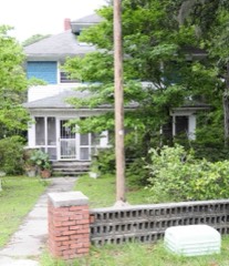 Dr. York Bailey Houselisted 1988
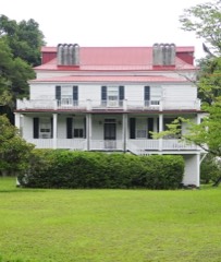 Coffin Point Plantationlisted 1975
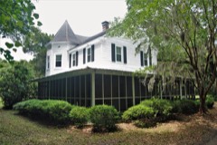 Coffin Point Plantation Caretaker's Houselisted 1989
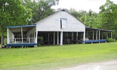 Corner Packing Shed, Thelisted 1988
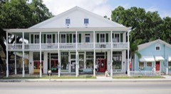 Corner Store and Office, Thelisted 1988
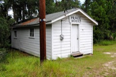 Eddings Point Community Praise Houselisted 1989
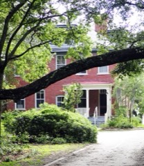 Fort Fremont Hospitallisted 1989
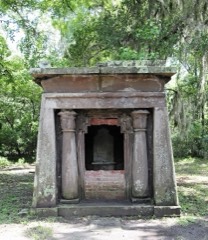 Fripp, Edgar, Mausoleum, St. Helena Island Parish Churchlisted 1988
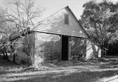 Frogmore Plantation Complexlisted 1989
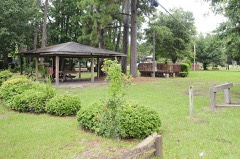 Green, Thelisted 1988
Every listing in Beaufort County
Surveyed buildings and structures 12 of 28 shown
- Barn, Frogmore Manor, Seaside Road, Frogmorefederal building survey, 4 photographs
- Cemetery, Orange Grove Plantation, Frogmorefederal building survey, 3 photographs
- Isaac Fripp House, Off of County Road, Frogmorefederal building survey, 8 photographs
- Penn School Historic District, Arnett House, SC Route 37, 1 mile South of Frogmore, St. Helena Island, Frogmorefederal building survey, 3 photographs
- Penn School Historic District, Benezet House, 1 mile South of Frogmore, Route 37, St Helena Island, Frogmorefederal building survey, 4 photographs
- Penn School Historic District, Brick Church, SC Route 37, 1 mile south of Frogmore, St. Helena Island, Frogmorefederal building survey, 15 photographs
- Penn School Historic District, Butler Building, SC Route 37, 1 mile South of Frogmore, St. Helena Island, Frogmorefederal building survey, 4 photographs
- Penn School Historic District, Cafeteria, SC Route 37, 1 mile South of Frogmore, St. Helena Island, Frogmorefederal building survey, 3 photographs
- Penn School Historic District, Cedar Cottage, SC Route 37, 1 mile South of Frogmore, St. Helena Island, Frogmorefederal building survey, 3 photographs
- Penn School Historic District, Cope Building, SC Route 37, 1 mile South of Frogmore, St. Helena Island, Frogmorefederal building survey, 4 photographs
- Penn School Historic District, Darrah Building, SC Route 37, 1 mile south of Frogmore, St. Helena Island, Frogmorefederal building survey, 1 photograph
- Penn School Historic District, Frissell Community House, SC Route 37, 1 mile South of Frogmore, St. Helena Island, Frogmorefederal building survey, 5 photographs
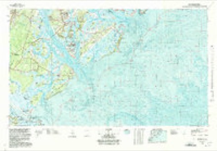
Topographic sheets covering this place
9 surveys from 16 printed sheetsMatched by testing this settlement's coordinate against the published boundary of every sheet in the United States Geological Survey's historical collection. Each opens the scanned sheet at the Survey.
- 1944 USGS Fort Fremont quadrangle1:62500
- 1947 USGS Savannah quadrangle1:250000
- 1948 USGS Savannah quadrangle1:250000
- 1956 USGS Frogmore quadrangle1:24000, 3 printings
- 1957 USGS Savannah quadrangle1:250000, 4 printings
- 1959 USGS Fort Fremont quadrangle1:62500
- 1960 USGS Savannah quadrangle1:250000
- 1961 USGS Savannah quadrangle1:250000, 2 printings
- 1978 USGS Beaufort quadrangle1:100000, 2 printings
Photographs
2 photographs,Taken for the Office of War Information and the Farm Security Administration, who photographed the country between 1935 and 1944. Works of United States government photographers, with no known restriction on use. Each opens its catalogue record.
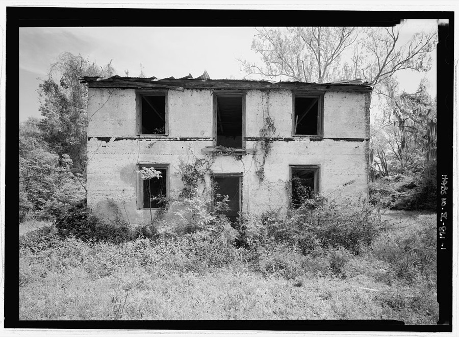
Photographer not recorded. Library of Congress
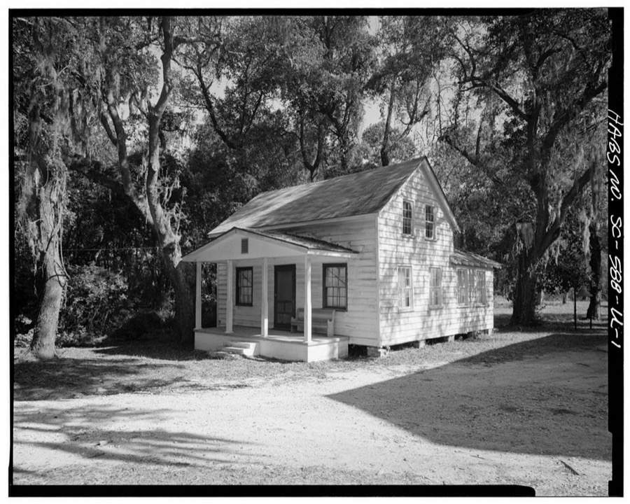
Photographer not recorded. Library of Congress
Fires near this place
166 since 1993Regional context, not property-specific evidence. The federal wildfire occurrence database lists 166 fires within 5 miles of Frogmore between 1993 and 2020, burning about 848 acres in total. 2 started naturally. 40 were recorded as arson. Distance is straight-line from the map coordinates, so a fire counted here may appear on a neighbouring settlement's page as well.
| Reported cause | Fires |
|---|---|
| Debris and open burning | 87 |
| Arson/incendiarism | 40 |
| Missing data/not specified/undetermined | 29 |
| Misuse of fire by a minor | 4 |
| Equipment and vehicle use | 3 |
| Natural | 2 |
| Recreation and ceremony | 1 |
The most recent of them, most recent first, with the day each was reported and the service that recorded it.
| Date | Cause | Size | Reported by | Name on the report |
|---|---|---|---|---|
| 7 September 1997 | Debris and open burning | 8.0 acres | South Carolina Forestry Commission | not named |
| 26 September 2019 | Debris and open burning | 3.0 acres | South Carolina Forestry Commission | not named |
| 26 September 2019 | Debris and open burning | 4.0 acres | South Carolina Forestry Commission | not named |
| 2 September 2014 | Debris and open burning | under an acre | South Carolina Forestry Commission | not named |
| 9 August 2002 | Debris and open burning | under an acre | South Carolina Forestry Commission | not named |
| 7 August 1999 | Arson/incendiarism | 2.0 acres | South Carolina Forestry Commission | not named |
| 5 August 2008 | Debris and open burning | under an acre | South Carolina Forestry Commission | not named |
| 31 August 2013 | Debris and open burning | 2.0 acres | South Carolina Forestry Commission | not named |
Settlements close enough to share some of these fires:
Storms near this place
33 since 1998Regional context, not property-specific evidence. The National Weather Service names Frogmore in 33 storm reports between 1998 and 2024: 22 thunderstorm wind, 4 hail, 3 tornado, 2 lightning. The reports record 1 death and 4 injuries. Each account below is quoted exactly as the forecast office filed it, from the NOAA Storm Events Database, and each date opens the federal record of that event.
| When | Event | Place named | Harm | What the report says |
|---|---|---|---|---|
| September 1998 | Tornado (F2) | Frogmore | 1 killed, 4 hurt, $360,000 | Thirteen homes were destroyed and another thirteen were heavily damaged, most of them were mobile homes. One mobile home was flipped in the air and smashed to the ground where a 66 -year old female was crushed to death. Numerous trees were snapped off 5 to 15 feet above the ground with others uprooted. The worse of the damage was concentrated in an area approximately 2.5 to 3 miles long across Fripp Island to near Morgan Island. The tornado then crossed the St Helena Sound and moved into Colleton County. |
| July 2020 | Flood | Frogmore | $10,000 | Officials at Hunting Island State Park reported widespread significant flooding on virtually all roads at the park. One road had approximately 3 feet of water on it. The flooding caused the park to be closed for the 7th, 8th, and 9th. The CoCoRaHS site (SC-BF-96) at the park reported a two day rainfall total of 12.75 inches. The 24 hour total ending at 7:00 am on 7/7 was 2.80 inches and the 24 hour total ending at 7:00 am on 7/8 was 9.95 inches. Based on radar data nearly all of the 12.75 inches occurred between 4:00 am and 7:00 pm on 7/7. In addition to the roadway flooding, the park also reported the potential loss of nearly 100 sea turtle nests. |
| June 2015 | Lightning | Frogmore | $10,000 | An emergency manager reported a structure fire due to lightning in the 600 block area of Dolphin Road on Fripp Island. |
| March 2012 | Thunderstorm Wind | Frogmore | $5,000 | Beaufort County Law Enforcement reported several trees down near Lands End Road and Tuck in the Woods. |
| July 2008 | Thunderstorm Wind | Frogmore | $3,000 | Power lines and telephone poles were reported down along Tomahawk Trail in Frogmore, South Carolina. |
| October 2020 | Thunderstorm Wind | Frogmore | $2,750 | A Beaufort County emergency manager reported a blown transformer and power lines down near to 100 Block of Doctor Martin Luther King Junior Drive. |
| August 2008 | Thunderstorm Wind | Frogmore | $2,500 | The Beaufort County Emergency Manager reported a large number of tents had been damaged by strong winds at Hunting Island State Park. |
| June 2019 | Thunderstorm Wind | Frogmore | $1,250 | An emergency manager reported power wires down along Sea Island Parkway. |
| June 2023 | Lightning | Frogmore | $1,000 | A Beaufort County 911 Call Center relayed a report of a tree on fire due to a lightning strike. |
| June 2010 | Thunderstorm Wind | Frogmore | $1,000 | Law Enforcement reported one tree down on Dr. Martin Luther King Drive on Saint Helena Island. |
| June 2008 | Thunderstorm Wind | Frogmore | $1,000 | Trees were reported down and partially blocking the road on the Harbor Island Bridge. |
| July 2010 | Thunderstorm Wind | Frogmore | $500 | A park ranger reported a tree down across a road at Hunting Island State Park, in Hunting Island, South Carolina. |
| July 2008 | Thunderstorm Wind | Frogmore | $500 | A tree was reported down along Dulamo Road in Frogmore, South Carolina. |
| May 2024 | Hail | Frogmore | - | A trained spotter reported golf ball sized hail on Fripp Island. |
| May 2024 | Hail | Frogmore | - | A Hunting Island State Park employee reported quarter sized hail. |
| May 2024 | Thunderstorm Wind | Frogmore | - | A trained spotter reported two trees down near the Penn Center south of Frogmore. |
| August 2024 | Tornado (EF0) | Frogmore | - | A National Weather Service Storm Survey Team confirmed an EF0 tornado with an estimated maximum wind speed of 74 mph in Saint Helena Island, South Carolina occurring from 1141 PM to 1143 PM EST. ||The weak and very short-lived tornado, which was associated with an outer rainband of Tropical Storm Debby, touched down over the marsh region of the Harbor River, just south of 1st Coleman Road. Radar data was used to estimate the beginning of the tornado path over the remote marsh region south of 1st Coleman Road. The first detectable damage was a small uprooted tree and a few snapped tree limbs near the southern end of 1st Coleman Road, where it borders the marsh region of the Harbor River. The tornado then moved rapidly northwest, generally along the southern and western side of 1st Coleman Road where it snapped several tree limbs and small trees, broke a flag pole at the base and caused minor damage to the metal skirt at the base of one mobile home. The tornado then continued briefly to the northwest where it ended in a heavily wooded area just southwest of the intersection of Seaside Road and 1st Coleman Road. |
| August 2022 | Thunderstorm Wind | Frogmore | - | The South Carolina Highway Patrol reported a tree down near the intersection of Seaside Road and Club Bridge Road. |
| June 2022 | Thunderstorm Wind | Frogmore | - | The Beaufort County Dispatch reported a tree down near the intersection of Doctor Martin Luther King Junior Drive and Penn Center Road. |
| June 2022 | Thunderstorm Wind | Frogmore | - | The Beaufort County Dispatch reported a tree down on Ball Park Road near the intersection with Saxonville Road. |
| August 2021 | Thunderstorm Wind | Frogmore | - | A Beaufort County emergency manager reported a large tree down and blocking the intersection of Club Bridge Road and Seaside Road. |
| April 2019 | Thunderstorm Wind | Frogmore | - | A Beaufort County emergency manager reported a tree on power lines along Sea Island Parkway. |
| March 2018 | Hail | Frogmore | - | A trained spotter reported penny sized hail at Racoon Ridge Road on Saint Helena Island. The hail lasted about 5 minutes. |
| July 2015 | Thunderstorm Wind | Frogmore | - | Beaufort County dispatch reported a tree down on Hunting Island across Sea Island Parkway. |
| July 2015 | Thunderstorm Wind | Frogmore | - | South Carolina Highway Patrol reported a tree down on Highway 21 at the Day Lilly Drive intersection. |
| July 2015 | Thunderstorm Wind | Frogmore | - | South Carolina Highway Patrol reported that a tree was blown down on Sea Island Parkway. |
| July 2015 | Thunderstorm Wind | Frogmore | - | Beaufort County dispatch reported a tree down on Fripp Point Road. |
| July 2015 | Thunderstorm Wind | Frogmore | - | Beaufort County dispatch reported several trees down near Ladys Island. One tree was down and in the roadway on Sea Island Parkway near Polowana Road. Three other trees were down along Martin Luther King Jr. Drive. |
| August 2015 | Thunderstorm Wind | Frogmore | - | The Beaufort County 911 Call Center reported a tree down near the intersection of Janette Drive and Coffin Point Road. |
| July 2013 | Tornado (EF0) | Frogmore | - | Law Enforcement reported a waterspout that possibly moved onshore on Hunting island before moving back over the water and dissipating. No damage was reported since it moved over marshland. |
| July 2008 | Flash Flood | Frogmore | - | Extensive flooding was reported at the Fripp Island Golf Course. Water was also reported to be approaching several homes on Porpoise Drive. |
| June 2008 | Hail | Frogmore | - | Quarter to half dollar size hail was reported by the public 11 miles east-northeast of Port Royal, South Carolina. |
| July 2005 | Thunderstorm Wind | Frogmore | - | Downed powerlines on Saint Helena Island. |
Nearest settlements
The eight closest, with where each one stands in the county. Distances are straight-line, computed from the Geographic Names Information System coordinates.
| Map | Place | Distance | Sheets |
|---|---|---|---|
| Dataw Island | 2.5 miles | 16 | |
| Morgan River Estates | 3.7 miles | 19 | |
| Oakwood Park | 3.9 miles | 19 | |
| Sherwood Forest | 3.9 miles | 19 | |
| Academy Estates | 4.0 miles | 19 | |
| Gay Oaks | 4.1 miles | 19 | |
| Ashdale | 4.2 miles | 16 | |
| Scott | 4.3 miles | 18 |
Elsewhere
Matched on this settlement's Geographic Names Information System number rather than its name, so it cannot be a different place of the same name in another state.
| Wikipedia article on Frogmore | An encyclopaedic summary. Its text is share-alike, so it is linked here rather than copied. |
| Wikidata item Q5505281 | The structured record the population and elevation above come from. Public domain (CC0). |
Provenance
This settlement is recorded in the Geographic Names Information System as feature 1231302. The sheet list is computed by point-in-boundary test against the United States Geological Survey's historical topographic inventory. Both are works of the United States government and carry no copyright under 17 U.S.C. 105.
Wildfire. Short, Karen C. 2022. Spatial wildfire occurrence data for the United States, 1992-2020 [FPA_FOD_20221014]. 6th Edition. Fort Collins, CO: Forest Service Research Data Archive. https://doi.org/10.2737/RDS-2013-0009.6 Collected with United States Government funding and usable without additional permissions or fees.
Storms. NOAA National Centers for Environmental Information, Storm Events Database https://www.ncei.noaa.gov/stormevents/ A work of the United States government, no copyright under 17 U.S.C. 105. Narratives are quoted verbatim from the National Weather Service report and are not edited or summarised.