 Block
Garden City, South Carolina
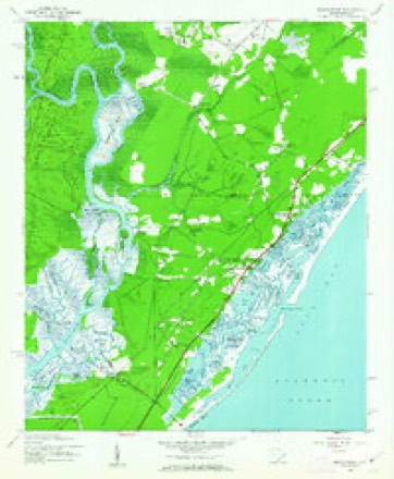
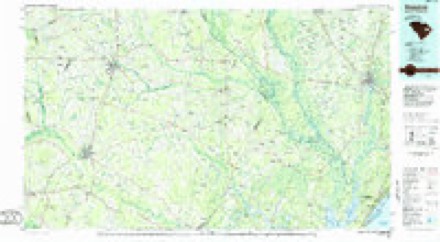
11 topographic sheets cover this place, the earliest surveyed in 1943 and the latest in 1986. It stands in the Myrtle Beach census division. It lies in ZIP code area 29576. The Survey maps it on the Brookgreen quadrangle. 10,235 people lived here at the 2020 count. It stands 20 feet above sea level.
Topographic sheets covering this place
5 surveys from 11 printed sheetsMatched by testing this settlement's coordinate against the published boundary of every sheet in the United States Geological Survey's historical collection. Each opens the scanned sheet at the Survey.
- 1943 USGS Brookgreen quadrangle1:24000, 5 printings
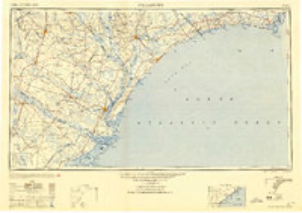
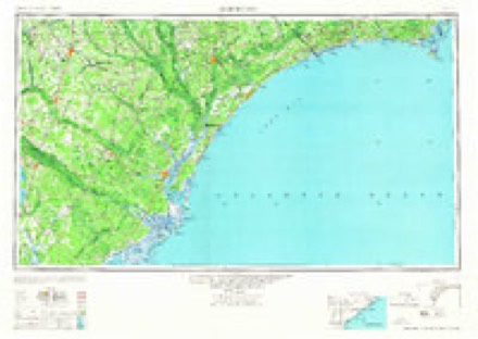
- 1949 USGS Georgetown quadrangle1:250000
- 1967 USGS Georgetown quadrangle1:250000
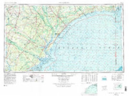
- 1974 USGS Georgetown quadrangle1:250000, 2 printings
- 1986 USGS Kingstree quadrangle1:100000, 2 printings
Fires near this place
126 since 1992Regional context, not property-specific evidence. The federal wildfire occurrence database lists 126 fires within 5 miles of Garden City between 1992 and 2019, burning about 1,206 acres in total. 2 started naturally. 14 were recorded as arson. Distance is straight-line from the map coordinates, so a fire counted here may appear on a neighbouring settlement's page as well.
| Reported cause | Fires |
|---|---|
| Missing data/not specified/undetermined | 80 |
| Debris and open burning | 19 |
| Arson/incendiarism | 14 |
| Misuse of fire by a minor | 10 |
| Natural | 2 |
| Equipment and vehicle use | 1 |
The most recent of them, most recent first, with the day each was reported and the service that recorded it.
| Date | Cause | Size | Reported by | Name on the report |
|---|---|---|---|---|
| 8 September 2007 | Misuse of fire by a minor | 10 acres | South Carolina Forestry Commission | not named |
| 18 September 2019 | Missing data/not specified/undetermined | 18 acres | South Carolina Forestry Commission | not named |
| 11 September 2007 | Arson/incendiarism | 30 acres | South Carolina Forestry Commission | not named |
| 30 August 1993 | Missing data/not specified/undetermined | 2.0 acres | South Carolina Forestry Commission | not named |
| 3 August 1998 | Debris and open burning | under an acre | South Carolina Forestry Commission | not named |
| 27 August 1997 | Arson/incendiarism | 20 acres | South Carolina Forestry Commission | not named |
| 26 August 1997 | Debris and open burning | 1.0 acres | South Carolina Forestry Commission | not named |
| 24 August 2016 | Debris and open burning | 1.0 acres | South Carolina Forestry Commission | not named |
Settlements close enough to share some of these fires:
Storms near this place
26 since 1996Regional context, not property-specific evidence. The National Weather Service names Garden City in 26 storm reports between 1996 and 2024: 8 flash flood, 7 hail, 3 thunderstorm wind, 2 waterspout. The reports record 4 injuries. Each account below is quoted exactly as the forecast office filed it, from the NOAA Storm Events Database, and each date opens the federal record of that event.
| When | Event | Place named | Harm | What the report says |
|---|---|---|---|---|
| June 2016 | Lightning | Garden City | 4 hurt | Lightning injured four people at the Taqueria las Comadres restaurant. Three of them had to be hospitalized. |
| June 2009 | Lightning | Garden City | $300,000 | Lightning struck the Garden City Baptist Church early Sunday morning June 28th, setting it on fire. Half the church was burning, along with part of another building, before the fire fighters arrived. It took five hours to extinguish the blaze, and the church was destroyed. A fireman injured his ankle in the event. |
| October 2016 | Flash Flood | Garden City | $250,000 | The intersection of Atlantic Avenue and Dogwood Drive was impassable due to flood waters. Adjacent structures were impacted by the flood waters. |
| September 2000 | Flash Flood | Garden City | $25,000 | Trained spotter reported over a foot of water on Waccamaw Drive. An Horry county spokeswoman reported several homes flooded. |
| November 2012 | Hail | Garden City | $3,000 | Hail to the size of quarters was reported. |
| July 2022 | Flash Flood | Garden City | $2,000 | Significant flooding was observed at the Inlet Square Mall area to Carolina Dr. and McDowell Shortcut Rd southward to Burgess Rd and highway 17. |
| November 2012 | Hail | Garden City | $1,500 | Hail to the size of quarters was reported on Salters Road near the intersection with Highway 17 Business. |
| August 2024 | Flash Flood | Garden City | - | Portions of the Inlet Square Mall parking lot flooded. Water over the curb in spots. |
| April 2023 | Thunderstorm Wind | Garden City | - | Tree uprooted and leaning on a house in Garden City. |
| September 2019 | Flash Flood | Garden City | - | The parking lot of Inlet Square Mall had two feet of water. |
| May 2018 | Flash Flood | Garden City | - | There was several feet of water in the Inlet Square Mall Parking lot. |
| June 2018 | Hail | Garden City | - | Quarter size hail was reported in Garden City. |
| May 2012 | Hail | Garden City | - | Hail up to penny size was reported on Bluebird Lane. The hail lasted for 3 minutes. |
| June 2009 | Hail | Garden City | - | Hail to the size of quarters was reported. |
| June 2008 | Hail | Garden City | - | Penny size hail was reported. Wind gusts to around 30 mph were estimated by the public. |
| August 2006 | Heavy Rain | Garden City | - | Ernesto moved off the Florida coast at Cape Canaveral on the morning of August 31st, and reached tropical storm strength by late morning while off the Georgia coast. Tropical Storm Ernesto made landfall on the eastern coast of Brunswick County NC near 10:30 pm EST.The South Carolina coast was for the most part spared from tropical storm Ernesto, as the strong winds occurred in North Carolina. Winds did not reach tropical storm strength on the SC coast, with the strongest sustained winds of 35 mph recorded at Myrtle Beach Airport. The main impact in South Carolina was rain, with rainfall totals ranging from just under two inches at Gallivants Ferry, to over seven inches with ponding on roadways at North Myrtle Beach. There were isolated power outages during the storm. |
| August 2002 | Heavy Rain | Garden City | - | 911 reported flooding in Garden City. Numerous roads were also flooded in North Myrtle Beach. |
| August 2002 | Thunderstorm Wind | Garden City | - | Public reported trees down. |
| September 2001 | Storm Surge/Tide | Garden City | - | As the center of Tropical Storm Gabrielle passed 200 miles off the coast, gale-force winds and 11 foot seas over the coastal waters combined with high tides to cause coastal flooding in Garden City. The fire department reported that Atlantic and Cypress Avenues were underwater and impassable. Minor flooding due to the rising tides was also reported at Caswell Beach and Oak Island. |
| February 1998 | Flash Flood | Garden City | - | Afternoon and evening rains measured 3 to 5 inches within 10 miles of the coast and less than 3 inches inland. Extensive flooding of roads and houses. The Waccamaw river rose from one foot, to 2 feet above flood stage. |
| August 1998 | Waterspout | Garden City | - | Murrells Inlet /Garden City Fire Department sighted six or seven waterspouts developing from showers and thunderstorms off the coast. The waterspouts remained off the coast and caused no damage. |
| February 1998 | Storm Surge/Tide | Garden City | - | A nor'easter caused heavy surf and 2-3 feet of beach erosion, especially along Cherry Grove Beach. |
| June 1997 | Waterspout | Garden City | - | WATER SPOUT REPORTED BY SHERIFFS DEPUTIES OFF THE COAST FROM GARDEN CITY, MOVING AWAY FROM SHORE |
| February 1999 | Hail | Garden City | - | no account filed |
| April 1996 | Thunderstorm Wind | Garden City | - | no account filed |
| October 1996 | Flash Flood | Garden City | - | no account filed |
Nearest settlements
The eight closest, with where each one stands in the county. Distances are straight-line, computed from the Geographic Names Information System coordinates.
| Map | Place | Distance | Sheets |
|---|---|---|---|
| Ocean Pines | 0.3 miles | 11 | |
| Jamestown | 0.5 miles | 11 | |
| Seabreeze | 0.6 miles | 11 | |
| Pirate Cove | 0.7 miles | 11 | |
| Windjammer Village | 0.8 miles | 11 | |
| Jensens | 0.9 miles | 11 | |
| Oceanside Village | 0.9 miles | 14 | |
| Mount Gilead | 1.3 miles | 11 |
Elsewhere
Matched on this settlement's Geographic Names Information System number rather than its name, so it cannot be a different place of the same name in another state.
| Wikipedia article on Garden City | An encyclopaedic summary. Its text is share-alike, so it is linked here rather than copied. |
| Wikidata item Q630253 | The structured record the population and elevation above come from. Public domain (CC0). |
Provenance
This settlement is recorded in the Geographic Names Information System as feature 1867521. The sheet list is computed by point-in-boundary test against the United States Geological Survey's historical topographic inventory. Both are works of the United States government and carry no copyright under 17 U.S.C. 105.
Wildfire. Short, Karen C. 2022. Spatial wildfire occurrence data for the United States, 1992-2020 [FPA_FOD_20221014]. 6th Edition. Fort Collins, CO: Forest Service Research Data Archive. https://doi.org/10.2737/RDS-2013-0009.6 Collected with United States Government funding and usable without additional permissions or fees.
Storms. NOAA National Centers for Environmental Information, Storm Events Database https://www.ncei.noaa.gov/stormevents/ A work of the United States government, no copyright under 17 U.S.C. 105. Narratives are quoted verbatim from the National Weather Service report and are not edited or summarised.