 Block
Gilbert, South Carolina
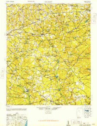
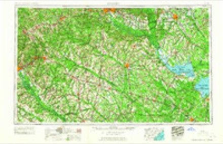
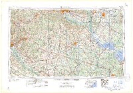
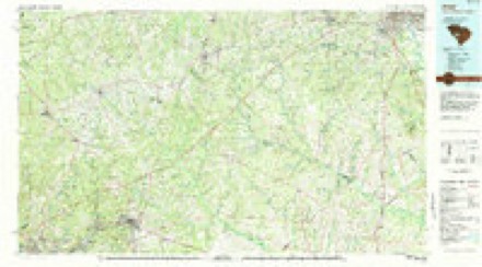
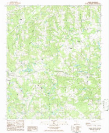
12 topographic sheets cover this place, the earliest surveyed in 1944 and the latest in 1986. It stands in the Gilbert census division. It lies in ZIP code area 29054. The Survey maps it on the Gilbert quadrangle. 571 people lived here at the 2020 count. It stands 535 feet above sea level.
Population over time
3 figuresGilbert grew from 500 to 571 between 2000 and 2020. These are the recorded population figures Wikidata holds for this place, reached through the Geographic Names Information System number this page is keyed on rather than by name, so they belong to this place and not to another of the same name. Most are census counts, but not all are: an early figure may be a founding or settlement estimate, and an estimate published within five years of a census is left out. The change column is computed, and is left blank where more than 20 years separate a figure from the one before it, because a gap that long is not a change between two counts.
| Year | People | Change |
|---|---|---|
| 2000 | 500 | |
| 2010 | 565 | +65 (+13%) |
| 2020 | 571 | +6 (+1%) |
Topographic sheets covering this place
8 surveys from 12 printed sheetsMatched by testing this settlement's coordinate against the published boundary of every sheet in the United States Geological Survey's historical collection. Each opens the scanned sheet at the Survey.
- 1944 USGS Gilbert quadrangle1:62500, 2 printings
- 1954 USGS Augusta quadrangle1:250000
- 1957 USGS Augusta quadrangle1:250000, 3 printings
- 1958 USGS Augusta quadrangle1:250000
- 1961 USGS Augusta quadrangle1:250000, 2 printings
- 1962 USGS Augusta quadrangle1:250000
- 1983 USGS Aiken quadrangle1:100000
- 1986 USGS Gilbert quadrangle1:24000
Fires near this place
268 since 1992Regional context, not property-specific evidence. The federal wildfire occurrence database lists 268 fires within 5 miles of Gilbert between 1992 and 2020, burning about 498 acres in total. 14 started naturally. 16 were recorded as arson. Distance is straight-line from the map coordinates, so a fire counted here may appear on a neighbouring settlement's page as well.
| Reported cause | Fires |
|---|---|
| Missing data/not specified/undetermined | 129 |
| Debris and open burning | 64 |
| Misuse of fire by a minor | 17 |
| Arson/incendiarism | 16 |
| Natural | 14 |
| Equipment and vehicle use | 13 |
| Railroad operations and maintenance | 8 |
| Smoking | 3 |
| Other causes | 3 |
| Power generation/transmission/distribution | 1 |
The most recent of them, most recent first, with the day each was reported and the service that recorded it.
| Date | Cause | Size | Reported by | Name on the report |
|---|---|---|---|---|
| 30 September 2019 | Debris and open burning | 1.0 acres | South Carolina Forestry Commission | not named |
| 22 September 1993 | Missing data/not specified/undetermined | under an acre | South Carolina Forestry Commission | not named |
| 20 September 1997 | Debris and open burning | 1.0 acres | South Carolina Forestry Commission | not named |
| 2 September 1993 | Missing data/not specified/undetermined | under an acre | South Carolina Forestry Commission | not named |
| 19 September 2005 | Debris and open burning | under an acre | South Carolina Forestry Commission | not named |
| 18 September 2001 | Debris and open burning | 15 acres | South Carolina Forestry Commission | not named |
| 17 September 2005 | Debris and open burning | under an acre | South Carolina Forestry Commission | not named |
| 15 September 2001 | Debris and open burning | under an acre | South Carolina Forestry Commission | not named |
Settlements close enough to share some of these fires:
Mines and quarries near this place
10 of 15 shownRegional context, not property-specific evidence. The federal mineral resources record lists 15 workings within 5 miles of Gilbert: 6 past producers, 6 unknowns, 3 producers. 3 still produce. What was taken out: Sand and Gravel, Construction, Clay, Sand. Distance is straight-line from the map coordinates, so a quarry counted here may appear on a neighbouring settlement's page as well.
| Where | Site | Commodity | Status | Recorded |
|---|---|---|---|---|
| Bowers Mine | Sand | Unknown | Sedimentary | |
| Rawl-Cotton Branch Road Mine | Sand | Unknown | Sedimentary | |
| Adolphus Hite Kaolin Pit | Clay | Past Producer | Sedimentary | |
| Clamp Kaolin Pit | Clay | Past Producer | Sedimentary | |
| Hoyt-Hite Kaolin Pit | Clay | Unknown | Sedimentary | |
| Gilbert Pit | Sand and Gravel, Construction | Past Producer | ||
| Leesville Pit | Sand and Gravel, Construction | Unknown | Sedimentary | |
| Leesville Pit | Sand and Gravel, Construction | Producer | ||
| Leesville Plant | Sand and Gravel, Construction | Producer | ||
| Summit Pit | Sand and Gravel, Construction | Producer |
Storms near this place
55 since 1994Regional context, not property-specific evidence. The National Weather Service names Gilbert in 55 storm reports between 1994 and 2024: 31 thunderstorm wind, 16 hail, 5 tornado, 3 flash flood. No death or injury is recorded in these reports. Each account below is quoted exactly as the forecast office filed it, from the NOAA Storm Events Database, and each date opens the federal record of that event.
| When | Event | Place named | Harm | What the report says |
|---|---|---|---|---|
| October 2015 | Flash Flood | Gilbert | $100,000 | SC Highway Patrol reports roadway washout at Hayes Crossing Road and Windy Road. |
| August 2008 | Thunderstorm Wind | Gilbert | $60,000 | EM reported several trees down, a dock destroyed, and a boat overturned at 622 East Point road on Lake Murray. SCE&G reoprted many poles and power lines down. |
| July 2012 | Hail | Gilbert | $20,000 | Public reported Hen egg size hail. |
| July 2012 | Hail | Gilbert | $15,000 | Public reported golfball size hail. |
| July 2010 | Thunderstorm Wind | Gilbert | $8,000 | Sheriff reported trees down in the Gilbert area on Juniper Springs, Pond Branch, and Neely Wingard roads. |
| July 2012 | Hail | Gilbert | $5,000 | Public reported quarter size hail. |
| April 2013 | Thunderstorm Wind | Gilbert | $4,000 | Highway Patrol reported trees down at the intersection of Crout Place and Old Charleston roads. |
| August 2013 | Flash Flood | Gilbert | $4,000 | Highway Patrol reported Wire road closed between Juniper Springs and Taylor Street in Gilbert. Other rural roads that were closed included Martin Smith, Sarah Ann, and Neely Wingard due to high water covering the roads. |
| April 2011 | Hail | Gilbert | $4,000 | Public reported quarter size hail in Gilbert. |
| June 2015 | Thunderstorm Wind | Gilbert | $3,000 | DOT reported trees down along Juniper Spring Road near Two Notch Road. Large limbs were also down in Gilbert. |
| June 2015 | Flash Flood | Gilbert | $2,000 | Dispatch reported flash flooding around Gilbert closing several roads. |
| August 2013 | Thunderstorm Wind | Gilbert | $2,000 | Highway Patrol reported trees down at Exit 44 on I-20. |
| July 2009 | Thunderstorm Wind | Gilbert | $2,000 | Public reported several trees down just northeast of Gilbert on hwy 604. |
| June 2024 | Thunderstorm Wind | Gilbert | - | SC Highway Patrol reported a tree down on I20 near mile marker 44. |
| January 2023 | Tornado (EF0) | Gilbert | - | A National Weather Service survey team confirmed an EF-0 tornado with peak winds|of 80 mph that tracked across western Lexington County, southeast of Gilbert. The|tornado began just west of Liberty Hill Road then crossed Calks Ferry Road, before|dissipating near Nazareth Road. Over the 1.4 mile track, the tornado produced sporadic|damage, snapping and uprooting multiple pine trees and downing power lines along Calks|Ferry Road. |
| June 2023 | Thunderstorm Wind | Gilbert | - | Public report of several large trees downed about 2 miles south of Gilbert. Time estimated. |
| June 2023 | Thunderstorm Wind | Gilbert | - | DOT reports tree on roadway near exit 44 of I-20. |
| September 2023 | Thunderstorm Wind | Gilbert | - | Lexington County EM reported downed trees and power lines on Lost Branch Rd near the intersection of Jeter Rd. The EM also reported trees downed on the 1100 block of Calks Ferry as well as Augusta Highway near the intersection of Calks Ferry Rd. Time estimated by radar. |
| May 2022 | Hail | Gilbert | - | Quarter size hail just southeast of Gilbert. Time estimated by radar. |
| October 2019 | Tornado (EF1) | Gilbert | - | A tornado touched down near the intersection of Roy Steele Rd and Crosby Rd, just NE of the town of Gilbert. It moved quickly to the NE at nearly 50 mph. It ended near the intersection of Drawbill Rd and Austin McCartha Rd. Much of the damage was |confined to trees that were both hardwood and softwood. The tornado downed large tree limbs, uprooted a tree and snapped a couple of softwood trees approximately |20 to 30 feet off the ground. The strong winds blew a piece of sheet metal that wrapped itself around a tree trunk. |
| March 2019 | Tornado (EF1) | Gilbert | - | A tornado touched down near Blackthorn Dr and Two Notch Rd southeast of Gilbert, then tracked in a general ENE direction for approximately 11 miles, crossing I-20 between mile markers 48-49, then moving across Longs Pond Rd, Muddy Springs|Rd, S Lake Dr and Emanuel Church Rd, before dissipating near Kitti Wake Dr near Red Bank. The tornado snapped and uprooted numerous hardwood and softwood trees, causing damage to support columns at Red Bank Baptist Church, and resulted in roof and property damage to several homes. |
| April 2018 | Thunderstorm Wind | Gilbert | - | A downburst, producing wind gusts estimated at 80 to 105 MPH, damaged two single wide mobile homes, downed over a half dozen trees, and snapped power poles, on Martin Smith Rd. A small outdoor building rolled over with two teenagers inside, both had no injuries. Two dog pens were damaged as they were moved 10 to 25 yards. The dogs were unharmed. |
| April 2018 | Tornado (EF2) | Gilbert | - | The tornado began near Two Notch Rd near Hayes Crossing Rd. The tornado continued on a N to NNE path for approximately 3.0 miles, crossing Semm Sease Rd, Wire Rd,|Isiah Hall Rd, Crosby Rd, Austin McCartha Dr, then dissipating near the intersection of Windy Rd and Walter Taylor Rd. Numerous trees were snapped or uprooted along the path. This also includes small and large limbs downed. A few power lines were snapped along the path. The most destructive area was where the tornado moved through a group of 7 chicken houses along Semm Sease Rd. It was at this location that the tornado reached its maximum strength and path width. Several structures, vehicles |and two campers were damaged along the path. Peak winds were estimated to be 120 mph. |
| April 2017 | Thunderstorm Wind | Gilbert | - | NWS Storm Survey Team found a couple of large trees that had some large branches spanned off due to straight line thunderstorm winds. Estimated peak wind gusts up to 70 MPH. |
| May 2017 | Thunderstorm Wind | Gilbert | - | SCHP reported trees down on Two Notch Rd and Oscar Price Rd. |
| May 2017 | Thunderstorm Wind | Gilbert | - | A large oak tree was brought down, with small hail also occurring, at Bridgewood Ct in Gilbert. Wind speed was estimated to be around 75 MPH. |
| April 2017 | Thunderstorm Wind | Gilbert | - | Fence around properties blown over near Juniper Springs Rd and Tiger Circle. Multiple trees snapped. Barn with cinder block walls blown out. |
| July 2017 | Thunderstorm Wind | Gilbert | - | Public report via social media of trees down, including one down on a house. |
| August 2016 | Thunderstorm Wind | Gilbert | - | Social Media report with images of multiple trees down near the town of Gilbert, SC. Time estimated from public reports and radar data. |
| June 2014 | Thunderstorm Wind | Gilbert | - | Utility Company reported multiple trees down on power lines between Batesburg-Leesville and Pelion. |
| April 2012 | Hail | Gilbert | - | Public reported dime to nickel size hail near Gilbert. |
| March 2012 | Hail | Gilbert | - | Public reported quarter size hail in Gilbert. |
| March 2012 | Hail | Gilbert | - | SKYWARN Spotter reported hail east of Gilbert along Hwy 1. |
| April 2012 | Hail | Gilbert | - | Public reported dime to nickel size hail in Gilbert. |
| July 2008 | Thunderstorm Wind | Gilbert | - | Reported several shingles blown off Post Office building. |
| August 2008 | Thunderstorm Wind | Gilbert | - | Sheriff reported large trees down just north of the Gilbert area. |
| March 2008 | Hail | Gilbert | - | SKYWARN spotter reported nickel size hail just south of Gilbert. |
| August 2007 | Thunderstorm Wind | Gilbert | - | Sheriff reported several trees down in Batesburg. |
| August 2007 | Thunderstorm Wind | Gilbert | - | Gilbert FD reported two trees down on Harley Taylor road and US 1. |
| May 2006 | Hail | Gilbert | - | Sheriff reported nickel size hail. |
| May 2006 | Hail | Gilbert | - | Public reported nickel quarter size hail. |
| July 2006 | Thunderstorm Wind | Gilbert | - | Sheriff reported large limbs down in Gilbert on Peachtree Extention Rd. |
| August 2006 | Thunderstorm Wind | Gilbert | - | EM reported some trees and powerlines down on Boiling Springs, Pond Branch, and Calks Ferry roads. |
| August 2006 | Thunderstorm Wind | Gilbert | - | Highway Dept. reported powerlines down in the Gilbert area. |
| June 2005 | Thunderstorm Wind | Gilbert | - | SKYWARN spotter reported trees down powerlines down in Gilbert and up to western Lake Murray. |
| September 2004 | Thunderstorm Wind | Gilbert | - | Sheriff reported trees down in the Gilbert area and in Heritage Hills subdivision of Lexington. |
| April 2002 | Hail | Gilbert | - | Sheriff reported ambulance driver called in dime size hail and heavy rain on U.S.1 heading toward Leesville. |
| June 2000 | Thunderstorm Wind | Gilbert | - | EOC reported a couple trees down on secondary roads. |
| December 2000 | Thunderstorm Wind | Gilbert | - | Sherff reported trees down. |
| June 1998 | Thunderstorm Wind | Gilbert | - | Two large steel bilboards torn apart by intense winds along I-20. |
| April 1998 | Hail | Gilbert | - | Spotter reports dime size hail. |
| April 1998 | Hail | Gilbert | - | Spotter reports dime size hail. |
| April 1998 | Thunderstorm Wind | Gilbert | - | Minor wind damage to Town Hall. Permanent sign and awning destroyed. |
| August 1994 | Tornado (F2) | Gilbert | - | Tornado observed as it touched down and damaged trees and home in southeast Edmund. It lifted and moved across Edmund Fire Station, then touched down and damaged pine forest immediately north of Edmund. |
| October 1995 | Hail | Gilbert | - | no account filed |
Nearest settlements
The eight closest, with where each one stands in the county. Distances are straight-line, computed from the Geographic Names Information System coordinates.
| Map | Place | Distance | Sheets |
|---|---|---|---|
| Summit | 1.5 miles | 12 | |
| Murray | 2.4 miles | 12 | |
| Clubhouse Crossroads | 2.5 miles | 12 | |
| Elsie | 3.2 miles | 12 | |
| Fredonia | 3.6 miles | 12 | |
| Ethon Crossroads | 4.3 miles | 12 | |
| Priceville | 5.2 miles | 12 | |
| Barr Crossing | 5.4 miles | 12 |
Elsewhere
Matched on this settlement's Geographic Names Information System number rather than its name, so it cannot be a different place of the same name in another state.
| Wikipedia article on Gilbert | An encyclopaedic summary. Its text is share-alike, so it is linked here rather than copied. |
| Wikidata item Q2203159 | The structured record the population and elevation above come from. Public domain (CC0). |
Provenance
This settlement is recorded in the Geographic Names Information System as feature 1245735. The sheet list is computed by point-in-boundary test against the United States Geological Survey's historical topographic inventory. Both are works of the United States government and carry no copyright under 17 U.S.C. 105.
Wildfire. Short, Karen C. 2022. Spatial wildfire occurrence data for the United States, 1992-2020 [FPA_FOD_20221014]. 6th Edition. Fort Collins, CO: Forest Service Research Data Archive. https://doi.org/10.2737/RDS-2013-0009.6 Collected with United States Government funding and usable without additional permissions or fees.
Mines and quarries. USGS Mineral Resources Data System (MRDS) https://mrdata.usgs.gov/mrds/ A work of the United States government, no copyright under 17 U.S.C. 105.
Storms. NOAA National Centers for Environmental Information, Storm Events Database https://www.ncei.noaa.gov/stormevents/ A work of the United States government, no copyright under 17 U.S.C. 105. Narratives are quoted verbatim from the National Weather Service report and are not edited or summarised.