 Block
Grassy Pond, South Carolina
18 topographic sheets cover this place, the earliest surveyed in 1909 and the latest in 1991. It stands in the Gaffney census division. It lies in ZIP code area 29341. It stands on Sarratt Creek. The Survey maps it on the Boiling Springs South quadrangle.
On record in Grassy Pond
Buildings and businesses the archive holds for this place. Each opens its own page, with the source record it came from.
On the National Register within a mile 1 record
The National Register names another town for these. They stand within one mile of this settlement's coordinate.
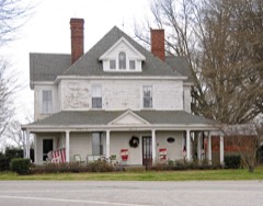 Magness-Humphries Houselisted 2001 · 0.1 miles away
Topographic sheets covering this place
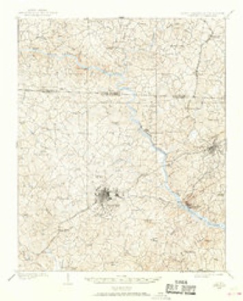
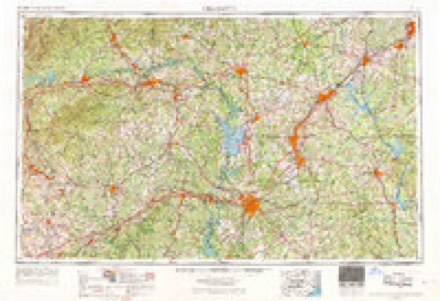
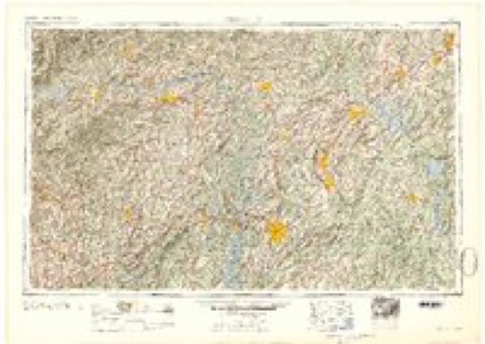
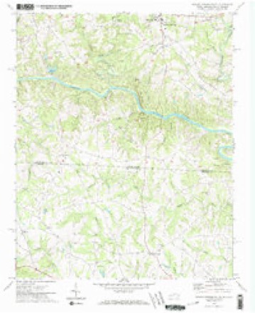
9 surveys from 18 printed sheetsMatched by testing this settlement's coordinate against the published boundary of every sheet in the United States Geological Survey's historical collection. Each opens the scanned sheet at the Survey.
- 1909 USGS Gaffney quadrangle1:62500, 4 printings
- 1953 USGS Charlotte quadrangle1:250000, 3 printings
- 1954 USGS Charlotte quadrangle1:250000, 2 printings
- 1960 USGS Charlotte quadrangle1:250000, 2 printings
- 1962 USGS Charlotte quadrangle1:250000
- 1971 USGS Boiling Springs South quadrangle1:24000, 3 printings
- 1976 USGS Boiling Springs South quadrangle1:24000
- 1986 USGS Gastonia quadrangle1:100000
- 1991 USGS Gastonia quadrangle1:100000
Fires near this place
191 since 1992Regional context, not property-specific evidence. The federal wildfire occurrence database lists 191 fires within 5 miles of Grassy Pond between 1992 and 2020, burning about 620 acres in total. 4 started naturally. 12 were recorded as arson. Distance is straight-line from the map coordinates, so a fire counted here may appear on a neighbouring settlement's page as well.
| Reported cause | Fires |
|---|---|
| Missing data/not specified/undetermined | 92 |
| Debris and open burning | 43 |
| Equipment and vehicle use | 13 |
| Misuse of fire by a minor | 12 |
| Arson/incendiarism | 12 |
| Smoking | 10 |
| Railroad operations and maintenance | 4 |
| Natural | 4 |
| Recreation and ceremony | 1 |
The most recent of them, most recent first, with the day each was reported and the service that recorded it.
| Date | Cause | Size | Reported by | Name on the report |
|---|---|---|---|---|
| 9 September 1992 | Missing data/not specified/undetermined | under an acre | South Carolina Forestry Commission | not named |
| 7 September 2009 | Equipment and vehicle use | under an acre | South Carolina Forestry Commission | not named |
| 7 September 2009 | Equipment and vehicle use | under an acre | South Carolina Forestry Commission | not named |
| 7 September 2009 | Equipment and vehicle use | under an acre | South Carolina Forestry Commission | not named |
| 29 September 1993 | Missing data/not specified/undetermined | 2.0 acres | South Carolina Forestry Commission | not named |
| 25 September 1998 | Debris and open burning | under an acre | South Carolina Forestry Commission | not named |
| 24 September 2015 | Equipment and vehicle use | 2.0 acres | South Carolina Forestry Commission | not named |
| 21 September 2005 | Misuse of fire by a minor | under an acre | South Carolina Forestry Commission | not named |
Settlements close enough to share some of these fires:
Mines and quarries near this place
10 of 45 shownRegional context, not property-specific evidence. The federal mineral resources record lists 45 workings within 5 miles of Grassy Pond: 35 unknowns, 5 past producers, 5 producers. 5 still produce. What was taken out: Iron, Sand and Gravel, Construction, Thorium, REE, Tin. Distance is straight-line from the map coordinates, so a quarry counted here may appear on a neighbouring settlement's page as well.
| Where | Site | Commodity | Status | Recorded |
|---|---|---|---|---|
| Camp Creek Monazite Placer S Tributary | REE, Thorium, Tin, Gold, Corundum | Past Producer | 1910, 1911 | |
| Northern Trib Cherokee Creek Monazite Placer | Thorium, REE, Corundum, Gold, Tin | Unknown | 1910, 1911 | |
| Thicketty Creek Monazite Placer Eastern Tributary | Thorium, REE, Tin, Corundum, Gold | Unknown | 1910, 1911 | |
| Unnamed Corundum Occurrence Gl - 048 | Corundum | Unknown | 1910 | |
| Unnamed Gneiss Quarry Gl-107 | Stone | Unknown | 1900 | |
| Unnamed Mica Prospect Gl - 052 | Mica | Unknown | 1931 | |
| Upper Cole Creek Monazite Placer | Thorium, REE, Gold, Corundum, Tin | Unknown | 1910, 1911 | |
| Headwater Cole Creek Monazite Placer | Thorium, REE, Gold, Tin, Corundum | Unknown | 1910, 1911 | |
| Headwater Irene Creek Monazite Placer | Thorium, REE, Gold, Tin, Corundum | Unknown | 1910, 1911 | |
| Northern Trib Ross Creek Monazite Placer | Thorium, REE, Gold, Tin, Corundum | Unknown | 1910, 1911 |
Storms near this place
36 since 1996Regional context, not property-specific evidence. The National Weather Service names Grassy Pond in 36 storm reports between 1996 and 2024: 16 thunderstorm wind, 11 hail, 4 flash flood, 3 tornado. No death or injury is recorded in these reports. Each account below is quoted exactly as the forecast office filed it, from the NOAA Storm Events Database, and each date opens the federal record of that event.
| When | Event | Place named | Harm | What the report says |
|---|---|---|---|---|
| October 2017 | Tornado (EF2) | Grassy Pond | $250,000 | NWS storm survey found the path of a strong tornado that touched down near the intersection of Farmington Rd and Meadowview Rd, with damage initially confined to downed trees. The tornado moved north/northeast to the|intersection of Fairview Rd and Highway 11, where two homes sustained EF2 damage, with much of the roofs of both homes removed. The tornado appeared to weaken northeast of this location, with damage confined mainly to minor structural damage and downed trees and power lines until it reached the area near the intersection of Furnace Mill Rd and Robb School Rd. A frame home slid off its foundation on W Diesel Dr, resulting in virtual destruction of the home. The path of the tornado through this area was less than 1000 ft west of a short track tornado that impacted the area around Robb School Rd and Twin Bridge Rd on October 8th 2017. The tornado weakened again from there, with damage confined to downed trees and tree limbs as it moved into Cleveland County between Twin Bridges Rd and McCraw Rd. |
| July 2023 | Thunderstorm Wind | Grassy Pond | $75,000 | County comms and emergency manager reported a wide swath of wind damage across western Cherokee County, from Cowpens National Battlefield, across the Macedonia and Thicketty communities. The most significant damage was in Macedonia, where numerous trees were blown down and minor structural damage occurred to several homes and a church. |
| January 2024 | Flash Flood | Grassy Pond | $50,000 | Multiple sources reported flash flooding developed across mainly northern Cherokee County after 3 to 5 inches of rain fell across the area in around 12 hours. Numerous roads were inundated due to stream flooding or poor drainage. Impacted streams included the Broad River near Blacksburg, which exceeded minor flood stage, indicating inundation of Little Hope Rd and River Rd. Emergency manager reported that more than two dozen roads were damaged or inundated throughout the county, including Mill Gin Rd in the northwest part of the county, which was flooded by Cherokee Creek. A number of water rescues occurred including a driver from a vehicle that was being swept away, and about 20 people who were evacuated from an apartment complex west of Blackburg. |
| February 2020 | Flash Flood | Grassy Pond | $50,000 | Stream gauges and EM reported flash flooding developed across Cherokee County after 4 to 6 inches of rain fell throughout the area in 24 hours, with much of that falling during the morning into the afternoon of the 6th. A stream gauge on the Broad River near Blacksburg indicated rapid rise of the stream, and rare flash flooding along a main stem river. Multiple roads were inundated, including Wolf Den Ln, Little Hope Rd, and River Rd. Multiple smaller streams also overflowed their banks and washed out roads, including Cherokee Creek Rd, Vermont Dr, and Lisas Ln, where two families were briefly trapped. |
| February 2020 | Flood | Grassy Pond | $50,000 | Although heavy rainfall tapered off across Cherokee County throughout the afternoon, high water conditions persisted due to runoff. This included moderate, record flooding along the Broad River. Multiple low-lying roads were inundated, including Little Hope Rd and River Rd, as was the Cherokee Ford Rec Area. The stream gauge at Blacksburg indicated the river reached its highest level since at least 1997. |
| October 2017 | Tornado (EF1) | Grassy Pond | $20,000 | NWS storm survey found a short tornado path in northwest Cherokee County, along Robb School Rd between Barbara Ave and Oliver's Way, with damage primarily limited to two residences. These homes received mostly minor exterior and roof damage, although some plywood was torn off the exterior of an attic of one home. The interior of this home received water damage from subsequent heavy rainfall. Flying debris broke out windows and caused additional exterior damage. Multiple trees were also blown down in the area. |
| September 2024 | Flash Flood | Grassy Pond | $10,000 | A stream gauge on the Broad River at Blacksburg (gauge dropped out around 00Z on the 27th) indicated flash flooding developed along the river after extreme rainfall occurred over the headwaters across the mountains and foothills, while rainfall over Cherokee County was generally between 6 and 10 inches over two days. A portion of Little Hope Rd and River Rd was inundated, as were various secondary roads. Access roads to Cherokee Falls and Gaston Shoals dams were also inundated. |
| August 2020 | Thunderstorm Wind | Grassy Pond | $10,000 | County comms reported a tree blown down against a home on Robb School Rd. Public reported multiple trees blown down on Bens Farm Rd. |
| March 2012 | Lightning | Grassy Pond | $10,000 | Lightning struck a storage building on Buck Shoals Rd, sparking a fire that destroyed the|building. |
| August 2023 | Thunderstorm Wind | Grassy Pond | $5,000 | Emergency manager reported multiple large trees uprooted and a few power poles snapped in the area around Cherokee National Highway and Clubhouse Dr. The roof of one home was damaged from a branch. |
| October 2017 | Tornado (EF1) | Grassy Pond | $5,000 | NWS Storm survey found the path of an EF1 tornado that began about 1 mile southeast of Chesnee near the Cherokee/Spartanburg county line. Damage associated with this tornado was largely confined to uprooted and snapped trees as it moved northeast, crossing Highway 11, Keg Town Mill Rd, and N Green River Rd before crossing into Rutherford County in North Carolina near Camp Ferry Rd. However, a couple of outbuildings were also damaged. |
| January 1996 | Thunderstorm Wind | Grassy Pond | $5,000 | no account filed |
| June 2018 | Thunderstorm Wind | Grassy Pond | $2,000 | County comms and media reported numerous trees and power lines blown down across the northern part of the county. The Grassy Pond community was hardest hit, with trees down on Robb School Rd and on Champion Ferry Rd, where a tree fell on and damaged a barn. |
| June 2019 | Flash Flood | Grassy Pond | $1,000 | County comms reported flash flooding developed after around 4 inches of rain fell in the area between Gaffney and the North Carolina border in just a few hours. Multiple roads were reported flooded due to either small stream or poor drainage flooding. One vehicle was stalled in flood water. |
| October 2023 | Hail | Grassy Pond | - | Multiple sources reported quarter to ping pong ball size hail from near the intersection of Cabin Creek Rd and Robbs School Rd, across Highway 11, to the city of Gaffney. The hail covered the ground in some locations. |
| June 2023 | Thunderstorm Wind | Grassy Pond | - | County comms reported numerous trees blown down across northern Cherokee County. |
| June 2023 | Hail | Grassy Pond | - | Ham radio operator reported golf ball size hail on Highway 221. |
| June 2023 | Hail | Grassy Pond | - | County comms reported 3/4 inch hail across northern Cherokee County. |
| July 2023 | Thunderstorm Wind | Grassy Pond | - | Law enforcement and utility company reported trees and power lines blown down from Dravo Rd across Blacksburg and vicinity. Impacted roads in Blacksburg included Dye Rd and Whitaker Mountain Rd. |
| April 2020 | Hail | Grassy Pond | - | Amateur radio operator reported quarter size hail near Cowpens National Battlefield. |
| April 2019 | Thunderstorm Wind | Grassy Pond | - | Public reported (via Social Media) trees blown down near Cowpens National Battlefield. |
| June 2019 | Thunderstorm Wind | Grassy Pond | - | County comms reported several trees blown down across Fairview Road and Cash Road west of Gaffney and additional trees down on Goldmine Springs Rd in town. |
| August 2019 | Hail | Grassy Pond | - | Public reported penny to quarter size hail on Oak Ridge Rd. |
| April 2015 | Hail | Grassy Pond | - | Spotter reported dime to quarter size hail near the intersection of Island Creek Rd and Highway 110. |
| September 2015 | Hail | Grassy Pond | - | Media reported hail slightly larger than quarter size just north of Chesnee. |
| July 2013 | Thunderstorm Wind | Grassy Pond | - | Multiple trees and power lines were blown down, mainly across the northwest part of the county. Affected roads included State Line Rd, Green Lake Rd, Woods Farm Rd and Swofford Dr. |
| June 2013 | Thunderstorm Wind | Grassy Pond | - | A tree was blown down on Buffalo Church Rd near Dravo Rd. Another tree was blown down off of Rock Springs Rd, about 2 miles north northwest of Blacksburg. And a third tree was blown down on I-85 near mile marker 102. |
| April 2011 | Hail | Grassy Pond | - | A swath of golf ball size hail fell from Old Mill Rd, across the east side of Gaffney, to a point about 6 miles southeast of Gaffney. |
| April 2011 | Hail | Grassy Pond | - | Baseball size hail damaged an amateur radio operator's roof in the Grassy Pond|community. |
| July 2010 | Thunderstorm Wind | Grassy Pond | - | The underskirting was blown off a mobile home and large tree limbs were blown down. |
| June 2010 | Thunderstorm Wind | Grassy Pond | - | Trees were blown down and blocked Fairview Rd just south of Linder Rd., which is a little over 5 miles northwest of Gaffney. |
| May 2009 | Hail | Grassy Pond | - | Hail was reported about 2 miles east of Cowpens National Battlefield. |
| June 2009 | Thunderstorm Wind | Grassy Pond | - | Large tree limbs blown down at the intersection of highway 11 and Old Metal Rd.|Several trees were uprooted and shingles blown off a home near the intersection of Morgan Dr and highway 29. |
| August 2008 | Thunderstorm Wind | Grassy Pond | - | Numerous trees were blown down across the county. A roof was blown off a building on the west side of Gaffney. |
| June 2009 | Hail | Grassy Pond | - | no account filed |
| August 2000 | Thunderstorm Wind | Grassy Pond | - | no account filed |
Nearest settlements
The eight closest, with where each one stands in the county. Distances are straight-line, computed from the Geographic Names Information System coordinates.
| Map | Place | Distance | Sheets |
|---|---|---|---|
| Goforth Cross Road (historical) | 1.3 miles | 18 | |
| Garden Park | 1.6 miles | 16 | |
| Harmony Hill | 2.0 miles | 16 | |
| Northgate | 2.0 miles | 16 | |
| Cherokee Hills | 2.0 miles | 16 | |
| Shalimar | 2.2 miles | 16 | |
| Forest Lake Homes | 2.6 miles | 16 | |
| Penn Jones | 3.0 miles | 16 |
Provenance
This settlement is recorded in the Geographic Names Information System as feature 1245815. The sheet list is computed by point-in-boundary test against the United States Geological Survey's historical topographic inventory. Both are works of the United States government and carry no copyright under 17 U.S.C. 105.
Wildfire. Short, Karen C. 2022. Spatial wildfire occurrence data for the United States, 1992-2020 [FPA_FOD_20221014]. 6th Edition. Fort Collins, CO: Forest Service Research Data Archive. https://doi.org/10.2737/RDS-2013-0009.6 Collected with United States Government funding and usable without additional permissions or fees.
Mines and quarries. USGS Mineral Resources Data System (MRDS) https://mrdata.usgs.gov/mrds/ A work of the United States government, no copyright under 17 U.S.C. 105.
Storms. NOAA National Centers for Environmental Information, Storm Events Database https://www.ncei.noaa.gov/stormevents/ A work of the United States government, no copyright under 17 U.S.C. 105. Narratives are quoted verbatim from the National Weather Service report and are not edited or summarised.