 Block
Greenwood, South Carolina
15 topographic sheets cover this place, the earliest surveyed in 1892 and the latest in 1979. It stands in the Greenwood census division. It lies in ZIP code area 29646. The Survey maps it on the Greenwood quadrangle. 22,545 people lived here at the 2020 count. It stands 663 feet above sea level.
Research this city
On record in Greenwood
Buildings and businesses the archive holds for this place. Each opens its own page, with the source record it came from.
On the National Register 12 of 13 shown
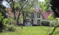 Barratt Houselisted 1985
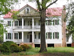 J. Wesley Brooks Houselisted 1973
 Lander College Old Main Buildinglisted 1984
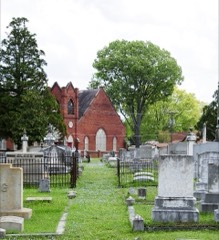 Magnolia Cemeterylisted 2004
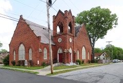 Mt. Pisgah A.M.E. Churchlisted 1979
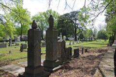 Old Greenwood Cemeterylisted 2002
 Old Greenwood High Schoollisted 1985
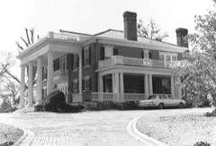 James C. Self Houselisted 1987
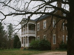 Stony Pointlisted 1975
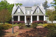 Sunnysidelisted 1978
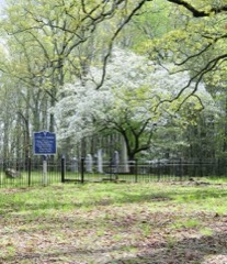 Tabernacle Cemeterylisted 2008
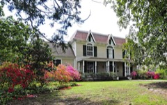 Vance-Maxwell Houselisted 1982
Every listing in Greenwood County
Surveyed buildings and structures 2 records
- D. B. Alexander House, 532 Calhoun Street, Greenwoodfederal building survey, 6 photographs
- Stony Point, Northeast corner of SC 246 & SC 39, Greenwoodfederal building survey, 14 photographs
Population over time
3 figuresGreenwood grew from 22,071 to 22,545 between 2000 and 2020. These are the recorded population figures Wikidata holds for this place, reached through the Geographic Names Information System number this page is keyed on rather than by name, so they belong to this place and not to another of the same name. Most are census counts, but not all are: an early figure may be a founding or settlement estimate, and an estimate published within five years of a census is left out. The change column is computed, and is left blank where more than 20 years separate a figure from the one before it, because a gap that long is not a change between two counts.
| Year | People | Change |
|---|---|---|
| 2000 | 22,071 | |
| 2010 | 23,222 | +1,151 (+5%) |
| 2020 | 22,545 | -677 (-3%) |
Topographic sheets covering this place
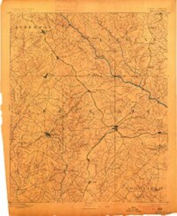
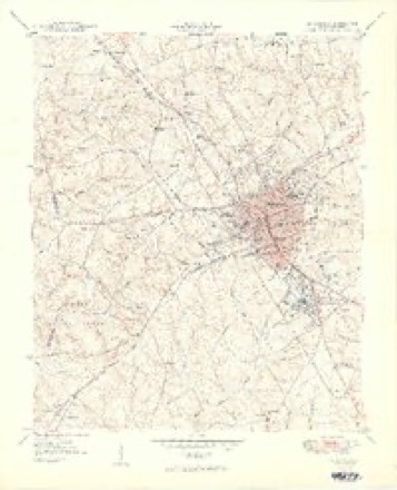
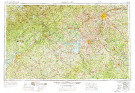
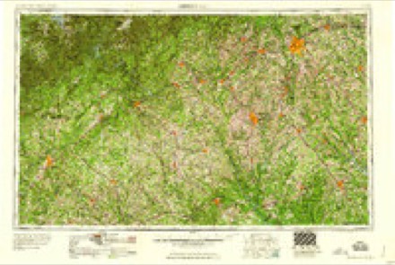
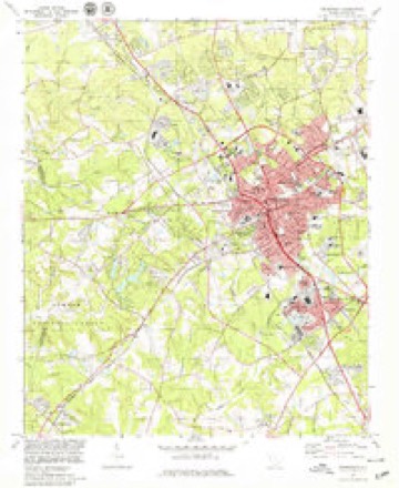
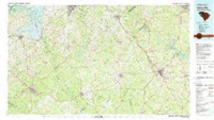
6 surveys from 15 printed sheetsMatched by testing this settlement's coordinate against the published boundary of every sheet in the United States Geological Survey's historical collection. Each opens the scanned sheet at the Survey.
- 1892 USGS Abbeville quadrangle1:125000, 6 printings
- 1949 USGS Greenwood quadrangle1:24000, 2 printings
- 1954 USGS Greenville quadrangle1:250000, 3 printings
- 1958 USGS Greenville quadrangle1:250000
- 1978 USGS Greenwood quadrangle1:24000
- 1979 USGS Abbeville quadrangle1:100000, 2 printings
Photographs
3 photographs, 2017Taken for the Office of War Information and the Farm Security Administration, who photographed the country between 1935 and 1944. Works of United States government photographers, with no known restriction on use. Each opens its catalogue record.
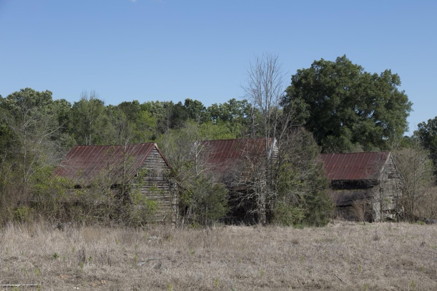
Highsmith, Carol M, 2017. Library of Congress
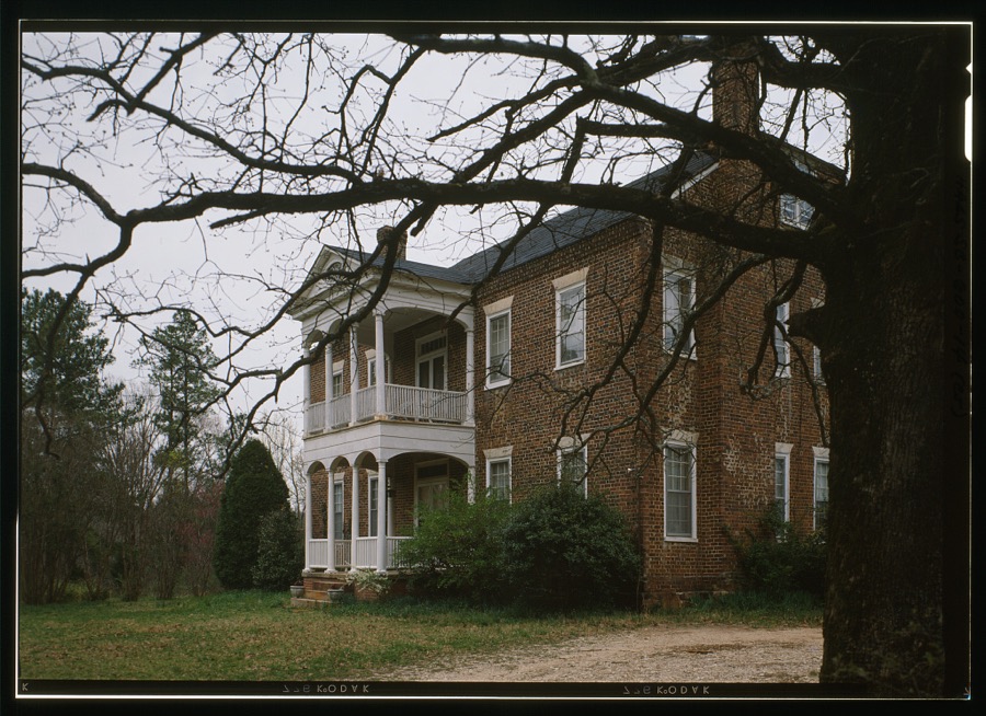
Photographer not recorded. Library of Congress
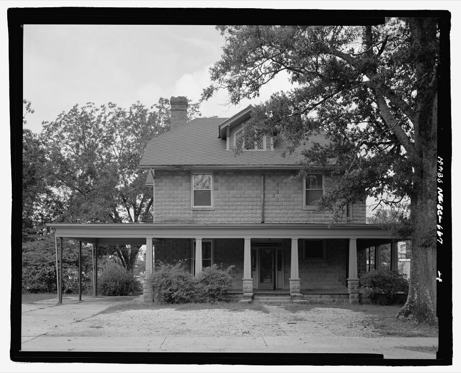
Photographer not recorded. Library of Congress
Fires near this place
319 since 1992Regional context, not property-specific evidence. The federal wildfire occurrence database lists 319 fires within 5 miles of Greenwood between 1992 and 2020, burning about 578 acres in total. 3 started naturally. 9 were recorded as arson. Distance is straight-line from the map coordinates, so a fire counted here may appear on a neighbouring settlement's page as well.
| Reported cause | Fires |
|---|---|
| Missing data/not specified/undetermined | 201 |
| Debris and open burning | 56 |
| Misuse of fire by a minor | 26 |
| Equipment and vehicle use | 11 |
| Smoking | 9 |
| Arson/incendiarism | 9 |
| Natural | 3 |
| Railroad operations and maintenance | 3 |
| Other causes | 1 |
The most recent of them, most recent first, with the day each was reported and the service that recorded it.
| Date | Cause | Size | Reported by | Name on the report |
|---|---|---|---|---|
| 6 September 1999 | Debris and open burning | under an acre | South Carolina Forestry Commission | not named |
| 6 September 1999 | Equipment and vehicle use | 1.0 acres | South Carolina Forestry Commission | not named |
| 4 September 1995 | Missing data/not specified/undetermined | under an acre | South Carolina Forestry Commission | not named |
| 3 September 2011 | Debris and open burning | 4.3 acres | South Carolina Forestry Commission | not named |
| 3 September 2011 | Debris and open burning | 1.0 acres | South Carolina Forestry Commission | not named |
| 3 September 1999 | Debris and open burning | under an acre | South Carolina Forestry Commission | not named |
| 18 September 1999 | Misuse of fire by a minor | under an acre | South Carolina Forestry Commission | not named |
| 18 September 1995 | Missing data/not specified/undetermined | under an acre | South Carolina Forestry Commission | not named |
Settlements close enough to share some of these fires:
Mines and quarries near this place
1 within 5 milesRegional context, not property-specific evidence. The federal mineral resources record lists 1 working within 5 miles of Greenwood: 1 unknown. None of them still produces. What was taken out: Stone, Dimension. Distance is straight-line from the map coordinates, so a quarry counted here may appear on a neighbouring settlement's page as well.
| Where | Site | Commodity | Status | Recorded |
|---|---|---|---|---|
| Benjamin Granite Quarry | Stone, Dimension | Unknown | Igneous |
Storms near this place
60 of 129 shownRegional context, not property-specific evidence. The National Weather Service names Greenwood in 129 storm reports between 1994 and 2025: 73 thunderstorm wind, 41 hail, 8 lightning, 2 flash flood. The reports record 1 injury. Each account below is quoted exactly as the forecast office filed it, from the NOAA Storm Events Database, and each date opens the federal record of that event.
| When | Event | Place named | Harm | What the report says |
|---|---|---|---|---|
| June 2001 | Lightning | Greenwood | 1 hurt | Lightning struck one person at Lake Greenwood State Park. The victim was taken to the hospital, where he eventually recovered. |
| March 1995 | Tornado (F1) | Greenwood | $125,000 | no account filed |
| March 1995 | Thunderstorm Wind | Greenwood | $125,000 | no account filed |
| May 2002 | Thunderstorm Wind | Greenwood | $50,000 | Numerous trees and powerlines were blown down, some onto vehciles and homes. The ASOS at Greenwood Airport measured a gust to 51 kts. |
| August 2000 | Lightning | Greenwood | $35,000 | Lightning struck a house and caused a fire to break out in the attic and second floor. |
| June 2004 | Lightning | Greenwood | $25,000 | Intense lightning caused a fire at an industrial site. In addition, at least 15 transformers were struck, causing power outages to over 1000 customers. |
| July 1996 | Thunderstorm Wind | Greenwood | $25,000 | no account filed |
| December 2024 | Thunderstorm Wind | Greenwood | $10,000 | County comms reported a tree blown down at Oak Forest Dr and Chinquapin Rd and another tree down on a house on nearby Creek Rd East. Multiple trees were also blown down on the north side of the city of Greenwood near the intersection of Montague Ave and Cobb Rd. This was shortly before a gust of 53 mph was measured at the Greenwood County airport. |
| June 2018 | Thunderstorm Wind | Greenwood | $10,000 | County comms reported numerous trees and power lines blown down across the county. One tree fell on a house on Lindsey Ave in Greenwood. |
| October 1994 | Thunderstorm Wind | Greenwood | $6,000 | no account filed |
| July 2016 | Thunderstorm Wind | Greenwood | $5,000 | County comms and Highway Patrol reported multiple trees blown down across roads in southwest Greenwood County, from the intersection of Alexander and Briarwood Rd, south to just north and east of Bradley. Part of a roof was reported to be damaged on Breezewood Rd east of Bradley. |
| July 2003 | Heavy Rain | Greenwood | $5,000 | During a heavy rainstorm, an air conditioner fell through the roof of a business when the weight of the accumulating rainfall became too great. |
| July 2003 | Lightning | Greenwood | $5,000 | Lightning strikes caused sporadic, minor damage throughout the city. |
| February 1995 | Thunderstorm Wind | Greenwood | $5,000 | Heavy rain of three to five inches caused a few local flood problems in northern parts of Greenville. The Reedy River reached 9 to 10 feet causing some minor flooding in the downtown area. Another mud and rock slide affected Highway 130 in northern Oconee County. Flooding closed several roads in Pickens and Spartanburg Counties. A large severe thunderstorm moved across Lake Russell into Abbeville County nd then across Greenwood. Although the storm was clearly rotating. It apparently only produced wind gusts at the surface in the 50 knot range. Large limbs blown across lines caused power outages at Calhoun Falls and a number of trees and power lines were blown down around Greenwood. The storm weakened rapidly as it moved across southern Laurens County. |
| November 1994 | Thunderstorm Wind | Greenwood | $5,000 | Winds toppled a tree into an apartment building causing significant damage to building. |
| January 1996 | Lightning | Greenwood | $5,000 | no account filed |
| July 2017 | Thunderstorm Wind | Greenwood | $2,000 | County comms and FD reported multiple trees and power lines blown down from the city of Greenwood east to near Lake Greenwood. Large limbs fell on a vehicle in the city. |
| April 2005 | Thunderstorm Wind | South Greenwood | $2,000 | Scattered trees down across the southern part of the county, including on the south side of the city and in Ninety Six. One house had roof damage in Greenwood. |
| June 1996 | Thunderstorm Wind | Greenwood | $2,000 | no account filed |
| August 2018 | Thunderstorm Wind | Greenwood | $1,000 | County comms reported a large tree limb fell on a vehicle on West Creswell Ave. |
| September 2003 | Lightning | Greenwood | $1,000 | Lightning struck a house and an apartment complex, causing some minor damage. |
| November 2002 | Thunderstorm Wind | Greenwood | $1,000 | Some trees were blown down. |
| May 2002 | Thunderstorm Wind | Greenwood | $1,000 | Some trees and powerlines were blown down near Lake Greenwood. |
| May 2002 | Hail | Greenwood | $1,000 | no account filed |
| April 2025 | Hail | South Greenwood | - | Public reported up to quarter size hail. |
| March 2025 | Thunderstorm Wind | Greenwood | - | Public reported several trees blown down around Greenwood and at least one tree down in Ninety Six. |
| June 2025 | Thunderstorm Wind | Greenwood | - | Public reported multiple trees, large limbs and power lines blown down in and around the city of Greenwood, with additional trees and lines down in the Ninety Six area and near Lake Greenwood. A gust of 59 mph, or 51 kts was measured by the ASOS at the Greenwood County Airport. |
| January 2024 | Thunderstorm Wind | Greenwood | - | Utility company reported multiple trees and large limbs blown down on power lines across the city of Greenwood. |
| August 2024 | Thunderstorm Wind | Greenwood | - | Utility company reported several trees blown down in Greenwood and vicinity, some of which fell on power lines. |
| July 2023 | Thunderstorm Wind | Greenwood | - | County comms reported three trees blown down within the city of Greenwood and three more trees down in the county. |
| July 2023 | Thunderstorm Wind | Greenwood | - | County comms reported two trees and a large limb blown down in the city of Greenwood. |
| August 2023 | Thunderstorm Wind | Greenwood | - | County comms reported sporadic trees along with a few power lines blown down throughout Greenwood County. |
| May 2021 | Hail | South Greenwood | - | Spotter reported quarter size hail on Highway 221 on the south side of Greenwood. |
| April 2020 | Thunderstorm Wind | South Greenwood | - | Emergency manager reported multiple trees and a few power lines blown down across central Greenwood County, with a few trees blocking roads. |
| August 2020 | Thunderstorm Wind | Greenwood | - | Emergency manager reported numerous trees blown down along Woodlawn Rd. |
| April 2019 | Thunderstorm Wind | Greenwood | - | County comms reported numerous power lines blown down in and around the city of Greenwood. |
| August 2019 | Hail | Greenwood | - | Public reported 3/4 inch hail. |
| June 2017 | Thunderstorm Wind | South Greenwood | - | County comms reported multiple trees blown down in association with two different storms from the south side of the city of Greenwood to near Lake Greenwood. |
| April 2015 | Thunderstorm Wind | Greenwood | - | Highway Patrol reported a tree blown down at Rosemont Dr and Highway 72 on the west side of the city of Greenwood and another tree blown down at Old Laurens Rd and Highway 246 (6 NE Greenwood). |
| May 2014 | Thunderstorm Wind | Greenwood | - | Highway Patrol reported a couple of trees blown down along Highway 178 in southern Greenwood County. |
| May 2014 | Hail | Greenwood | - | Public reported quarter to half dollar size hail on the south side of Greenwood. |
| June 2013 | Thunderstorm Wind | Greenwood | - | Multiple trees and power lines were blown down along West Durst Ave in downtown Greenwood. |
| June 2013 | Hail | Greenwood | - | Spotters reported penny size hail around the Greenwood area. |
| July 2013 | Thunderstorm Wind | Greenwood | - | About a half dozen trees were blown down, mostly across the central part of the county and the city of Greenwood. |
| June 2013 | Thunderstorm Wind | Greenwood | - | Trees were blown down on Sagewood Rd. |
| May 2012 | Thunderstorm Wind | Greenwood | - | Trees and power lines were blown down at High St and West Cambridge Ave. |
| July 2012 | Thunderstorm Wind | Greenwood | - | Multiple trees were blown down along McCormick Highway southwest of the city. |
| March 2012 | Hail | Greenwood | - | Penny size hail was reported on Logan Rd, near the Abbeville County line. Penny size hail was also reported on Gatewood Dr on the south side of Greenwood. |
| July 2012 | Thunderstorm Wind | Greenwood | - | Multiple trees and some power lines were blown down from the north side of the city of Greenwood to the Hodges area. |
| July 2012 | Thunderstorm Wind | Greenwood | - | A few trees were blown down in an around Greenwood, including in the Cedar Lake area, Oak Ridge Dr about 2 miles northeast of town and at Panola Ave and South Main St about 2 miles southeast of town. |
| June 2011 | Thunderstorm Wind | Greenwood | - | Large tree limbs were blown down on highway 25 near downtown Greenwood and a tree fell on a house on highway 221. Large tree limbs were also snapped 4 miles north northeast of town. |
| July 2011 | Thunderstorm Wind | Greenwood | - | Multiple trees were blown down in and around Greenwood. |
| April 2011 | Thunderstorm Wind | Greenwood | - | Several trees were blown down in the Greenwood area, including one tree on a vehicle on Dukes Ave. |
| June 2009 | Thunderstorm Wind | Greenwood | - | Numerous trees were blown down across the southern part of the county, with damage running from the city of Greenwood to Troy. |
| August 2009 | Thunderstorm Wind | Greenwood | - | Several trees were blown down across the city of Greenwood. |
| March 2008 | Thunderstorm Wind | Greenwood | - | Trees blown down in the Lake Greenwood area. |
| May 2007 | Hail | Greenwood | - | Reported at the intersection of Cokesbury and East Cambridge. |
| May 2007 | Hail | Greenwood | - | Reported on Mosley Rd. |
| January 2007 | Thunderstorm Wind | Greenwood | - | A tree was blown down across Rutledge Rd and a power line was blown down on Kreig Rd. |
| June 2007 | Hail | Greenwood | - | Hail reported in the Cokesbury area. |
Nearest settlements
The eight closest, with where each one stands in the county. Distances are straight-line, computed from the Geographic Names Information System coordinates.
| Map | Place | Distance | Sheets |
|---|---|---|---|
| Grendel Village | 0.6 miles | 15 | |
| Greenwood Village | 0.6 miles | 15 | |
| Lodge Grounds | 1.2 miles | 15 | |
| Cedar Lake | 1.3 miles | 15 | |
| Kimbrook | 1.4 miles | 15 | |
| Wade Heights | 1.5 miles | 15 | |
| Stalnaker Heights | 1.6 miles | 15 | |
| Sheffield | 1.6 miles | 15 |
Elsewhere
Matched on this settlement's Geographic Names Information System number rather than its name, so it cannot be a different place of the same name in another state.
| Wikipedia article on Greenwood | An encyclopaedic summary. Its text is share-alike, so it is linked here rather than copied. |
| Wikidata item Q520251 | The structured record the population and elevation above come from. Public domain (CC0). |
Provenance
This settlement is recorded in the Geographic Names Information System as feature 1245844. The sheet list is computed by point-in-boundary test against the United States Geological Survey's historical topographic inventory. Both are works of the United States government and carry no copyright under 17 U.S.C. 105.
Wildfire. Short, Karen C. 2022. Spatial wildfire occurrence data for the United States, 1992-2020 [FPA_FOD_20221014]. 6th Edition. Fort Collins, CO: Forest Service Research Data Archive. https://doi.org/10.2737/RDS-2013-0009.6 Collected with United States Government funding and usable without additional permissions or fees.
Mines and quarries. USGS Mineral Resources Data System (MRDS) https://mrdata.usgs.gov/mrds/ A work of the United States government, no copyright under 17 U.S.C. 105.
Storms. NOAA National Centers for Environmental Information, Storm Events Database https://www.ncei.noaa.gov/stormevents/ A work of the United States government, no copyright under 17 U.S.C. 105. Narratives are quoted verbatim from the National Weather Service report and are not edited or summarised.