 Block
Irmo, South Carolina
20 topographic sheets cover this place, the earliest surveyed in 1904 and the latest in 1986. It stands in the Irmo census division. It lies in ZIP code area 29063. The Survey maps it on the Irmo quadrangle. 11,569 people lived here at the 2020 count. It stands 354 feet above sea level.
Research this city
On record in Irmo
Buildings and businesses the archive holds for this place. Each opens its own page, with the source record it came from.
On the National Register 2 records
 Jacob Wingard Dreher Houselisted 1983
- St. Michael's Evangelical Lutheran Churchlisted 2023
Population over time
2 figuresIrmo grew from 11,097 to 11,569 between 2010 and 2020. These are the recorded population figures Wikidata holds for this place, reached through the Geographic Names Information System number this page is keyed on rather than by name, so they belong to this place and not to another of the same name. Most are census counts, but not all are: an early figure may be a founding or settlement estimate, and an estimate published within five years of a census is left out. The change column is computed, and is left blank where more than 20 years separate a figure from the one before it, because a gap that long is not a change between two counts.
| Year | People | Change |
|---|---|---|
| 2010 | 11,097 | |
| 2020 | 11,569 | +472 (+4%) |
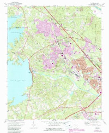
Topographic sheets covering this place
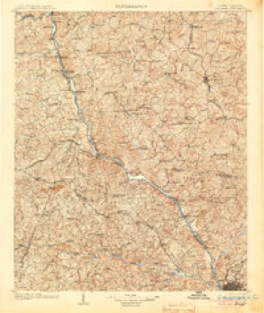
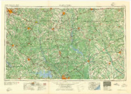
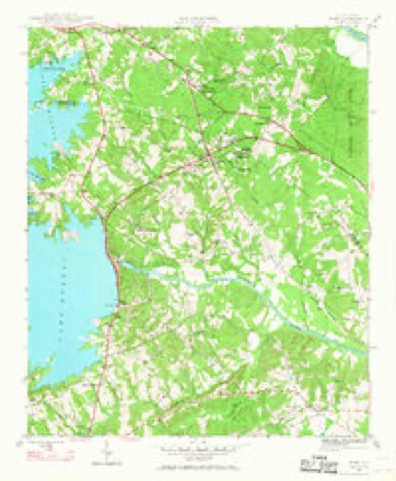
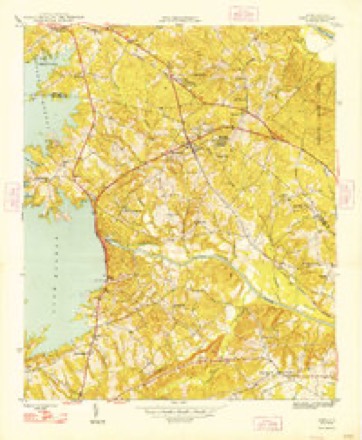
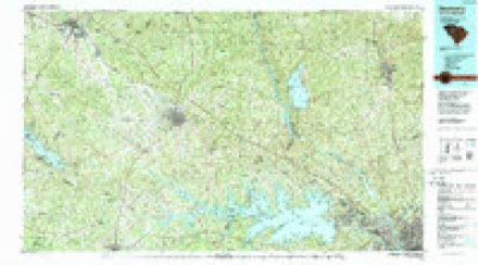
10 surveys from 20 printed sheetsMatched by testing this settlement's coordinate against the published boundary of every sheet in the United States Geological Survey's historical collection. Each opens the scanned sheet at the Survey.
- 1904 USGS Columbia quadrangle1:125000, 2 printings
- 1941 USGS Spartanburg quadrangle1:250000
- 1946 USGS Irmo quadrangle1:24000
- 1948 USGS Irmo quadrangle1:24000, 2 printings
- 1953 USGS Spartanburg quadrangle1:250000, 4 printings
- 1960 USGS Spartanburg quadrangle1:250000, 2 printings
- 1963 USGS Spartanburg quadrangle1:250000
- 1964 USGS Spartanburg quadrangle1:250000
- 1971 USGS Irmo quadrangle1:24000, 4 printings
- 1986 USGS Newberry quadrangle1:100000, 2 printings

Fires near this place
128 since 1992Regional context, not property-specific evidence. The federal wildfire occurrence database lists 128 fires within 5 miles of Irmo between 1992 and 2018, burning about 213 acres in total. 2 started naturally. 21 were recorded as arson. Distance is straight-line from the map coordinates, so a fire counted here may appear on a neighbouring settlement's page as well.
| Reported cause | Fires |
|---|---|
| Missing data/not specified/undetermined | 52 |
| Misuse of fire by a minor | 22 |
| Arson/incendiarism | 21 |
| Debris and open burning | 19 |
| Railroad operations and maintenance | 6 |
| Equipment and vehicle use | 3 |
| Natural | 2 |
| Recreation and ceremony | 1 |
| Power generation/transmission/distribution | 1 |
| Fireworks | 1 |
The most recent of them, most recent first, with the day each was reported and the service that recorded it.
| Date | Cause | Size | Reported by | Name on the report |
|---|---|---|---|---|
| 9 September 1999 | Missing data/not specified/undetermined | under an acre | South Carolina Forestry Commission | not named |
| 6 September 1997 | Arson/incendiarism | under an acre | South Carolina Forestry Commission | not named |
| 12 September 1993 | Missing data/not specified/undetermined | under an acre | South Carolina Forestry Commission | not named |
| 10 September 2010 | Debris and open burning | under an acre | South Carolina Forestry Commission | not named |
| 10 September 2005 | Railroad operations and maintenance | under an acre | South Carolina Forestry Commission | not named |
| 1 September 2007 | Arson/incendiarism | under an acre | South Carolina Forestry Commission | not named |
| 30 August 2010 | Debris and open burning | under an acre | South Carolina Forestry Commission | not named |
| 26 August 1993 | Missing data/not specified/undetermined | under an acre | South Carolina Forestry Commission | not named |
Settlements close enough to share some of these fires:
Mines and quarries near this place
10 of 14 shownRegional context, not property-specific evidence. The federal mineral resources record lists 14 workings within 5 miles of Irmo: 7 producers, 4 unknowns, 3 past producers. 7 still produce. What was taken out: Clay, Stone, Crushed/Broken, Granite, Stone, Crushed/Broken. Distance is straight-line from the map coordinates, so a quarry counted here may appear on a neighbouring settlement's page as well.
| Where | Site | Commodity | Status | Recorded |
|---|---|---|---|---|
| Columbia North Quarry | Granite, Stone, Crushed/Broken | Producer | Igneous | |
| Dreyfus Quarry | Granite, Stone, Crushed/Broken | Producer | Igneous | |
| Harbison Quarry | Granite, Stone, Crushed/Broken | Past Producer | Igneous | |
| Dreyfus Quarry | Stone, Crushed/Broken | Producer | ||
| Harbison Quarry | Stone, Crushed/Broken | Past Producer | ||
| North Columbia Quarry | Stone, Crushed/Broken | Producer | ||
| Unnamed Crushed Stone Quarry | Stone, Crushed/Broken | Unknown | Igneous | |
| Corley Mill Rd Pit | Clay | Producer | Metamorphic | |
| Harbison Mine | Clay | Unknown | Sedimentary | |
| Harbison Mine | Clay | Past Producer |
Storms near this place
60 of 103 shownRegional context, not property-specific evidence. The National Weather Service names Irmo in 103 storm reports between 1994 and 2025: 59 thunderstorm wind, 22 hail, 15 flash flood, 3 heavy rain. The reports record 2 injuries. Each account below is quoted exactly as the forecast office filed it, from the NOAA Storm Events Database, and each date opens the federal record of that event.
| When | Event | Place named | Harm | What the report says |
|---|---|---|---|---|
| November 1995 | Thunderstorm Wind | Irmo | 2 hurt | Trees, power lines, and large signs down. Two people were slightly injured when trees fell on a building. |
| October 2015 | Flash Flood | Irmo | $3,000,000 | Law enforcement rescued over 60 people from 55 homes in the Coldstream neighborhood between 7:30 AM and 10:30 AM. |
| June 2004 | Lightning | Irmo | $750,000 | Sheriff reported 4 homes on fire in Irmo from lightning strikes. |
| October 2018 | Flash Flood | Irmo | $50,000 | Flash flooding in the Whitehall subdivision along Kinley Creek flooded at least 10 homes, with several residents rescued from their homes. |
| October 2018 | Flash Flood | Irmo | $25,000 | Flash flooding occurred along Rawls Creek near the Coldstream and Walden neighborhoods, where some homes and yards were inundated by flood waters. |
| July 2010 | Thunderstorm Wind | Irmo | $24,000 | NWS employee reported many trees down in the Irmo from an intense wet microburst. Minor roof damage also occurred to several structures including homes and businesses. |
| July 2010 | Lightning | Irmo | $20,000 | Home fire from lightning strike damages the upper portion of the sturcture. |
| August 2008 | Flash Flood | Irmo | $20,000 | Sheriff and public reported flash flooding across several roads with water up to 3 feet deep closing roadways. Some vehicles were stalled but no occupants were trapped. Spotters reported 2 to 4 inches of rain within a 1 to 2 hour period from the remnants of Tropical Storm Fay. |
| September 2015 | Flash Flood | Irmo | $14,000 | Sheriff reported flooding at the Country Walk Apartments at 408 Fox Fire Drive near Bower Parkway and Piney Grove Road. Road was impassable with one stranded vehicle. |
| July 2015 | Flash Flood | Irmo | $12,000 | Sheriff and Highway Patrol reported heavy rain and flash flooding in southeast Irmo around the Paces Brook Apartment Complexes. Several roads were also closed due to the high water including Boulters Lock Road and North Woodrow Road. |
| July 2010 | Thunderstorm Wind | Irmo | $12,000 | Police reported many trees down in and east of the Irmo area into Richland County. |
| October 2018 | Flash Flood | Irmo | $10,000 | Flash flooding occurred along Corley Mill Rd at the Twelve Mile Creek bridge and near the Saluda River Club community. |
| September 2015 | Flash Flood | Irmo | $8,000 | Social Media report via Facebook showed a home with a flooded basement. |
| June 2010 | Thunderstorm Wind | Irmo | $8,000 | NWS employee reported trees down on the northeast side of Irmo. |
| June 2010 | Thunderstorm Wind | Irmo | $8,000 | NWS employee reported trees down just east of Irmo east of I-20. |
| July 2010 | Thunderstorm Wind | Irmo | $8,000 | DOT reported several trees down subdivisions just south of Irmo. |
| July 2010 | Thunderstorm Wind | Irmo | $8,000 | Highway Patrol reported many trees down on Charing road and US 76. |
| December 2009 | Flash Flood | Irmo | $8,000 | Many road closures and widespread flooding along streams reported by Emergency Management and also a small earthen dam breach on Bush River road in the St. Andrews/Whitehall area. |
| August 2014 | Thunderstorm Wind | Irmo | $6,000 | Sheriff reported trees and powerlines down at the intersection of Coldstream Drive and Brent Ford Road. |
| August 2020 | Flash Flood | Irmo | $5,000 | Flooding at Churchill Apartments off St. Andrews Rd. Rising water moved about a dozen vehicles in the complex parking lot. No injuries. |
| September 2016 | Flash Flood | Irmo | $5,000 | Spotter reported Kinley Creek in the Seven Oaks area exceeding its banks with water running over roadways. |
| September 2016 | Flash Flood | Irmo | $5,000 | Spotter reported Rawls Creek exceeding its banks in Irmo. Water approaching houses. |
| September 2015 | Heavy Rain | Irmo | $4,000 | RCWINDS Lake Murray site received 3.39 inches of rain between 12:50am and 1:50am...1.85 inches fell in a 15 minute period ending at 1:20am. |
| June 2015 | Thunderstorm Wind | Irmo | $3,000 | Highway Patrol reported trees down near Windward Point and River Road. |
| November 2014 | Thunderstorm Wind | Irmo | $3,000 | Public reported trees down in the Coatsworth Subdivision off of St. Andrews Road. |
| January 2013 | Thunderstorm Wind | Irmo | $3,000 | Sheriff reported a few trees down along College Street in Irmo. |
| March 2012 | Thunderstorm Wind | Irmo | $3,000 | Sheriff reported trees down at Beatty road and Morningside Drive. |
| June 2011 | Thunderstorm Wind | Irmo | $3,000 | Sheriff reported trees down near Morningside Drive and Beatty Road in West Columbia. |
| July 2010 | Thunderstorm Wind | Irmo | $3,000 | NWS employee reported several trees down on Hollingshed Road and Lykes Lane northeast of the Irmo area. |
| June 2013 | Thunderstorm Wind | Irmo | $2,000 | SC Highway Patrol reported powerlines down on Mill Stream Road at Corley Mill Road. |
| July 2010 | Thunderstorm Wind | Irmo | $2,000 | EM reported powerlines down on Foxglove road. |
| August 2020 | Flash Flood | Irmo | $1,000 | Flood waters closed Corley Mill Rd where it crosses Twelve Mile Creek just NW of River Bluff HS. |
| July 2010 | Thunderstorm Wind | Irmo | $1,000 | Sheriff reported a tree down at Bush River road and Langsdale road. |
| February 2024 | Hail | Irmo | $100 | An mPING report of half inch hail, about 1 mile SW of Irmo, was received. |
| February 2024 | Hail | Irmo | $100 | Public reported pea size hail about 2 miles ENE of Lake Murray Dam. |
| April 2023 | Thunderstorm Wind | Irmo | $100 | USGS gage on the Lake Murray towers measured a wind gust of 48 mph. |
| October 2023 | Hail | Irmo | $100 | Spotter reported pea size hail along Hwy 6 near the Lake Murray Dam. |
| August 2022 | Hail | Irmo | $100 | SC DHEC meteorologist reported pea size hail near Bush River Rd and St Andrews Rd. Minor street flooding also reported. |
| December 2019 | Flash Flood | Irmo | $100 | SCDOT closed Corley Mill Rd between Waterstone Dr and Mill Stream Rd due to flooding. Time estimated. |
| July 2018 | Hail | Irmo | $100 | Pea size hail and estimated wind gusts up to 40 mph near Irmo. |
| April 2022 | Hail | Irmo | $10 | Public reported, via social media, pea size hail in the St. Andrews area. Exact location unknown. Time estimated. |
| May 2022 | Thunderstorm Wind | Irmo | $10 | RCWinds mesonet reported a peak wind gust of 43 mph at the Lake Murray Dam. |
| January 2020 | Thunderstorm Wind | Irmo | $10 | The USGS weather equipment atop the Lake Murray Towers near the dam recorded a peak wind gust of 47 MPH. |
| April 2020 | Thunderstorm Wind | Irmo | $10 | RCWINDS gage near Lake Murray Dam measured a wind gust of 52 MPH. |
| February 2019 | Hail | Irmo | $10 | Pea sized hail reported in Irmo. |
| August 2025 | Thunderstorm Wind | Irmo | - | Lexington County dispatch reported power lines down along Bush River Rd at Spartan Dr. |
| June 2025 | Thunderstorm Wind | Irmo | - | SC Highway Patrol reports powerlines down blocking the roadway along North Lake Dr. Time estimated by radar. |
| May 2024 | Thunderstorm Wind | Irmo | - | Power lines down along Weed Drive. Time estimated by radar. |
| July 2024 | Thunderstorm Wind | Irmo | - | Photo report from public of medium sized tree down near the Lake Murray Dam. |
| August 2023 | Thunderstorm Wind | Irmo | - | County Emergency Manager reported a tree down over the roadway on Corley Mill Road. |
| August 2023 | Thunderstorm Wind | Irmo | - | Emergency Manager reported power lines down along Quail Valley East, south of Irmo. |
| September 2023 | Thunderstorm Wind | Irmo | - | Lexington County EM reported downed trees on Foxfire Drive near Pine Grove Apartments. Time estimated by radar. |
| September 2023 | Thunderstorm Wind | Irmo | - | Lexington County EM reported downed trees along the 200 block of Bishop Gate Rd and Wescott Rd near the intersection of Greenpines Rd. The EM also reported power lines downed along the 100 block of Thames Valley Ct. Time estimated by radar. |
| June 2022 | Thunderstorm Wind | Irmo | - | Public report with photo, via social media, of a small tree downed. Time estimated. |
| July 2020 | Heavy Rain | Irmo | - | RCWINDS gage at Lake Murray Dam measured a total rainfall amount for the evening of 4.96 inches, 4.06 inches of which fell in just 55 minutes from about 7 pm to 8 pm EDT. |
| August 2020 | Heavy Rain | Irmo | - | RCWINDS rain gage reported a total of 3.78 inches of rain. 3.66 inches fell in 90 minutes, and 2.50 inches fell in 60 minutes from around 1800 EDT (1700 EST) to around 1900 EDT (1800 EST). |
| April 2018 | Tornado (EF1) | Irmo | - | Tornado damage began just south of Corley Mill Rd along Lee Kleckley Rd. The tornado continued to the NNE and crossed the Saluda River at Saluda Shoals Park near Woodwinds Dr in Irmo. The tornado continued to the NNE, ending near Lockner Rd before reaching Bower Pkwy and the Columbiana Station shopping center. Numerous hardwood and softwood trees were snapped and uprooted along the path of the tornado. Many trees were down on homes and vehicles. Peak winds were estimated to be 95 mph. |
| March 2017 | Thunderstorm Wind | Irmo | - | SC Highway Patrol reported trees down on Corley Mill Rd at River Bluff High School. |
| May 2017 | Thunderstorm Wind | Irmo | - | Tree uprooted and crashed into a home, damaging the roof and several rooms, near St. Andrews Rd and Tram Rd. |
| May 2017 | Thunderstorm Wind | Irmo | - | Tree in road at Harrow Dr and Stonehedge Dr. |
Nearest settlements
The eight closest, with where each one stands in the county. Distances are straight-line, computed from the Geographic Names Information System coordinates.
| Map | Place | Distance | Sheets |
|---|---|---|---|
| Coatesworth | 0.6 miles | 20 | |
| Hillcreek | 0.9 miles | 20 | |
| Challedon West | 1.5 miles | 20 | |
| Walden | 1.8 miles | 20 | |
| Coldstream | 1.9 miles | 20 | |
| Challedon | 2.0 miles | 20 | |
| Selwood Trace | 2.2 miles | 20 | |
| Selwood Shores | 2.4 miles | 20 |
Elsewhere
Matched on this settlement's Geographic Names Information System number rather than its name, so it cannot be a different place of the same name in another state.
| Wikipedia article on Irmo | An encyclopaedic summary. Its text is share-alike, so it is linked here rather than copied. |
| Wikidata item Q304451 | The structured record the population and elevation above come from. Public domain (CC0). |
Provenance
This settlement is recorded in the Geographic Names Information System as feature 1231420. The sheet list is computed by point-in-boundary test against the United States Geological Survey's historical topographic inventory. Both are works of the United States government and carry no copyright under 17 U.S.C. 105.
Wildfire. Short, Karen C. 2022. Spatial wildfire occurrence data for the United States, 1992-2020 [FPA_FOD_20221014]. 6th Edition. Fort Collins, CO: Forest Service Research Data Archive. https://doi.org/10.2737/RDS-2013-0009.6 Collected with United States Government funding and usable without additional permissions or fees.
Mines and quarries. USGS Mineral Resources Data System (MRDS) https://mrdata.usgs.gov/mrds/ A work of the United States government, no copyright under 17 U.S.C. 105.
Storms. NOAA National Centers for Environmental Information, Storm Events Database https://www.ncei.noaa.gov/stormevents/ A work of the United States government, no copyright under 17 U.S.C. 105. Narratives are quoted verbatim from the National Weather Service report and are not edited or summarised.