 Block
Marion, South Carolina
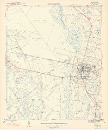
8 topographic sheets cover this place, the earliest surveyed in 1947 and the latest in 1983. It stands in the Marion census division. It lies in ZIP code area 29571. The Survey maps it on the Marion quadrangle. 6,448 people lived here at the 2020 count. It stands 72 feet above sea level.
On record in Marion
Buildings and businesses the archive holds for this place. Each opens its own page, with the source record it came from.
On the National Register 4 records
 Marion High Schoollisted 2001
 Marion Historic Districtlisted 1973
- Marion Historic District (Boundary Increase)listed 1979
- Richardson-Godbold Houselisted 2018
Population over time
2 figuresMarion fell from 6,939 to 6,448 between 2010 and 2020. These are the recorded population figures Wikidata holds for this place, reached through the Geographic Names Information System number this page is keyed on rather than by name, so they belong to this place and not to another of the same name. Most are census counts, but not all are: an early figure may be a founding or settlement estimate, and an estimate published within five years of a census is left out. The change column is computed, and is left blank where more than 20 years separate a figure from the one before it, because a gap that long is not a change between two counts.
| Year | People | Change |
|---|---|---|
| 2010 | 6,939 | |
| 2020 | 6,448 | -491 (-7%) |
Topographic sheets covering this place
4 surveys from 8 printed sheetsMatched by testing this settlement's coordinate against the published boundary of every sheet in the United States Geological Survey's historical collection. Each opens the scanned sheet at the Survey.
- 1947 USGS Marion quadrangle1:24000, 3 printings
- 1953 USGS Florence quadrangle1:250000, 3 printings
- 1954 USGS Florence quadrangle1:250000
- 1983 USGS Florence quadrangle1:100000
Photographs
1 photograph,Taken for the Office of War Information and the Farm Security Administration, who photographed the country between 1935 and 1944. Works of United States government photographers, with no known restriction on use. Each opens its catalogue record.
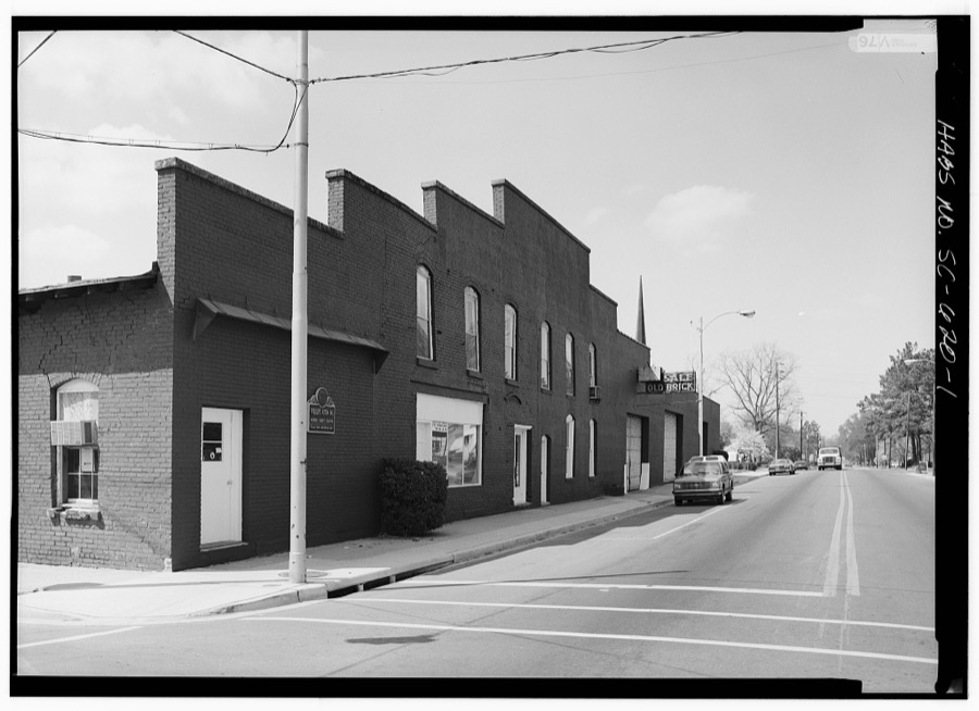
Photographer not recorded. Library of Congress
Fires near this place
175 since 1992Regional context, not property-specific evidence. The federal wildfire occurrence database lists 175 fires within 5 miles of Marion between 1992 and 2019, burning about 1,003 acres in total. 9 started naturally. 27 were recorded as arson. Distance is straight-line from the map coordinates, so a fire counted here may appear on a neighbouring settlement's page as well.
| Reported cause | Fires |
|---|---|
| Debris and open burning | 67 |
| Missing data/not specified/undetermined | 51 |
| Arson/incendiarism | 27 |
| Natural | 9 |
| Equipment and vehicle use | 9 |
| Misuse of fire by a minor | 7 |
| Smoking | 3 |
| Power generation/transmission/distribution | 2 |
The most recent of them, most recent first, with the day each was reported and the service that recorded it.
| Date | Cause | Size | Reported by | Name on the report |
|---|---|---|---|---|
| 27 September 1998 | Debris and open burning | 1.0 acres | South Carolina Forestry Commission | not named |
| 25 September 1998 | Arson/incendiarism | 30 acres | South Carolina Forestry Commission | not named |
| 22 September 2005 | Arson/incendiarism | under an acre | South Carolina Forestry Commission | not named |
| 2 September 1992 | Missing data/not specified/undetermined | under an acre | South Carolina Forestry Commission | not named |
| 15 September 2001 | Equipment and vehicle use | 1.5 acres | South Carolina Forestry Commission | not named |
| 11 September 1998 | Debris and open burning | 1.0 acres | South Carolina Forestry Commission | not named |
| 9 August 2002 | Debris and open burning | 14 acres | South Carolina Forestry Commission | not named |
| 29 August 2015 | Debris and open burning | 32 acres | South Carolina Forestry Commission | not named |
Settlements close enough to share some of these fires:
Storms near this place
60 of 87 shownRegional context, not property-specific evidence. The National Weather Service names Marion in 87 storm reports between 1993 and 2025: 53 thunderstorm wind, 19 hail, 8 flash flood, 3 tornado. The reports record 2 injuries. Each account below is quoted exactly as the forecast office filed it, from the NOAA Storm Events Database, and each date opens the federal record of that event.
| When | Event | Place named | Harm | What the report says |
|---|---|---|---|---|
| June 2001 | Thunderstorm Wind | Marion | 2 hurt, $10,000 | Law enforcement reported a large tree fell on a car, injuring two people. Quarter size hail and trees on power lines were also reported. |
| May 2024 | Tornado (EF1) | Marion | $200,000 | Storm survey of damage in the Marion, SC area indicated that a |tornado touched down briefly on Tuesday May 14, 2024 between 6:10 |PM EDT and was on the ground until 6:13 PM EDT before ending north|of Luther Rogers Road. ||The tornado formed near the intersection of Baker Street and |Baptist Street in southeast Marion, SC. Large limbs were down |across nearby roadways and minor roof damage was observed near |this location. The tornado continued northeast and created some |damage near Mullins Street and Withlacoochee Street. Damage here |remained rated at EF-0 (approximately 70 mph). Power lines were |wrapped around tree limbs and an electrical meter head had been |detached from the side of the house. A large tree fell near the |intersection and damaged a small fence. Additional minor roof |damage to surrounding homes was observed. Large downed tree limbs |were observed along McEachern Heights Street, 2nd Avenue, and in |Amazing Grace Park.||The most significant damage occurred in downtown Marion along |Main Street. A roof completely collapsed near the city center with|limited damage to the exterior walls. Across the street, windows |and window dividers were completely blown out. A wall on the |second floor was pushed inward and its attached window and window |seals were missing. An adjacent building lost a large portion of |roof covering which fell to the street below. All debris was |scattered in multiple directions.||The tornado continued toward the northeast and snapped tree tops |near the intersection of Fairlee Street and Wheeler Street. |Portions of roof coverings were missing from a few homes and |businesses. Damage here was not as significant as on Main Street. |Additional damage was not observed for one mile indicating the |tornado was likely making contact with the ground intermittently. |Along Luther Rogers Road, a trampoline that had previously been |secured with large metal stakes was lofted into the side of a |neighbors home two homes to the east. As the trampoline was |lofted, it made contact with siding and solar panels of the |adjacent neighbor before hitting the side and penetrating the |vinyl siding of the neighbor two homes east. ||The majority of the damage was rated at EF-0 and 70 mph, but |significant damage downtown indicated peak intensity as described |above. There was a lack of significant tree damage typically seen |with tornadoes which may indicate that the tornado did not contact|the ground for a long period of time. It is worth noting all |buildings on Main Street that observed significant damage were two|to three story masonry buildings. |
| October 1995 | Tornado (F1) | Marion | $100,000 | A tornado touched down in west Marion in the Pine Lake area, moved through English Park area to U.S. Highway 501. Downed trees caused additional property damage and downed power lines. No injuries. |
| August 2007 | Thunderstorm Wind | Marion | $50,000 | A thunderstorm downburst produced damage along a path 2 miles long and up to a half mile wide. Damage was more destuctive along a 100 foot path. Several trees up to 2 feet in diameter were snapped 12 to 20 feet above the ground. A line of four power poles were leaning one way and trees snapped the other way. Ten stuctures sustained minor damage to include roof shingles and mobile home underpinnings. One tree fell onto a house and brick pillars on the porch were knocked down. |
| September 2018 | Flash Flood | Marion | $40,000 | Flash flooding occurred in streets and businesses along US-76 near Metal Street. |
| January 2024 | Thunderstorm Wind | Marion | $35,000 | Multiple large trees down on homes and blocking roadways in and near the 900 block of Jones Avenue/NC-41. In addition, a large brick wall in main street commons in downtown Marion separated from a building and collapsed. |
| June 2009 | Thunderstorm Wind | West Marion | $20,000 | Numerous trees were reported down across town. Reports were relayed through Marion County 911 Center. |
| August 2007 | Thunderstorm Wind | Marion | $20,000 | A large tree fell, severely damaging a vehicle. Tree caused minor damage to the exterior of a home on Henry Street, cracking a window and separating the electrical meter from the wall. Nickel size hail also fell. |
| November 2011 | Lightning | Marion | $15,000 | Lightning started a house fire on Grassy Court Road. |
| February 2003 | Thunderstorm Wind | Marion | $15,000 | Ham radio operator reported trees down on two vehicles. |
| July 1999 | Thunderstorm Wind | Marion | $15,000 | Large trees were downed onto power lines. |
| September 2018 | Flash Flood | Marion | $10,000 | US 501 closed due to dam overflow at Reedy Creek. |
| June 2015 | Thunderstorm Wind | Marion | $10,000 | Numerous trees were reported down across the city of Marion. The time was estimated based on radar data. |
| October 2015 | Flash Flood | Marion | $10,000 | Significant flooding in downtown Marion to include Northside Avenue, Godbold Street and Wheeler Street. |
| October 2015 | Flash Flood | Marion | $10,000 | Significant flooding was reported on Old Conway Road. |
| July 2012 | Thunderstorm Wind | Marion | $10,000 | Numerous trees were reported down near the center of town. |
| August 1999 | Thunderstorm Wind | Marion | $10,000 | Thunderstorm wind downed trees onto power lines. |
| April 2011 | Thunderstorm Wind | Marion | $6,000 | A large tree and power lines were reportedly down on Stewart Street. The time was estimated based on radar data. |
| June 2009 | Thunderstorm Wind | West Marion | $5,000 | Tree fell onto power line which then fell onto a car. Occupants were briefly trapped inside the vehicle. There were no injuries. |
| October 1995 | Thunderstorm Wind | Marion | $5,000 | Trees 12 inch diameter and large limbs broke and downed power lines. |
| April 2011 | Thunderstorm Wind | Marion | $4,000 | Trees were reportedly down on Waverly Way. The time was estimated based on radar data. |
| April 2011 | Thunderstorm Wind | Marion | $4,000 | Trees were reportedly down on South Main Street. The time was estimated based on radar data. |
| April 2011 | Thunderstorm Wind | Marion | $3,000 | A large tree reportedly fell onto a fence on McEachern Heights. The time was estimated based on radar data. |
| April 2011 | Thunderstorm Wind | Marion | $3,000 | A large tree reportedly fell onto a house on Georgetown Street. The time was estimated based on radar data. |
| January 2024 | Thunderstorm Wind | Marion | $2,000 | Tree down on house along NC-41 near intersection with Walnut Street. |
| July 2016 | Thunderstorm Wind | Marion | $2,000 | Power lines were reported down near the intersection of Penderboro Road and Bluff Road. |
| April 2013 | Thunderstorm Wind | Marion | $2,000 | A tree was reported down across a power line on Tom Gasque Avenue. The time was estimated based on radar data. |
| April 2012 | Thunderstorm Wind | Marion | $2,000 | Trees were reported down. |
| April 2011 | Thunderstorm Wind | Marion | $2,000 | A large tree reportedly fell onto power lines on South Pine Street. The time was estimated based on radar data. |
| May 2016 | Hail | West Marion | $1,500 | Hail to the size of golf balls was reported near the intersection of U.S. 76 and Laughlin Road. |
| August 2024 | Flash Flood | Marion | $1,000 | South Main Street reported to be completely flooded in Marion. |
| June 2015 | Thunderstorm Wind | West Marion | $1,000 | A tree was reported down. |
| August 2013 | Thunderstorm Wind | Marion | $1,000 | A tree was reported down across power lines on East Railroad Avenue. |
| April 2011 | Thunderstorm Wind | Marion | $1,000 | Large tree limbs reportedly fell across U.S. Highway 76. The time was estimated based on radar data. |
| April 2011 | Thunderstorm Wind | Marion | $1,000 | Large tree limbs reportedly fell across Gibson Street. The time was estimated based on radar data. |
| April 2006 | Thunderstorm Wind | Marion | $1,000 | Two trees were blown down on Hwy 76 and a camper top was blown off on Hwy 41. |
| October 2012 | Hail | Marion | $750 | Hail to the size of quarters was reported. |
| July 2015 | Thunderstorm Wind | Marion | $500 | Large tree limbs were reported down on Azalea Avenue. |
| June 2025 | Thunderstorm Wind | Marion | - | An EM reported trees down in Marion. |
| June 2025 | Thunderstorm Wind | Marion | - | Reports came in of four trees down in and near the city of Marion. |
| July 2023 | Thunderstorm Wind | Marion | - | Tree limb fell onto residential power line resulted in a local power outage. |
| August 2023 | Thunderstorm Wind | Marion | - | Power lines down in the town of Marion. |
| August 2021 | Flash Flood | Marion | - | Flash flooding reported with numerous streets flooded across town. |
| May 2020 | Flash Flood | Marion | - | The Marion County 911 center reported flowing water across Hwy 41. The water was flowing into the canal. |
| May 2014 | Flood | Marion | - | Ham radio relayed a report from the police department that several roads in downtown Marion were flooded. |
| July 2013 | Flood | Marion | - | Luther Rogers Road at North Main Street was closed due to flooding. |
| July 2013 | Flood | Marion | - | Godbold Street near Hwy 76 was closed due to flooding. |
| May 2009 | Hail | Marion | - | Hail up to the size of quarters was reported near the intersection of SC-501 and SC-501 Bypass. |
| June 2008 | Hail | Marion | - | Nickel size hail was reported. |
| July 2008 | Thunderstorm Wind | Marion | - | Trees were reported down on Luther Rogers Road. The trees were blocking half of the roadway. |
| July 2007 | Thunderstorm Wind | Marion | - | Power lines were blown down along Main Street. Numerous power outages. |
| September 2007 | Thunderstorm Wind | Marion | - | A large tree was blown down across the intersection of Rt 9 and 41. |
| April 2006 | Thunderstorm Wind | Marion | - | Trees down on Senator Gasque Rd., Shelly Rd., and off of Hwy 9. |
| April 2006 | Thunderstorm Wind | Marion | - | A 14" tree was blown down on Lipscomb Road. |
| April 2006 | Thunderstorm Wind | Marion | - | A 22" diameter tree fell on Girly Rd. |
| May 2006 | Hail | Marion | - | Quarter size hail was reported. |
| May 2006 | Hail | Marion | - | Quarter and nickel size hail were reported. |
| July 2006 | Thunderstorm Wind | Marion | - | Two trees down. One on Terrells Bay road, and a large tree down on Hubert Baxley Rd. |
| July 2006 | Thunderstorm Wind | Marion | - | Trees down on US Hwy 41. |
| March 2005 | Thunderstorm Wind | Marion | - | Law enforcement reported trees down on Butler Avenue. |
Nearest settlements
The eight closest, with where each one stands in the county. Distances are straight-line, computed from the Geographic Names Information System coordinates.
| Map | Place | Distance | Sheets |
|---|---|---|---|
| West Marion | 1.4 miles | 8 | |
| Turner Place | 1.5 miles | 8 | |
| Country Club Estates | 1.6 miles | 11 | |
| Laughlin | 4.2 miles | 8 | |
| Spring Branch | 4.4 miles | 8 | |
| Pendeboro | 5.7 miles | 11 | |
| Koonce | 6.4 miles | 11 | |
| Blue Brick | 7.0 miles | 9 |
Elsewhere
Matched on this settlement's Geographic Names Information System number rather than its name, so it cannot be a different place of the same name in another state.
| Wikipedia article on Marion | An encyclopaedic summary. Its text is share-alike, so it is linked here rather than copied. |
| Wikidata item Q1424514 | The structured record the population and elevation above come from. Public domain (CC0). |
Provenance
This settlement is recorded in the Geographic Names Information System as feature 1246533. The sheet list is computed by point-in-boundary test against the United States Geological Survey's historical topographic inventory. Both are works of the United States government and carry no copyright under 17 U.S.C. 105.
Wildfire. Short, Karen C. 2022. Spatial wildfire occurrence data for the United States, 1992-2020 [FPA_FOD_20221014]. 6th Edition. Fort Collins, CO: Forest Service Research Data Archive. https://doi.org/10.2737/RDS-2013-0009.6 Collected with United States Government funding and usable without additional permissions or fees.
Storms. NOAA National Centers for Environmental Information, Storm Events Database https://www.ncei.noaa.gov/stormevents/ A work of the United States government, no copyright under 17 U.S.C. 105. Narratives are quoted verbatim from the National Weather Service report and are not edited or summarised.