 Block
Oats, South Carolina
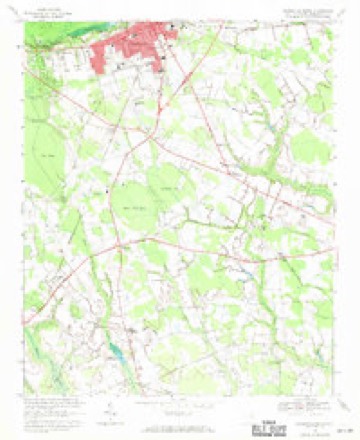
14 topographic sheets cover this place, the earliest surveyed in 1941 and the latest in 1986. It stands in the Lake Swamp census division. It lies in ZIP code area 29069. The Survey maps it on the Hartsville South quadrangle.
Topographic sheets covering this place
8 surveys from 14 printed sheetsMatched by testing this settlement's coordinate against the published boundary of every sheet in the United States Geological Survey's historical collection. Each opens the scanned sheet at the Survey.
- 1941 USGS Spartanburg quadrangle1:250000
- 1953 USGS Spartanburg quadrangle1:250000, 4 printings
- 1960 USGS Spartanburg quadrangle1:250000, 2 printings
- 1963 USGS Spartanburg quadrangle1:250000
- 1964 USGS Spartanburg quadrangle1:250000
- 1968 USGS Hartsville South quadrangle1:24000
- 1986 USGS Camden quadrangle1:100000, 2 printings
- 1986 USGS Camden South quadrangle1:100000, 2 printings


Fires near this place
311 since 1992Regional context, not property-specific evidence. The federal wildfire occurrence database lists 311 fires within 5 miles of Oats between 1992 and 2020, burning about 1,445 acres in total. 2 started naturally. 61 were recorded as arson. Distance is straight-line from the map coordinates, so a fire counted here may appear on a neighbouring settlement's page as well.
| Reported cause | Fires |
|---|---|
| Debris and open burning | 117 |
| Missing data/not specified/undetermined | 106 |
| Arson/incendiarism | 61 |
| Misuse of fire by a minor | 9 |
| Equipment and vehicle use | 8 |
| Smoking | 6 |
| Natural | 2 |
| Power generation/transmission/distribution | 1 |
| Other causes | 1 |
The most recent of them, most recent first, with the day each was reported and the service that recorded it.
| Date | Cause | Size | Reported by | Name on the report |
|---|---|---|---|---|
| 30 September 2003 | Arson/incendiarism | 3.0 acres | South Carolina Forestry Commission | not named |
| 27 September 1996 | Missing data/not specified/undetermined | under an acre | South Carolina Forestry Commission | not named |
| 23 September 2007 | Arson/incendiarism | 2.5 acres | South Carolina Forestry Commission | not named |
| 22 September 2007 | Arson/incendiarism | under an acre | South Carolina Forestry Commission | not named |
| 21 September 2006 | Debris and open burning | under an acre | South Carolina Forestry Commission | not named |
| 20 September 2010 | Missing data/not specified/undetermined | 1.0 acres | South Carolina Forestry Commission | not named |
| 19 September 2011 | Debris and open burning | under an acre | South Carolina Forestry Commission | not named |
| 17 September 2019 | Debris and open burning | 3.0 acres | South Carolina Forestry Commission | not named |
Settlements close enough to share some of these fires:
Mines and quarries near this place
1 within 5 milesRegional context, not property-specific evidence. The federal mineral resources record lists 1 working within 5 miles of Oats: 1 past producer. None of them still produces. What was taken out: Sand and Gravel, Construction. Distance is straight-line from the map coordinates, so a quarry counted here may appear on a neighbouring settlement's page as well.
| Where | Site | Commodity | Status | Recorded |
|---|---|---|---|---|
| Lamar Asphalt Plant | Sand and Gravel, Construction | Past Producer |
Storms near this place
13 since 2000Regional context, not property-specific evidence. The National Weather Service names Oats in 13 storm reports between 2000 and 2017: 9 thunderstorm wind, 2 hail, 2 tornado. The reports record 3 injuries. Each account below is quoted exactly as the forecast office filed it, from the NOAA Storm Events Database, and each date opens the federal record of that event.
| When | Event | Place named | Harm | What the report says |
|---|---|---|---|---|
| April 2010 | Tornado (EF2) | Oats | 3 hurt, $750,000 | A National Weather Service Storm Survey Team confirmed an EF2 tornado with winds estimated to 130 mph. The tornado first touched down in a stand of pine trees, snapping approximately 30 of them several feet off the ground. The largest of the snapped trees was 12 inches in diameter. The tornado then moved east into a cluster of homes and mobile homes along East 7 Pines Street. One mobile home was blown 20 yards off its frame and was completely destroyed. The debris was blown into another single wide mobile home which was subsequently destroyed. A large pecan tree was uprooted before the tornado lifted off the ground. The damage was rated EF1 with winds to 100 mph. The second touchdown occurred a few hundred yards to the east. The tornado moved over a stand of trees and descended practically on top of a two story single family residence located on East 7 Pines Street. This dwelling was blown off its foundation and flipped over onto two automobiles and in the process was completely destroyed. Three people were in the home at the time. They took shelter in an interior hallway moments before the tornado struck. They were transported to the hospital, treated for minor injuries and released. A Ford Ranger Pickup was lifted and dropped approximately 50 yards away. A horse trailer was lifted and dropped 100 yards away. A large wood framed workshop and horse barn were also destroyed. The tornado moved east approximately two tenths of a mile and damaged or uprooted several trees as it lifted. The damage was rated EF2 with winds to 130 mph. |
| May 2017 | Tornado (EF1) | Oats | $80,000 | A survey conducted by the National Weather Service concluded an EF1 tornado with winds to 95 mph first touched down along Fisherman Road, north of Andrews Mill Road where winds estimated up to 80 mph uprooted a few large trees which fell onto a garage. The tornado lifted and then touched down again near Mineral Springs St. where it damaged several trees as it moved north across Oates Highway. After crossing Oates Highway, the tornado caused significant roof and awning damage to a home on Dudley Drive. A tin carport at this location was blown a few hundred yards. As the tornado continued north, the most significant damage occurred to two mobile homes on Philadelphia St. One home was destroyed while the other sustained heavy damage. Although four occupants were inside the destroyed home at the time, none were injured. The tornado crossed E 7 Pines St. and into a wooded area before dissipating. |
| June 2009 | Thunderstorm Wind | Oats | $9,000 | A few large trees were reportedly uprooted. Some trees were down across power lines. |
| April 2012 | Thunderstorm Wind | Oats | $7,000 | A grove of pine trees was reportedly snapped and a 2 foot diameter oak tree was blown over. |
| April 2015 | Thunderstorm Wind | Oats | $5,000 | A National Weather Service Storm Survey team observed several Leland Cypress trees blown down and two Bradford Pear trees snapped at a residence on Andrews Mill Road. |
| April 2012 | Thunderstorm Wind | Oats | $5,000 | A roof was partially lifted off a mobile home. |
| March 2017 | Thunderstorm Wind | Oats | $1,000 | A tree was reported down at the intersection of Oates Hwy and Indian Branch Rd. The time was estimated based on radar data. |
| July 2016 | Thunderstorm Wind | Oats | $1,000 | A tree was reported down on Indian Branch Road near the intersection with Oates Highway. The time was estimated based on radar data. |
| June 2015 | Thunderstorm Wind | Oats | $1,000 | A tree was reported down along Highway 403. |
| April 2012 | Thunderstorm Wind | Oats | $1,000 | A tree was reportedly down across West Seven Pines Street. |
| April 2000 | Thunderstorm Wind | Oats | $1,000 | Police reported 4-5 trees down along with a downed power pole in the area of Oats and Hartsville. |
| June 2009 | Hail | Oats | - | Hail to the size of nickels was reported. |
| July 2007 | Hail | Oats | - | Strong storms produced half dollar size hail over a wide area. In addition to large hail, strong winds blew an ornamental pear tree down and a camper shell was blown across the roadway. Power lines were also blown down. |
Nearest settlements
The eight closest, with where each one stands in the county. Distances are straight-line, computed from the Geographic Names Information System coordinates.
| Map | Place | Distance | Sheets |
|---|---|---|---|
| Register Crossroads | 1.3 miles | 14 | |
| Suggs Crossroads | 2.2 miles | 14 | |
| McLaughlin Crossroads | 2.3 miles | 14 | |
| Yarborough Crossroads | 3.1 miles | 14 | |
| Lydia | 3.1 miles | 14 | |
| Una | 3.2 miles | 14 | |
| Lees Crossroads | 3.2 miles | 14 | |
| Vaughans Crossroads | 3.4 miles | 14 |
Provenance
This settlement is recorded in the Geographic Names Information System as feature 1225158. The sheet list is computed by point-in-boundary test against the United States Geological Survey's historical topographic inventory. Both are works of the United States government and carry no copyright under 17 U.S.C. 105.
Wildfire. Short, Karen C. 2022. Spatial wildfire occurrence data for the United States, 1992-2020 [FPA_FOD_20221014]. 6th Edition. Fort Collins, CO: Forest Service Research Data Archive. https://doi.org/10.2737/RDS-2013-0009.6 Collected with United States Government funding and usable without additional permissions or fees.
Mines and quarries. USGS Mineral Resources Data System (MRDS) https://mrdata.usgs.gov/mrds/ A work of the United States government, no copyright under 17 U.S.C. 105.
Storms. NOAA National Centers for Environmental Information, Storm Events Database https://www.ncei.noaa.gov/stormevents/ A work of the United States government, no copyright under 17 U.S.C. 105. Narratives are quoted verbatim from the National Weather Service report and are not edited or summarised.